 Image 1 of 4
 Image 2 of 4
 Image 3 of 4
 Image 4 of 4
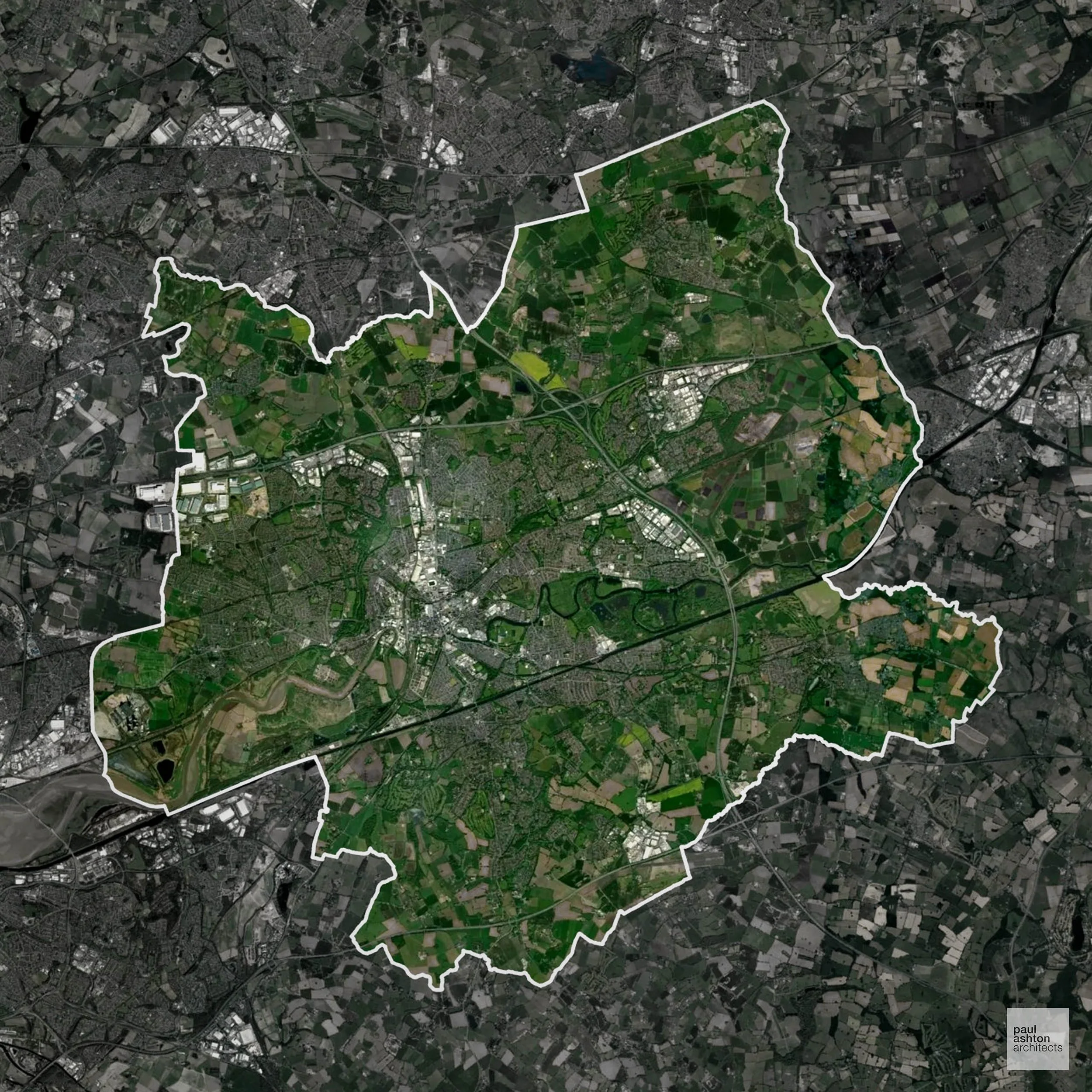
Warrington includes the town centre, Latchford, and Great Sankey. About 60.8% of the borough is Green Belt, shaping settlement edges and protecting rural villages. Known for historic streets, industrial heritage, and suburban towns, planning balances residential, commercial, and conversion projects with countryside protection.
In the last year Warrington decided 901 applications which is slightly below the national average of 988. The approval rate was 76% (slightly below the national average of 88%) and 70% of applications were decided on time, (significantly above the national average of 59%). Stats updated March 2026 from gov. sources. See how Warrington performs relative to other LPAs in our LPA hub.
Warrington has a varied historic environment, with several Conservation Areas and a number of listed buildings reflecting its market town and industrial origins. Heritage constraints are particularly evident within the Stockton Heath Conservation Area and Latchford Village Conservation Area, where historic street patterns, village character, and traditional building forms define local identity.
One of the top reasons heritage building applications are refused is causing harm to historic significance, a risk that can arise when proposals are not prepared by a consultant with heritage expertise. We help minimise this risk with expert, site-specific guidance; contact us here.
Significantly, 60.8% of Warrington is within the Green Belt and proposals in these areas can be subject to very high levels of scrutiny.
The Green Belt near Lymm and Grappenhall limits development to preserve countryside and village separation.
In our experience, one of the top reasons poorly conceived Green Belt proposals are refused is causing 'harm to openness'. We can lower the risk of refusal with site-specific guidance. Contact us here.
You can also check whether your land is within the Green Belt using our interactive Green Belt map.
Warrington includes open farmland and Mersey floodplain areas, where development is restricted to protect rural character and wildlife corridors.
One of the top reasons poorly prepared proposals in the Open Countryside are refused is that they fail to demonstrate a policy-supported need. To minimise that risk with bespoke advice contact us here.
The River Mersey floodplain runs through the heart of the borough, and large areas of Flood Zone 3 have been a major constraint on Warrington's ambitious growth and housing delivery ambitions.
Where constraints permit, we can develop proposals that manage flood risk thoughtfully to give applications the best chance of approval. Learn more about development risks in flood risk areas here.
Parts of Warrington fall within the Rostherne Mere catchment, where both nitrogen and phosphorus neutrality are required for new residential development in the affected area.
Unfortunately, Nutrient Neutrality can halt development completely. If you need early-stage, project-specific advice contact us here.
In addition to acting as Planing Conultants we are ARB registered architects with 25+ years of experience. We provide a full range of planning services, including:
We specialise in resolving complex planning challenges through thoughtful architectural design, turning constrained or difficult sites into successful Planning Permission outcomes. Let’s discuss your project.