
 Image 1 of 4
 Image 2 of 4
 Image 3 of 4
 Image 4 of 4
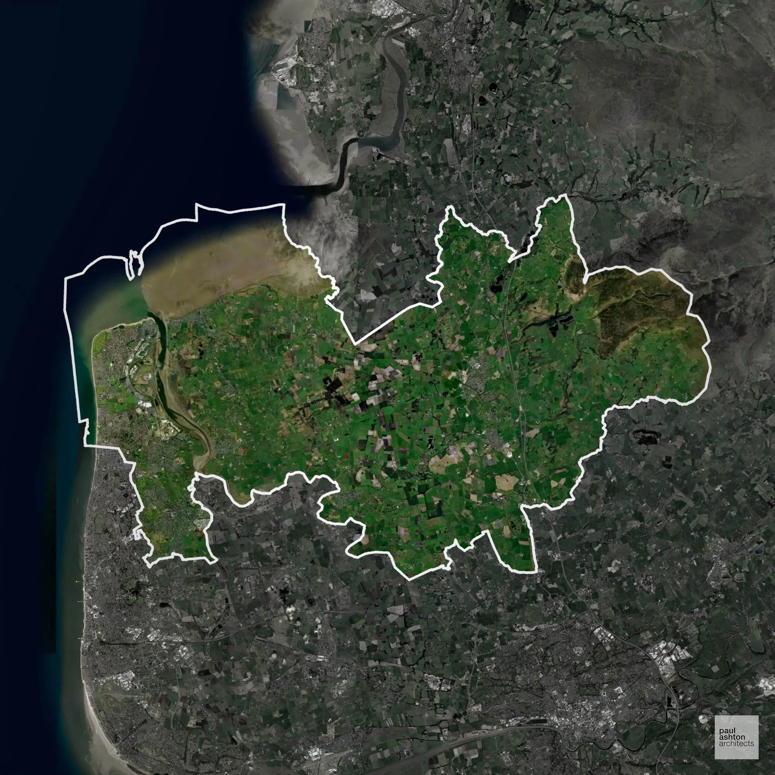
Wyre includes Poulton-le-Fylde, Fleetwood, and Garstang. About 2.4% of the district is Green Belt, framing minor settlement edges. Known for historic streets, market towns, and coastal villages, planning focuses on residential, commercial, and conversion projects.
In the last year Wyre decided 448 applications which is well below the national average of 988. The approval rate was 93% (marginally above the national average of 88%) and 65% of applications were decided on time, (slightly above the national average of 59%). Stats updated March 2026 from gov. sources. See how Wyre performs relative to other LPAs in our LPA hub.
Areas of Outstanding Natural Beauty (AONBs), (now often referred to as National Landscapes), are protected areas recognised for their exceptional scenic and natural value.
Wyre is partially within the Arnside & Silverdale AONB. Development must consider scenic and environmental effects.
In our experience, one of the top reasons proposals in Areas of Outstanding Natural Beauty are refused is causing landscape harm or visual intrusion, a risk that often arises when applications are not fully informed. We help minimise the likelihood of refusal with expert, guidance; contact us here.
2.4% of Wyre is within the Green Belt and proposals in these areas can be subject to reasonable levels of scrutiny.
The Green Belt around Wyre protects the villages of Hambleton and St Michael’s on Wyre, preserving the fertile Fylde farmland, river corridors, and historic parklands, which are particularly sensitive to development pressures from nearby Preston and Blackpool.
In our experience, one of the top reasons poorly conceived Green Belt proposals are refused is causing 'harm to openness'. We can lower the risk of refusal with site-specific guidance. Contact us here.
You can also check whether your land is within the Green Belt using our interactive Green Belt map.
Wyre includes the Forest of Bowland fringes and rural coastal landscapes, where development is carefully controlled.
One of the top reasons poorly prepared proposals in the Open Countryside are refused is that they fail to demonstrate a policy-supported need. To minimise that risk with bespoke advice contact us here.
The Wyre Estuary and the low-lying Fylde coastal plain expose significant areas of the borough to tidal flood risk, with Flood Zone 3 constraining development in Fleetwood and other coastal settlements.
Where constraints permit, we can develop proposals that manage flood risk thoughtfully to give applications the best chance of approval. Learn more about development risks in flood risk areas here.
As well as acting as Planning Consultants we are ARB registered architects with over 25 years’ experience. We support clients through all stages of the planning process, offering the following services:
We specialise in resolving complex planning challenges through thoughtful architectural design, turning constrained or difficult sites into successful Planning Permission outcomes. Let’s discuss your project.