Title
LPA
LPA
- FRA |
- National Park |
- LPA |
Filters
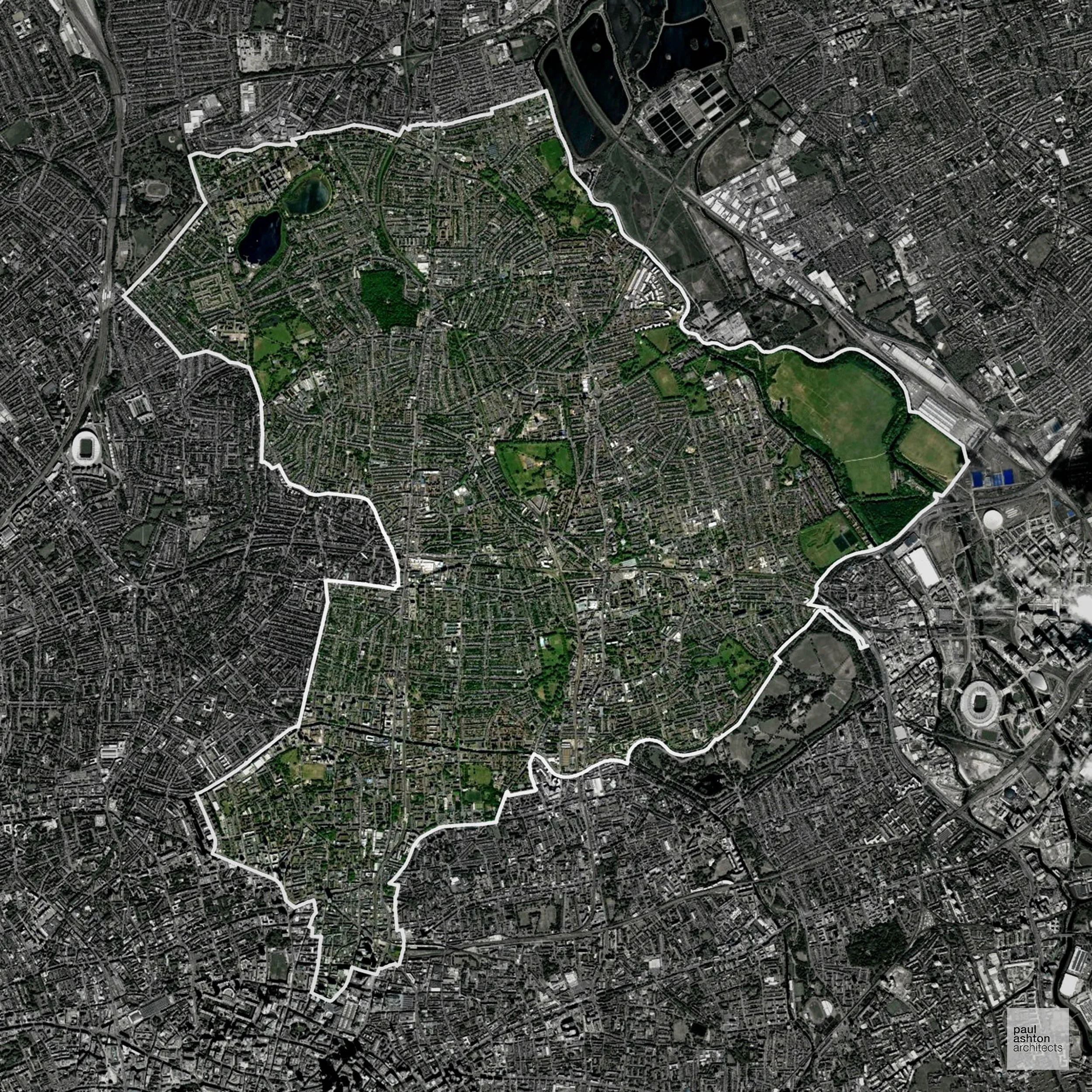
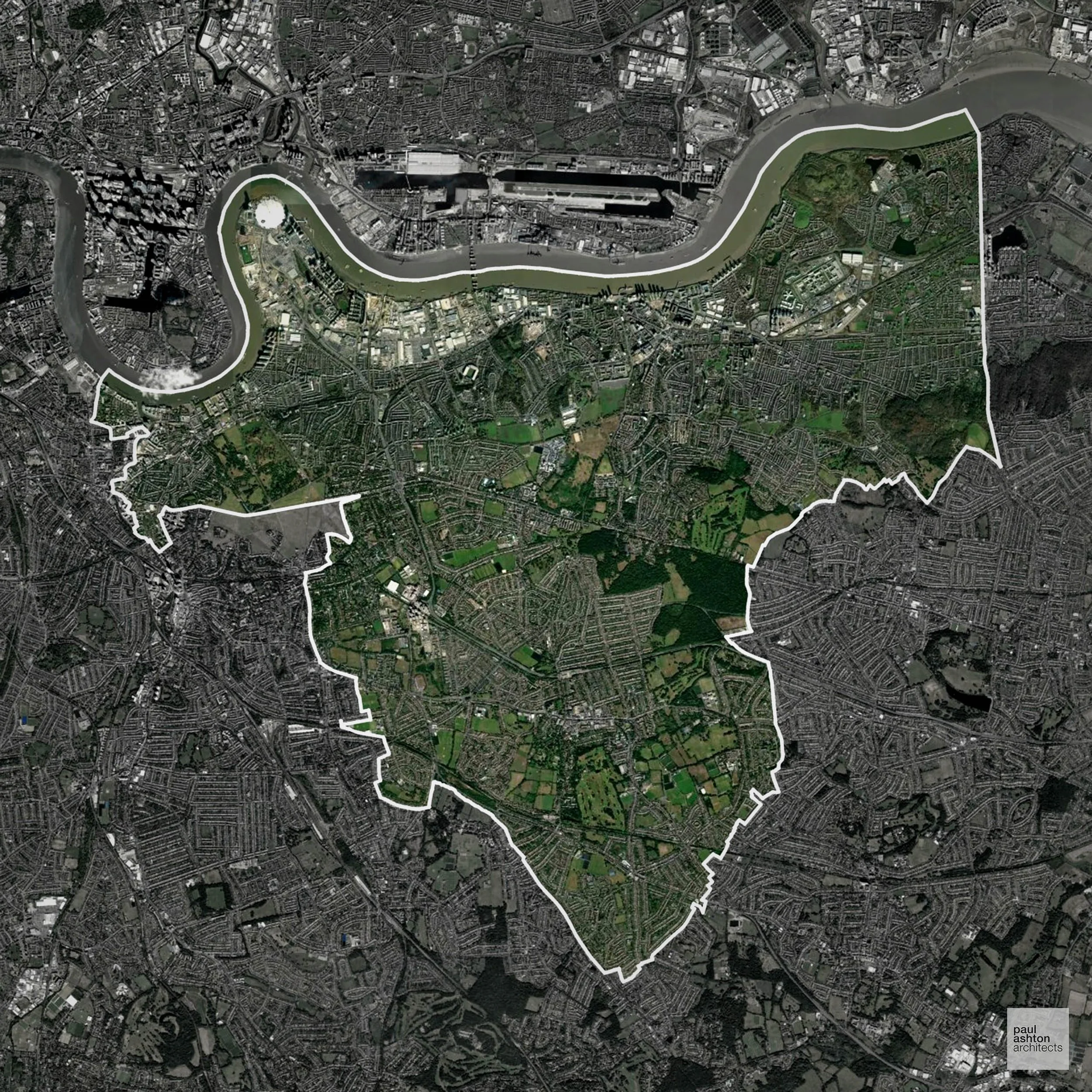
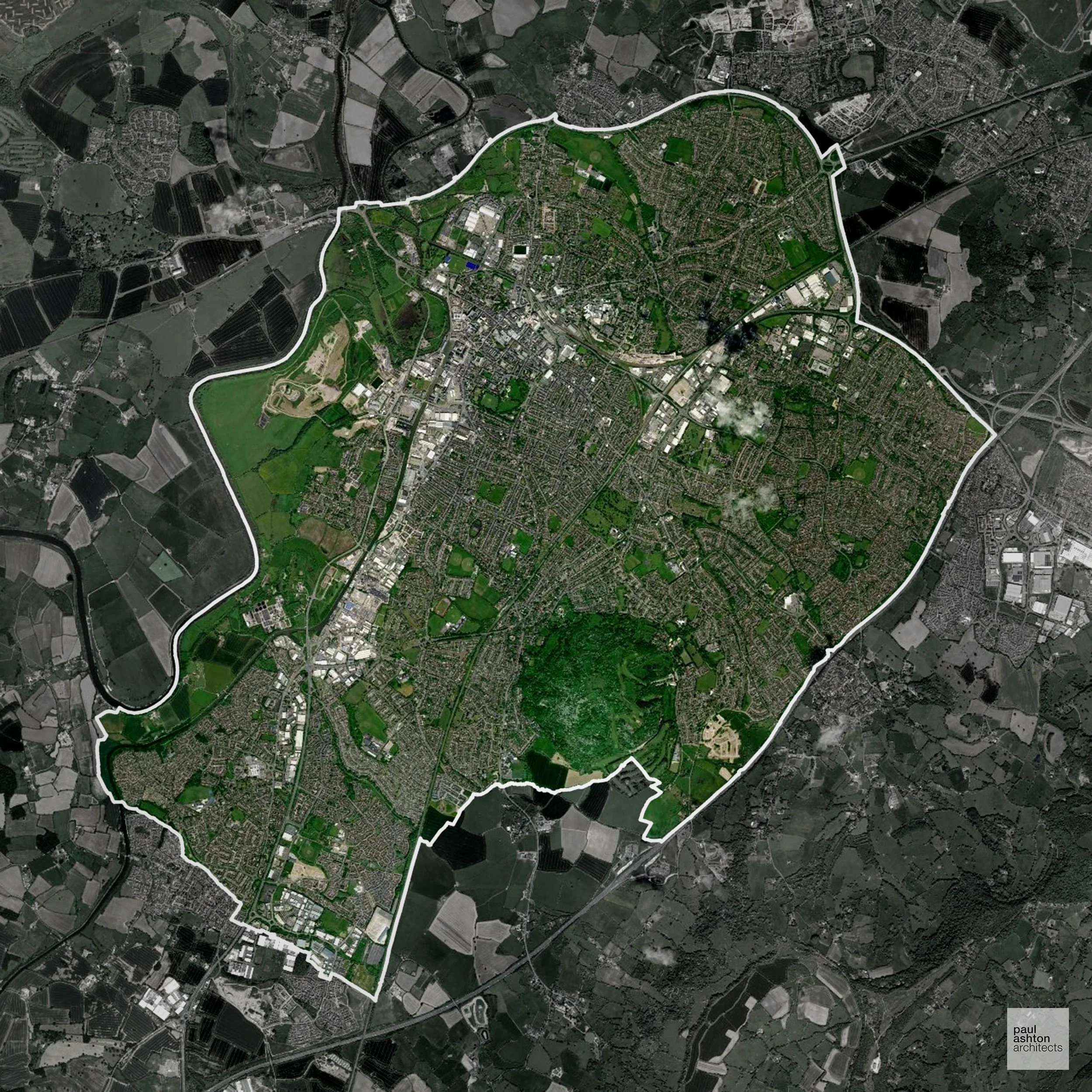
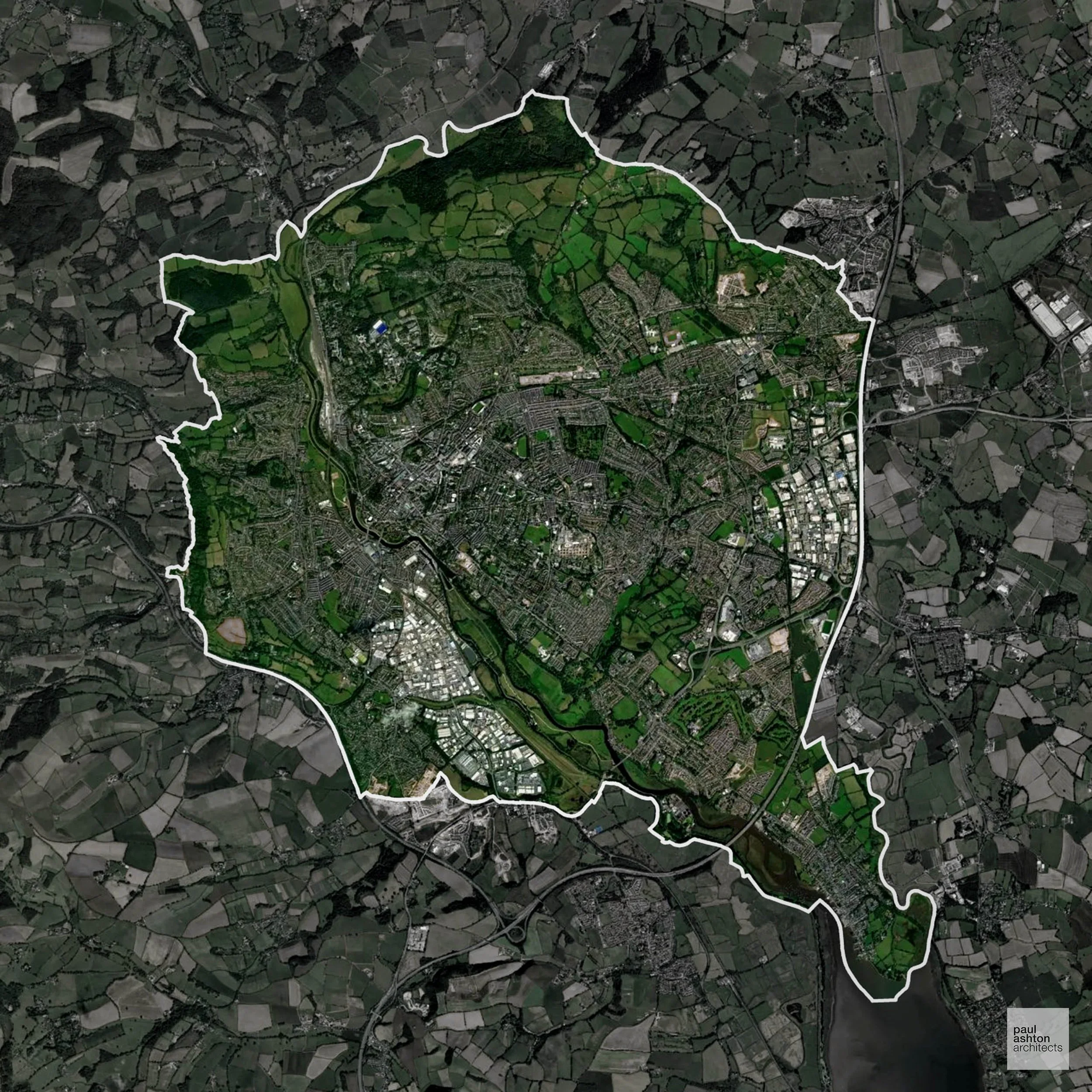
Hackney in London includes Hackney Central, Dalston, and Shoreditch. Known for cultural vibrancy, historic streets, and urban regeneration. Planning focuses on dense urban sites, conversions, and residential extensions. We can advise and support projects throughout Hackney.
In the last year Hackney decided 1,345 applications which is well above the national average of 988. The approval rate was 81% (slightly below the national average of 88%) and 54% of applications were decided on time, (slightly below the national average of 59%). Stats updated March 2026 from gov. sources. See how Hackney performs relative to other LPAs in our LPA hub.
"We love helping clients win Planning Permission in Hackney"
Conservation and Listed Buildings in Hackney
Hackney has a dense and varied historic environment, with numerous Conservation Areas and a significant number of listed buildings across the borough. Heritage constraints are particularly evident within the De Beauvoir Conservation Area and Clapton Square Conservation Area, where Georgian and Victorian townscape, terraces, and formal squares define local character.
One of the top reasons heritage building applications are refused is causing harm to historic significance, a risk that can arise when proposals are not prepared by a consultant with heritage expertise. We help minimise this risk with expert, site-specific guidance; contact us here.
Planning Applications in Hackney
Alongside acting as Planning Consultants we are ARB registered architects with 25+ years of experience. We use the following proven work stages to guide clients in Hackney through the planning process in order to maximise the potential of their development :
- Stage 1: Site Appraisals & Planning Strategy Advice
- Stage 2: Feasibility Studies & Concept Designs
- Stage 3: Planning Application Packages
- Architectural Drawing Packages
- Planning Statements & Design and Access Statements
- Coordination of Consultant Reports
- Direct Liaison with Planning Officers
- Stage 4: Technical Design
- Discharge of Planning Conditions
- Building Regulations and Construction Packages
Planning Services We Offer in Hackney
- Full Planning Applications: Commercial, new buildings, changes of use.
- Householder Planning Applications: Domestic extensions / garden structures.
- Listed Building Consent: Alterations / repairs to listed buildings.
- Conservation Area Consent: Developments within Conservation Areas.
- Lawful Development Certificates: Confirming existing / completed works are lawful.
- Validation Requirements: Gathering documentation to ensure applications are validated by Hackney LPA.
Contextual Planning Support in Hackney
We work collaboratively with clients and shape a design that respects local character and meets Planning Policy requirements in order to maximise your chances of winning Planning Permission.
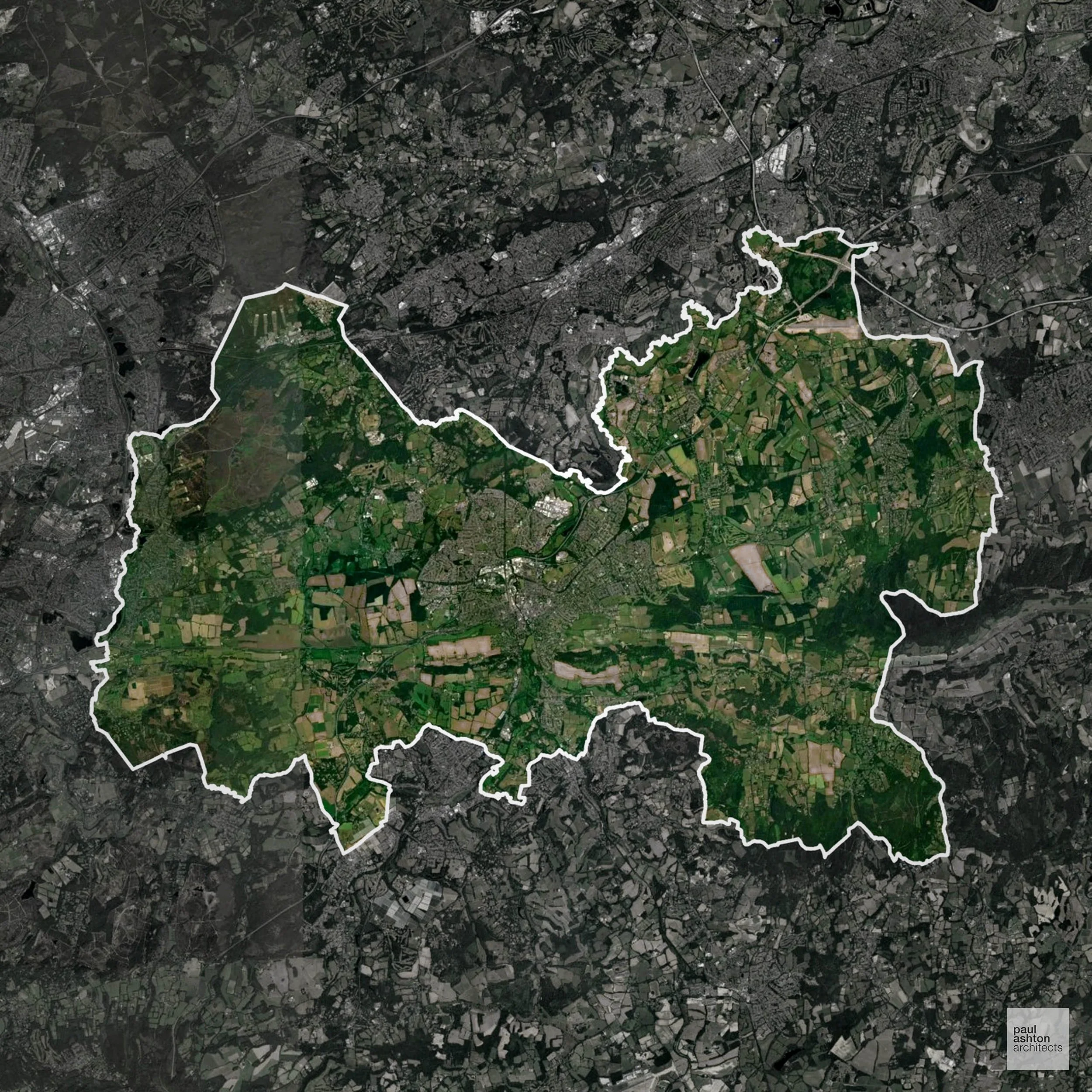


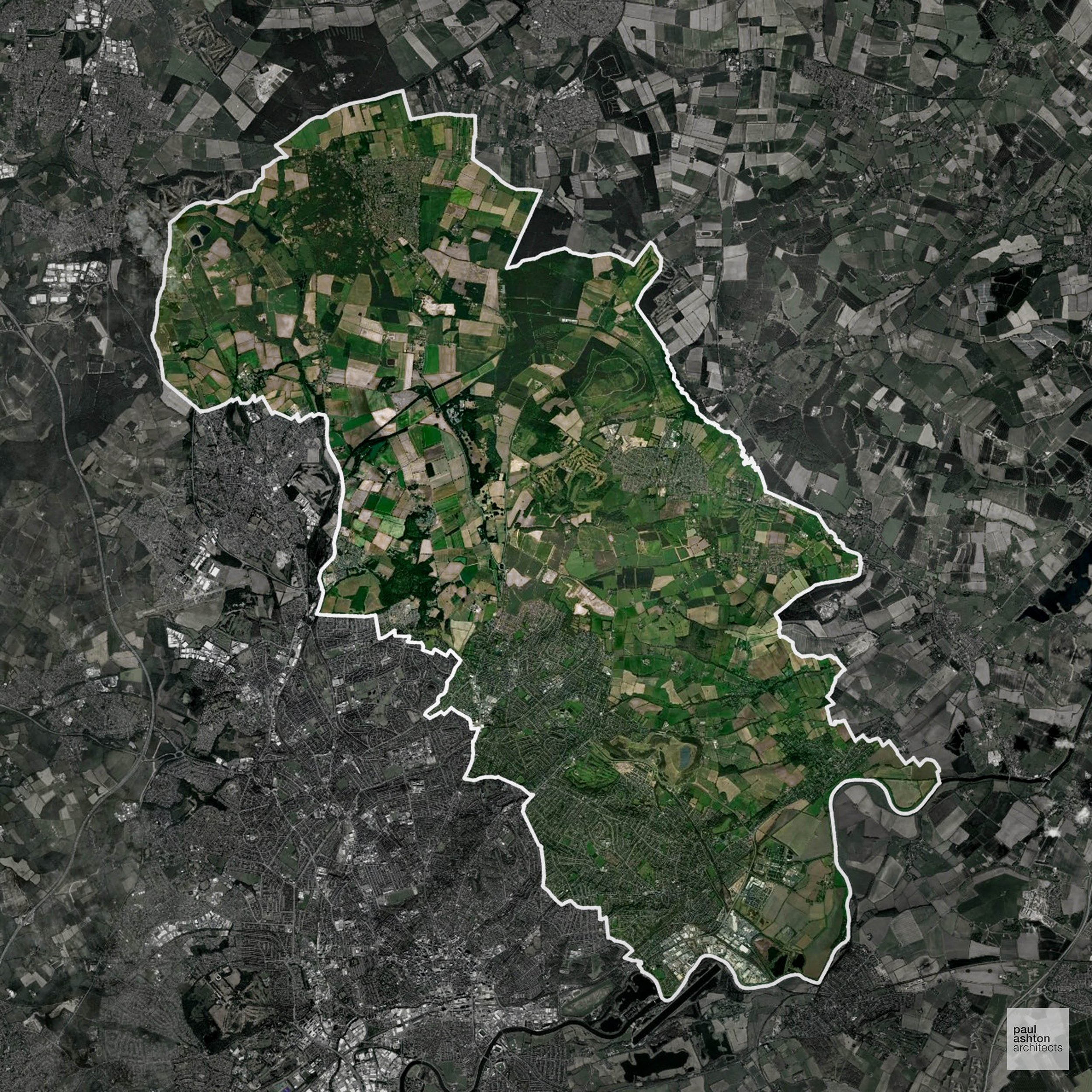
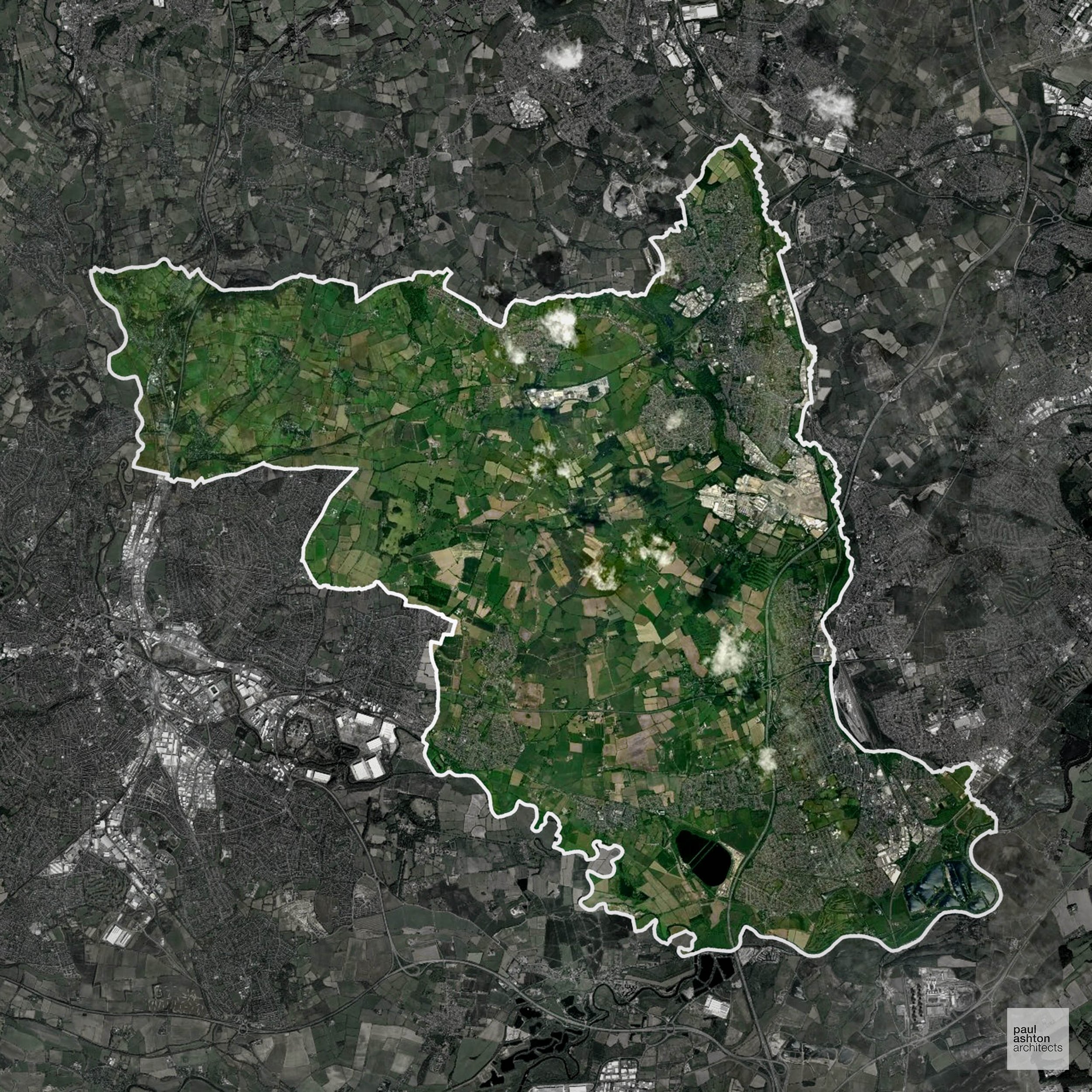
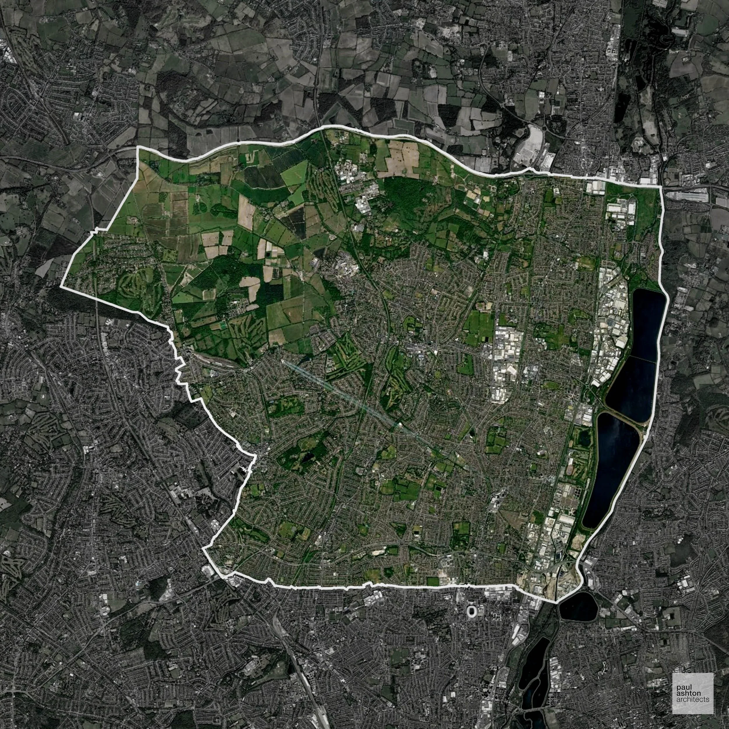
Guildford in Surrey includes Guildford town, Godalming, and Cranleigh. Approximately 83.5% of the district is Green Belt, shaping urban expansion and development patterns. Known for historic streets, the castle, and affluent suburban communities, planning balances growth with conservation. We can advise and support residential, commercial, and conversion projects across Guildford.
In the last year Guildford decided 1,316 applications which is well above the national average of 988. The approval rate was 84% (roughly equal to the national average of 88%) and 30% of applications were decided on time, (significantly below the national average of 59%). Stats updated March 2026 from gov. sources. See how Guildford performs relative to other LPAs in our LPA hub.
"We love helping clients win Planning Permission in Guildford"
Areas of Outstanding Natural Beauty in Guildford
Areas of Outstanding Natural Beauty (AONBs), often referred to as National Landscapes, are protected for their remarkable natural and scenic value. Any development proposals here are closely evaluated, with a strong presumption against works that could harm the landscape.
Guildford overlaps with the Surrey Hills AONB. Projects must preserve visual character and ecological quality.
In our experience, one of the top reasons proposals in Areas of Outstanding Natural Beauty are refused is causing landscape harm or visual intrusion, a risk that often arises when applications are not fully informed. We help minimise the likelihood of refusal with expert, guidance; contact us here.
Green Belt Approvals in Guildford
The Green Belt is a policy protecting land around many English towns and cities, where development is tightly controlled to safeguard the open countryside.
Significantly, 83.5% of Guildford is within the Green Belt and proposals in these areas can be subject to very high levels of scrutiny.
The Green Belt areas around Guildford, Shalford, and Christ’s Hospital are highly sensitive, with policy focusing on preserving Surrey Hills landscape and village character.
In our experience, one of the top reasons poorly conceived Green Belt proposals are refused is causing 'harm to openness'. We can lower the risk of refusal with site-specific guidance. Contact us here.
You can also check whether your land is within the Green Belt using our interactive Green Belt map.
Planning Applications in Guildford
In addition to acting as Planing Conultants we are ARB registered architects with 25+ years of experience. Our planning proposals are creatively tailored to each site to maximise potential and improve planning outcomes. We use the following tried and tested process to guide clients in Guildford through planning to completion:
- Stage 1: Site Appraisals & Planning Strategy Advice
- Stage 2: Feasibility Studies & Concept Designs
- Stage 3: Planning Application Packages
- Architectural Drawing Packages
- Planning Statements & Design and Access Statements
- Coordination of Consultant Reports
- Direct Liaison with Planning Officers
- Stage 4: Technical Design
- Discharge of Planning Conditions
- Building Regulations and Construction Packages
Planning Services We Offer in Guildford
- Full Planning Applications: Commercial, new buildings, changes of use.
- Householder Planning Applications: Domestic extensions / garden structures.
- Listed Building Consent: Alterations / repairs to listed buildings.
- Conservation Area Consent: Developments within Conservation Areas.
- Lawful Development Certificates: Confirming existing / completed works are lawful.
- Validation Requirements: Gathering documentation to ensure applications are validated by Guildford LPA.
Contextual Planning Support in Guildford
We work collaboratively with clients and shape a design that respects local character and meets Planning Policy requirements in order to maximise your chances of winning Planning Permission.
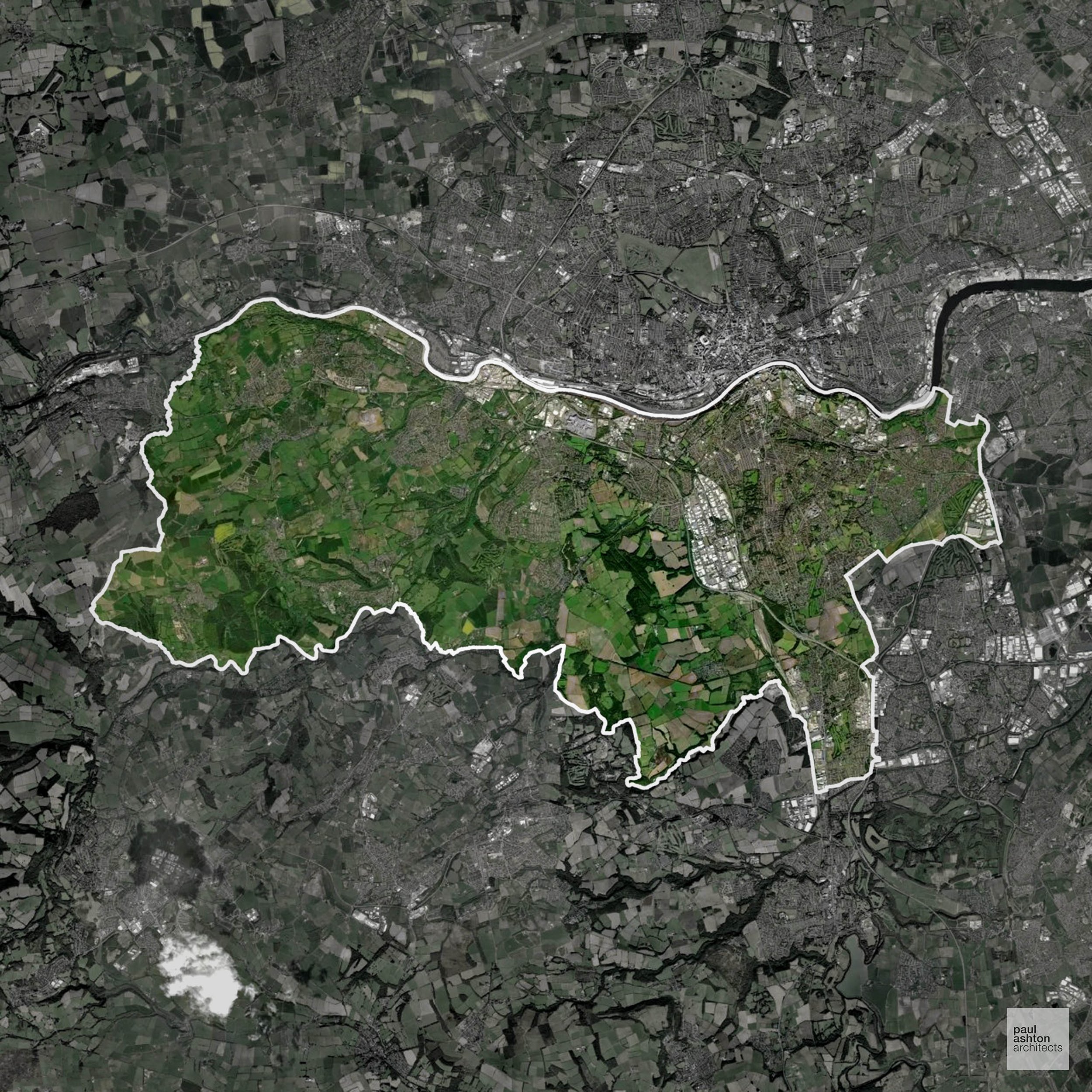
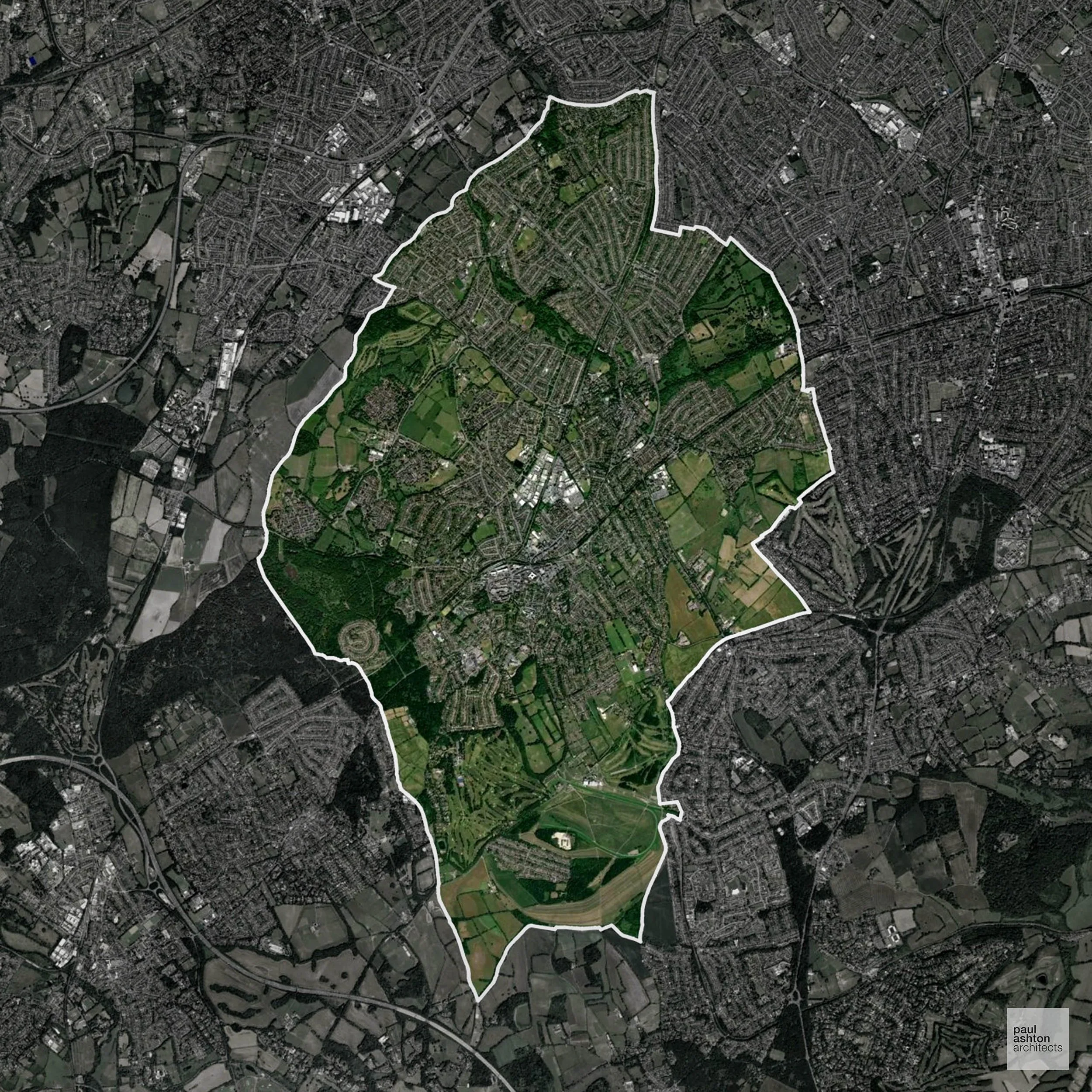
Greenwich in London includes Greenwich town, Blackheath, and Woolwich. Known for the Royal Observatory, historic architecture, and riverside heritage. Planning focuses on urban densification, conversions, and residential schemes. We can advise and support projects throughout Greenwich.
In the last year Greenwich decided 1,487 applications which is well above the national average of 988. The approval rate was 78% (slightly below the national average of 88%) and 73% of applications were decided on time, (significantly above the national average of 59%). Stats updated March 2026 from gov. sources. See how Greenwich performs relative to other LPAs in our LPA hub.
"We love helping clients win Planning Permission in Greenwich"
Conservation and Listed Buildings in Greenwich
Greenwich has a highly sensitive historic environment, with numerous Conservation Areas and a significant number of listed buildings across the borough. Heritage constraints are particularly pronounced within the Greenwich Town Centre Conservation Area and Blackheath Conservation Area, where formal townscape, open heathland, and historic architecture define character.
Development proposals are rigorously assessed in relation to key views and the setting of assets such as Old Royal Naval College, with Planning Permission typically requiring a highly sensitive, design-led approach.One of the top reasons heritage building applications are refused is causing harm to historic significance, a risk that can arise when proposals are not prepared by a consultant with heritage expertise. We help minimise this risk with expert, site-specific guidance; contact us here.
Planning Applications in Greenwich
In addition to acting as Planing Conultants we are ARB registered architects with 25+ years of experience. Our planning proposals are creatively tailored to each site to maximise potential and improve planning outcomes. We use the following tried and tested process to guide clients in Greenwich through planning to completion:
- Stage 1: Site Appraisals & Planning Strategy Advice
- Stage 2: Feasibility Studies & Concept Designs
- Stage 3: Planning Application Packages
- Architectural Drawing Packages
- Planning Statements & Design and Access Statements
- Coordination of Consultant Reports
- Direct Liaison with Planning Officers
- Stage 4: Technical Design
- Discharge of Planning Conditions
- Building Regulations and Construction Packages
Planning Services We Offer in Greenwich
- Full Planning Applications: Commercial, new buildings, changes of use.
- Householder Planning Applications: Domestic extensions / garden structures.
- Listed Building Consent: Alterations / repairs to listed buildings.
- Conservation Area Consent: Developments within Conservation Areas.
- Lawful Development Certificates: Confirming existing / completed works are lawful.
- Validation Requirements: Gathering documentation to ensure applications are validated by Greenwich LPA.
Contextual Planning Support in Greenwich
We work collaboratively with clients and shape a design that respects local character and meets Planning Policy requirements in order to maximise your chances of winning Planning Permission.
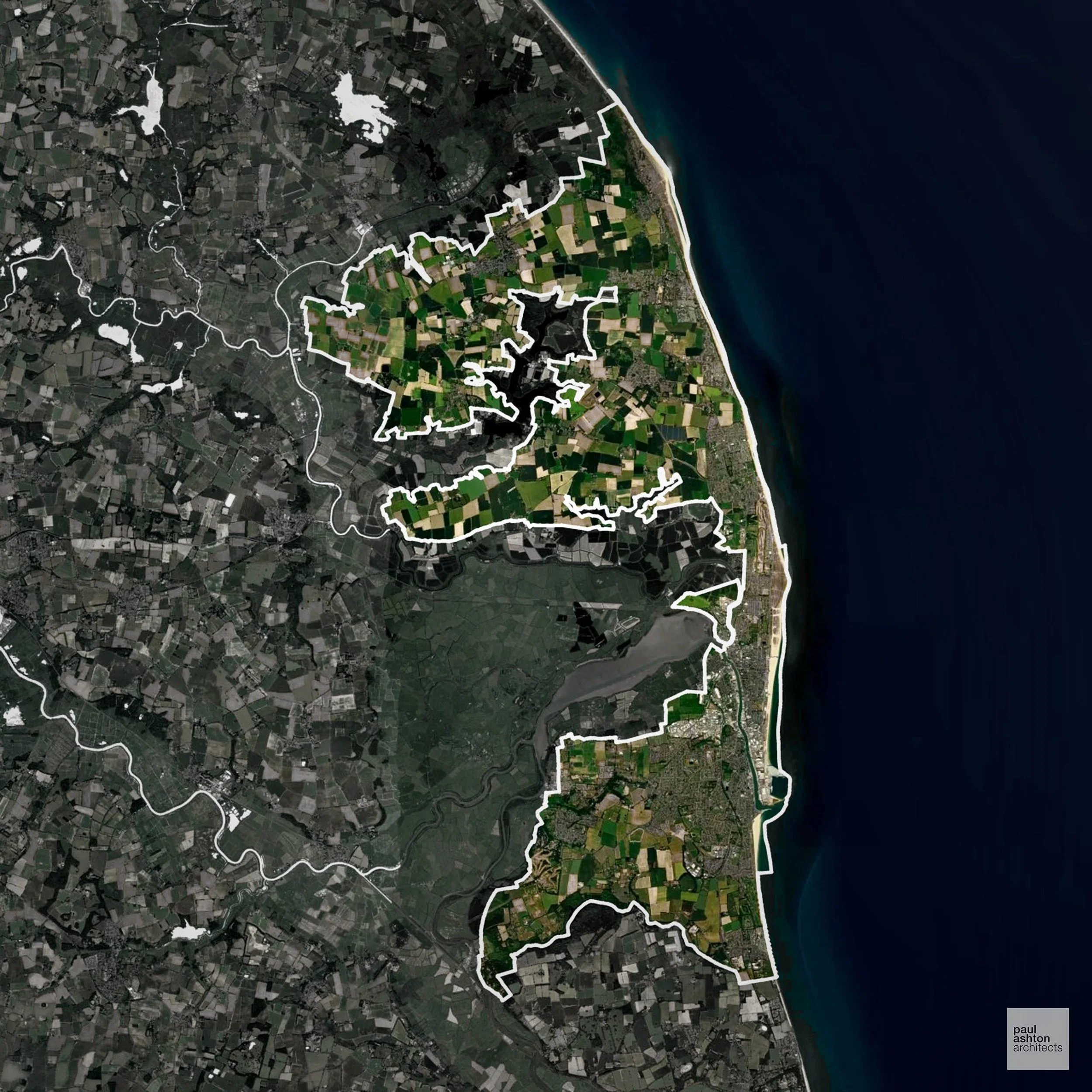
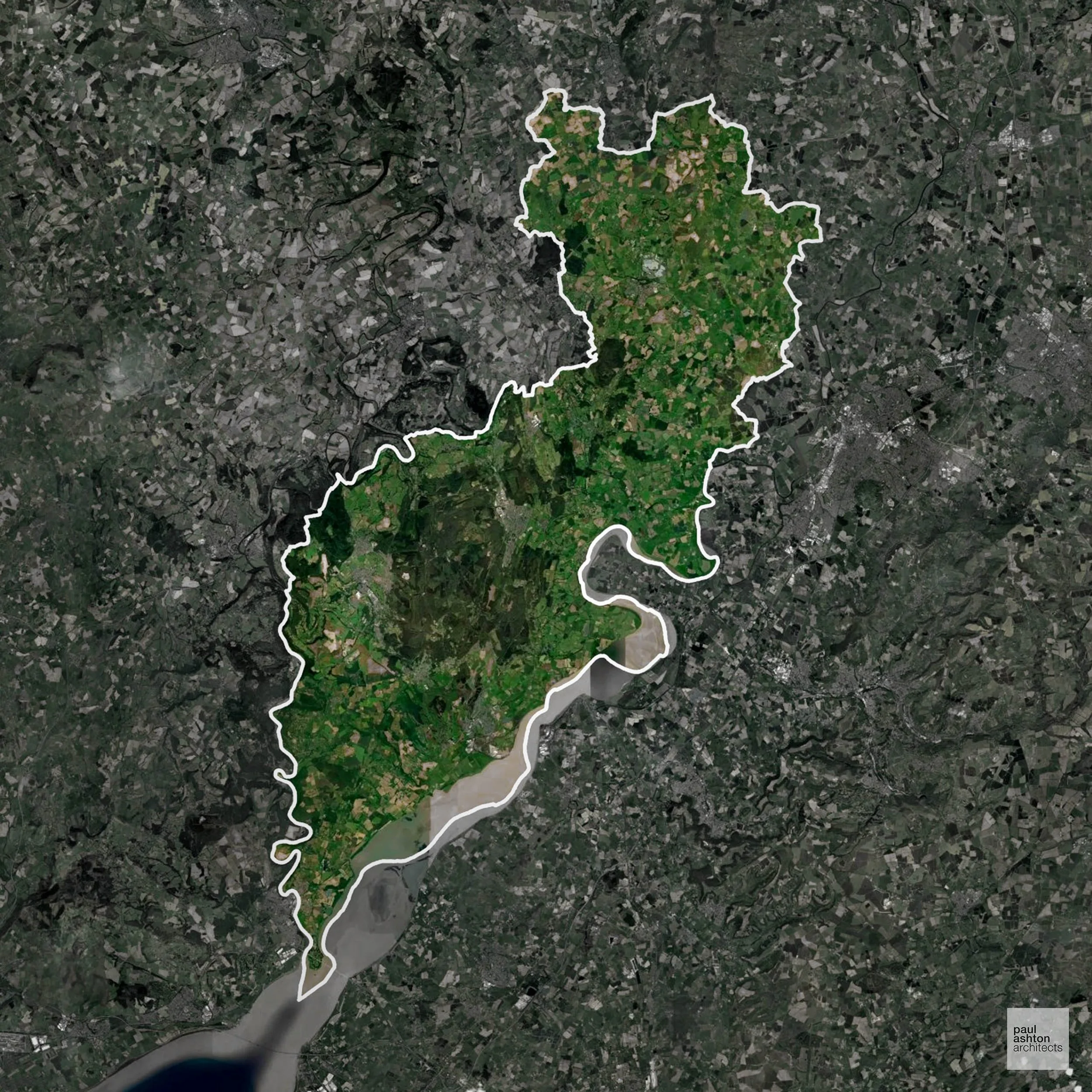
Great Yarmouth in Norfolk includes the town itself and surrounding villages such as Caister-on-Sea. Known for its seaside tourism, historic piers, and coastal heritage. Planning focuses on regeneration, residential growth, and sensitive coastal development. We can advise and support projects across Great Yarmouth.
In the last year Great Yarmouth decided 376 applications which is well below the national average of 988. The approval rate was 92% (roughly equal to the national average of 88%) and 56% of applications were decided on time, (on par with the national average of 59%). Stats updated March 2026 from gov. sources. See how Great Yarmouth performs relative to other LPAs in our LPA hub.
"We love helping clients win Planning Permission in Great Yarmouth"
Development in the Open Countryside
Open Countryside within Great Yarmouth refers to land situated outside built-up areas and Green Belt boundaries, typically comprising farmland or natural landscapes. Residential development is generally restricted unless special circumstances can be demonstrated.
Great Yarmouth includes the Norfolk Broads and coastal marshes, which are highly sensitive to development due to their ecological and floodplain value.
One of the top reasons poorly prepared proposals in the Open Countryside are refused is that they fail to demonstrate a policy-supported need. To minimise that risk with bespoke advice contact us here.
Flood Risk in Great Yarmouth
In some areas of the LPA, flood risk plays a key role in determining planning proposals. With the tidal River Yare, the Norfolk Broads, and a low-lying North Sea coastline, Great Yarmouth faces some of the most acute tidal and fluvial flood risk in England. Where constraints permit, we can develop proposals that manage flood risk thoughtfully to give applications the best chance of approval.
Nutrient Neutrality in Great Yarmouth
Nutrient Neutrality ensures new developments do not increase harmful nitrogen or phosphorus levels in sensitive waterways. Within the Broads SAC catchment area; both nitrogen and phosphorus neutrality apply to new residential development and overnight accommodation, contributing to significant planning delays across Norfolk. Unfortunately, Nutrient Neutrality can halt development completely. If you need early-stage, project-specific advice contact us here.
Planning Applications in Great Yarmouth
As well as acting as Planning Consultants we are ARB registered architects with over 25 years’ experience. Our site-specific planning proposals balance creativity with strategic insight. We use the following field-tested work stages to help clients in Great Yarmouth achieve successful planning outcomes:
- Stage 1: Site Appraisals & Planning Strategy Advice
- Stage 2: Feasibility Studies & Concept Designs
- Stage 3: Planning Application Packages
- Architectural Drawing Packages
- Planning Statements & Design and Access Statements
- Coordination of Consultant Reports
- Direct Liaison with Planning Officers
- Stage 4: Technical Design
- Discharge of Planning Conditions
- Building Regulations and Construction Packages
Planning Services We Offer in Great Yarmouth
- Full Planning Applications: Commercial, new buildings, changes of use.
- Householder Planning Applications: Domestic extensions / garden structures.
- Listed Building Consent: Alterations / repairs to listed buildings.
- Conservation Area Consent: Developments within Conservation Areas.
- Lawful Development Certificates: Confirming existing / completed works are lawful.
- Validation Requirements: Gathering documentation to ensure applications are validated by Great Yarmouth LPA.
Design-Led Planning Advice in Great Yarmouth
We can review your site in Great Yarmouth and offer informed guidance on how proposals can be developed in order to maximise your chances of securing Planning Permission.
Gravesham in Kent includes Gravesend, Northfleet, and Higham. About 76.8% of the borough is Green Belt, shaping the edges of settlements and controlling urban expansion. Known for historic market towns and riverside heritage, planning balances growth with countryside protection. We can advise and support residential, commercial, and conversion projects throughout Gravesham.
In the last year Gravesham decided 627 applications which is well below the national average of 988. The approval rate was 72% (slightly below the national average of 88%) and 63% of applications were decided on time, (slightly above the national average of 59%). Stats updated March 2026 from gov. sources. See how Gravesham performs relative to other LPAs in our LPA hub.
"We love helping clients win Planning Permission in Gravesham"
Green Belt Approvals in Gravesham
The Green Belt is a policy protecting land around many English towns and cities, where development is tightly controlled to safeguard the open countryside.
Significantly, 76.8% of Gravesham is within the Green Belt and proposals in these areas can be subject to very high levels of scrutiny.
The Green Belt areas around Gravesend and Meopham are sensitive to development due to settlement separation and the need to protect countryside character.
In our experience, one of the top reasons poorly conceived Green Belt proposals are refused is causing 'harm to openness'. We can lower the risk of refusal with site-specific guidance. Contact us here.
You can also check whether your land is within the Green Belt using our interactive Green Belt map.
Flood Risk in Gravesham
In some areas of the LPA, flood risk plays a key role in determining planning proposals. The tidal Thames runs along the entire northern boundary of the borough, with substantial areas of low-lying land in Flood Zone 3 that limit development potential in riverside locations. Where constraints permit, we can develop proposals that manage flood risk thoughtfully to give applications the best chance of approval.
Planning Applications in Gravesham
In addition to acting as Planing Conultants we are ARB registered architects with 25+ years of experience. Our planning proposals are creatively tailored to each site to maximise potential and improve planning outcomes. We use the following tried and tested process to guide clients in Gravesham through planning to completion:
- Stage 1: Site Appraisals & Planning Strategy Advice
- Stage 2: Feasibility Studies & Concept Designs
- Stage 3: Planning Application Packages
- Architectural Drawing Packages
- Planning Statements & Design and Access Statements
- Coordination of Consultant Reports
- Direct Liaison with Planning Officers
- Stage 4: Technical Design
- Discharge of Planning Conditions
- Building Regulations and Construction Packages
Planning Services We Offer in Gravesham
- Full Planning Applications: Commercial, new buildings, changes of use.
- Householder Planning Applications: Domestic extensions / garden structures.
- Listed Building Consent: Alterations / repairs to listed buildings.
- Conservation Area Consent: Developments within Conservation Areas.
- Lawful Development Certificates: Confirming existing / completed works are lawful.
- Validation Requirements: Gathering documentation to ensure applications are validated by Gravesham LPA.
Design-Led Planning Advice in Gravesham
We can review your site in Gravesham and offer informed guidance on how proposals can be developed in order to maximise your chances of securing Planning Permission.
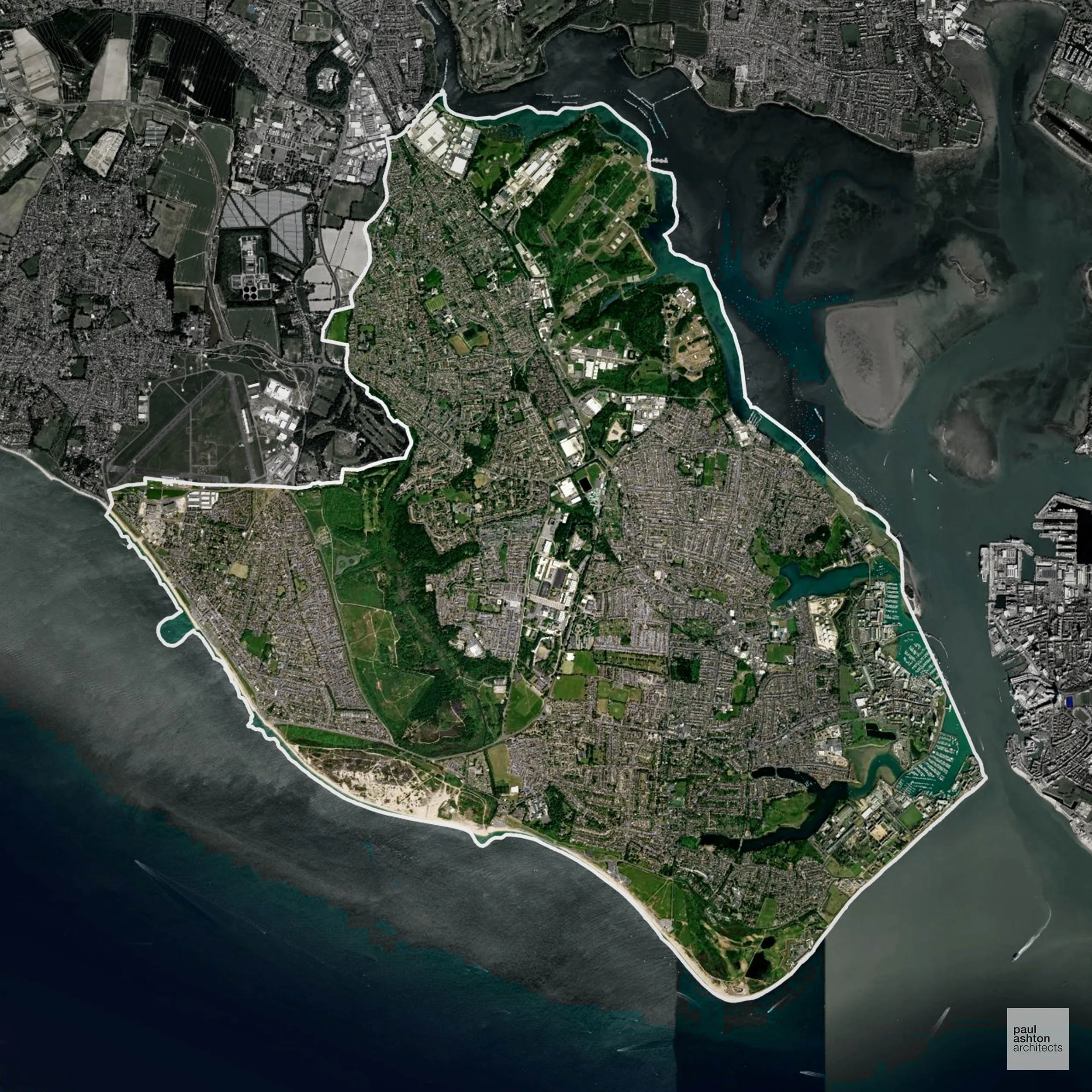
Gosport in Hampshire includes Gosport town, Lee-on-the-Solent, and Alverstoke. Known for naval history, historic forts, and waterfront areas. Planning focuses on urban regeneration, residential extensions, and sensitive commercial development. We can advise and support projects across Gosport.
In the last year Gosport decided 243 applications which is well below the national average of 988. The approval rate was 94% (marginally above the national average of 88%) and 69% of applications were decided on time, (significantly above the national average of 59%). Stats updated March 2026 from gov. sources. See how Gosport performs relative to other LPAs in our LPA hub.
"We love helping clients win Planning Permission in Gosport"
Development in the Open Countryside
Gosport includes areas classed as Open Countryside, generally encompassing land beyond settlements and Green Belt zones, often used for agriculture or left as natural landscapes. Development in these areas is tightly controlled, with standard residential proposals rarely permitted.
Gosport's limited open land includes Browndown coastal heath, Lee-on-the-Solent foreshore, and the green buffers separating the peninsula's settlements, all carefully protected given the constrained nature of the borough.
One of the top reasons poorly prepared proposals in the Open Countryside are refused is that they fail to demonstrate a policy-supported need. To minimise that risk with bespoke advice contact us here.
Nutrient Neutrality in Gosport
Nutrient Neutrality ensures new developments do not increase harmful nitrogen or phosphorus levels in sensitive waterways. Gosport is entirely within the Solent nitrogen catchment; all development within the Borough drains to Peel Common Wastewater Treatment Works, and a nutrient budget calculation is required for every new residential application. Unfortunately, Nutrient Neutrality can halt development completely. If you need early-stage, project-specific advice contact us here.
Planning Applications in Gosport
In addition to acting as Planing Conultants we are ARB registered architects with 25+ years of experience. Our planning proposals are creatively tailored to each site to maximise potential and improve planning outcomes. We use the following tried and tested process to guide clients in Gosport through planning to completion:
- Stage 1: Site Appraisals & Planning Strategy Advice
- Stage 2: Feasibility Studies & Concept Designs
- Stage 3: Planning Application Packages
- Architectural Drawing Packages
- Planning Statements & Design and Access Statements
- Coordination of Consultant Reports
- Direct Liaison with Planning Officers
- Stage 4: Technical Design
- Discharge of Planning Conditions
- Building Regulations and Construction Packages
Planning Services We Offer in Gosport
- Full Planning Applications: Commercial, new buildings, changes of use.
- Householder Planning Applications: Domestic extensions / garden structures.
- Listed Building Consent: Alterations / repairs to listed buildings.
- Conservation Area Consent: Developments within Conservation Areas.
- Lawful Development Certificates: Confirming existing / completed works are lawful.
- Validation Requirements: Gathering documentation to ensure applications are validated by Gosport LPA.
Contextual Planning Support in Gosport
We work collaboratively with clients and shape a design that respects local character and meets Planning Policy requirements in order to maximise your chances of winning Planning Permission.
Gloucester city includes the historic centre, Tuffley, and Quedgeley. Known for Gloucester Cathedral, historic docks, and Roman heritage. Planning focuses on urban regeneration, extensions, and sensitive conversions. We can advise and support residential, commercial, and town centre projects across Gloucester.
In the last year Gloucester decided 431 applications which is well below the national average of 988. The approval rate was 81% (slightly below the national average of 88%) and 52% of applications were decided on time, (significantly below the national average of 59%). Stats updated March 2026 from gov. sources. See how Gloucester performs relative to other LPAs in our LPA hub.
"We love helping clients win Planning Permission in Gloucester"
Flood Risk in Gloucester
In some areas of the LPA, flood risk plays a key role in determining planning proposals. Situated at the confluence of the Severn and Avon, Gloucester has a long history of serious flooding and large Flood Zone 3 areas that constrain development across significant parts of the city. Where constraints permit, we can develop proposals that manage flood risk thoughtfully to give applications the best chance of approval.
Planning Applications in Gloucester
As well as acting as Planning Consultants we are ARB registered architects with over 25 years’ experience. Our site-specific planning proposals balance creativity with strategic insight. We use the following field-tested work stages to help clients in Gloucester achieve successful planning outcomes:
- Stage 1: Site Appraisals & Planning Strategy Advice
- Stage 2: Feasibility Studies & Concept Designs
- Stage 3: Planning Application Packages
- Architectural Drawing Packages
- Planning Statements & Design and Access Statements
- Coordination of Consultant Reports
- Direct Liaison with Planning Officers
- Stage 4: Technical Design
- Discharge of Planning Conditions
- Building Regulations and Construction Packages
Planning Services We Offer in Gloucester
- Full Planning Applications: Commercial, new buildings, changes of use.
- Householder Planning Applications: Domestic extensions / garden structures.
- Listed Building Consent: Alterations / repairs to listed buildings.
- Conservation Area Consent: Developments within Conservation Areas.
- Lawful Development Certificates: Confirming existing / completed works are lawful.
- Validation Requirements: Gathering documentation to ensure applications are validated by Gloucester LPA.
Contextual Planning Support in Gloucester
We work collaboratively with clients and shape a design that respects local character and meets Planning Policy requirements in order to maximise your chances of winning Planning Permission.
Gedling in Nottinghamshire includes Arnold, Carlton, and Bestwood Village. Approximately 73.3% of the borough is Green Belt, framing towns and shaping where new development can occur. The area features historic villages and suburban communities. We can advise on and support residential, commercial, and sensitive conversion projects across Gedling.
In the last year Gedling decided 458 applications which is well below the national average of 988. The approval rate was 92% (marginally above the national average of 88%) and 58% of applications were decided on time, (on par with the national average of 59%). Stats updated March 2026 from gov. sources. See how Gedling performs relative to other LPAs in our LPA hub.
"We love helping clients win Planning Permission in Gedling"
Green Belt Approvals in Gedling
The Green Belt is a nationally designated area of protected land surrounding many English towns and cities, where development is strictly controlled to prevent urban sprawl.
Significantly, 73.3% of Gedling is within the Green Belt and proposals in these areas can be subject to high levels of scrutiny.
The Green Belt near Arnold and Carlton restricts housing and commercial development to preserve countryside and settlement separation.
In our experience, one of the top reasons poorly conceived Green Belt proposals are refused is causing 'harm to openness'. We can lower the risk of refusal with site-specific guidance. Contact us here.
You can also check whether your land is within the Green Belt using our interactive Green Belt map.
Development in the Open Countryside
The Open Countryside is generally defined as land outside settlement and Green Belt boundaries, often comprising agricultural or natural land. Development, particularly standard residential development, is usually restricted in Open Countryside.
Gedling's open countryside east of Nottingham includes the Trent Valley floodplain, ridge farmland around Burton Joyce and Lambley, and the wooded slopes of Gedling Country Park, all visually prominent and sensitive to built development.
One of the top reasons poorly prepared proposals in the Open Countryside are refused is that they fail to demonstrate a policy-supported need. To minimise that risk with bespoke advice contact us here.
Planning Applications in Gedling
Alongside acting as Planning Consultants we are ARB registered architects with 25+ years of experience. We use the following proven work stages to guide clients in Gedling through the planning process in order to maximise the potential of their development :
- Stage 1: Site Appraisals & Planning Strategy Advice
- Stage 2: Feasibility Studies & Concept Designs
- Stage 3: Planning Application Packages
- Architectural Drawing Packages
- Planning Statements & Design and Access Statements
- Coordination of Consultant Reports
- Direct Liaison with Planning Officers
- Stage 4: Technical Design
- Discharge of Planning Conditions
- Building Regulations and Construction Packages
Planning Services We Offer in Gedling
- Full Planning Applications: Commercial, new buildings, changes of use.
- Householder Planning Applications: Domestic extensions / garden structures.
- Listed Building Consent: Alterations / repairs to listed buildings.
- Conservation Area Consent: Developments within Conservation Areas.
- Lawful Development Certificates: Confirming existing / completed works are lawful.
- Validation Requirements: Gathering documentation to ensure applications are validated by Gedling LPA.
Design-Led Planning Advice in Gedling
We can review your site in Gedling and offer informed guidance on how proposals can be developed in order to maximise your chances of securing Planning Permission.
Gateshead in Tyne and Wear includes Gateshead town, Whickham, and Blaydon. About 59.8% of the borough is Green Belt, shaping development around urban centres. Known for the Angel of the North, historic streets, and industrial heritage, planning focuses on residential, commercial, and town centre schemes. We can advise and support projects throughout Gateshead.
In the last year Gateshead decided 468 applications which is well below the national average of 988. The approval rate was 90% (roughly equal to the national average of 88%) and 35% of applications were decided on time, (significantly below the national average of 59%). Stats updated March 2026 from gov. sources. See how Gateshead performs relative to other LPAs in our LPA hub.
"We love helping clients win Planning Permission in Gateshead"
Green Belt Approvals in Gateshead
The Green Belt is a policy protecting land around many English towns and cities, where development is tightly controlled to safeguard the open countryside.
Significantly, 59.8% of Gateshead is within the Green Belt and proposals in these areas can be subject to high levels of scrutiny.
The Green Belt near Blaydon and Ryton limits growth to maintain open countryside and prevent urban sprawl.
In our experience, one of the top reasons poorly conceived Green Belt proposals are refused is causing 'harm to openness'. We can lower the risk of refusal with site-specific guidance. Contact us here.
You can also check whether your land is within the Green Belt using our interactive Green Belt map.
Planning Applications in Gateshead
As well as acting as Planning Consultants we are ARB registered architects with over 25 years’ experience. Our site-specific planning proposals balance creativity with strategic insight. We use the following field-tested work stages to help clients in Gateshead achieve successful planning outcomes:
- Stage 1: Site Appraisals & Planning Strategy Advice
- Stage 2: Feasibility Studies & Concept Designs
- Stage 3: Planning Application Packages
- Architectural Drawing Packages
- Planning Statements & Design and Access Statements
- Coordination of Consultant Reports
- Direct Liaison with Planning Officers
- Stage 4: Technical Design
- Discharge of Planning Conditions
- Building Regulations and Construction Packages
Planning Services We Offer in Gateshead
- Full Planning Applications: Commercial, new buildings, changes of use.
- Householder Planning Applications: Domestic extensions / garden structures.
- Listed Building Consent: Alterations / repairs to listed buildings.
- Conservation Area Consent: Developments within Conservation Areas.
- Lawful Development Certificates: Confirming existing / completed works are lawful.
- Validation Requirements: Gathering documentation to ensure applications are validated by Gateshead LPA.
Contextual Planning Support in Gateshead
We work collaboratively with clients and shape a design that respects local character and meets Planning Policy requirements in order to maximise your chances of winning Planning Permission.

Fylde in Lancashire includes Lytham St Annes, Kirkham, and Wesham. About 10.6% of the district is Green Belt, influencing development on the outskirts of towns. Known for coastal resorts, historic streets, and market towns, planning balances growth with conservation. We can advise and support residential, commercial, and conversion schemes throughout Fylde.
In the last year Fylde decided 421 applications which is well below the national average of 988. The approval rate was 96% (marginally above the national average of 88%) and 47% of applications were decided on time, (significantly below the national average of 59%). Stats updated March 2026 from gov. sources. See how Fylde performs relative to other LPAs in our LPA hub.
"We love helping clients win Planning Permission in Fylde"
Conservation and Listed Buildings in Fylde
Fylde has a varied historic environment, with several Conservation Areas and a number of listed buildings across its coastal and rural settlements. Heritage constraints are particularly evident within the Lytham Conservation Area and St Annes Conservation Area, where resort architecture, historic street patterns, and coastal setting define local character.
One of the top reasons heritage building applications are refused is causing harm to historic significance, a risk that can arise when proposals are not prepared by a consultant with heritage expertise. We help minimise this risk with expert, site-specific guidance; contact us here.
Green Belt Approvals in Fylde
The Green Belt is a nationally designated area of protected land surrounding many English towns and cities, where development is strictly controlled to prevent urban sprawl.
10.6% of Fylde is within the Green Belt and proposals in these areas can be subject to reasonable levels of scrutiny.
The Fylde Green Belt preserves open farmland, coastal hinterlands, and villages such as Kirkham and Wrea Green, protecting low-lying landscapes from urban expansion and maintaining settlement separation.
In our experience, one of the top reasons poorly conceived Green Belt proposals are refused is causing 'harm to openness'. We can lower the risk of refusal with site-specific guidance. Contact us here.
You can also check whether your land is within the Green Belt using our interactive Green Belt map.
Development in the Open Countryside
Fylde includes areas classed as Open Countryside, generally encompassing land beyond settlements and Green Belt zones, often used for agriculture or left as natural landscapes. Development in these areas is tightly controlled, with standard residential proposals rarely permitted.
Fylde's flat coastal plain, mossland habitats around Lytham, and open farmland separating Blackpool's urban fringe from rural villages are sensitive to development and carefully protected.
One of the top reasons poorly prepared proposals in the Open Countryside are refused is that they fail to demonstrate a policy-supported need. To minimise that risk with bespoke advice contact us here.
Flood Risk in Fylde
In some areas of the LPA, flood risk plays a key role in determining planning proposals. The Ribble Estuary and the low-lying Fylde coastal plain place extensive areas of the borough in Flood Zone 3, with tidal flood risk a primary constraint on development in many locations. Where constraints permit, we can develop proposals that manage flood risk thoughtfully to give applications the best chance of approval.
Planning Applications in Fylde
In addition to acting as Planing Conultants we are ARB registered architects with 25+ years of experience. Our planning proposals are creatively tailored to each site to maximise potential and improve planning outcomes. We use the following tried and tested process to guide clients in Fylde through planning to completion:
- Stage 1: Site Appraisals & Planning Strategy Advice
- Stage 2: Feasibility Studies & Concept Designs
- Stage 3: Planning Application Packages
- Architectural Drawing Packages
- Planning Statements & Design and Access Statements
- Coordination of Consultant Reports
- Direct Liaison with Planning Officers
- Stage 4: Technical Design
- Discharge of Planning Conditions
- Building Regulations and Construction Packages
Planning Services We Offer in Fylde
- Full Planning Applications: Commercial, new buildings, changes of use.
- Householder Planning Applications: Domestic extensions / garden structures.
- Listed Building Consent: Alterations / repairs to listed buildings.
- Conservation Area Consent: Developments within Conservation Areas.
- Lawful Development Certificates: Confirming existing / completed works are lawful.
- Validation Requirements: Gathering documentation to ensure applications are validated by Fylde LPA.
Creative Planning Advice in Fylde
We collaborate closely with our clients to develop designs that respond to local character and align with Planning Policy, helping to maximise the likelihood of securing Planning Permission in Fylde.
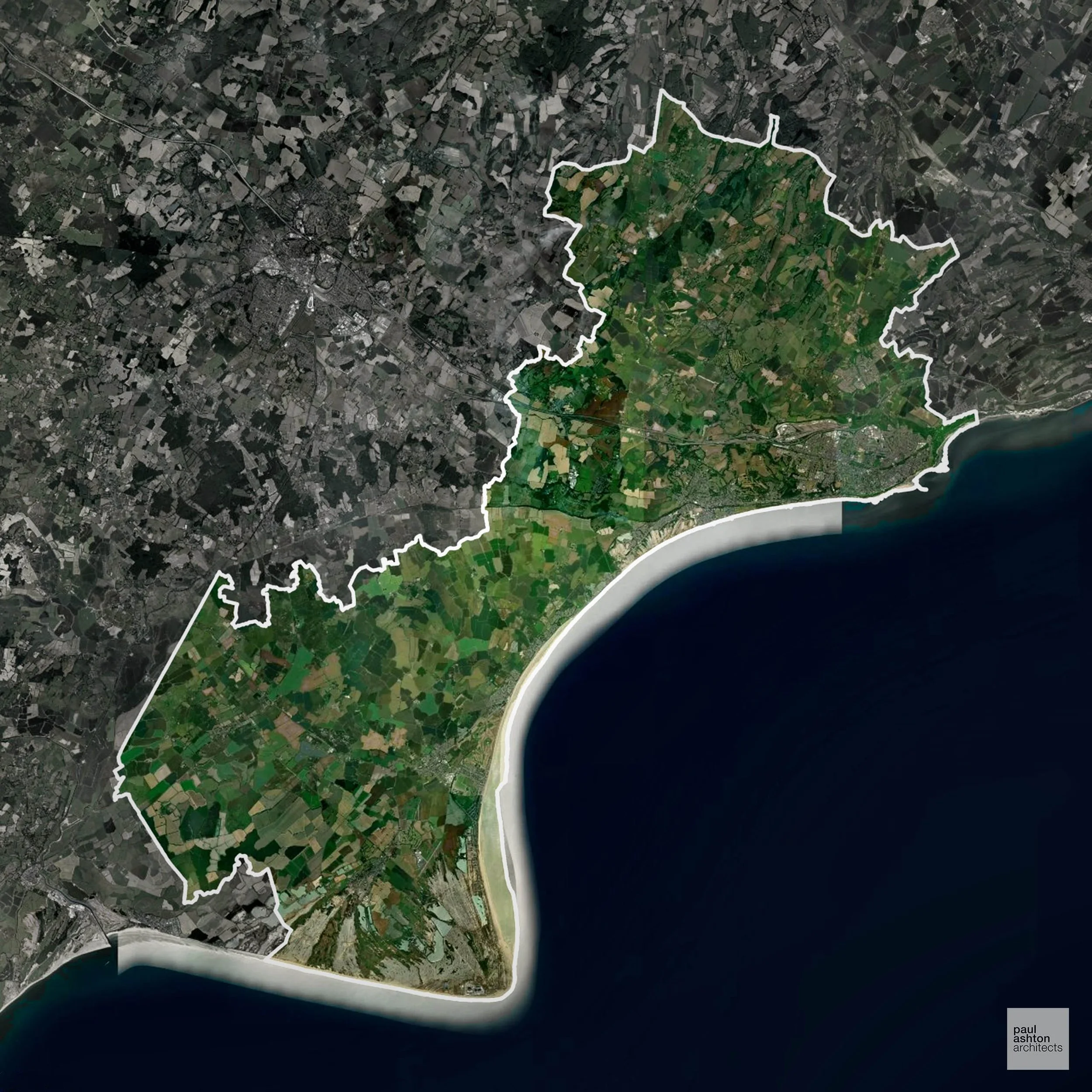
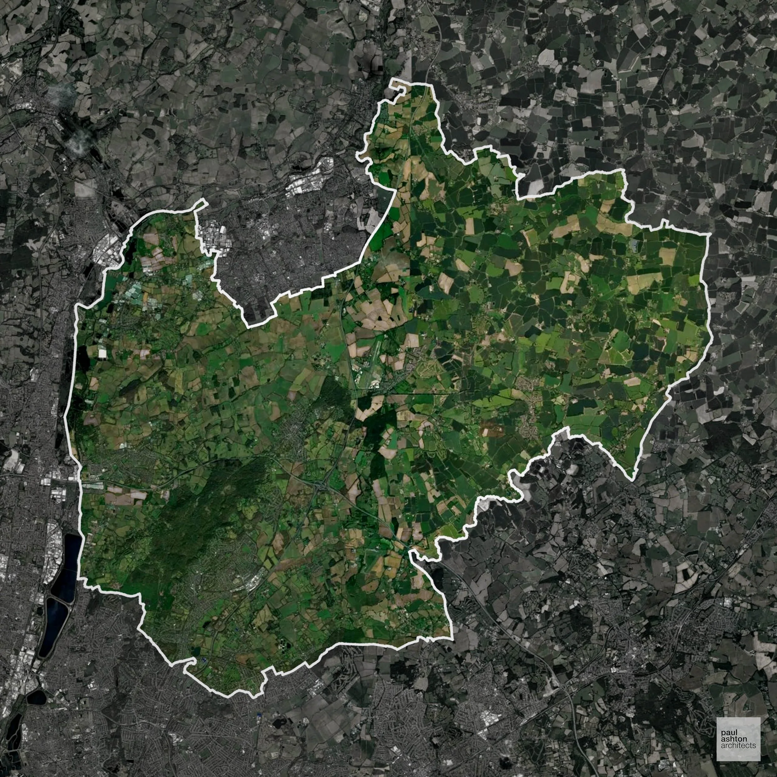
Forest of Dean in Gloucestershire includes Coleford, Cinderford, and Lydney. Known for its woodland, historic ironworks, and rural heritage. Planning focuses on conserving natural landscapes while supporting residential and commercial development. We can advise and support projects throughout the district.
In the last year Forest of Dean decided 596 applications which is well below the national average of 988. The approval rate was 92% (marginally above the national average of 88%) and 54% of applications were decided on time, (slightly below the national average of 59%). Stats updated March 2026 from gov. sources. See how Forest of Dean performs relative to other LPAs in our LPA hub.
"We love helping clients win Planning Permission in Forest of Dean"
Areas of Outstanding Natural Beauty in Forest of Dean
Areas of Outstanding Natural Beauty (AONBs), often referred to as National Landscapes, are protected for their remarkable natural and scenic value. Any development proposals here are closely evaluated, with a strong presumption against works that could harm the landscape.
Forest of Dean contains parts of the Wye Valley AONB. Development must preserve landscape and environmental character.
In our experience, one of the top reasons proposals in Areas of Outstanding Natural Beauty are refused is causing landscape harm or visual intrusion, a risk that often arises when applications are not fully informed. We help minimise the likelihood of refusal with expert, guidance; contact us here.
Development in the Open Countryside
The Open Countryside is generally defined as land outside settlement and Green Belt boundaries, often comprising agricultural or natural land. Development, particularly standard residential development, is usually restricted in Open Countryside.
Forest of Dean encompasses protected rural areas and scenic landscapes, requiring careful consideration for any proposed development to preserve their natural qualities.
One of the top reasons poorly prepared proposals in the Open Countryside are refused is that they fail to demonstrate a policy-supported need. To minimise that risk with bespoke advice contact us here.
Planning Applications in Forest of Dean
As well as acting as Planning Consultants we are ARB registered architects with over 25 years’ experience. Our site-specific planning proposals balance creativity with strategic insight. We use the following field-tested work stages to help clients in Forest of Dean achieve successful planning outcomes:
- Stage 1: Site Appraisals & Planning Strategy Advice
- Stage 2: Feasibility Studies & Concept Designs
- Stage 3: Planning Application Packages
- Architectural Drawing Packages
- Planning Statements & Design and Access Statements
- Coordination of Consultant Reports
- Direct Liaison with Planning Officers
- Stage 4: Technical Design
- Discharge of Planning Conditions
- Building Regulations and Construction Packages
Planning Services We Offer in Forest of Dean
- Full Planning Applications: Commercial, new buildings, changes of use.
- Householder Planning Applications: Domestic extensions / garden structures.
- Listed Building Consent: Alterations / repairs to listed buildings.
- Conservation Area Consent: Developments within Conservation Areas.
- Lawful Development Certificates: Confirming existing / completed works are lawful.
- Validation Requirements: Gathering documentation to ensure applications are validated by Forest of Dean LPA.
Contextual Planning Support in Forest of Dean
We work collaboratively with clients and shape a design that respects local character and meets Planning Policy requirements in order to maximise your chances of winning Planning Permission.
Folkestone and Hythe in Kent includes Folkestone, Hythe, and Sandgate. Known for coastal towns, historic buildings, and maritime heritage. Planning focuses on sensitive seaside development, conversions, and residential schemes. We can advise and support projects across Folkestone and Hythe.
In the last year Folkestone and Hythe decided 756 applications which is well below the national average of 988. The approval rate was 83% (slightly below the national average of 88%) and 88% of applications were decided on time, (significantly above the national average of 59%). Stats updated March 2026 from gov. sources. See how Folkestone and Hythe performs relative to other LPAs in our LPA hub.
"We love helping clients win Planning Permission in Folkestone and Hythe"
Development in the Open Countryside
Open Countryside within Folkestone and Hythe refers to land situated outside built-up areas and Green Belt boundaries, typically comprising farmland or natural landscapes. Residential development is generally restricted unless special circumstances can be demonstrated.
Folkestone and Hythe holds notable open countryside that contributes to local character and biodiversity, with strict controls on inappropriate development.
One of the top reasons poorly prepared proposals in the Open Countryside are refused is that they fail to demonstrate a policy-supported need. To minimise that risk with bespoke advice contact us here.
Flood Risk in Folkestone and Hythe
In some areas of the LPA, flood risk plays a key role in determining planning proposals. Romney Marsh, which forms a large part of the district, is low-lying reclaimed land in Flood Zone 3 subject to tidal and surface water flood risk, significantly limiting development options. Where constraints permit, we can develop proposals that manage flood risk thoughtfully to give applications the best chance of approval.
Nutrient Neutrality in Folkestone and Hythe
Nutrient Neutrality ensures new developments do not increase harmful nitrogen or phosphorus levels in sensitive waterways. Parts of Folkestone and Hythe fall within the Stodmarsh designated sensitive catchment, requiring both nitrogen and phosphorus neutrality for new residential development in those areas. Unfortunately, Nutrient Neutrality can halt development completely. If you need early-stage, project-specific advice contact us here.
Planning Applications in Folkestone and Hythe
As well as acting as Planning Consultants we are ARB registered architects with over 25 years’ experience. Our site-specific planning proposals balance creativity with strategic insight. We use the following field-tested work stages to help clients in Folkestone and Hythe achieve successful planning outcomes:
- Stage 1: Site Appraisals & Planning Strategy Advice
- Stage 2: Feasibility Studies & Concept Designs
- Stage 3: Planning Application Packages
- Architectural Drawing Packages
- Planning Statements & Design and Access Statements
- Coordination of Consultant Reports
- Direct Liaison with Planning Officers
- Stage 4: Technical Design
- Discharge of Planning Conditions
- Building Regulations and Construction Packages
Planning Services We Offer in Folkestone and Hythe
- Full Planning Applications: Commercial, new buildings, changes of use.
- Householder Planning Applications: Domestic extensions / garden structures.
- Listed Building Consent: Alterations / repairs to listed buildings.
- Conservation Area Consent: Developments within Conservation Areas.
- Lawful Development Certificates: Confirming existing / completed works are lawful.
- Validation Requirements: Gathering documentation to ensure applications are validated by Folkestone and Hythe LPA.
Contextual Planning Support in Folkestone and Hythe
We work collaboratively with clients and shape a design that respects local character and meets Planning Policy requirements in order to maximise your chances of winning Planning Permission.
Fenland in Cambridgeshire includes March, Wisbech, and Chatteris. Famous for agriculture, historic market towns, and flat fenland landscapes. Planning focuses on sensitive rural development and conservation of historic buildings. We can advise and support residential and commercial schemes throughout Fenland.
In the last year Fenland decided 599 applications which is well below the national average of 988. The approval rate was 87% (roughly equal to the national average of 88%) and 54% of applications were decided on time, (slightly below the national average of 59%). Stats updated March 2026 from gov. sources. See how Fenland performs relative to other LPAs in our LPA hub.
"We love helping clients win Planning Permission in Fenland"
Development in the Open Countryside
Fenland includes areas classed as Open Countryside, generally encompassing land beyond settlements and Green Belt zones, often used for agriculture or left as natural landscapes. Development in these areas is tightly controlled, with standard residential proposals rarely permitted.
Fenland's Black Fen landscapes, including the Nene Washes and open droves around Wisbech and March, are internationally important for wetland ecology and form a visually distinctive landscape of great sensitivity.
One of the top reasons poorly prepared proposals in the Open Countryside are refused is that they fail to demonstrate a policy-supported need. To minimise that risk with bespoke advice contact us here.
Flood Risk in Fenland
In some areas of the LPA, flood risk plays a key role in determining planning proposals. Comprising almost entirely reclaimed fenland that sits at or below sea level, Fenland has one of the highest proportions of land in Flood Zone 3 of any local authority in England. Where constraints permit, we can develop proposals that manage flood risk thoughtfully to give applications the best chance of approval.
Planning Applications in Fenland
As well as acting as Planning Consultants we are ARB registered architects with over 25 years’ experience. Our site-specific planning proposals balance creativity with strategic insight. We use the following field-tested work stages to help clients in Fenland achieve successful planning outcomes:
- Stage 1: Site Appraisals & Planning Strategy Advice
- Stage 2: Feasibility Studies & Concept Designs
- Stage 3: Planning Application Packages
- Architectural Drawing Packages
- Planning Statements & Design and Access Statements
- Coordination of Consultant Reports
- Direct Liaison with Planning Officers
- Stage 4: Technical Design
- Discharge of Planning Conditions
- Building Regulations and Construction Packages
Planning Services We Offer in Fenland
- Full Planning Applications: Commercial, new buildings, changes of use.
- Householder Planning Applications: Domestic extensions / garden structures.
- Listed Building Consent: Alterations / repairs to listed buildings.
- Conservation Area Consent: Developments within Conservation Areas.
- Lawful Development Certificates: Confirming existing / completed works are lawful.
- Validation Requirements: Gathering documentation to ensure applications are validated by Fenland LPA.
Creative Planning Advice in Fenland
We collaborate closely with our clients to develop designs that respond to local character and align with Planning Policy, helping to maximise the likelihood of securing Planning Permission in Fenland.
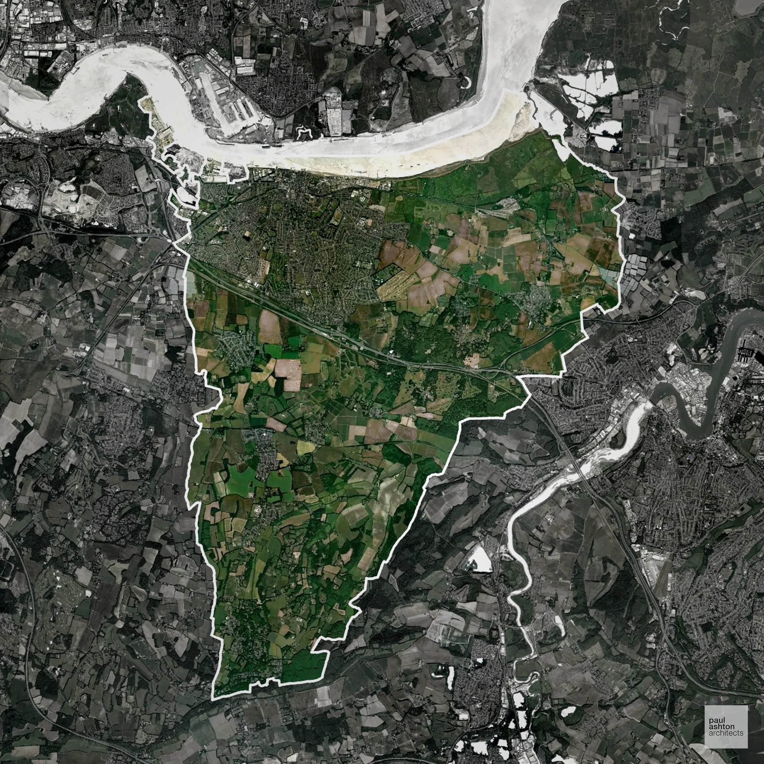
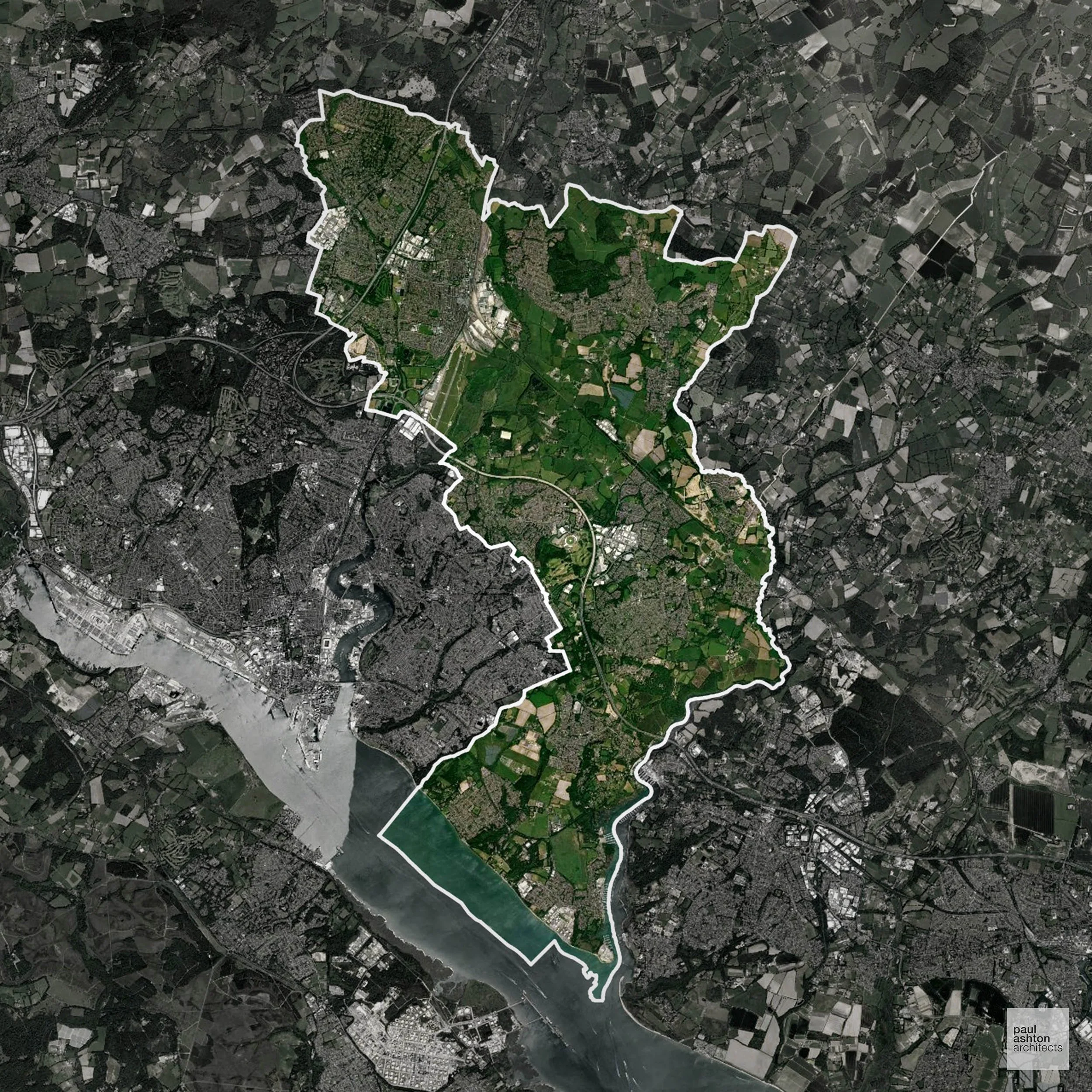
Fareham in Hampshire includes Fareham town, Portchester, and Locks Heath. Known for naval history, market towns, and suburban communities. Planning focuses on residential growth, extensions, and town centre projects. We can advise and support projects across Fareham.
In the last year Fareham decided 595 applications which is well below the national average of 988. The approval rate was 98% (marginally above the national average of 88%) and 78% of applications were decided on time, (significantly above the national average of 59%). Stats updated March 2026 from gov. sources. See how Fareham performs relative to other LPAs in our LPA hub.
"We love helping clients win Planning Permission in Fareham"
Development in the Open Countryside
Fareham includes areas classed as Open Countryside, generally encompassing land beyond settlements and Green Belt zones, often used for agriculture or left as natural landscapes. Development in these areas is tightly controlled, with standard residential proposals rarely permitted.
Fareham's Open Countryside includes the Meon Valley, Titchfield Haven National Nature Reserve, and the farmland separating Fareham from Wickham and Stubbington, valued for scenic quality and biodiversity.
One of the top reasons poorly prepared proposals in the Open Countryside are refused is that they fail to demonstrate a policy-supported need. To minimise that risk with bespoke advice contact us here.
Nutrient Neutrality in Fareham
Nutrient Neutrality ensures new developments do not increase harmful nitrogen or phosphorus levels in sensitive waterways. Entirely within the Solent nitrogen catchment; one of the original LPAs subject to nutrient neutrality since 2018/2019, with all new residential development requiring demonstrated nitrogen neutrality. Unfortunately, Nutrient Neutrality can halt development completely. If you need early-stage, project-specific advice contact us here.
Planning Applications in Fareham
As well as acting as Planning Consultants we are ARB registered architects with over 25 years’ experience. Our site-specific planning proposals balance creativity with strategic insight. We use the following field-tested work stages to help clients in Fareham achieve successful planning outcomes:
- Stage 1: Site Appraisals & Planning Strategy Advice
- Stage 2: Feasibility Studies & Concept Designs
- Stage 3: Planning Application Packages
- Architectural Drawing Packages
- Planning Statements & Design and Access Statements
- Coordination of Consultant Reports
- Direct Liaison with Planning Officers
- Stage 4: Technical Design
- Discharge of Planning Conditions
- Building Regulations and Construction Packages
Planning Services We Offer in Fareham
- Full Planning Applications: Commercial, new buildings, changes of use.
- Householder Planning Applications: Domestic extensions / garden structures.
- Listed Building Consent: Alterations / repairs to listed buildings.
- Conservation Area Consent: Developments within Conservation Areas.
- Lawful Development Certificates: Confirming existing / completed works are lawful.
- Validation Requirements: Gathering documentation to ensure applications are validated by Fareham LPA.
Design-Led Planning Advice in Fareham
We can review your site in Fareham and offer informed guidance on how proposals can be developed in order to maximise your chances of securing Planning Permission.
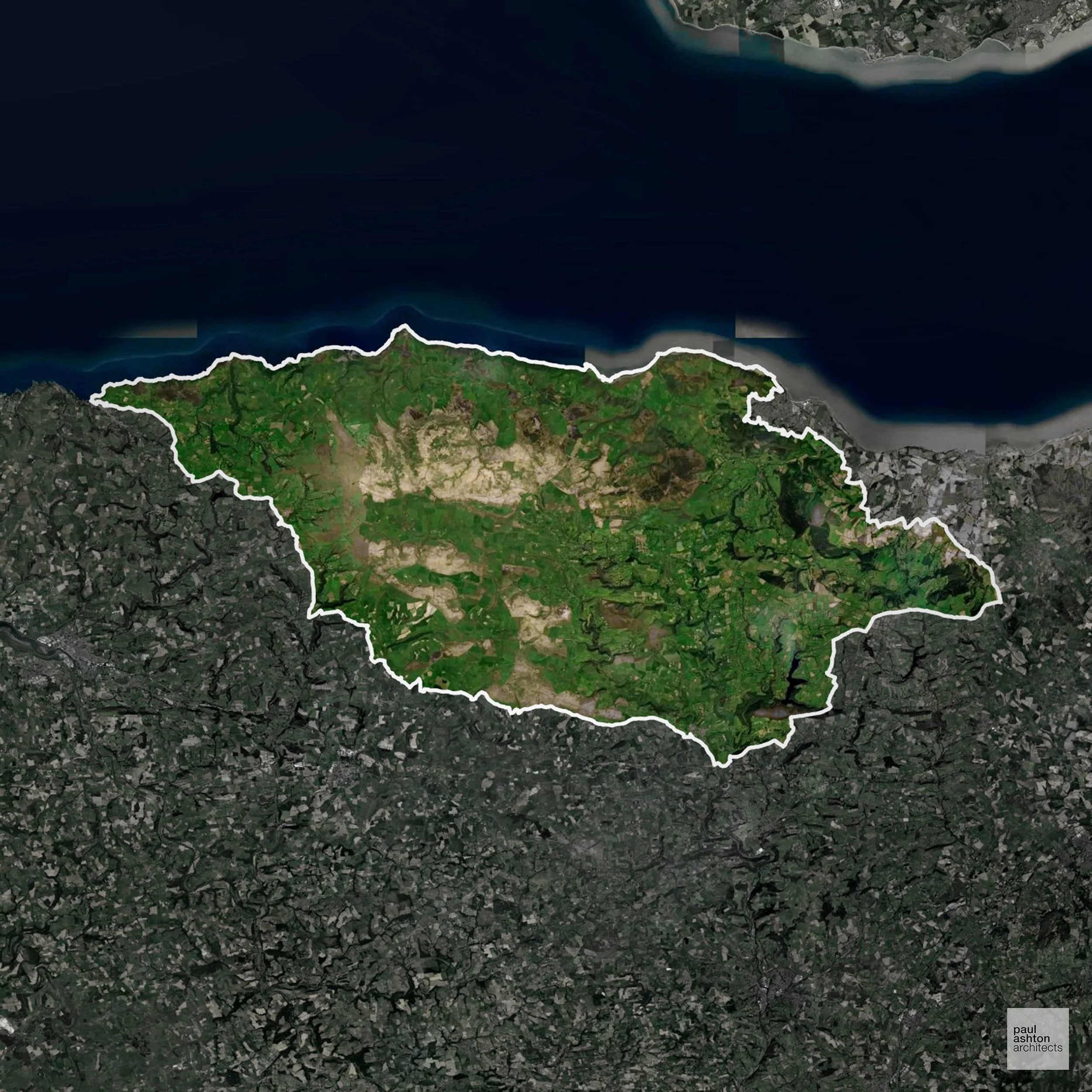
Exmoor National Park includes villages like Dulverton, Porlock, and Lynton. Famous for its moorland, historic settlements, and natural beauty, it is designated as a National Park. Planning is focused on conserving landscapes, heritage, and sustainable rural development. We can advise and support residential, commercial, and sensitive conversion projects within the park.
In the last year Exmoor National Park decided 161 applications which is well below the national average of 988. The approval rate was 93% (marginally above the national average of 88%) and 45% of applications were decided on time, (significantly below the national average of 59%). Stats updated March 2026 from gov. sources. See how Exmoor National Park performs relative to other LPAs in our LPA hub.
"We love helping clients win Planning Permission in Exmoor National Park"
Development in Exmoor National Park
National Parks have stricter protections, with development tightly controlled to safeguard landscape, wildlife, and heritage.
Exmoor’s moorlands, coastal cliffs, and villages such as Lynmouth and Porlock are tightly regulated, with most greenfield housing opposed. Opportunities may arise through the sympathetic conversion of historic farm buildings or minor development in settlements with defined boundaries, provided it does not disrupt landscape character, protected habitats, or flood-prone areas.
One of the top reasons National Park applications lacking specialist expertise are refused is failing to conserve or enhance the landscape. We help reduce this risk with expert, site-specific guidance; contact us here.
Nutrient Neutrality in Exmoor National Park
Nutrient Neutrality ensures new developments do not increase harmful nitrogen or phosphorus levels in sensitive waterways. Parts of the Exmoor National Park drain to the Somerset Levels and Moors catchment, where phosphorus neutrality is required for any residential development generating additional wastewater. Unfortunately, Nutrient Neutrality can halt development completely. If you need early-stage, project-specific advice contact us here.
Planning Applications in Exmoor National Park
Alongside acting as Planning Consultants we are ARB registered architects with 25+ years of experience. We use the following proven work stages to guide clients in Exmoor National Park through the planning process in order to maximise the potential of their development :
- Stage 1: Site Appraisals & Planning Strategy Advice
- Stage 2: Feasibility Studies & Concept Designs
- Stage 3: Planning Application Packages
- Architectural Drawing Packages
- Planning Statements & Design and Access Statements
- Coordination of Consultant Reports
- Direct Liaison with Planning Officers
- Stage 4: Technical Design
- Discharge of Planning Conditions
- Building Regulations and Construction Packages
Planning Services We Offer in Exmoor National Park
- Full Planning Applications: Commercial, new buildings, changes of use.
- Householder Planning Applications: Domestic extensions / garden structures.
- Listed Building Consent: Alterations / repairs to listed buildings.
- Conservation Area Consent: Developments within Conservation Areas.
- Lawful Development Certificates: Confirming existing / completed works are lawful.
- Validation Requirements: Gathering documentation to ensure applications are validated by Exmoor National Park LPA.
Design-Led Planning Advice in Exmoor National Park
We can review your site in Exmoor National Park and offer informed guidance on how proposals can be developed in order to maximise your chances of securing Planning Permission.
Exeter in Devon includes the city centre, Heavitree, and Topsham. Known for Exeter Cathedral, historic streets, and a university presence. Planning focuses on urban regeneration, conversions, and residential extensions. We can advise and support projects across Exeter.
In the last year Exeter decided 559 applications which is well below the national average of 988. The approval rate was 85% (roughly equal to the national average of 88%) and 61% of applications were decided on time, (on par with the national average of 59%). Stats updated March 2026 from gov. sources. See how Exeter performs relative to other LPAs in our LPA hub.
"We love helping clients win Planning Permission in Exeter"
Conservation and Listed Buildings in Exeter
Exeter has a rich historic environment centred around its medieval core, with a substantial Conservation Area and numerous listed buildings. Development proposals must carefully consider impacts on historic streetscapes, archaeological sensitivity, and key views, particularly in relation to assets such as Exeter Cathedral. Exeter LPA places strong emphasis on heritage-led design, with Planning Permission typically requiring proposals that preserve or enhance the city’s historic character.
One of the top reasons heritage building applications are refused is causing harm to historic significance, a risk that can arise when proposals are not prepared by a consultant with heritage expertise. We help minimise this risk with expert, site-specific guidance; contact us here.
Development in the Open Countryside
The Open Countryside is generally defined as land outside settlement and Green Belt boundaries, often comprising agricultural or natural land. Development, particularly standard residential development, is usually restricted in Open Countryside.
Exeter's rural fringes include the Exe Valley, Haldon Ridge woodland, and open farmland around Ide and Alphington, where development beyond the urban boundary is generally resisted.
One of the top reasons poorly prepared proposals in the Open Countryside are refused is that they fail to demonstrate a policy-supported need. To minimise that risk with bespoke advice contact us here.
Planning Applications in Exeter
As well as acting as Planning Consultants we are ARB registered architects with over 25 years’ experience. Our site-specific planning proposals balance creativity with strategic insight. We use the following field-tested work stages to help clients in Exeter achieve successful planning outcomes:
- Stage 1: Site Appraisals & Planning Strategy Advice
- Stage 2: Feasibility Studies & Concept Designs
- Stage 3: Planning Application Packages
- Architectural Drawing Packages
- Planning Statements & Design and Access Statements
- Coordination of Consultant Reports
- Direct Liaison with Planning Officers
- Stage 4: Technical Design
- Discharge of Planning Conditions
- Building Regulations and Construction Packages
Planning Services We Offer in Exeter
- Full Planning Applications: Commercial, new buildings, changes of use.
- Householder Planning Applications: Domestic extensions / garden structures.
- Listed Building Consent: Alterations / repairs to listed buildings.
- Conservation Area Consent: Developments within Conservation Areas.
- Lawful Development Certificates: Confirming existing / completed works are lawful.
- Validation Requirements: Gathering documentation to ensure applications are validated by Exeter LPA.
Contextual Planning Support in Exeter
We work collaboratively with clients and shape a design that respects local character and meets Planning Policy requirements in order to maximise your chances of winning Planning Permission.
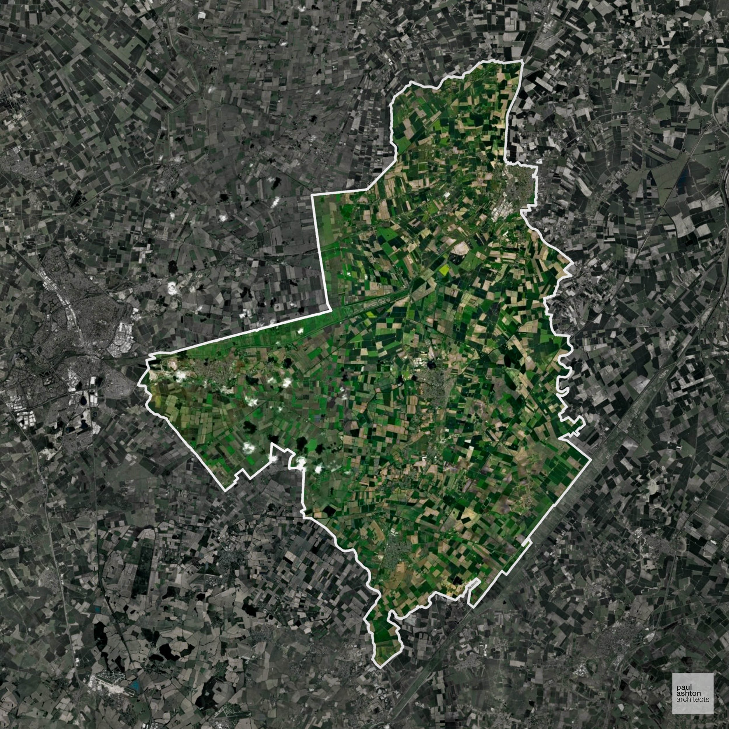
Erewash in Derbyshire includes Ilkeston, Long Eaton, and Stapleford. Approximately 71.6% of the district is Green Belt, framing urban expansion and protecting surrounding countryside. The area is known for historic mills, market towns, and industrial heritage. We can advise and support residential, commercial, and sensitive conversion projects throughout Erewash.
In the last year Erewash decided 389 applications which is well below the national average of 988. The approval rate was 94% (marginally above the national average of 88%) and 73% of applications were decided on time, (significantly above the national average of 59%). Stats updated March 2026 from gov. sources. See how Erewash performs relative to other LPAs in our LPA hub.
"We love helping clients win Planning Permission in Erewash"
Green Belt Approvals in Erewash
The Green Belt is nationally designated land around towns and cities, created to limit urban growth.
Significantly, 71.6% of Erewash is within the Green Belt and proposals in these areas can be subject to high levels of scrutiny.
The Green Belt around Ilkeston and Long Eaton limits development to protect landscape, village separation, and rural character.
In our experience, one of the top reasons poorly conceived Green Belt proposals are refused is causing 'harm to openness'. We can lower the risk of refusal with site-specific guidance. Contact us here.
You can also check whether your land is within the Green Belt using our interactive Green Belt map.
Planning Applications in Erewash
As well as acting as Planning Consultants we are ARB registered architects with over 25 years’ experience. Our site-specific planning proposals balance creativity with strategic insight. We use the following field-tested work stages to help clients in Erewash achieve successful planning outcomes:
- Stage 1: Site Appraisals & Planning Strategy Advice
- Stage 2: Feasibility Studies & Concept Designs
- Stage 3: Planning Application Packages
- Architectural Drawing Packages
- Planning Statements & Design and Access Statements
- Coordination of Consultant Reports
- Direct Liaison with Planning Officers
- Stage 4: Technical Design
- Discharge of Planning Conditions
- Building Regulations and Construction Packages
Planning Services We Offer in Erewash
- Full Planning Applications: Commercial, new buildings, changes of use.
- Householder Planning Applications: Domestic extensions / garden structures.
- Listed Building Consent: Alterations / repairs to listed buildings.
- Conservation Area Consent: Developments within Conservation Areas.
- Lawful Development Certificates: Confirming existing / completed works are lawful.
- Validation Requirements: Gathering documentation to ensure applications are validated by Erewash LPA.
Creative Planning Advice in Erewash
We collaborate closely with our clients to develop designs that respond to local character and align with Planning Policy, helping to maximise the likelihood of securing Planning Permission in Erewash.
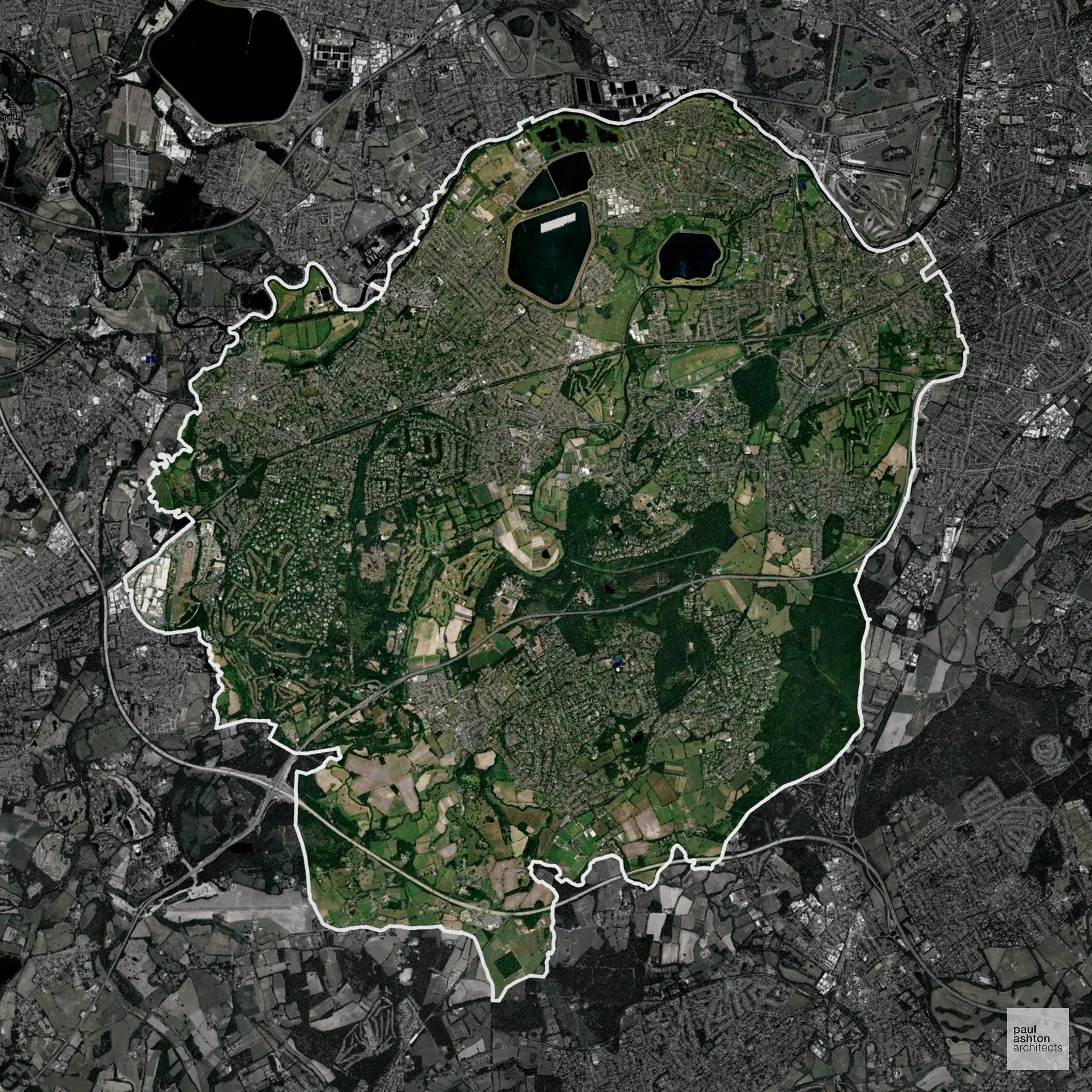
Epsom and Ewell in Surrey includes Epsom town and surrounding villages. About 45.8% of the district is Green Belt, shaping development on the outskirts. Known for the Epsom Downs Racecourse, historic buildings, and market towns, planning balances urban growth with conservation. We can advise and support residential, commercial, and conversion projects across Epsom and Ewell.
In the last year Epsom and Ewell decided 631 applications which is well below the national average of 988. The approval rate was 85% (roughly equal to the national average of 88%) and 84% of applications were decided on time, (significantly above the national average of 59%). Stats updated March 2026 from gov. sources. See how Epsom and Ewell performs relative to other LPAs in our LPA hub.
"We love helping clients win Planning Permission in Epsom and Ewell"
Green Belt Approvals in Epsom and Ewell
The Green Belt is nationally designated land around towns and cities, created to limit urban growth.
45.8% of Epsom and Ewell is within the Green Belt and proposals in these areas can be subject to high levels of scrutiny.
The Green Belt within Epsom and Ewell covers the North Downs and open countryside near Ewell and Ashtead, sensitive to development due to landscape value.
In our experience, one of the top reasons poorly conceived Green Belt proposals are refused is causing 'harm to openness'. We can lower the risk of refusal with site-specific guidance. Contact us here.
You can also check whether your land is within the Green Belt using our interactive Green Belt map.
Planning Applications in Epsom and Ewell
Alongside acting as Planning Consultants we are ARB registered architects with 25+ years of experience. We use the following proven work stages to guide clients in Epsom and Ewell through the planning process in order to maximise the potential of their development :
- Stage 1: Site Appraisals & Planning Strategy Advice
- Stage 2: Feasibility Studies & Concept Designs
- Stage 3: Planning Application Packages
- Architectural Drawing Packages
- Planning Statements & Design and Access Statements
- Coordination of Consultant Reports
- Direct Liaison with Planning Officers
- Stage 4: Technical Design
- Discharge of Planning Conditions
- Building Regulations and Construction Packages
Planning Services We Offer in Epsom and Ewell
- Full Planning Applications: Commercial, new buildings, changes of use.
- Householder Planning Applications: Domestic extensions / garden structures.
- Listed Building Consent: Alterations / repairs to listed buildings.
- Conservation Area Consent: Developments within Conservation Areas.
- Lawful Development Certificates: Confirming existing / completed works are lawful.
- Validation Requirements: Gathering documentation to ensure applications are validated by Epsom and Ewell LPA.
Creative Planning Advice in Epsom and Ewell
We collaborate closely with our clients to develop designs that respond to local character and align with Planning Policy, helping to maximise the likelihood of securing Planning Permission in Epsom and Ewell.
Epping Forest in Essex includes Loughton, Waltham Abbey, and Epping. Around 90.9% of the district is Green Belt, strongly influencing development patterns. Known for its forest, market towns, and heritage villages, planning focuses on balancing growth with protection of open countryside. We can advise and support residential, commercial, and sensitive development projects throughout Epping Forest.
In the last year Epping Forest decided 1,350 applications which is well above the national average of 988. The approval rate was 66% (well below the national average of 88%) and 67% of applications were decided on time, (significantly above the national average of 59%). Stats updated March 2026 from gov. sources. See how Epping Forest performs relative to other LPAs in our LPA hub.
"We love helping clients win Planning Permission in Epping Forest"
Green Belt Approvals in Epping Forest
The Green Belt is nationally designated land around towns and cities, created to limit urban growth.
Significantly, 90.9% of Epping Forest is within the Green Belt and proposals in these areas can be subject to very high levels of scrutiny.
The Epping Forest Green Belt surrounding Loughton, Epping, and Harlow is sensitive due to pressures for housing and the need to protect ancient woodland and prevent settlement coalescence.
In our experience, one of the top reasons poorly conceived Green Belt proposals are refused is causing 'harm to openness'. We can lower the risk of refusal with site-specific guidance. Contact us here.
You can also check whether your land is within the Green Belt using our interactive Green Belt map.
Planning Applications in Epping Forest
Alongside acting as Planning Consultants we are ARB registered architects with 25+ years of experience. We use the following proven work stages to guide clients in Epping Forest through the planning process in order to maximise the potential of their development :
- Stage 1: Site Appraisals & Planning Strategy Advice
- Stage 2: Feasibility Studies & Concept Designs
- Stage 3: Planning Application Packages
- Architectural Drawing Packages
- Planning Statements & Design and Access Statements
- Coordination of Consultant Reports
- Direct Liaison with Planning Officers
- Stage 4: Technical Design
- Discharge of Planning Conditions
- Building Regulations and Construction Packages
Planning Services We Offer in Epping Forest
- Full Planning Applications: Commercial, new buildings, changes of use.
- Householder Planning Applications: Domestic extensions / garden structures.
- Listed Building Consent: Alterations / repairs to listed buildings.
- Conservation Area Consent: Developments within Conservation Areas.
- Lawful Development Certificates: Confirming existing / completed works are lawful.
- Validation Requirements: Gathering documentation to ensure applications are validated by Epping Forest LPA.
Design-Led Planning Advice in Epping Forest
We can review your site in Epping Forest and offer informed guidance on how proposals can be developed in order to maximise your chances of securing Planning Permission.
Enfield in North London includes Enfield town, Edmonton, and Southgate. About 37.4% of the borough is Green Belt, limiting development at the urban edges. The area is known for suburban communities, historic streets, and parks. We can advise and support residential, commercial, and mixed-use schemes across Enfield.
In the last year Enfield decided 1,989 applications which is well above the national average of 988. The approval rate was 79% (slightly below the national average of 88%) and 96% of applications were decided on time, (significantly above the national average of 59%). Stats updated March 2026 from gov. sources. See how Enfield performs relative to other LPAs in our LPA hub.
"We love helping clients win Planning Permission in Enfield"
Green Belt Approvals in Enfield
The Green Belt is a policy protecting land around many English towns and cities, where development is tightly controlled to safeguard the open countryside.
37.4% of Enfield is within the Green Belt and proposals in these areas can be subject to very high levels of scrutiny.
Development within the Green Belt surrounding London is highly sensitive and politically contentious. The Green Belt within Enfield contains woodlands, parklands, and village buffers separating London suburbs, particularly around Enfield Chase, sensitive to urban sprawl.
In our experience, one of the top reasons poorly conceived Green Belt proposals are refused is causing 'harm to openness'. We can lower the risk of refusal with site-specific guidance. Contact us here.
You can also check whether your land is within the Green Belt using our interactive Green Belt map.
Planning Applications in Enfield
As well as acting as Planning Consultants we are ARB registered architects with over 25 years’ experience. Our site-specific planning proposals balance creativity with strategic insight. We use the following field-tested work stages to help clients in Enfield achieve successful planning outcomes:
- Stage 1: Site Appraisals & Planning Strategy Advice
- Stage 2: Feasibility Studies & Concept Designs
- Stage 3: Planning Application Packages
- Architectural Drawing Packages
- Planning Statements & Design and Access Statements
- Coordination of Consultant Reports
- Direct Liaison with Planning Officers
- Stage 4: Technical Design
- Discharge of Planning Conditions
- Building Regulations and Construction Packages
Planning Services We Offer in Enfield
- Full Planning Applications: Commercial, new buildings, changes of use.
- Householder Planning Applications: Domestic extensions / garden structures.
- Listed Building Consent: Alterations / repairs to listed buildings.
- Conservation Area Consent: Developments within Conservation Areas.
- Lawful Development Certificates: Confirming existing / completed works are lawful.
- Validation Requirements: Gathering documentation to ensure applications are validated by Enfield LPA.
Contextual Planning Support in Enfield
We work collaboratively with clients and shape a design that respects local character and meets Planning Policy requirements in order to maximise your chances of winning Planning Permission.
Elmbridge in Surrey includes Walton-on-Thames, Esher, and Cobham. Approximately 58.2% of the district is Green Belt, shaping residential and commercial development around towns. The area is known for affluent suburbs, historic architecture, and riverside communities. We can advise and support residential, commercial, and conversion projects across Elmbridge.
In the last year Elmbridge decided 1,327 applications which is well above the national average of 988. The approval rate was 76% (slightly below the national average of 88%) and 71% of applications were decided on time, (significantly above the national average of 59%). Stats updated March 2026 from gov. sources. See how Elmbridge performs relative to other LPAs in our LPA hub.
"We love helping clients win Planning Permission in Elmbridge"
Areas of Outstanding Natural Beauty in Elmbridge
Areas of Outstanding Natural Beauty (AONBs), sometimes called National Landscapes, are designated for their exceptional scenic and natural importance. Planning proposals in these areas face close scrutiny, with a strong presumption against inappropriate development.
Elmbridge includes parts of the Surrey Hills AONB. Development is carefully reviewed for landscape impact.
In our experience, one of the top reasons proposals in Areas of Outstanding Natural Beauty are refused is causing landscape harm or visual intrusion, a risk that often arises when applications are not fully informed. We help minimise the likelihood of refusal with expert, guidance; contact us here.
Green Belt Approvals in Elmbridge
The Green Belt is nationally designated land around towns and cities, created to limit urban growth.
Significantly, 58.2% of Elmbridge is within the Green Belt and proposals in these areas can be subject to very high levels of scrutiny.
The Green Belt around Esher, Cobham, and Weybridge limits development to preserve village character and separation from Greater London.
In our experience, one of the top reasons poorly conceived Green Belt proposals are refused is causing 'harm to openness'. We can lower the risk of refusal with site-specific guidance. Contact us here.
You can also check whether your land is within the Green Belt using our interactive Green Belt map.
Planning Applications in Elmbridge
In addition to acting as Planing Conultants we are ARB registered architects with 25+ years of experience. Our planning proposals are creatively tailored to each site to maximise potential and improve planning outcomes. We use the following tried and tested process to guide clients in Elmbridge through planning to completion:
- Stage 1: Site Appraisals & Planning Strategy Advice
- Stage 2: Feasibility Studies & Concept Designs
- Stage 3: Planning Application Packages
- Architectural Drawing Packages
- Planning Statements & Design and Access Statements
- Coordination of Consultant Reports
- Direct Liaison with Planning Officers
- Stage 4: Technical Design
- Discharge of Planning Conditions
- Building Regulations and Construction Packages
Planning Services We Offer in Elmbridge
- Full Planning Applications: Commercial, new buildings, changes of use.
- Householder Planning Applications: Domestic extensions / garden structures.
- Listed Building Consent: Alterations / repairs to listed buildings.
- Conservation Area Consent: Developments within Conservation Areas.
- Lawful Development Certificates: Confirming existing / completed works are lawful.
- Validation Requirements: Gathering documentation to ensure applications are validated by Elmbridge LPA.
Contextual Planning Support in Elmbridge
We work collaboratively with clients and shape a design that respects local character and meets Planning Policy requirements in order to maximise your chances of winning Planning Permission.
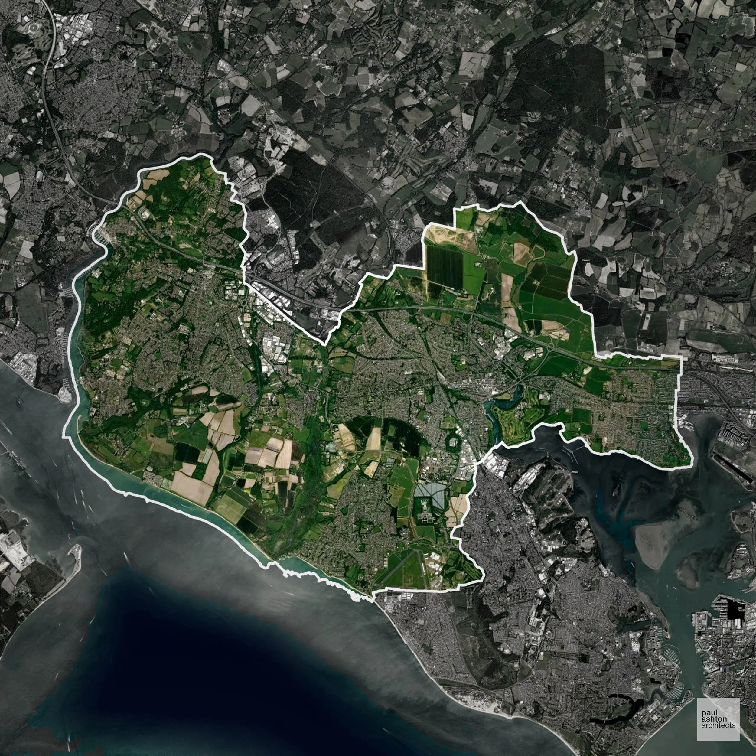
Eastleigh in Hampshire includes Eastleigh town, Hedge End, and Bishopstoke. Known for railway heritage, suburban development, and nearby Winchester. Planning focuses on town centre projects, conversions, and new residential schemes. We can advise and support projects across Eastleigh.
In the last year Eastleigh decided 536 applications which is well below the national average of 988. The approval rate was 89% (roughly equal to the national average of 88%) and 74% of applications were decided on time, (significantly above the national average of 59%). Stats updated March 2026 from gov. sources. See how Eastleigh performs relative to other LPAs in our LPA hub.
"We love helping clients win Planning Permission in Eastleigh"
Areas of Outstanding Natural Beauty in Eastleigh
Areas of Outstanding Natural Beauty (AONBs), often referred to as National Landscapes, are protected for their remarkable natural and scenic value. Any development proposals here are closely evaluated, with a strong presumption against works that could harm the landscape.
Eastleigh contains part of the South Downs AONB. Development must consider visual and ecological sensitivity.
In our experience, one of the top reasons proposals in Areas of Outstanding Natural Beauty are refused is causing landscape harm or visual intrusion, a risk that often arises when applications are not fully informed. We help minimise the likelihood of refusal with expert, guidance; contact us here.
Nutrient Neutrality in Eastleigh
Nutrient Neutrality ensures new developments do not increase harmful nitrogen or phosphorus levels in sensitive waterways. Eastleigh faces a dual constraint: nitrogen neutrality for the Solent and phosphorus neutrality for the River Itchen SAC, making it one of the most complex nutrient neutrality environments for developers in England. Unfortunately, Nutrient Neutrality can halt development completely. If you need early-stage, project-specific advice contact us here.
Planning Applications in Eastleigh
In addition to acting as Planing Conultants we are ARB registered architects with 25+ years of experience. Our planning proposals are creatively tailored to each site to maximise potential and improve planning outcomes. We use the following tried and tested process to guide clients in Eastleigh through planning to completion:
- Stage 1: Site Appraisals & Planning Strategy Advice
- Stage 2: Feasibility Studies & Concept Designs
- Stage 3: Planning Application Packages
- Architectural Drawing Packages
- Planning Statements & Design and Access Statements
- Coordination of Consultant Reports
- Direct Liaison with Planning Officers
- Stage 4: Technical Design
- Discharge of Planning Conditions
- Building Regulations and Construction Packages
Planning Services We Offer in Eastleigh
- Full Planning Applications: Commercial, new buildings, changes of use.
- Householder Planning Applications: Domestic extensions / garden structures.
- Listed Building Consent: Alterations / repairs to listed buildings.
- Conservation Area Consent: Developments within Conservation Areas.
- Lawful Development Certificates: Confirming existing / completed works are lawful.
- Validation Requirements: Gathering documentation to ensure applications are validated by Eastleigh LPA.
Design-Led Planning Advice in Eastleigh
We can review your site in Eastleigh and offer informed guidance on how proposals can be developed in order to maximise your chances of securing Planning Permission.
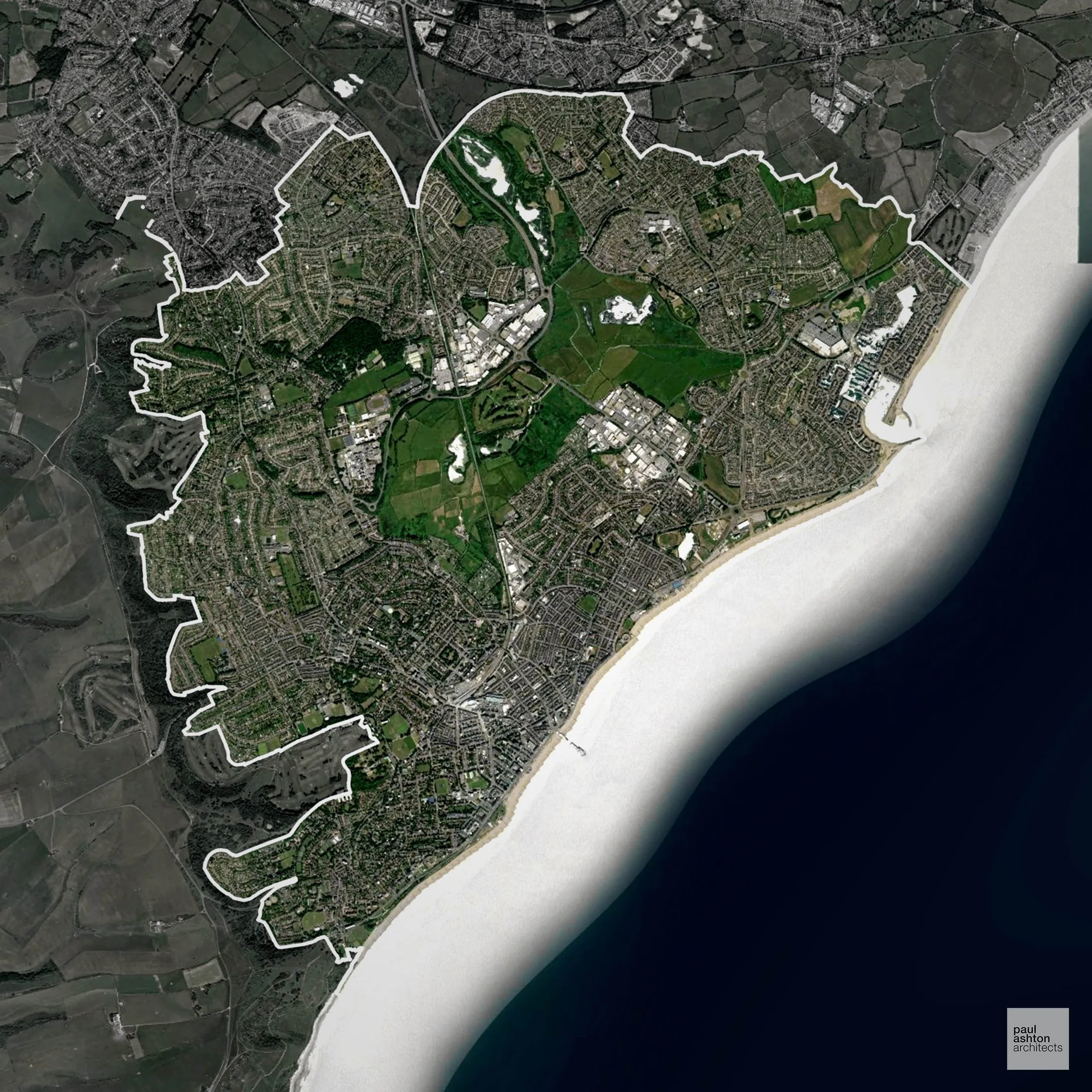
Eastbourne in East Sussex is a seaside town with Victorian architecture, theatres, and seafront attractions. Planning is primarily urban-focused. We can advise and support residential, commercial, and extension projects throughout Eastbourne.
In the last year Eastbourne decided 315 applications which is well below the national average of 988. The approval rate was 90% (roughly equal to the national average of 88%) and 69% of applications were decided on time, (significantly above the national average of 59%). Stats updated March 2026 from gov. sources. See how Eastbourne performs relative to other LPAs in our LPA hub.
"We love helping clients win Planning Permission in Eastbourne"
Flood Risk in Eastbourne
In some areas of the LPA, flood risk plays a key role in determining planning proposals. The town's proximity to the Pevensey Levels and its position on a low-lying coastal plain means Flood Zone 3 constrains development on the eastern and northern fringes of the borough. Where constraints permit, we can develop proposals that manage flood risk thoughtfully to give applications the best chance of approval.
Planning Applications in Eastbourne
Alongside acting as Planning Consultants we are ARB registered architects with 25+ years of experience. We use the following proven work stages to guide clients in Eastbourne through the planning process in order to maximise the potential of their development :
- Stage 1: Site Appraisals & Planning Strategy Advice
- Stage 2: Feasibility Studies & Concept Designs
- Stage 3: Planning Application Packages
- Architectural Drawing Packages
- Planning Statements & Design and Access Statements
- Coordination of Consultant Reports
- Direct Liaison with Planning Officers
- Stage 4: Technical Design
- Discharge of Planning Conditions
- Building Regulations and Construction Packages
Planning Services We Offer in Eastbourne
- Full Planning Applications: Commercial, new buildings, changes of use.
- Householder Planning Applications: Domestic extensions / garden structures.
- Listed Building Consent: Alterations / repairs to listed buildings.
- Conservation Area Consent: Developments within Conservation Areas.
- Lawful Development Certificates: Confirming existing / completed works are lawful.
- Validation Requirements: Gathering documentation to ensure applications are validated by Eastbourne LPA.
Contextual Planning Support in Eastbourne
We work collaboratively with clients and shape a design that respects local character and meets Planning Policy requirements in order to maximise your chances of winning Planning Permission.
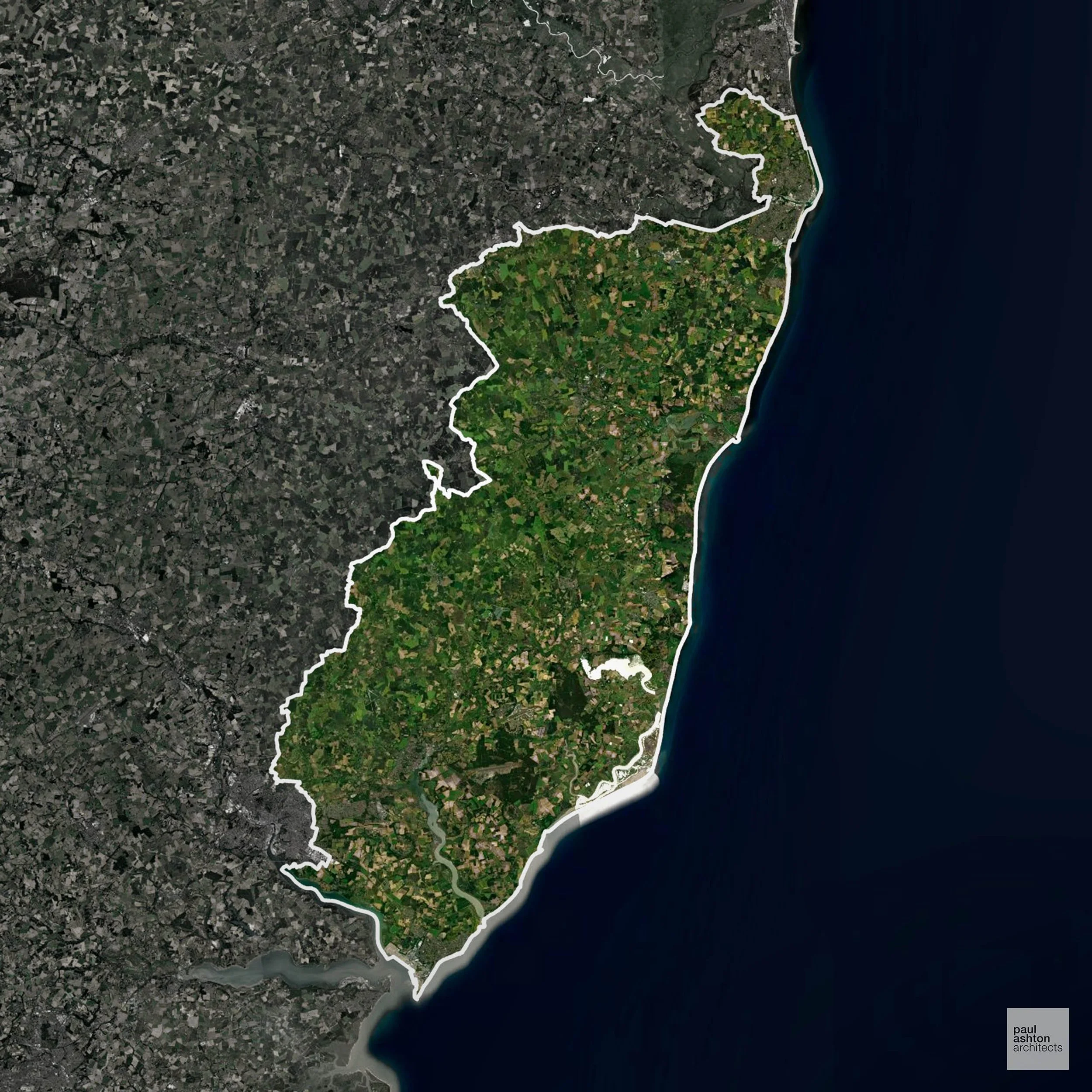
East Suffolk includes Lowestoft, Felixstowe, and Woodbridge. Known for coastal towns, historic villages, and maritime heritage. Planning focuses on conservation, town centre regeneration, and sensitive housing schemes. We can advise and support projects across East Suffolk.
In the last year East Suffolk decided 1,992 applications which is well above the national average of 988. The approval rate was 92% (marginally above the national average of 88%) and 58% of applications were decided on time, (on par with the national average of 59%). Stats updated March 2026 from gov. sources. See how East Suffolk performs relative to other LPAs in our LPA hub.
"We love helping clients win Planning Permission in East Suffolk"
Development in the Open Countryside
The Open Countryside is generally defined as land outside settlement and Green Belt boundaries, often comprising agricultural or natural land. Development, particularly standard residential development, is usually restricted in Open Countryside.
East Suffolk’s heritage coastline, open farmland, and AONB landscapes are sensitive to development and protected under planning policy.
One of the top reasons poorly prepared proposals in the Open Countryside are refused is that they fail to demonstrate a policy-supported need. To minimise that risk with bespoke advice contact us here.
Flood Risk in East Suffolk
In some areas of the LPA, flood risk plays a key role in determining planning proposals. The Blyth, Deben and Orwell estuaries, combined with a vulnerable Suffolk Heritage Coast, place significant areas of the district in Flood Zone 3 and make coastal flood risk a major planning consideration. Where constraints permit, we can develop proposals that manage flood risk thoughtfully to give applications the best chance of approval.
Planning Applications in East Suffolk
As well as acting as Planning Consultants we are ARB registered architects with over 25 years’ experience. Our site-specific planning proposals balance creativity with strategic insight. We use the following field-tested work stages to help clients in East Suffolk achieve successful planning outcomes:
- Stage 1: Site Appraisals & Planning Strategy Advice
- Stage 2: Feasibility Studies & Concept Designs
- Stage 3: Planning Application Packages
- Architectural Drawing Packages
- Planning Statements & Design and Access Statements
- Coordination of Consultant Reports
- Direct Liaison with Planning Officers
- Stage 4: Technical Design
- Discharge of Planning Conditions
- Building Regulations and Construction Packages
Planning Services We Offer in East Suffolk
- Full Planning Applications: Commercial, new buildings, changes of use.
- Householder Planning Applications: Domestic extensions / garden structures.
- Listed Building Consent: Alterations / repairs to listed buildings.
- Conservation Area Consent: Developments within Conservation Areas.
- Lawful Development Certificates: Confirming existing / completed works are lawful.
- Validation Requirements: Gathering documentation to ensure applications are validated by East Suffolk LPA.
Contextual Planning Support in East Suffolk
We work collaboratively with clients and shape a design that respects local character and meets Planning Policy requirements in order to maximise your chances of winning Planning Permission.
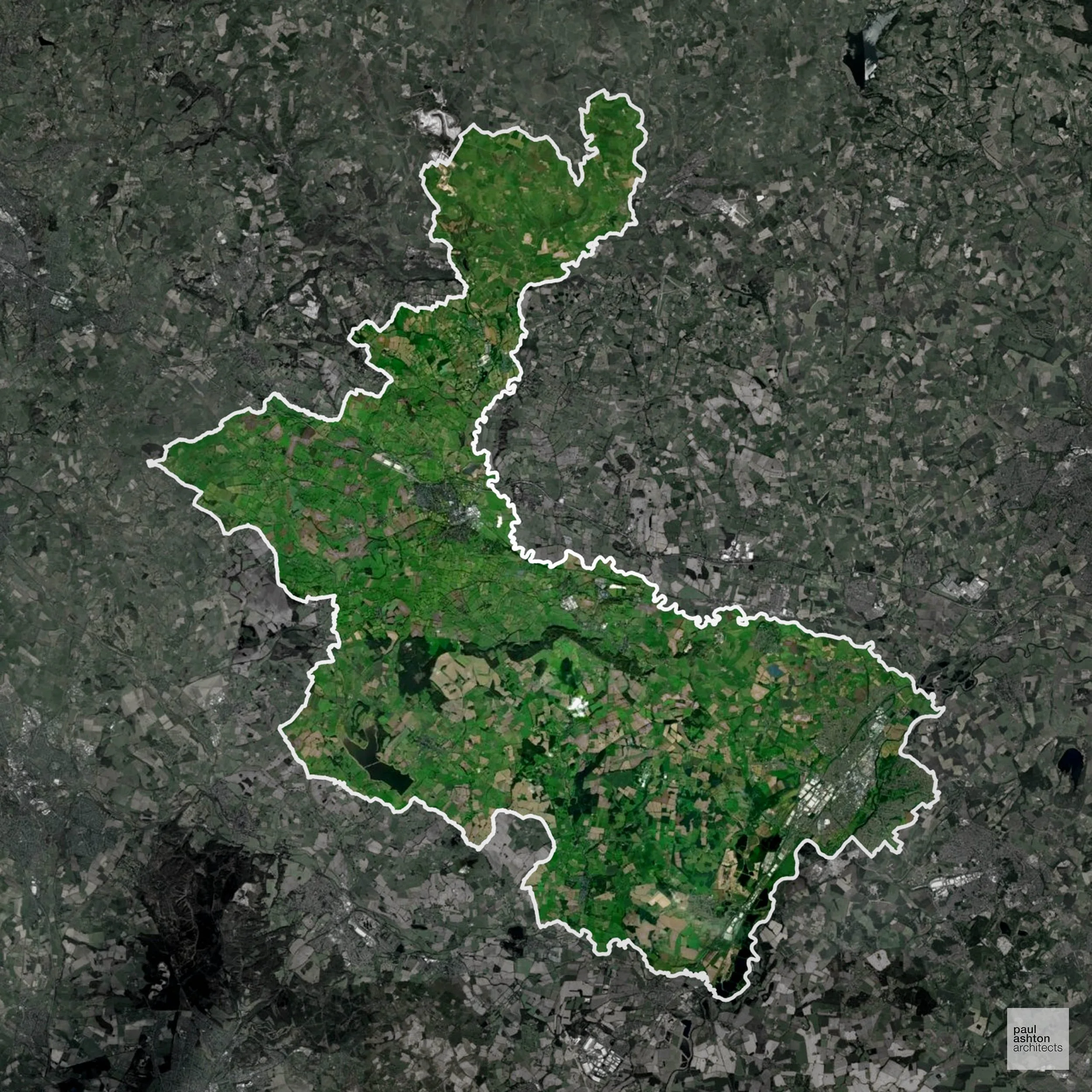
East Staffordshire encompasses Burton upon Trent, Uttoxeter, and surrounding villages. Famous for its brewing heritage, market towns, and historic architecture, about 0.1% of the area is Green Belt, affecting only the very edges of settlements. We can advise and support residential and commercial projects throughout East Staffordshire.
In the last year East Staffordshire decided 558 applications which is well below the national average of 988. The approval rate was 92% (marginally above the national average of 88%) and 33% of applications were decided on time, (significantly below the national average of 59%). Stats updated March 2026 from gov. sources. See how East Staffordshire performs relative to other LPAs in our LPA hub.
"We love helping clients win Planning Permission in East Staffordshire"
Green Belt Approvals in East Staffordshire
The Green Belt is nationally designated land around towns and cities, created to limit urban growth.
0.1% of East Staffordshire is within the Green Belt and proposals in these areas can be subject to reasonable levels of scrutiny.
The East Staffordshire Green Belt protects farmland, historic villages such as Tutbury and Rolleston, and rolling countryside around Burton upon Trent, limiting development and preserving landscape character and settlement separation.
In our experience, one of the top reasons poorly conceived Green Belt proposals are refused is causing 'harm to openness'. We can lower the risk of refusal with site-specific guidance. Contact us here.
You can also check whether your land is within the Green Belt using our interactive Green Belt map.
Development in the Open Countryside
Open Countryside within East Staffordshire refers to land situated outside built-up areas and Green Belt boundaries, typically comprising farmland or natural landscapes. Residential development is generally restricted unless special circumstances can be demonstrated.
East Staffordshire’s rural fringes, including farmland and wooded valleys, are subject to planning controls to protect the landscape and heritage.
One of the top reasons poorly prepared proposals in the Open Countryside are refused is that they fail to demonstrate a policy-supported need. To minimise that risk with bespoke advice contact us here.
Planning Applications in East Staffordshire
As well as acting as Planning Consultants we are ARB registered architects with over 25 years’ experience. Our site-specific planning proposals balance creativity with strategic insight. We use the following field-tested work stages to help clients in East Staffordshire achieve successful planning outcomes:
- Stage 1: Site Appraisals & Planning Strategy Advice
- Stage 2: Feasibility Studies & Concept Designs
- Stage 3: Planning Application Packages
- Architectural Drawing Packages
- Planning Statements & Design and Access Statements
- Coordination of Consultant Reports
- Direct Liaison with Planning Officers
- Stage 4: Technical Design
- Discharge of Planning Conditions
- Building Regulations and Construction Packages
Planning Services We Offer in East Staffordshire
- Full Planning Applications: Commercial, new buildings, changes of use.
- Householder Planning Applications: Domestic extensions / garden structures.
- Listed Building Consent: Alterations / repairs to listed buildings.
- Conservation Area Consent: Developments within Conservation Areas.
- Lawful Development Certificates: Confirming existing / completed works are lawful.
- Validation Requirements: Gathering documentation to ensure applications are validated by East Staffordshire LPA.
Design-Led Planning Advice in East Staffordshire
We can review your site in East Staffordshire and offer informed guidance on how proposals can be developed in order to maximise your chances of securing Planning Permission.
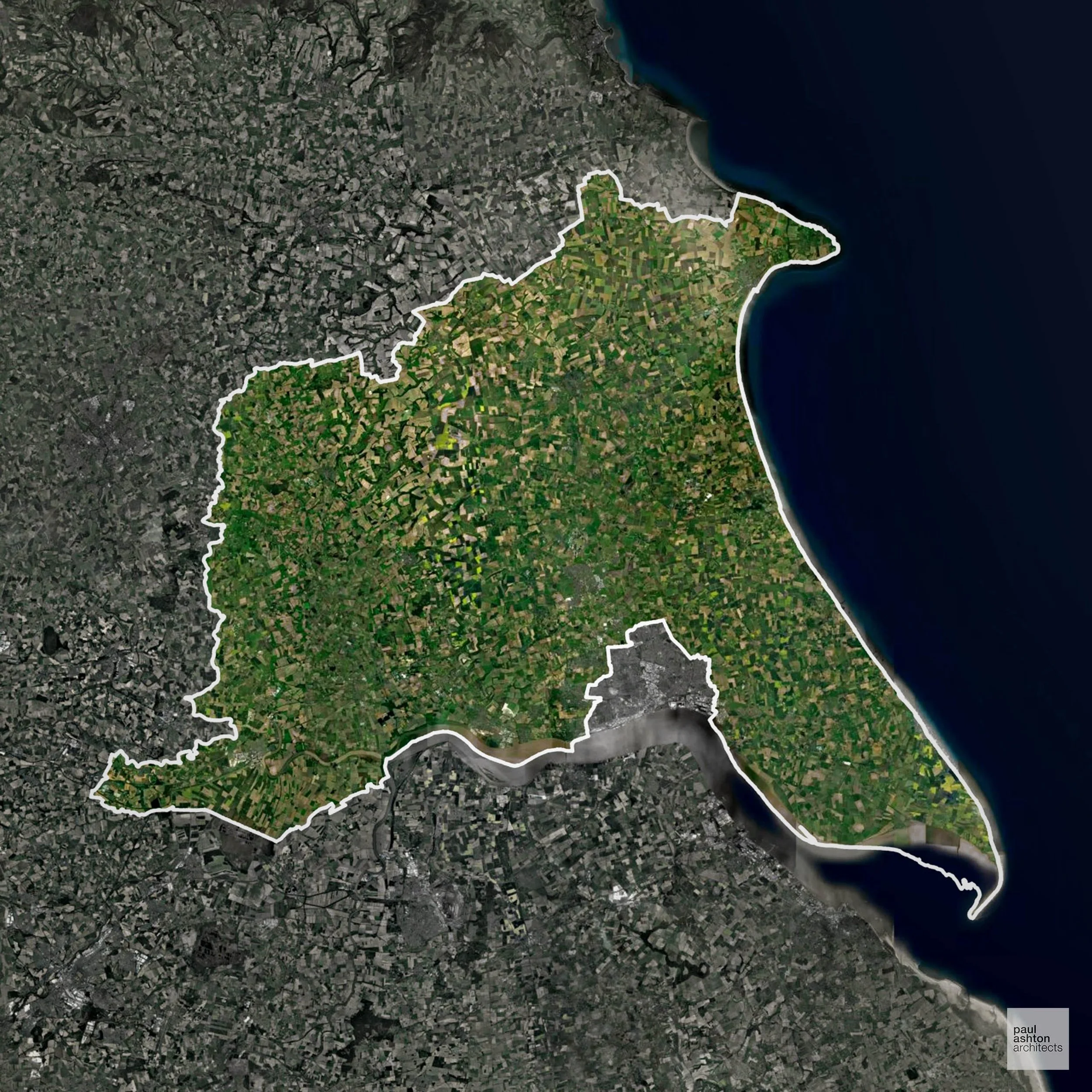
East Riding of Yorkshire includes Beverley, Bridlington, and Goole. Known for historic market towns, coastal resorts, and agricultural landscapes, planning focuses on conservation and sensitive residential growth. We can advise and support residential, commercial, and conversion schemes across the district.
In the last year East Riding of Yorkshire decided 1,878 applications which is well above the national average of 988. The approval rate was 89% (roughly equal to the national average of 88%) and 85% of applications were decided on time, (significantly above the national average of 59%). Stats updated March 2026 from gov. sources. See how East Riding of Yorkshire performs relative to other LPAs in our LPA hub.
"We love helping clients win Planning Permission in East Riding of Yorkshire"
Development in the Open Countryside
Open Countryside within East Riding of Yorkshire refers to land situated outside built-up areas and Green Belt boundaries, typically comprising farmland or natural landscapes. Residential development is generally restricted unless special circumstances can be demonstrated.
East Riding’s agricultural plains, estuaries, and historic villages are visually prominent and safeguarded from inappropriate development.
One of the top reasons poorly prepared proposals in the Open Countryside are refused is that they fail to demonstrate a policy-supported need. To minimise that risk with bespoke advice contact us here.
Flood Risk in East Riding of Yorkshire
In some areas of the LPA, flood risk plays a key role in determining planning proposals. The Humber Estuary, the River Hull catchment, and the low-lying Vale of York together create some of the most extensive Flood Zone 3 areas in the country, severely constraining growth across much of the authority. Where constraints permit, we can develop proposals that manage flood risk thoughtfully to give applications the best chance of approval.
Nutrient Neutrality in East Riding of Yorkshire
Nutrient Neutrality ensures new developments do not increase harmful nitrogen or phosphorus levels in sensitive waterways. Parts of the East Riding fall within the Hornsea Mere catchment, where both nitrogen and phosphorus neutrality apply to new residential development affecting this internationally important coastal lake. Unfortunately, Nutrient Neutrality can halt development completely. If you need early-stage, project-specific advice contact us here.
Planning Applications in East Riding of Yorkshire
As well as acting as Planning Consultants we are ARB registered architects with over 25 years’ experience. Our site-specific planning proposals balance creativity with strategic insight. We use the following field-tested work stages to help clients in East Riding of Yorkshire achieve successful planning outcomes:
- Stage 1: Site Appraisals & Planning Strategy Advice
- Stage 2: Feasibility Studies & Concept Designs
- Stage 3: Planning Application Packages
- Architectural Drawing Packages
- Planning Statements & Design and Access Statements
- Coordination of Consultant Reports
- Direct Liaison with Planning Officers
- Stage 4: Technical Design
- Discharge of Planning Conditions
- Building Regulations and Construction Packages
Planning Services We Offer in East Riding of Yorkshire
- Full Planning Applications: Commercial, new buildings, changes of use.
- Householder Planning Applications: Domestic extensions / garden structures.
- Listed Building Consent: Alterations / repairs to listed buildings.
- Conservation Area Consent: Developments within Conservation Areas.
- Lawful Development Certificates: Confirming existing / completed works are lawful.
- Validation Requirements: Gathering documentation to ensure applications are validated by East Riding of Yorkshire LPA.
Contextual Planning Support in East Riding of Yorkshire
We work collaboratively with clients and shape a design that respects local character and meets Planning Policy requirements in order to maximise your chances of winning Planning Permission.
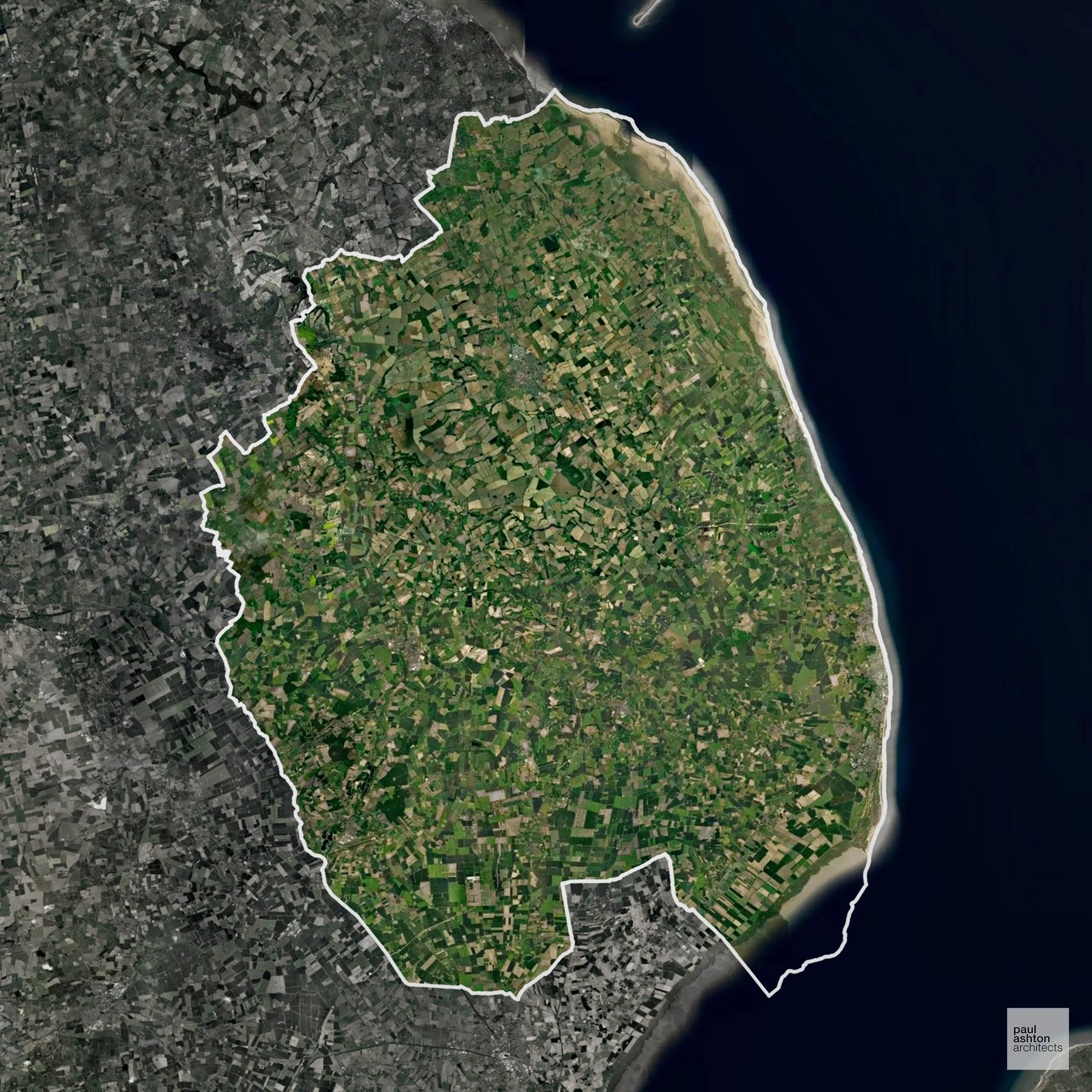
East Lindsey in Lincolnshire includes Skegness, Louth, and Horncastle. Known for coastal towns, historic market villages, and rural landscapes. Planning focuses on sensitive development, conservation, and coastal schemes. We can advise on residential and commercial projects throughout East Lindsey.
In the last year East Lindsey decided 818 applications which is slightly below the national average of 988. The approval rate was 93% (marginally above the national average of 88%) and 57% of applications were decided on time, (on par with the national average of 59%). Stats updated March 2026 from gov. sources. See how East Lindsey performs relative to other LPAs in our LPA hub.
"We love helping clients win Planning Permission in East Lindsey"
Development in the Open Countryside
East Lindsey includes areas classed as Open Countryside, generally encompassing land beyond settlements and Green Belt zones, often used for agriculture or left as natural landscapes. Development in these areas is tightly controlled, with standard residential proposals rarely permitted.
East Lindseys coastal marshes, dunes, and historic farmland are sensitive to development, preserving both heritage and ecology.
One of the top reasons poorly prepared proposals in the Open Countryside are refused is that they fail to demonstrate a policy-supported need. To minimise that risk with bespoke advice contact us here.
Flood Risk in East Lindsey
In some areas of the LPA, flood risk plays a key role in determining planning proposals. The Lincolnshire coast and the low-lying Fens hinterland place vast areas of the district in Flood Zone 3, making this one of the authorities in England most exposed to both tidal and fluvial flood risk. Where constraints permit, we can develop proposals that manage flood risk thoughtfully to give applications the best chance of approval.
Planning Applications in East Lindsey
Alongside acting as Planning Consultants we are ARB registered architects with 25+ years of experience. We use the following proven work stages to guide clients in East Lindsey through the planning process in order to maximise the potential of their development :
- Stage 1: Site Appraisals & Planning Strategy Advice
- Stage 2: Feasibility Studies & Concept Designs
- Stage 3: Planning Application Packages
- Architectural Drawing Packages
- Planning Statements & Design and Access Statements
- Coordination of Consultant Reports
- Direct Liaison with Planning Officers
- Stage 4: Technical Design
- Discharge of Planning Conditions
- Building Regulations and Construction Packages
Planning Services We Offer in East Lindsey
- Full Planning Applications: Commercial, new buildings, changes of use.
- Householder Planning Applications: Domestic extensions / garden structures.
- Listed Building Consent: Alterations / repairs to listed buildings.
- Conservation Area Consent: Developments within Conservation Areas.
- Lawful Development Certificates: Confirming existing / completed works are lawful.
- Validation Requirements: Gathering documentation to ensure applications are validated by East Lindsey LPA.
Contextual Planning Support in East Lindsey
We work collaboratively with clients and shape a design that respects local character and meets Planning Policy requirements in order to maximise your chances of winning Planning Permission.
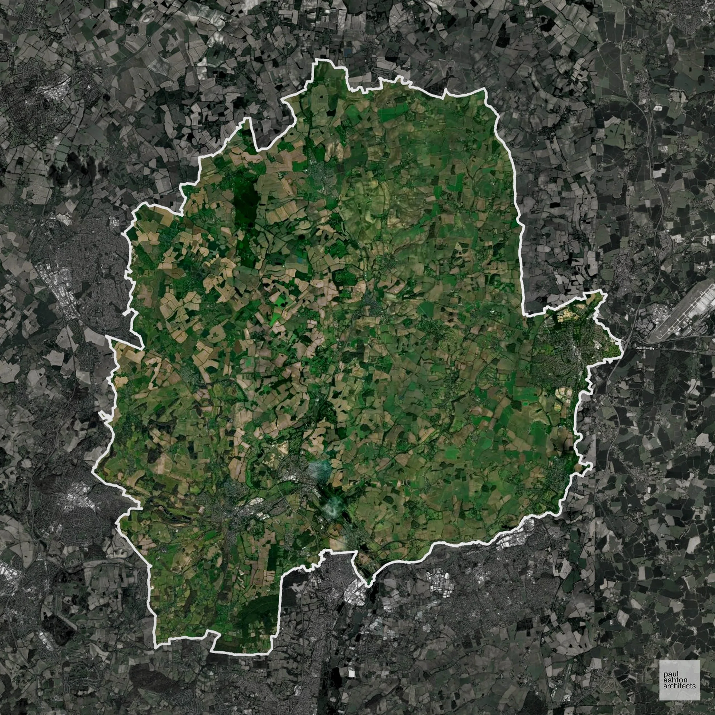
East Hertfordshire includes Hertford, Ware, and Bishop’s Stortford. Approximately 34.6% of the district is Green Belt, influencing development around towns. The district is known for historic streets, market towns, and heritage buildings. Planning balances growth with conservation. We can support residential, commercial, and conversion schemes across East Hertfordshire.
In the last year East Hertfordshire decided 1,218 applications which is well above the national average of 988. The approval rate was 80% (slightly below the national average of 88%) and 68% of applications were decided on time, (significantly above the national average of 59%). Stats updated March 2026 from gov. sources. See how East Hertfordshire performs relative to other LPAs in our LPA hub.
"We love helping clients win Planning Permission in East Hertfordshire"
Areas of Outstanding Natural Beauty in East Hertfordshire
Areas of Outstanding Natural Beauty (AONBs), (now often referred to as National Landscapes), are protected areas recognised for their exceptional scenic and natural value. For developers, this means that planning proposals within these areas are carefully scrutinised, with a strong presumption against inappropriate development.
East Hertfordshire is partially within the Chilterns AONB. Planning considers impact on landscape character and views.
In our experience, one of the top reasons proposals in Areas of Outstanding Natural Beauty are refused is causing landscape harm or visual intrusion, a risk that often arises when applications are not fully informed. We help minimise the likelihood of refusal with expert, guidance; contact us here.
Green Belt Approvals in East Hertfordshire
The Green Belt is nationally designated land around towns and cities, created to limit urban growth.
34.6% of East Hertfordshire is within the Green Belt and proposals in these areas can be subject to high levels of scrutiny.
The Green Belt within East Hertfordshire includes river valleys, farmland, and village edges around Hertford and Sawbridgeworth, sensitive to urban expansion and sprawl.
In our experience, one of the top reasons poorly conceived Green Belt proposals are refused is causing 'harm to openness'. We can lower the risk of refusal with site-specific guidance. Contact us here.
You can also check whether your land is within the Green Belt using our interactive Green Belt map.
Development in the Open Countryside
The Open Countryside is generally defined as land outside settlement and Green Belt boundaries, often comprising agricultural or natural land. Development, particularly standard residential development, is usually restricted in Open Countryside.
East Hertfordshire’s river valleys, open farmland, and historic villages are protected to maintain rural character and scenic quality.
One of the top reasons poorly prepared proposals in the Open Countryside are refused is that they fail to demonstrate a policy-supported need. To minimise that risk with bespoke advice contact us here.
Planning Applications in East Hertfordshire
As well as acting as Planning Consultants we are ARB registered architects with over 25 years’ experience. Our site-specific planning proposals balance creativity with strategic insight. We use the following field-tested work stages to help clients in East Hertfordshire achieve successful planning outcomes:
- Stage 1: Site Appraisals & Planning Strategy Advice
- Stage 2: Feasibility Studies & Concept Designs
- Stage 3: Planning Application Packages
- Architectural Drawing Packages
- Planning Statements & Design and Access Statements
- Coordination of Consultant Reports
- Direct Liaison with Planning Officers
- Stage 4: Technical Design
- Discharge of Planning Conditions
- Building Regulations and Construction Packages
Planning Services We Offer in East Hertfordshire
- Full Planning Applications: Commercial, new buildings, changes of use.
- Householder Planning Applications: Domestic extensions / garden structures.
- Listed Building Consent: Alterations / repairs to listed buildings.
- Conservation Area Consent: Developments within Conservation Areas.
- Lawful Development Certificates: Confirming existing / completed works are lawful.
- Validation Requirements: Gathering documentation to ensure applications are validated by East Hertfordshire LPA.
Creative Planning Advice in East Hertfordshire
We collaborate closely with our clients to develop designs that respond to local character and align with Planning Policy, helping to maximise the likelihood of securing Planning Permission in East Hertfordshire.
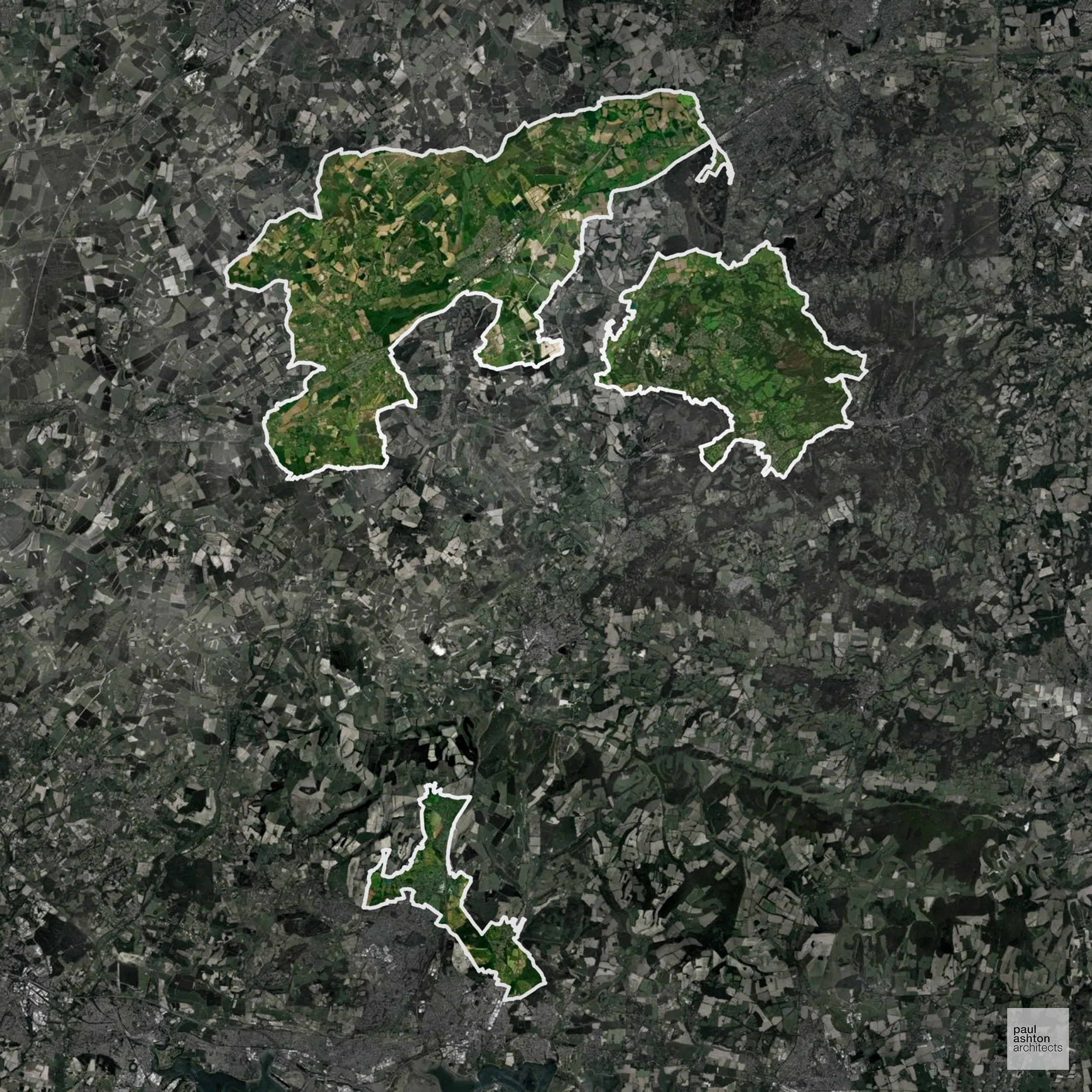
East Hampshire includes Petersfield, Alton, and Liphook. Famous for rural villages, historic market towns, and countryside walks. Planning focuses on sensitive residential and commercial development. We can advise on projects throughout East Hampshire.
In the last year East Hampshire decided 583 applications which is well below the national average of 988. The approval rate was 88% (roughly equal to the national average of 88%) and 26% of applications were decided on time, (significantly below the national average of 59%). Stats updated March 2026 from gov. sources. See how East Hampshire performs relative to other LPAs in our LPA hub.
"We love helping clients win Planning Permission in East Hampshire"
Areas of Outstanding Natural Beauty in East Hampshire
Areas of Outstanding Natural Beauty (AONBs), sometimes called National Landscapes, are designated for their exceptional scenic and natural importance. Planning proposals in these areas face close scrutiny, with a strong presumption against inappropriate development.
East Hampshire overlaps with the South Downs AONB. Proposals must conserve scenic and ecological value.
In our experience, one of the top reasons proposals in Areas of Outstanding Natural Beauty are refused is causing landscape harm or visual intrusion, a risk that often arises when applications are not fully informed. We help minimise the likelihood of refusal with expert, guidance; contact us here.
Development in the Open Countryside
East Hampshire includes areas classed as Open Countryside, generally encompassing land beyond settlements and Green Belt zones, often used for agriculture or left as natural landscapes. Development in these areas is tightly controlled, with standard residential proposals rarely permitted.
East Hampshire’s South Downs and wooded valleys are highly scenic and development is tightly managed to preserve landscape character.
One of the top reasons poorly prepared proposals in the Open Countryside are refused is that they fail to demonstrate a policy-supported need. To minimise that risk with bespoke advice contact us here.
Nutrient Neutrality in East Hampshire
Nutrient Neutrality ensures new developments do not increase harmful nitrogen or phosphorus levels in sensitive waterways. Substantially within the Solent nitrogen catchment, with a significant proportion of the district's development requiring nitrogen neutrality; the East Hampshire operational catchment feeds into Peel Common Wastewater Treatment Works. Unfortunately, Nutrient Neutrality can halt development completely. If you need early-stage, project-specific advice contact us here.
Planning Applications in East Hampshire
In addition to acting as Planing Conultants we are ARB registered architects with 25+ years of experience. Our planning proposals are creatively tailored to each site to maximise potential and improve planning outcomes. We use the following tried and tested process to guide clients in East Hampshire through planning to completion:
- Stage 1: Site Appraisals & Planning Strategy Advice
- Stage 2: Feasibility Studies & Concept Designs
- Stage 3: Planning Application Packages
- Architectural Drawing Packages
- Planning Statements & Design and Access Statements
- Coordination of Consultant Reports
- Direct Liaison with Planning Officers
- Stage 4: Technical Design
- Discharge of Planning Conditions
- Building Regulations and Construction Packages
Planning Services We Offer in East Hampshire
- Full Planning Applications: Commercial, new buildings, changes of use.
- Householder Planning Applications: Domestic extensions / garden structures.
- Listed Building Consent: Alterations / repairs to listed buildings.
- Conservation Area Consent: Developments within Conservation Areas.
- Lawful Development Certificates: Confirming existing / completed works are lawful.
- Validation Requirements: Gathering documentation to ensure applications are validated by East Hampshire LPA.
Contextual Planning Support in East Hampshire
We work collaboratively with clients and shape a design that respects local character and meets Planning Policy requirements in order to maximise your chances of winning Planning Permission.
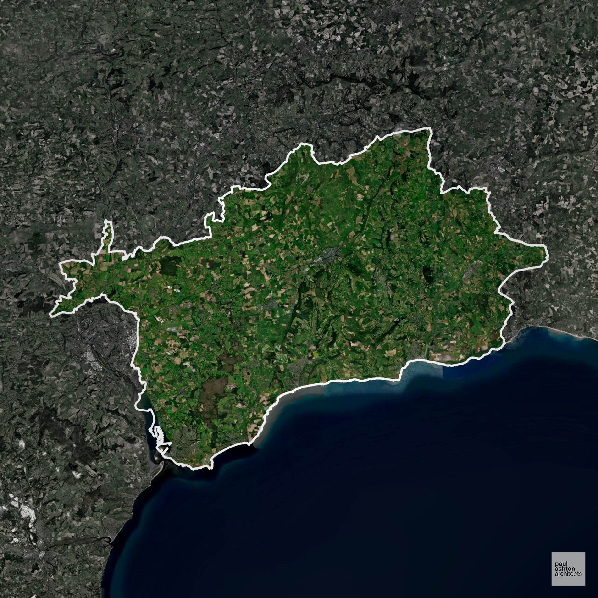
East Devon includes Exmouth, Sidmouth, and Honiton. Known for Jurassic Coast tourism, market towns, and historic villages Planning focuses on conservation, coastal development, and sensitive housing schemes. We can support residential, commercial, and extension projects across East Devon.
In the last year East Devon decided 1,323 applications which is well above the national average of 988. The approval rate was 89% (roughly equal to the national average of 88%) and 65% of applications were decided on time, (slightly above the national average of 59%). Stats updated March 2026 from gov. sources. See how East Devon performs relative to other LPAs in our LPA hub.
"We love helping clients win Planning Permission in East Devon"
Conservation and Listed Buildings in East Devon
East Devon has a diverse historic environment, with numerous Conservation Areas and a high number of listed buildings across its towns, villages, and rural settlements. Heritage constraints are particularly pronounced within the Sidmouth Conservation Area and Ottery St Mary Conservation Area, where historic town centres, riverside settings, and traditional architecture define character.
One of the top reasons heritage building applications are refused is causing harm to historic significance, a risk that can arise when proposals are not prepared by a consultant with heritage expertise. We help minimise this risk with expert, site-specific guidance; contact us here.
Development in the Open Countryside
The Open Countryside is generally defined as land outside settlement and Green Belt boundaries, often comprising agricultural or natural land. Development, particularly standard residential development, is usually restricted in Open Countryside.
East Devon’s Jurassic Coast and protected inland valleys are environmentally sensitive and subject to strict planning controls.
One of the top reasons poorly prepared proposals in the Open Countryside are refused is that they fail to demonstrate a policy-supported need. To minimise that risk with bespoke advice contact us here.
Flood Risk in East Devon
In some areas of the LPA, flood risk plays a key role in determining planning proposals. The estuaries of the Exe and Axe, combined with the coastal floodplain around Exmouth and Seaton, create extensive Flood Zone 3 areas that significantly restrict development options. Where constraints permit, we can develop proposals that manage flood risk thoughtfully to give applications the best chance of approval.
Nutrient Neutrality in East Devon
Nutrient Neutrality ensures new developments do not increase harmful nitrogen or phosphorus levels in sensitive waterways. The primary LPA affected by the River Axe SAC catchment; phosphorus neutrality is required for new residential development, and the designation as a sensitive catchment means water company upgrades are required by 2030. Unfortunately, Nutrient Neutrality can halt development completely. If you need early-stage, project-specific advice contact us here.
Planning Applications in East Devon
As well as acting as Planning Consultants we are ARB registered architects with over 25 years’ experience. Our site-specific planning proposals balance creativity with strategic insight. We use the following field-tested work stages to help clients in East Devon achieve successful planning outcomes:
- Stage 1: Site Appraisals & Planning Strategy Advice
- Stage 2: Feasibility Studies & Concept Designs
- Stage 3: Planning Application Packages
- Architectural Drawing Packages
- Planning Statements & Design and Access Statements
- Coordination of Consultant Reports
- Direct Liaison with Planning Officers
- Stage 4: Technical Design
- Discharge of Planning Conditions
- Building Regulations and Construction Packages
Planning Services We Offer in East Devon
- Full Planning Applications: Commercial, new buildings, changes of use.
- Householder Planning Applications: Domestic extensions / garden structures.
- Listed Building Consent: Alterations / repairs to listed buildings.
- Conservation Area Consent: Developments within Conservation Areas.
- Lawful Development Certificates: Confirming existing / completed works are lawful.
- Validation Requirements: Gathering documentation to ensure applications are validated by East Devon LPA.
Creative Planning Advice in East Devon
We collaborate closely with our clients to develop designs that respond to local character and align with Planning Policy, helping to maximise the likelihood of securing Planning Permission in East Devon.
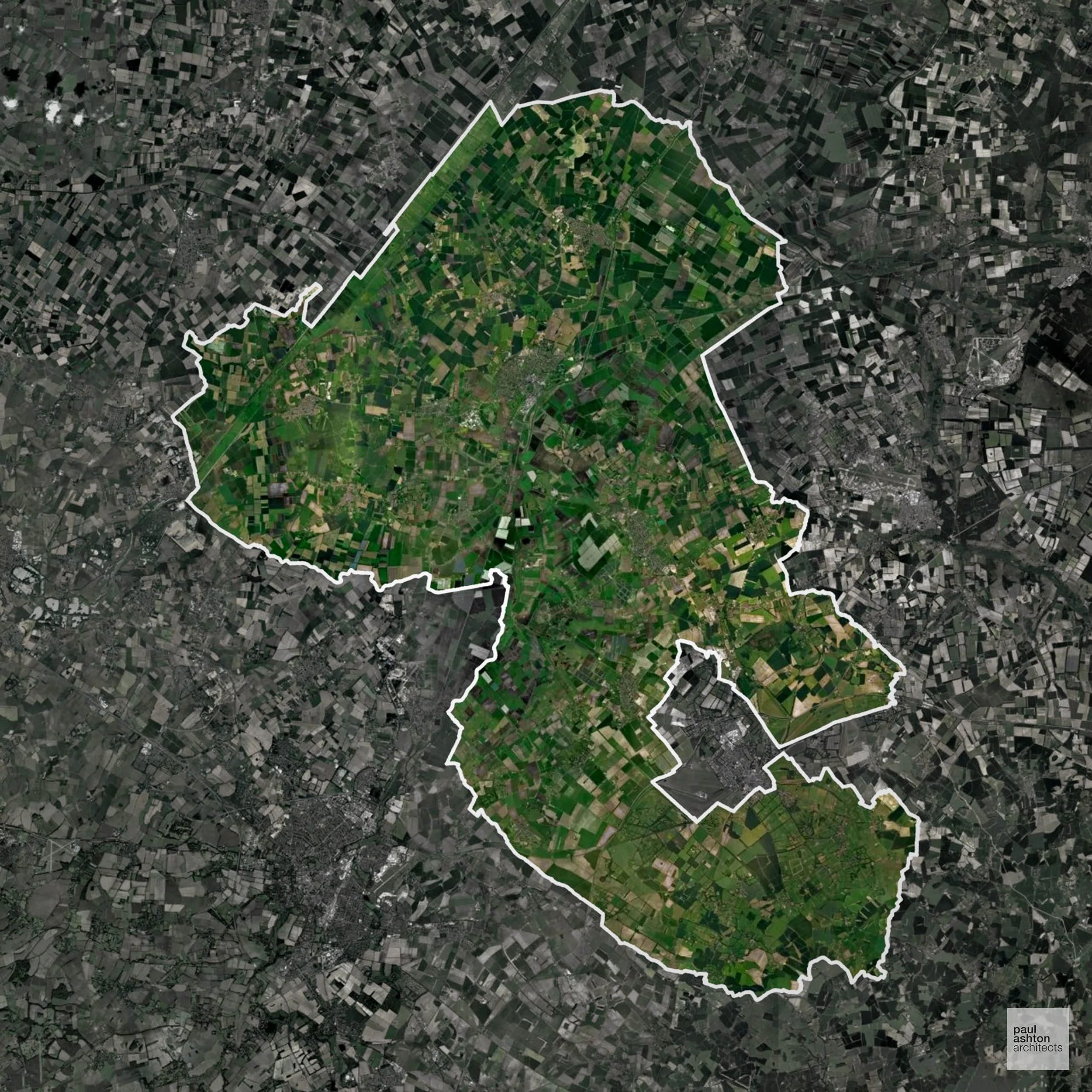
East Cambridgeshire includes Ely, Soham, and Littleport. Famous for Ely Cathedral, market towns, and rural villages, about 2.9% of the district is Green Belt, guiding development around towns. Planning balances heritage with residential growth. We can advise on residential, commercial, and conversion projects throughout East Cambridgeshire.
In the last year East Cambridgeshire decided 725 applications which is well below the national average of 988. The approval rate was 87% (roughly equal to the national average of 88%) and 67% of applications were decided on time, (significantly above the national average of 59%). Stats updated March 2026 from gov. sources. See how East Cambridgeshire performs relative to other LPAs in our LPA hub.
"We love helping clients win Planning Permission in East Cambridgeshire"
Green Belt Approvals in East Cambridgeshire
The Green Belt is nationally designated land around towns and cities, created to limit urban growth.
2.9% of East Cambridgeshire is within the Green Belt and proposals in these areas can be subject to reasonable levels of scrutiny.
The East Cambridgeshire Green Belt preserves open farmland, historic villages such as Elyford and Swaffham Prior, and river valley landscapes, restricting expansion and protecting the rural character of the district.
In our experience, one of the top reasons poorly conceived Green Belt proposals are refused is causing 'harm to openness'. We can lower the risk of refusal with site-specific guidance. Contact us here.
You can also check whether your land is within the Green Belt using our interactive Green Belt map.
Development in the Open Countryside
East Cambridgeshire includes areas classed as Open Countryside, generally encompassing land beyond settlements and Green Belt zones, often used for agriculture or left as natural landscapes. Development in these areas is tightly controlled, with standard residential proposals rarely permitted.
East Cambridgeshire’s fenlands and historic villages are highly sensitive to development to protect open vistas and biodiversity.
One of the top reasons poorly prepared proposals in the Open Countryside are refused is that they fail to demonstrate a policy-supported need. To minimise that risk with bespoke advice contact us here.
Planning Applications in East Cambridgeshire
As well as acting as Planning Consultants we are ARB registered architects with over 25 years’ experience. Our site-specific planning proposals balance creativity with strategic insight. We use the following field-tested work stages to help clients in East Cambridgeshire achieve successful planning outcomes:
- Stage 1: Site Appraisals & Planning Strategy Advice
- Stage 2: Feasibility Studies & Concept Designs
- Stage 3: Planning Application Packages
- Architectural Drawing Packages
- Planning Statements & Design and Access Statements
- Coordination of Consultant Reports
- Direct Liaison with Planning Officers
- Stage 4: Technical Design
- Discharge of Planning Conditions
- Building Regulations and Construction Packages
Planning Services We Offer in East Cambridgeshire
- Full Planning Applications: Commercial, new buildings, changes of use.
- Householder Planning Applications: Domestic extensions / garden structures.
- Listed Building Consent: Alterations / repairs to listed buildings.
- Conservation Area Consent: Developments within Conservation Areas.
- Lawful Development Certificates: Confirming existing / completed works are lawful.
- Validation Requirements: Gathering documentation to ensure applications are validated by East Cambridgeshire LPA.
Creative Planning Advice in East Cambridgeshire
We collaborate closely with our clients to develop designs that respond to local character and align with Planning Policy, helping to maximise the likelihood of securing Planning Permission in East Cambridgeshire.
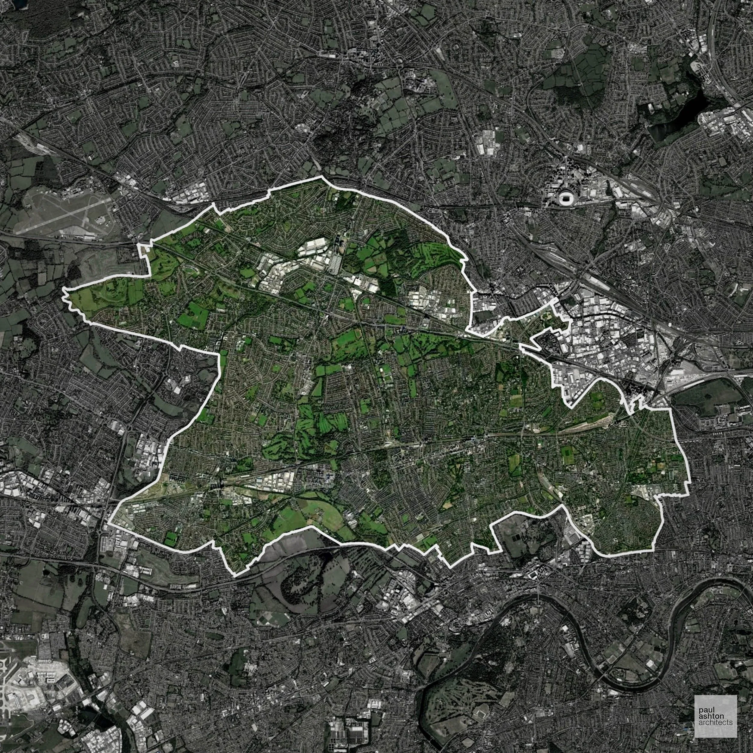
Ealing in West London includes Ealing town, Acton, and Southall. Known for its film studios, parks, and suburban neighbourhoods, around 5.6% of the borough is Green Belt. Planning focuses on urban densification, extensions, and conservation. We can support residential and commercial projects across Ealing.
In the last year Ealing decided 1,835 applications which is well above the national average of 988. The approval rate was 85% (roughly equal to the national average of 88%) and 41% of applications were decided on time, (significantly below the national average of 59%). Stats updated March 2026 from gov. sources. See how Ealing performs relative to other LPAs in our LPA hub.
"We love helping clients win Planning Permission in Ealing"
Conservation and Listed Buildings in Ealing
Ealing has a well-defined historic environment, with numerous Conservation Areas and a significant number of listed buildings across its suburban centres. Heritage constraints are particularly evident within the Ealing Green Conservation Area and Bedford Park Conservation Area, where planned suburban layouts, Victorian architecture, and landscaped streets create a sensitive townscape.
One of the top reasons heritage building applications are refused is causing harm to historic significance, a risk that can arise when proposals are not prepared by a consultant with heritage expertise. We help minimise this risk with expert, site-specific guidance; contact us here.
Green Belt Approvals in Ealing
The Green Belt is a policy protecting land around many English towns and cities, where development is tightly controlled to safeguard the open countryside.
5.6% of Ealing is within the Green Belt and proposals in these areas can be subject to high levels of scrutiny.
Development within the Green Belt surrounding London is highly sensitive and politically contentious.
In our experience, one of the top reasons poorly conceived Green Belt proposals are refused is causing 'harm to openness'. We can lower the risk of refusal with site-specific guidance. Contact us here.
You can also check whether your land is within the Green Belt using our interactive Green Belt map.
Planning Applications in Ealing
As well as acting as Planning Consultants we are ARB registered architects with over 25 years’ experience. Our site-specific planning proposals balance creativity with strategic insight. We use the following field-tested work stages to help clients in Ealing achieve successful planning outcomes:
- Stage 1: Site Appraisals & Planning Strategy Advice
- Stage 2: Feasibility Studies & Concept Designs
- Stage 3: Planning Application Packages
- Architectural Drawing Packages
- Planning Statements & Design and Access Statements
- Coordination of Consultant Reports
- Direct Liaison with Planning Officers
- Stage 4: Technical Design
- Discharge of Planning Conditions
- Building Regulations and Construction Packages
Planning Services We Offer in Ealing
- Full Planning Applications: Commercial, new buildings, changes of use.
- Householder Planning Applications: Domestic extensions / garden structures.
- Listed Building Consent: Alterations / repairs to listed buildings.
- Conservation Area Consent: Developments within Conservation Areas.
- Lawful Development Certificates: Confirming existing / completed works are lawful.
- Validation Requirements: Gathering documentation to ensure applications are validated by Ealing LPA.
Contextual Planning Support in Ealing
We work collaboratively with clients and shape a design that respects local character and meets Planning Policy requirements in order to maximise your chances of winning Planning Permission.
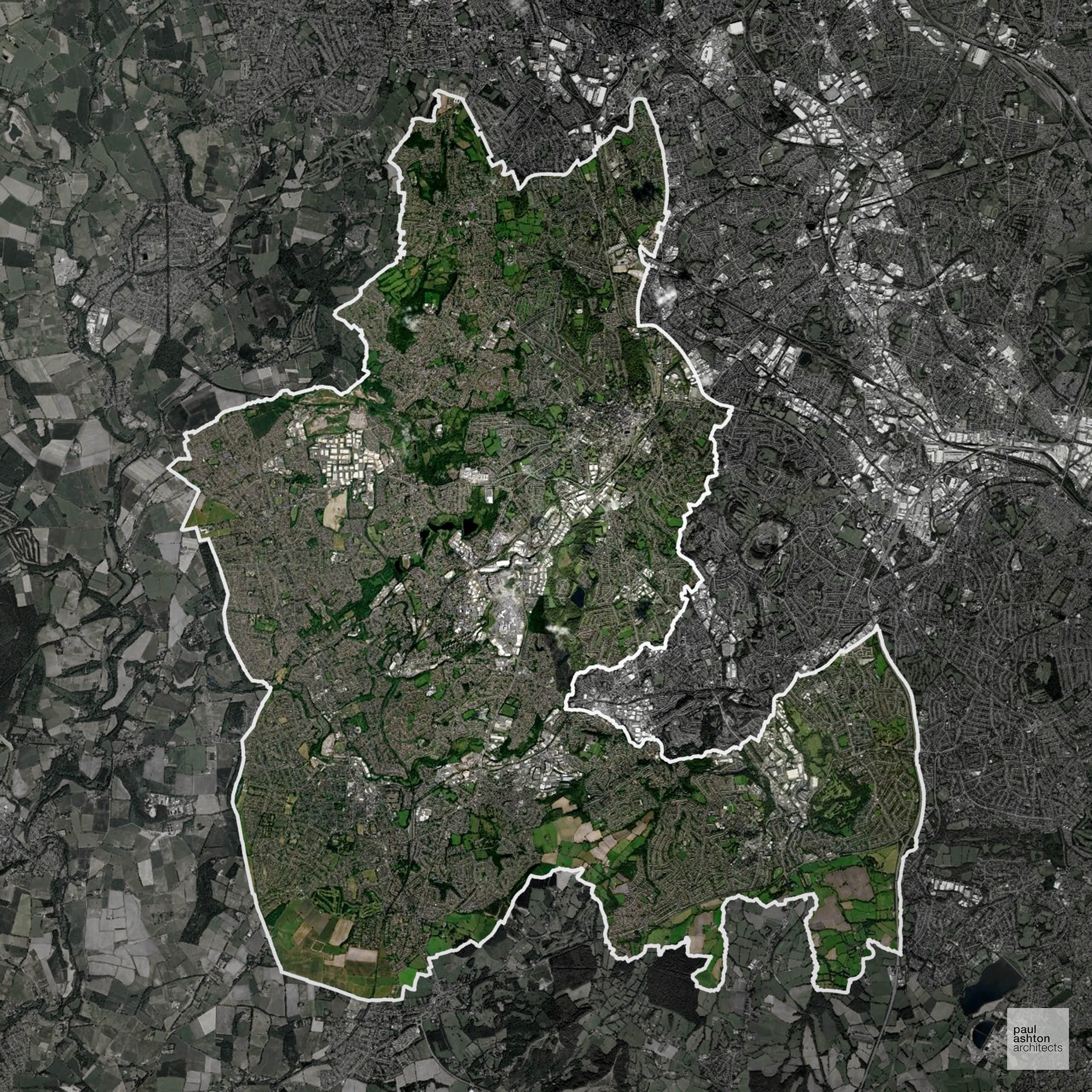
Dudley in the West Midlands includes Dudley, Stourbridge, and Brierley Hill. Known for its industrial history, Black Country heritage, and castles, about 18% of the borough is Green Belt. Planning balances urban growth with protection of surrounding countryside. We can help deliver residential, commercial, and conversion schemes throughout Dudley.
In the last year Dudley decided 740 applications which is well below the national average of 988. The approval rate was 83% (slightly below the national average of 88%) and 73% of applications were decided on time, (significantly above the national average of 59%). Stats updated March 2026 from gov. sources. See how Dudley performs relative to other LPAs in our LPA hub.
"We love helping clients win Planning Permission in Dudley"
Green Belt Approvals in Dudley
The Green Belt is a policy protecting land around many English towns and cities, where development is tightly controlled to safeguard the open countryside.
18.0% of Dudley is within the Green Belt and proposals in these areas can be subject to high levels of scrutiny.
The Green Belt around Dudley covers wooded farmland and village settings near Sedgley and Gornal, sensitive to urban sprawl.
In our experience, one of the top reasons poorly conceived Green Belt proposals are refused is causing 'harm to openness'. We can lower the risk of refusal with site-specific guidance. Contact us here.
You can also check whether your land is within the Green Belt using our interactive Green Belt map.
Planning Applications in Dudley
As well as acting as Planning Consultants we are ARB registered architects with over 25 years’ experience. Our site-specific planning proposals balance creativity with strategic insight. We use the following field-tested work stages to help clients in Dudley achieve successful planning outcomes:
- Stage 1: Site Appraisals & Planning Strategy Advice
- Stage 2: Feasibility Studies & Concept Designs
- Stage 3: Planning Application Packages
- Architectural Drawing Packages
- Planning Statements & Design and Access Statements
- Coordination of Consultant Reports
- Direct Liaison with Planning Officers
- Stage 4: Technical Design
- Discharge of Planning Conditions
- Building Regulations and Construction Packages
Planning Services We Offer in Dudley
- Full Planning Applications: Commercial, new buildings, changes of use.
- Householder Planning Applications: Domestic extensions / garden structures.
- Listed Building Consent: Alterations / repairs to listed buildings.
- Conservation Area Consent: Developments within Conservation Areas.
- Lawful Development Certificates: Confirming existing / completed works are lawful.
- Validation Requirements: Gathering documentation to ensure applications are validated by Dudley LPA.
Design-Led Planning Advice in Dudley
We can review your site in Dudley and offer informed guidance on how proposals can be developed in order to maximise your chances of securing Planning Permission.
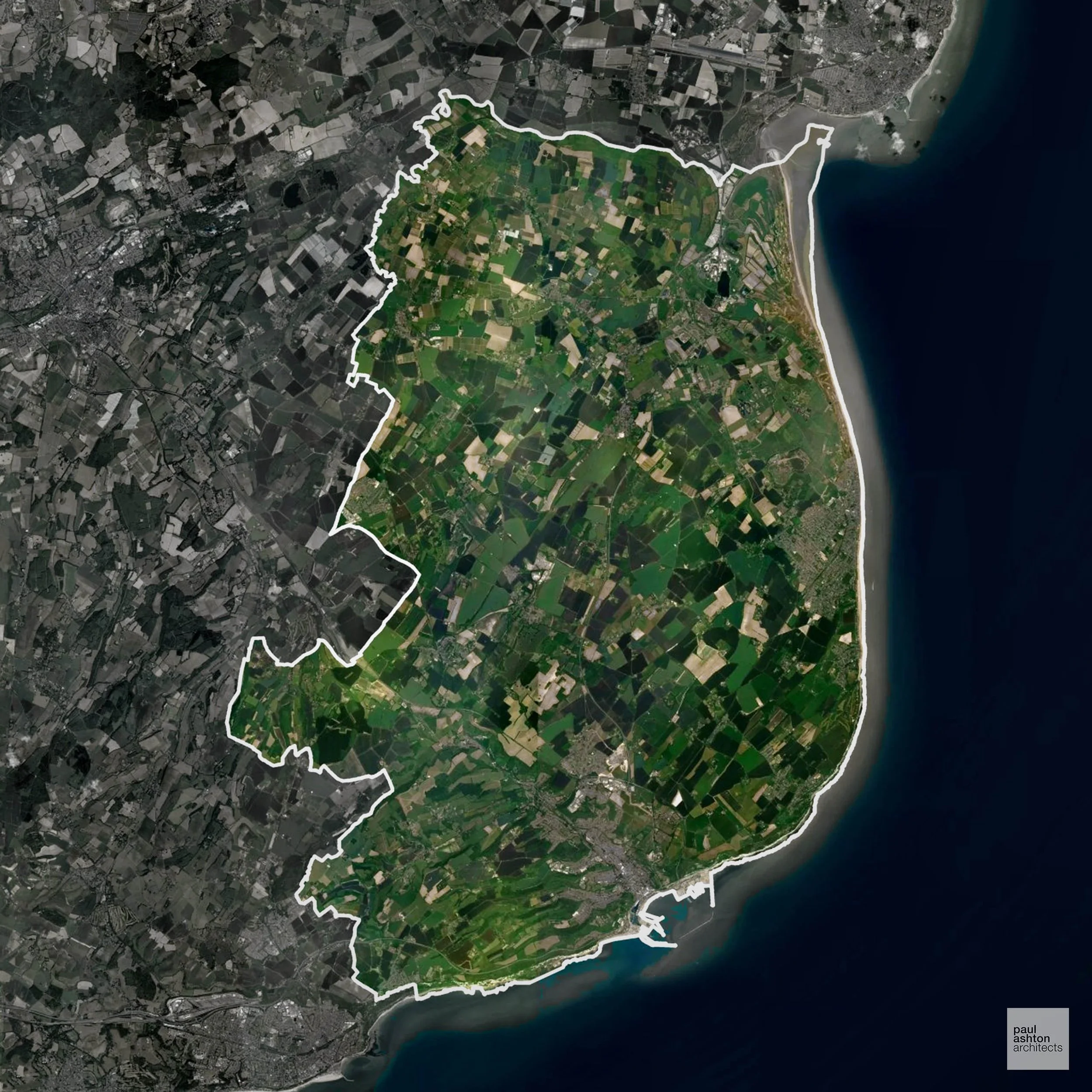
Dover in Kent includes Dover town, Deal, and Sandwich. Famous for the White Cliffs, historic castles, and port heritage. Planning focuses on urban regeneration, residential extensions, and conservation projects. We can advise on projects across Dover.
In the last year Dover decided 784 applications which is well below the national average of 988. The approval rate was 90% (roughly equal to the national average of 88%) and 66% of applications were decided on time, (significantly above the national average of 59%). Stats updated March 2026 from gov. sources. See how Dover performs relative to other LPAs in our LPA hub.
"We love helping clients win Planning Permission in Dover"
Development in the Open Countryside
Dover includes areas classed as Open Countryside, generally encompassing land beyond settlements and Green Belt zones, often used for agriculture or left as natural landscapes. Development in these areas is tightly controlled, with standard residential proposals rarely permitted.
Dover’s chalk cliffs, rolling downland, and rural hinterlands are visually prominent and safeguarded against development.
One of the top reasons poorly prepared proposals in the Open Countryside are refused is that they fail to demonstrate a policy-supported need. To minimise that risk with bespoke advice contact us here.
Nutrient Neutrality in Dover
Nutrient Neutrality ensures new developments do not increase harmful nitrogen or phosphorus levels in sensitive waterways. Parts of Dover district drain to the Stodmarsh designated sensitive catchment, requiring both nitrogen and phosphorus neutrality for new residential development in those areas. Unfortunately, Nutrient Neutrality can halt development completely. If you need early-stage, project-specific advice contact us here.
Planning Applications in Dover
In addition to acting as Planing Conultants we are ARB registered architects with 25+ years of experience. Our planning proposals are creatively tailored to each site to maximise potential and improve planning outcomes. We use the following tried and tested process to guide clients in Dover through planning to completion:
- Stage 1: Site Appraisals & Planning Strategy Advice
- Stage 2: Feasibility Studies & Concept Designs
- Stage 3: Planning Application Packages
- Architectural Drawing Packages
- Planning Statements & Design and Access Statements
- Coordination of Consultant Reports
- Direct Liaison with Planning Officers
- Stage 4: Technical Design
- Discharge of Planning Conditions
- Building Regulations and Construction Packages
Planning Services We Offer in Dover
- Full Planning Applications: Commercial, new buildings, changes of use.
- Householder Planning Applications: Domestic extensions / garden structures.
- Listed Building Consent: Alterations / repairs to listed buildings.
- Conservation Area Consent: Developments within Conservation Areas.
- Lawful Development Certificates: Confirming existing / completed works are lawful.
- Validation Requirements: Gathering documentation to ensure applications are validated by Dover LPA.
Contextual Planning Support in Dover
We work collaboratively with clients and shape a design that respects local character and meets Planning Policy requirements in order to maximise your chances of winning Planning Permission.
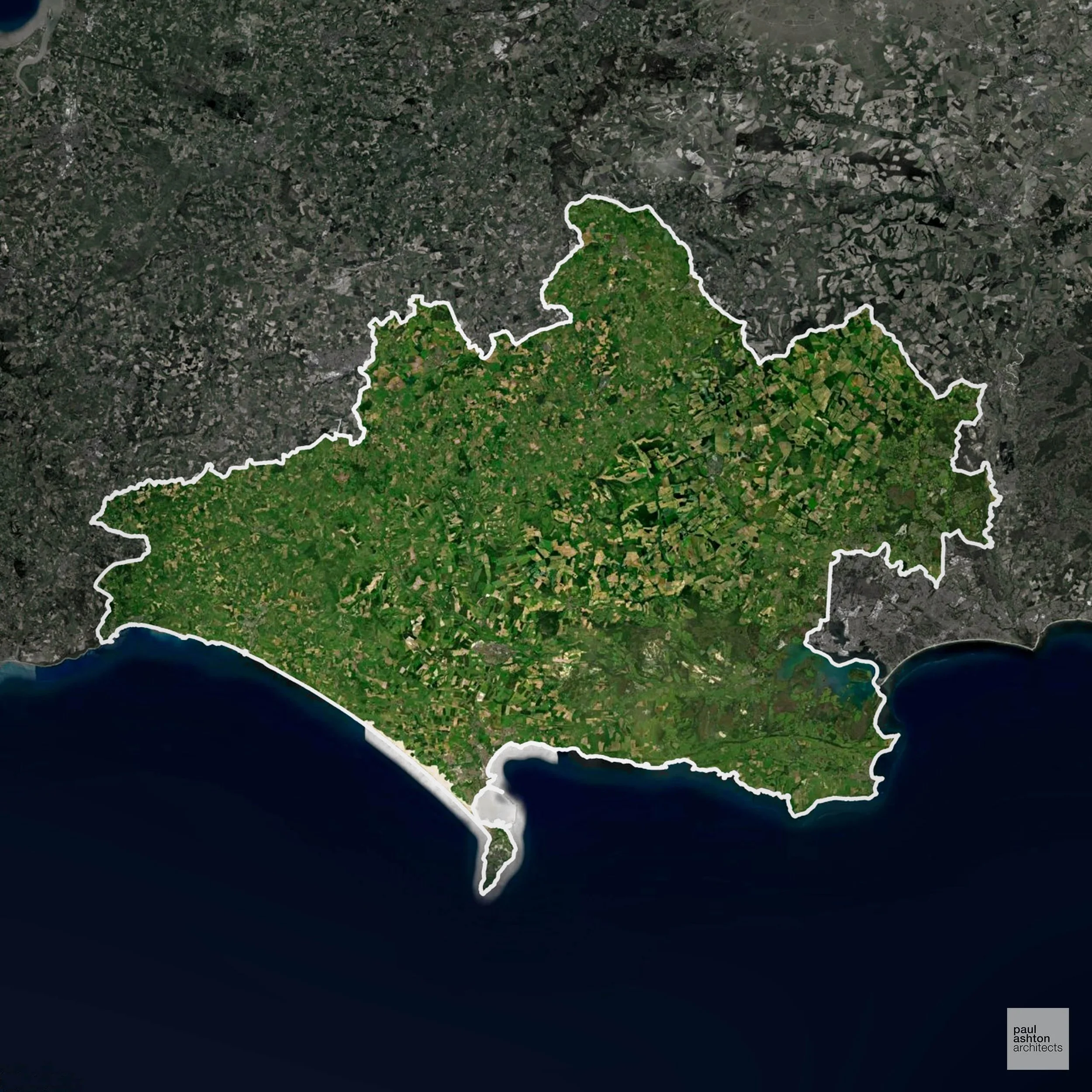
Dorset includes Dorchester, Weymouth, and Bridport. Known for coastal towns, heritage architecture, and rural villages, about 9.8% of the county is Green Belt, shaping development near urban edges. Planning focuses on sensitive residential, commercial, and extension projects. We can support schemes across Dorset.
In the last year Dorset decided 2,785 applications which is well above the national average of 988. The approval rate was 91% (roughly equal to the national average of 88%) and 66% of applications were decided on time, (significantly above the national average of 59%). Stats updated March 2026 from gov. sources. See how Dorset performs relative to other LPAs in our LPA hub.
"We love helping clients win Planning Permission in Dorset"
Green Belt Approvals in Dorset
The Green Belt is a nationally designated area of protected land surrounding many English towns and cities, where development is strictly controlled to prevent urban sprawl.
9.8% of Dorset is within the Green Belt and proposals in these areas can be subject to reasonable levels of scrutiny.
The Dorset Green Belt protects the rural hinterlands of Dorset, including villages such as Sherborne and Cerne Abbas, chalk downlands, and river valleys, helping to prevent urban sprawl and maintain the distinctive Dorset countryside.
In our experience, one of the top reasons poorly conceived Green Belt proposals are refused is causing 'harm to openness'. We can lower the risk of refusal with site-specific guidance. Contact us here.
You can also check whether your land is within the Green Belt using our interactive Green Belt map.
Nutrient Neutrality in Dorset
Nutrient Neutrality ensures new developments do not increase harmful nitrogen or phosphorus levels in sensitive waterways. Dorset Council is affected by two catchments: Poole Harbour (nitrogen, designated sensitive) and Chesil and the Fleet (nitrogen and phosphorus); developers in different parts of the district face different neutrality requirements. Unfortunately, Nutrient Neutrality can halt development completely. If you need early-stage, project-specific advice contact us here.
Planning Applications in Dorset
As well as acting as Planning Consultants we are ARB registered architects with over 25 years’ experience. Our site-specific planning proposals balance creativity with strategic insight. We use the following field-tested work stages to help clients in Dorset achieve successful planning outcomes:
- Stage 1: Site Appraisals & Planning Strategy Advice
- Stage 2: Feasibility Studies & Concept Designs
- Stage 3: Planning Application Packages
- Architectural Drawing Packages
- Planning Statements & Design and Access Statements
- Coordination of Consultant Reports
- Direct Liaison with Planning Officers
- Stage 4: Technical Design
- Discharge of Planning Conditions
- Building Regulations and Construction Packages
Planning Services We Offer in Dorset
- Full Planning Applications: Commercial, new buildings, changes of use.
- Householder Planning Applications: Domestic extensions / garden structures.
- Listed Building Consent: Alterations / repairs to listed buildings.
- Conservation Area Consent: Developments within Conservation Areas.
- Lawful Development Certificates: Confirming existing / completed works are lawful.
- Validation Requirements: Gathering documentation to ensure applications are validated by Dorset LPA.
Design-Led Planning Advice in Dorset
We can review your site in Dorset and offer informed guidance on how proposals can be developed in order to maximise your chances of securing Planning Permission.
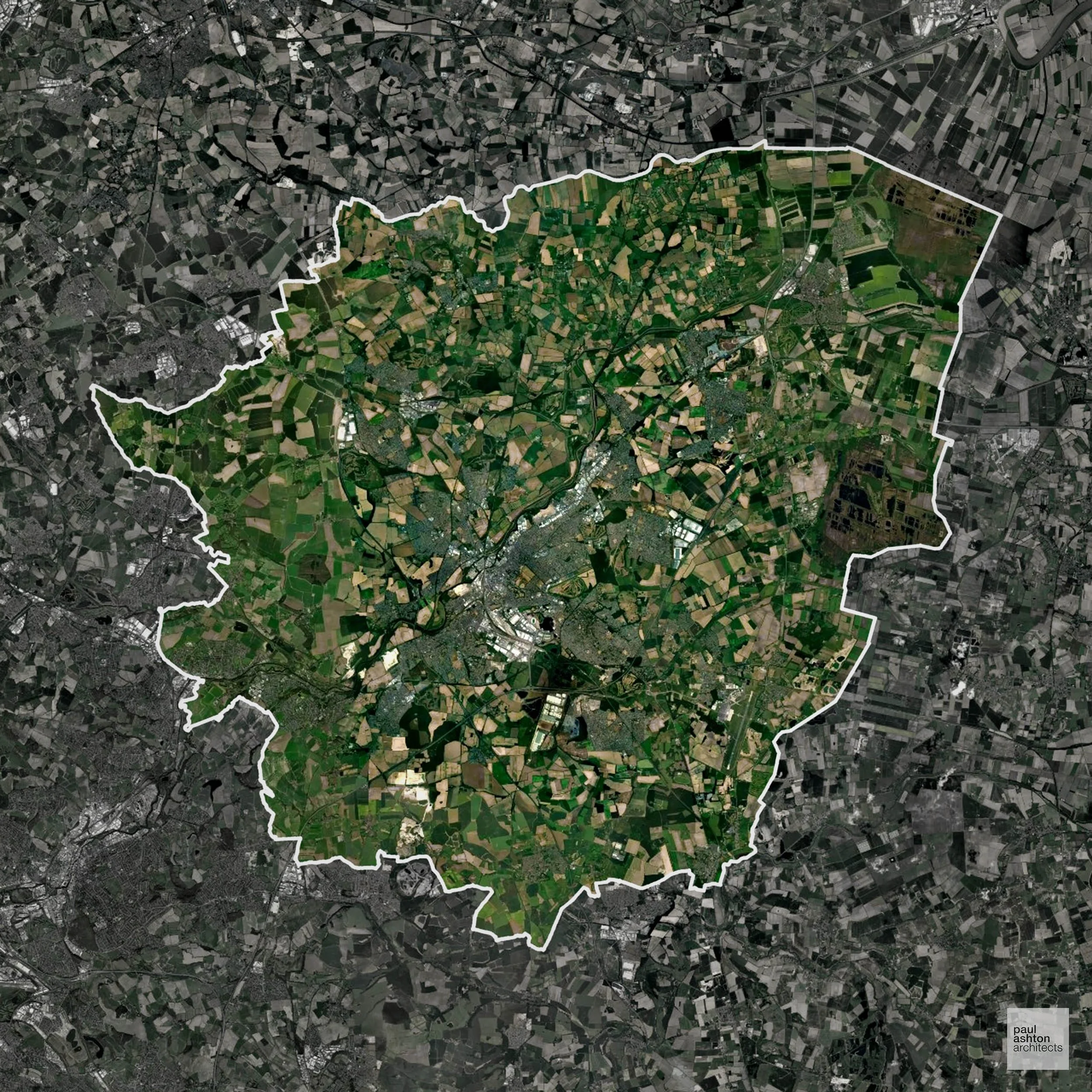
Doncaster in South Yorkshire includes the town centre, Mexborough, and Thorne. Famous for its racecourse, historic buildings, and industrial heritage, around 40.5% of the district is Green Belt. Planning balances urban development with protection of open countryside. We can advise on residential, commercial, and conversion projects throughout Doncaster.
In the last year Doncaster decided 913 applications which is slightly below the national average of 988. The approval rate was 86% (roughly equal to the national average of 88%) and 68% of applications were decided on time, (significantly above the national average of 59%). Stats updated March 2026 from gov. sources. See how Doncaster performs relative to other LPAs in our LPA hub.
"We love helping clients win Planning Permission in Doncaster"
Green Belt Approvals in Doncaster
The Green Belt is a policy protecting land around many English towns and cities, where development is tightly controlled to safeguard the open countryside.
40.5% of Doncaster is within the Green Belt and proposals in these areas can be subject to high levels of scrutiny.
The Green Belt near Conisbrough and Bentley constrains growth to safeguard countryside and prevent urban sprawl.
In our experience, one of the top reasons poorly conceived Green Belt proposals are refused is causing 'harm to openness'. We can lower the risk of refusal with site-specific guidance. Contact us here.
You can also check whether your land is within the Green Belt using our interactive Green Belt map.
Development in the Open Countryside
The Open Countryside is generally defined as land outside settlement and Green Belt boundaries, often comprising agricultural or natural land. Development, particularly standard residential development, is usually restricted in Open Countryside.
Doncaster’s open arable and grassland landscapes are preserved under planning policy to protect historic rural character.
One of the top reasons poorly prepared proposals in the Open Countryside are refused is that they fail to demonstrate a policy-supported need. To minimise that risk with bespoke advice contact us here.
Flood Risk in Doncaster
In some areas of the LPA, flood risk plays a key role in determining planning proposals. The Don and Dearne floodplains cover large areas of the borough, and Doncaster was severely affected by the 2007 floods, with Flood Zone 3 a major constraint on growth across the district. Where constraints permit, we can develop proposals that manage flood risk thoughtfully to give applications the best chance of approval.
Planning Applications in Doncaster
In addition to acting as Planing Conultants we are ARB registered architects with 25+ years of experience. Our planning proposals are creatively tailored to each site to maximise potential and improve planning outcomes. We use the following tried and tested process to guide clients in Doncaster through planning to completion:
- Stage 1: Site Appraisals & Planning Strategy Advice
- Stage 2: Feasibility Studies & Concept Designs
- Stage 3: Planning Application Packages
- Architectural Drawing Packages
- Planning Statements & Design and Access Statements
- Coordination of Consultant Reports
- Direct Liaison with Planning Officers
- Stage 4: Technical Design
- Discharge of Planning Conditions
- Building Regulations and Construction Packages
Planning Services We Offer in Doncaster
- Full Planning Applications: Commercial, new buildings, changes of use.
- Householder Planning Applications: Domestic extensions / garden structures.
- Listed Building Consent: Alterations / repairs to listed buildings.
- Conservation Area Consent: Developments within Conservation Areas.
- Lawful Development Certificates: Confirming existing / completed works are lawful.
- Validation Requirements: Gathering documentation to ensure applications are validated by Doncaster LPA.
Creative Planning Advice in Doncaster
We collaborate closely with our clients to develop designs that respond to local character and align with Planning Policy, helping to maximise the likelihood of securing Planning Permission in Doncaster.
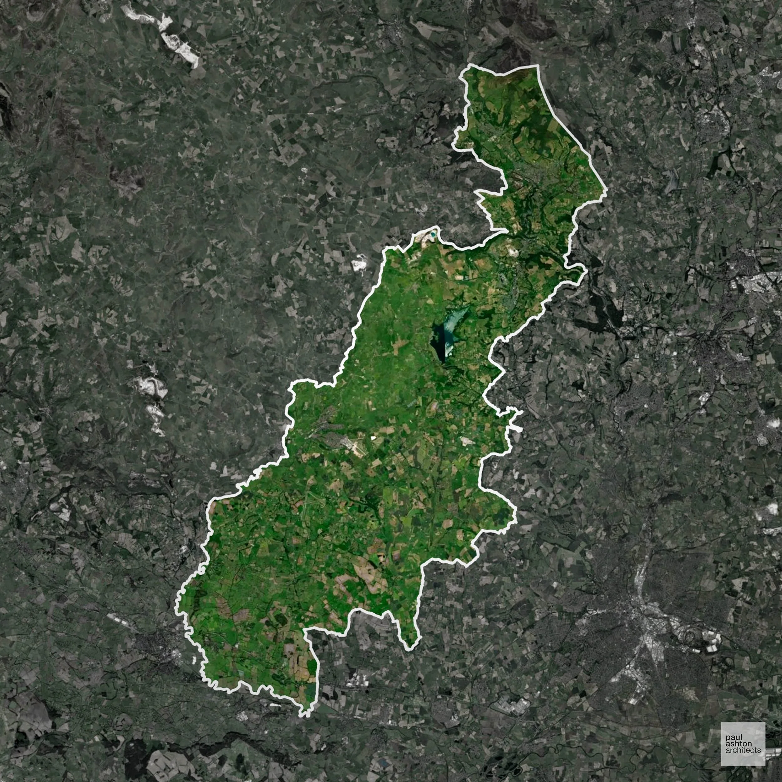
Derbyshire Dales includes Matlock, Ashbourne, and Wirksworth. Known for market towns, historic mills, and Peak District fringe villages. Planning focuses on conservation, rural development, and sensitive residential schemes. We can support projects across the district.
In the last year Derbyshire Dales decided 498 applications which is well below the national average of 988. The approval rate was 89% (roughly equal to the national average of 88%) and 60% of applications were decided on time, (on par with the national average of 59%). Stats updated March 2026 from gov. sources. See how Derbyshire Dales performs relative to other LPAs in our LPA hub.
"We love helping clients win Planning Permission in Derbyshire Dales"
Development in the Open Countryside
Derbyshire Dales includes areas classed as Open Countryside, generally encompassing land beyond settlements and Green Belt zones, often used for agriculture or left as natural landscapes. Development in these areas is tightly controlled, with standard residential proposals rarely permitted.
Derbyshire Dales’ Peak District fringes and river valleys are protected for their scenic and recreational importance.
One of the top reasons poorly prepared proposals in the Open Countryside are refused is that they fail to demonstrate a policy-supported need. To minimise that risk with bespoke advice contact us here.
Nutrient Neutrality in Derbyshire Dales
Nutrient Neutrality ensures new developments do not increase harmful nitrogen or phosphorus levels in sensitive waterways. Parts of Derbyshire Dales fall within the Peak District Dales SAC catchment, where phosphorus neutrality is required for residential development in affected areas. Unfortunately, Nutrient Neutrality can halt development completely. If you need early-stage, project-specific advice contact us here.
Planning Applications in Derbyshire Dales
As well as acting as Planning Consultants we are ARB registered architects with over 25 years’ experience. Our site-specific planning proposals balance creativity with strategic insight. We use the following field-tested work stages to help clients in Derbyshire Dales achieve successful planning outcomes:
- Stage 1: Site Appraisals & Planning Strategy Advice
- Stage 2: Feasibility Studies & Concept Designs
- Stage 3: Planning Application Packages
- Architectural Drawing Packages
- Planning Statements & Design and Access Statements
- Coordination of Consultant Reports
- Direct Liaison with Planning Officers
- Stage 4: Technical Design
- Discharge of Planning Conditions
- Building Regulations and Construction Packages
Planning Services We Offer in Derbyshire Dales
- Full Planning Applications: Commercial, new buildings, changes of use.
- Householder Planning Applications: Domestic extensions / garden structures.
- Listed Building Consent: Alterations / repairs to listed buildings.
- Conservation Area Consent: Developments within Conservation Areas.
- Lawful Development Certificates: Confirming existing / completed works are lawful.
- Validation Requirements: Gathering documentation to ensure applications are validated by Derbyshire Dales LPA.
Design-Led Planning Advice in Derbyshire Dales
We can review your site in Derbyshire Dales and offer informed guidance on how proposals can be developed in order to maximise your chances of securing Planning Permission.
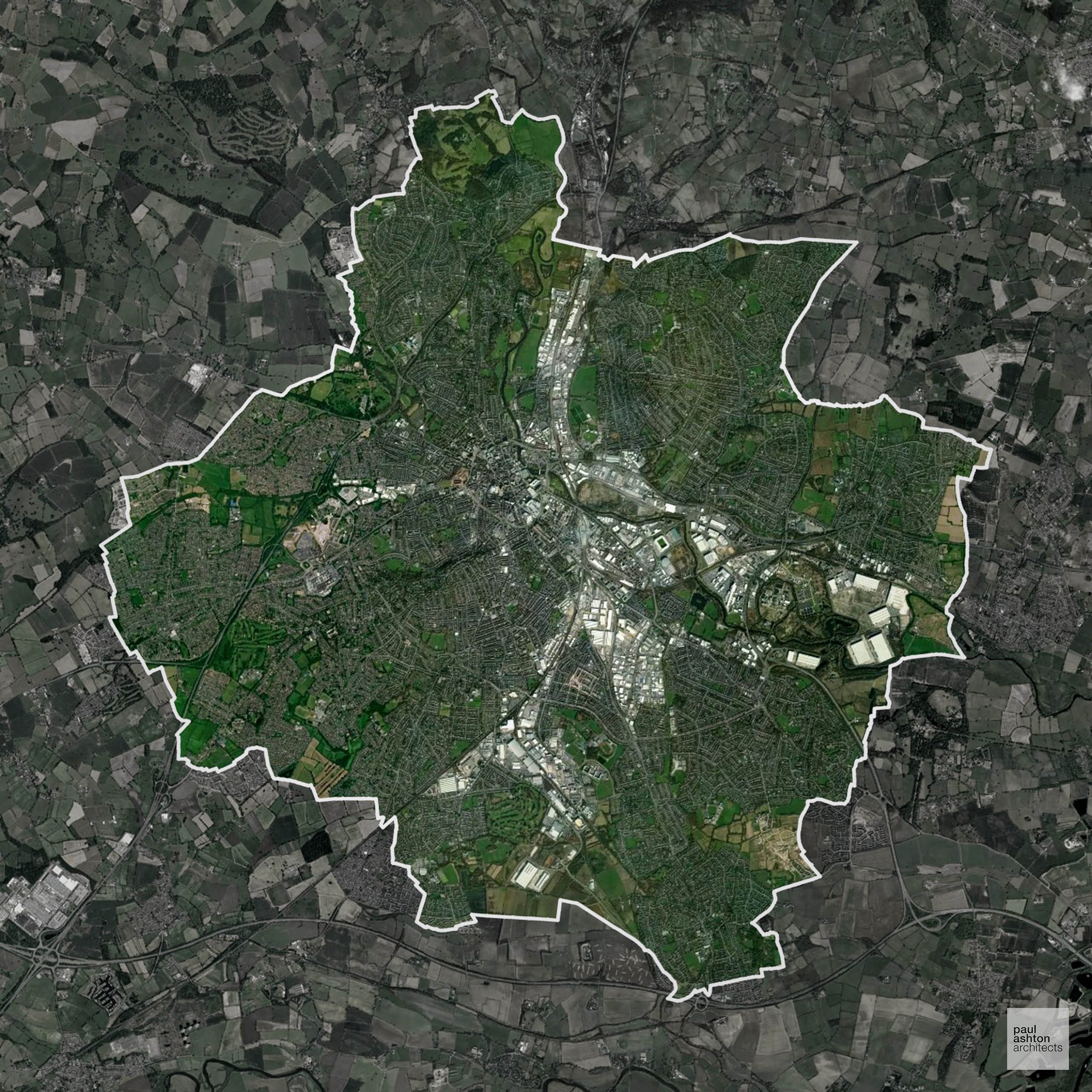
Derby city includes the centre, Alvaston, and Littleover. Famous for Rolls-Royce and industrial heritage, about 3.1% of the district is Green Belt, shaping development on the outskirts. Planning focuses on residential and commercial growth within sensitive urban areas. We can advise on conversions, extensions, and new-build projects throughout Derby.
In the last year Derby decided 937 applications which is slightly below the national average of 988. The approval rate was 91% (roughly equal to the national average of 88%) and 39% of applications were decided on time, (significantly below the national average of 59%). Stats updated March 2026 from gov. sources. See how Derby performs relative to other LPAs in our LPA hub.
"We love helping clients win Planning Permission in Derby"
Green Belt Approvals in Derby
The Green Belt is a nationally designated area of protected land surrounding many English towns and cities, where development is strictly controlled to prevent urban sprawl.
3.1% of Derby is within the Green Belt and proposals in these areas can be subject to reasonable levels of scrutiny.
The Derby Green Belt preserves the surrounding farmland, small settlements such as Littleover and Mickleover, and the open landscapes along the Derwent Valley, preventing encroachment from urban expansion and protecting locally valued ecological and historic features.
In our experience, one of the top reasons poorly conceived Green Belt proposals are refused is causing 'harm to openness'. We can lower the risk of refusal with site-specific guidance. Contact us here.
You can also check whether your land is within the Green Belt using our interactive Green Belt map.
Planning Applications in Derby
Alongside acting as Planning Consultants we are ARB registered architects with 25+ years of experience. We use the following proven work stages to guide clients in Derby through the planning process in order to maximise the potential of their development :
- Stage 1: Site Appraisals & Planning Strategy Advice
- Stage 2: Feasibility Studies & Concept Designs
- Stage 3: Planning Application Packages
- Architectural Drawing Packages
- Planning Statements & Design and Access Statements
- Coordination of Consultant Reports
- Direct Liaison with Planning Officers
- Stage 4: Technical Design
- Discharge of Planning Conditions
- Building Regulations and Construction Packages
Planning Services We Offer in Derby
- Full Planning Applications: Commercial, new buildings, changes of use.
- Householder Planning Applications: Domestic extensions / garden structures.
- Listed Building Consent: Alterations / repairs to listed buildings.
- Conservation Area Consent: Developments within Conservation Areas.
- Lawful Development Certificates: Confirming existing / completed works are lawful.
- Validation Requirements: Gathering documentation to ensure applications are validated by Derby LPA.
Contextual Planning Support in Derby
We work collaboratively with clients and shape a design that respects local character and meets Planning Policy requirements in order to maximise your chances of winning Planning Permission.

Dartford in Kent includes Dartford town, Greenhithe, and Swanscombe. About 56.3% of the borough is Green Belt, framing development around settlements. Planning balances residential growth with protection of open countryside. We can support residential, commercial, and mixed-use schemes across Dartford.
In the last year Dartford decided 592 applications which is well below the national average of 988. The approval rate was 80% (slightly below the national average of 88%) and 61% of applications were decided on time, (on par with the national average of 59%). Stats updated March 2026 from gov. sources. See how Dartford performs relative to other LPAs in our LPA hub.
"We love helping clients win Planning Permission in Dartford"
Green Belt Approvals in Dartford
The Green Belt is a nationally designated area of protected land surrounding many English towns and cities, where development is strictly controlled to prevent urban sprawl.
Significantly, 56.3% of Dartford is within the Green Belt and proposals in these areas can be subject to high levels of scrutiny.
The Green Belt near Dartford town constrains growth to protect countryside and maintain gaps with neighbouring settlements.
In our experience, one of the top reasons poorly conceived Green Belt proposals are refused is causing 'harm to openness'. We can lower the risk of refusal with site-specific guidance. Contact us here.
You can also check whether your land is within the Green Belt using our interactive Green Belt map.
Planning Applications in Dartford
Alongside acting as Planning Consultants we are ARB registered architects with 25+ years of experience. We use the following proven work stages to guide clients in Dartford through the planning process in order to maximise the potential of their development :
- Stage 1: Site Appraisals & Planning Strategy Advice
- Stage 2: Feasibility Studies & Concept Designs
- Stage 3: Planning Application Packages
- Architectural Drawing Packages
- Planning Statements & Design and Access Statements
- Coordination of Consultant Reports
- Direct Liaison with Planning Officers
- Stage 4: Technical Design
- Discharge of Planning Conditions
- Building Regulations and Construction Packages
Planning Services We Offer in Dartford
- Full Planning Applications: Commercial, new buildings, changes of use.
- Householder Planning Applications: Domestic extensions / garden structures.
- Listed Building Consent: Alterations / repairs to listed buildings.
- Conservation Area Consent: Developments within Conservation Areas.
- Lawful Development Certificates: Confirming existing / completed works are lawful.
- Validation Requirements: Gathering documentation to ensure applications are validated by Dartford LPA.
Creative Planning Advice in Dartford
We collaborate closely with our clients to develop designs that respond to local character and align with Planning Policy, helping to maximise the likelihood of securing Planning Permission in Dartford.
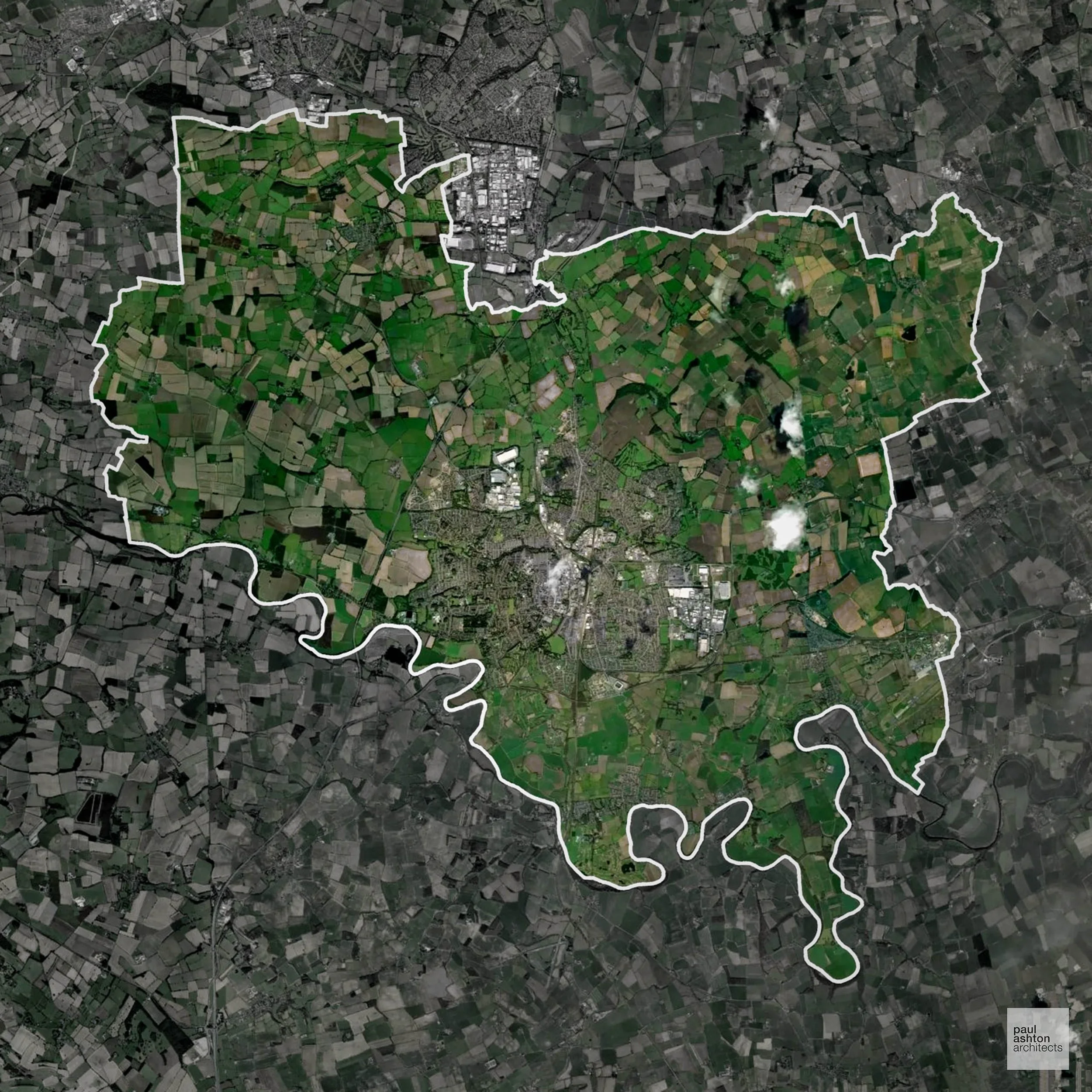
Darlington in County Durham includes the town itself and surrounding villages. Known for its railway heritage and historic buildings. Planning often focuses on urban regeneration, extensions, and residential conversions. We can advise on projects throughout Darlington.
In the last year Darlington decided 451 applications which is well below the national average of 988. The approval rate was 90% (roughly equal to the national average of 88%) and 65% of applications were decided on time, (significantly above the national average of 59%). Stats updated March 2026 from gov. sources. See how Darlington performs relative to other LPAs in our LPA hub.
"We love helping clients win Planning Permission in Darlington"
Nutrient Neutrality in Darlington
Nutrient Neutrality ensures new developments do not increase harmful nitrogen or phosphorus levels in sensitive waterways. Within the Teesmouth nitrogen catchment; residential development must demonstrate nitrogen neutrality. Unfortunately, Nutrient Neutrality can halt development completely. If you need early-stage, project-specific advice contact us here.
Planning Applications in Darlington
In addition to acting as Planing Conultants we are ARB registered architects with 25+ years of experience. Our planning proposals are creatively tailored to each site to maximise potential and improve planning outcomes. We use the following tried and tested process to guide clients in Darlington through planning to completion:
- Stage 1: Site Appraisals & Planning Strategy Advice
- Stage 2: Feasibility Studies & Concept Designs
- Stage 3: Planning Application Packages
- Architectural Drawing Packages
- Planning Statements & Design and Access Statements
- Coordination of Consultant Reports
- Direct Liaison with Planning Officers
- Stage 4: Technical Design
- Discharge of Planning Conditions
- Building Regulations and Construction Packages
Planning Services We Offer in Darlington
- Full Planning Applications: Commercial, new buildings, changes of use.
- Householder Planning Applications: Domestic extensions / garden structures.
- Listed Building Consent: Alterations / repairs to listed buildings.
- Conservation Area Consent: Developments within Conservation Areas.
- Lawful Development Certificates: Confirming existing / completed works are lawful.
- Validation Requirements: Gathering documentation to ensure applications are validated by Darlington LPA.
Creative Planning Advice in Darlington
We collaborate closely with our clients to develop designs that respond to local character and align with Planning Policy, helping to maximise the likelihood of securing Planning Permission in Darlington.
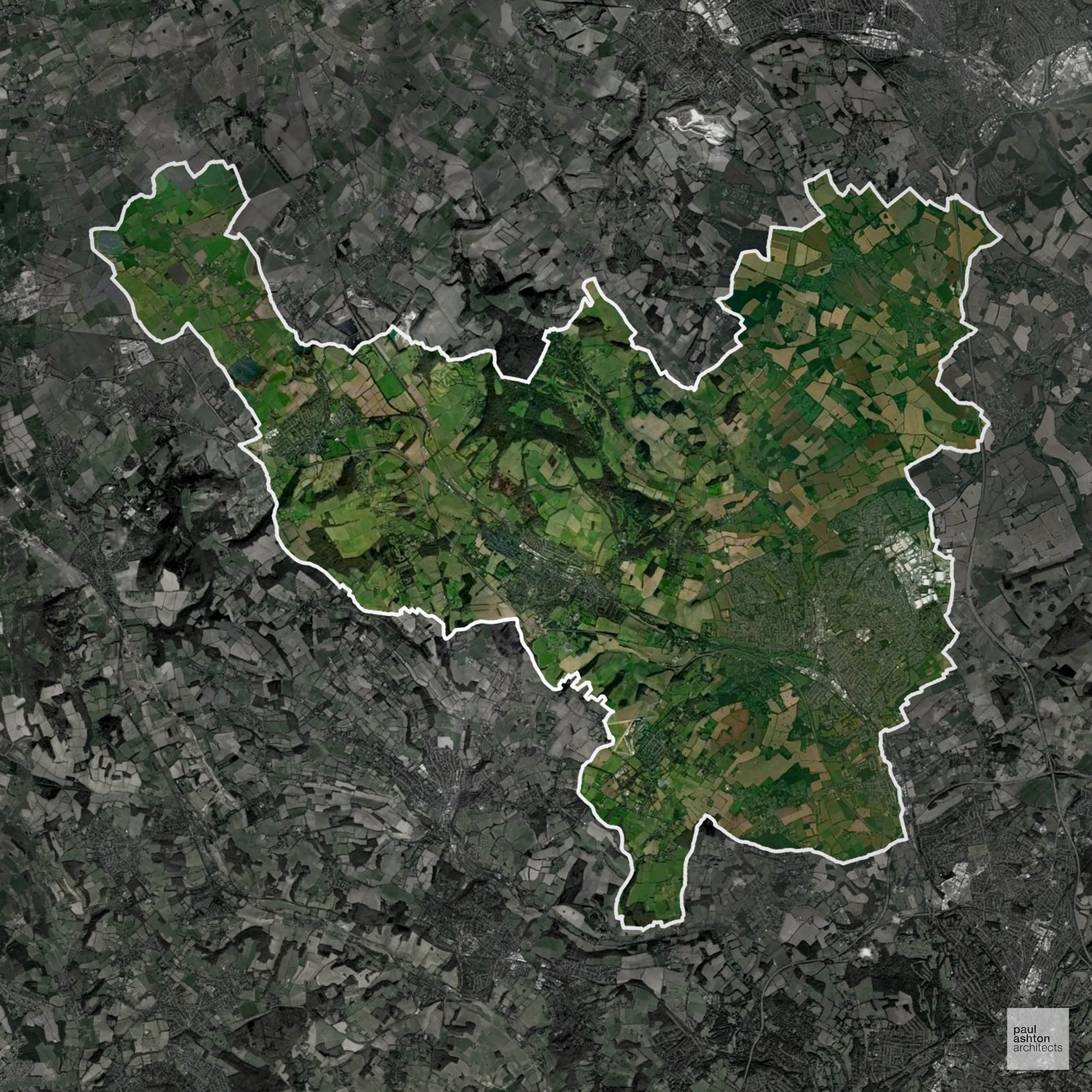
Dacorum in Hertfordshire includes Hemel Hempstead, Berkhamsted, and Tring. About 50% of the district is Green Belt, influencing where new housing and commercial developments can be located. Planning balances urban growth with preservation of rural landscapes. We can support residential, commercial, and conversion projects across Dacorum.
In the last year Dacorum decided 1,137 applications which is just above the national average of 988. The approval rate was 89% (roughly equal to the national average of 88%) and 77% of applications were decided on time, (significantly above the national average of 59%). Stats updated March 2026 from gov. sources. See how Dacorum performs relative to other LPAs in our LPA hub.
"We love helping clients win Planning Permission in Dacorum"
Green Belt Approvals in Dacorum
The Green Belt is a nationally designated area of protected land surrounding many English towns and cities, where development is strictly controlled to prevent urban sprawl.
50.0% of Dacorum is within the Green Belt and proposals in these areas can be subject to high levels of scrutiny.
The Green Belt surrounding Hemel Hempstead and the Chilterns constrains growth to safeguard countryside and ecological assets.
In our experience, one of the top reasons poorly conceived Green Belt proposals are refused is causing 'harm to openness'. We can lower the risk of refusal with site-specific guidance. Contact us here.
You can also check whether your land is within the Green Belt using our interactive Green Belt map.
Planning Applications in Dacorum
As well as acting as Planning Consultants we are ARB registered architects with over 25 years’ experience. Our site-specific planning proposals balance creativity with strategic insight. We use the following field-tested work stages to help clients in Dacorum achieve successful planning outcomes:
- Stage 1: Site Appraisals & Planning Strategy Advice
- Stage 2: Feasibility Studies & Concept Designs
- Stage 3: Planning Application Packages
- Architectural Drawing Packages
- Planning Statements & Design and Access Statements
- Coordination of Consultant Reports
- Direct Liaison with Planning Officers
- Stage 4: Technical Design
- Discharge of Planning Conditions
- Building Regulations and Construction Packages
Planning Services We Offer in Dacorum
- Full Planning Applications: Commercial, new buildings, changes of use.
- Householder Planning Applications: Domestic extensions / garden structures.
- Listed Building Consent: Alterations / repairs to listed buildings.
- Conservation Area Consent: Developments within Conservation Areas.
- Lawful Development Certificates: Confirming existing / completed works are lawful.
- Validation Requirements: Gathering documentation to ensure applications are validated by Dacorum LPA.
Design-Led Planning Advice in Dacorum
We can review your site in Dacorum and offer informed guidance on how proposals can be developed in order to maximise your chances of securing Planning Permission.
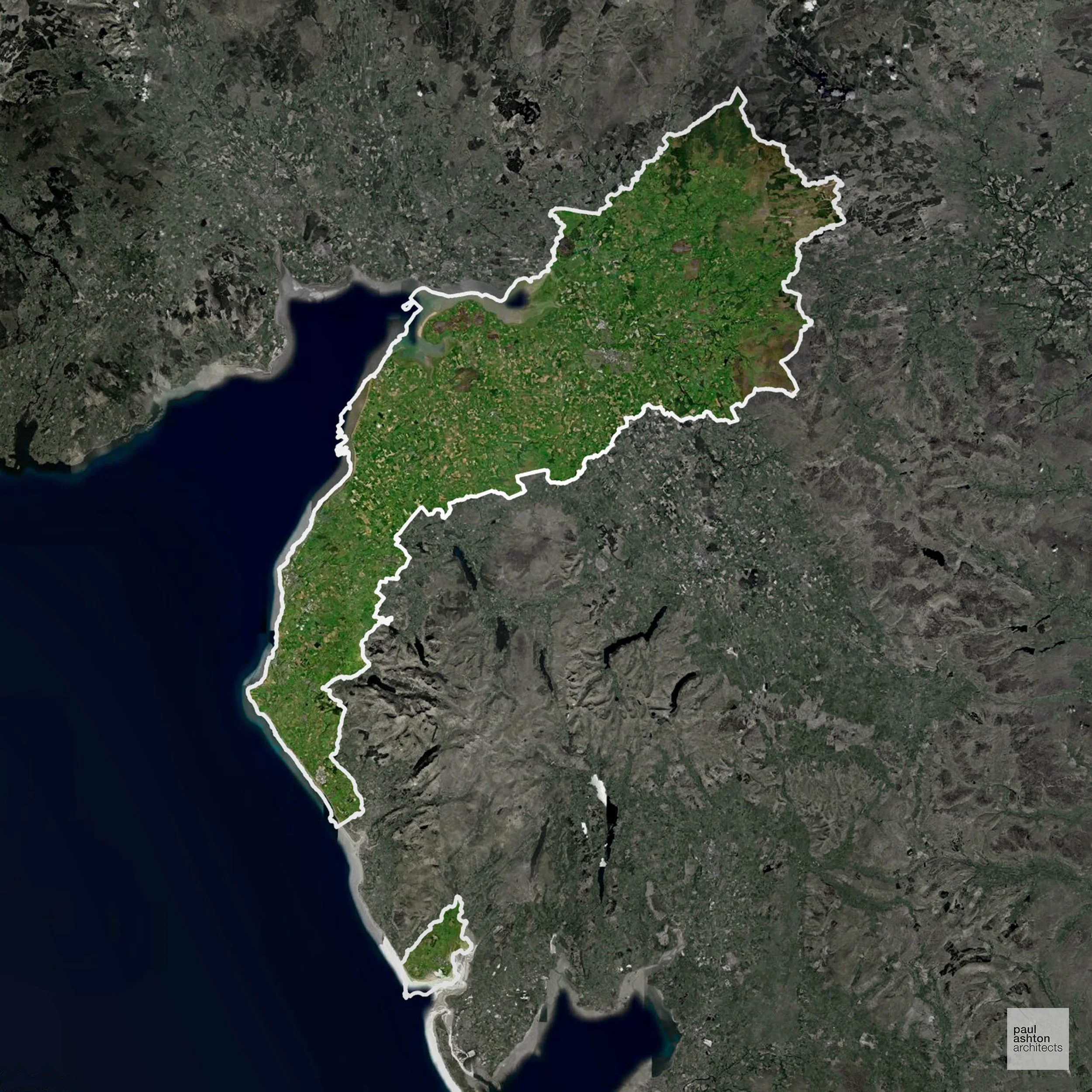
Cumberland encompasses towns such as Carlisle, Workington, and Whitehaven. Rich in Roman and industrial heritage, planning is focused on sensitive urban development and conservation. We can advise on residential, commercial, and mixed-use schemes throughout the district.
In the last year Cumberland decided 1,146 applications which is just above the national average of 988. The approval rate was 97% (marginally above the national average of 88%) and 57% of applications were decided on time, (on par with the national average of 59%). Stats updated March 2026 from gov. sources. See how Cumberland performs relative to other LPAs in our LPA hub.
"We love helping clients win Planning Permission in Cumberland"
Flood Risk in Cumberland
In some areas of the LPA, flood risk plays a key role in determining planning proposals. Storm Desmond (2015) and subsequent flood events caused severe damage across Carlisle and the Eden and Derwent valleys, and flood risk remains a fundamental constraint on development in many parts of the authority. Where constraints permit, we can develop proposals that manage flood risk thoughtfully to give applications the best chance of approval.
Nutrient Neutrality in Cumberland
Nutrient Neutrality ensures new developments do not increase harmful nitrogen or phosphorus levels in sensitive waterways. Parts of Cumberland fall within both the River Eden and River Derwent/Bassenthwaite Lake designated sensitive catchments, requiring phosphorus neutrality for residential development in affected areas. Unfortunately, Nutrient Neutrality can halt development completely. If you need early-stage, project-specific advice contact us here.
Planning Applications in Cumberland
As well as acting as Planning Consultants we are ARB registered architects with over 25 years’ experience. Our site-specific planning proposals balance creativity with strategic insight. We use the following field-tested work stages to help clients in Cumberland achieve successful planning outcomes:
- Stage 1: Site Appraisals & Planning Strategy Advice
- Stage 2: Feasibility Studies & Concept Designs
- Stage 3: Planning Application Packages
- Architectural Drawing Packages
- Planning Statements & Design and Access Statements
- Coordination of Consultant Reports
- Direct Liaison with Planning Officers
- Stage 4: Technical Design
- Discharge of Planning Conditions
- Building Regulations and Construction Packages
Planning Services We Offer in Cumberland
- Full Planning Applications: Commercial, new buildings, changes of use.
- Householder Planning Applications: Domestic extensions / garden structures.
- Listed Building Consent: Alterations / repairs to listed buildings.
- Conservation Area Consent: Developments within Conservation Areas.
- Lawful Development Certificates: Confirming existing / completed works are lawful.
- Validation Requirements: Gathering documentation to ensure applications are validated by Cumberland LPA.
Design-Led Planning Advice in Cumberland
We can review your site in Cumberland and offer informed guidance on how proposals can be developed in order to maximise your chances of securing Planning Permission.
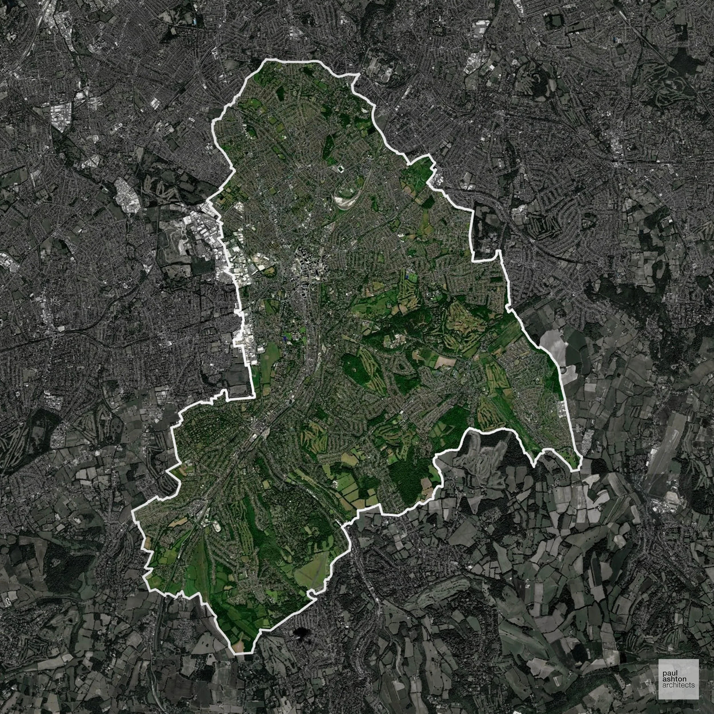
Croydon in South London includes Croydon town, Purley, and South Norwood. Known for its commercial hub, Victorian architecture, and suburban communities, around 25.3% of the borough is Green Belt, shaping development at the edges. Planning focuses on urban intensification, conversions, and residential growth. We can deliver Planning Permission for residential and commercial projects across Croydon.
In the last year Croydon decided 1,582 applications which is well above the national average of 988. The approval rate was 75% (slightly below the national average of 88%) and 60% of applications were decided on time, (on par with the national average of 59%). Stats updated March 2026 from gov. sources. See how Croydon performs relative to other LPAs in our LPA hub.
"We love helping clients win Planning Permission in Croydon"
Green Belt Approvals in Croydon
The Green Belt is a policy protecting land around many English towns and cities, where development is tightly controlled to safeguard the open countryside.
25.3% of Croydon is within the Green Belt and proposals in these areas can be subject to very high levels of scrutiny.
Development within the Green Belt surrounding London is highly sensitive and politically contentious. The Croydon Green Belt contains open land, parkland, and woodland buffers between suburban areas, particularly around Selsdon and Kenley which are under development pressure.
In our experience, one of the top reasons poorly conceived Green Belt proposals are refused is causing 'harm to openness'. We can lower the risk of refusal with site-specific guidance. Contact us here.
You can also check whether your land is within the Green Belt using our interactive Green Belt map.
Planning Applications in Croydon
As well as acting as Planning Consultants we are ARB registered architects with over 25 years’ experience. Our site-specific planning proposals balance creativity with strategic insight. We use the following field-tested work stages to help clients in Croydon achieve successful planning outcomes:
- Stage 1: Site Appraisals & Planning Strategy Advice
- Stage 2: Feasibility Studies & Concept Designs
- Stage 3: Planning Application Packages
- Architectural Drawing Packages
- Planning Statements & Design and Access Statements
- Coordination of Consultant Reports
- Direct Liaison with Planning Officers
- Stage 4: Technical Design
- Discharge of Planning Conditions
- Building Regulations and Construction Packages
Planning Services We Offer in Croydon
- Full Planning Applications: Commercial, new buildings, changes of use.
- Householder Planning Applications: Domestic extensions / garden structures.
- Listed Building Consent: Alterations / repairs to listed buildings.
- Conservation Area Consent: Developments within Conservation Areas.
- Lawful Development Certificates: Confirming existing / completed works are lawful.
- Validation Requirements: Gathering documentation to ensure applications are validated by Croydon LPA.
Design-Led Planning Advice in Croydon
We can review your site in Croydon and offer informed guidance on how proposals can be developed in order to maximise your chances of securing Planning Permission.
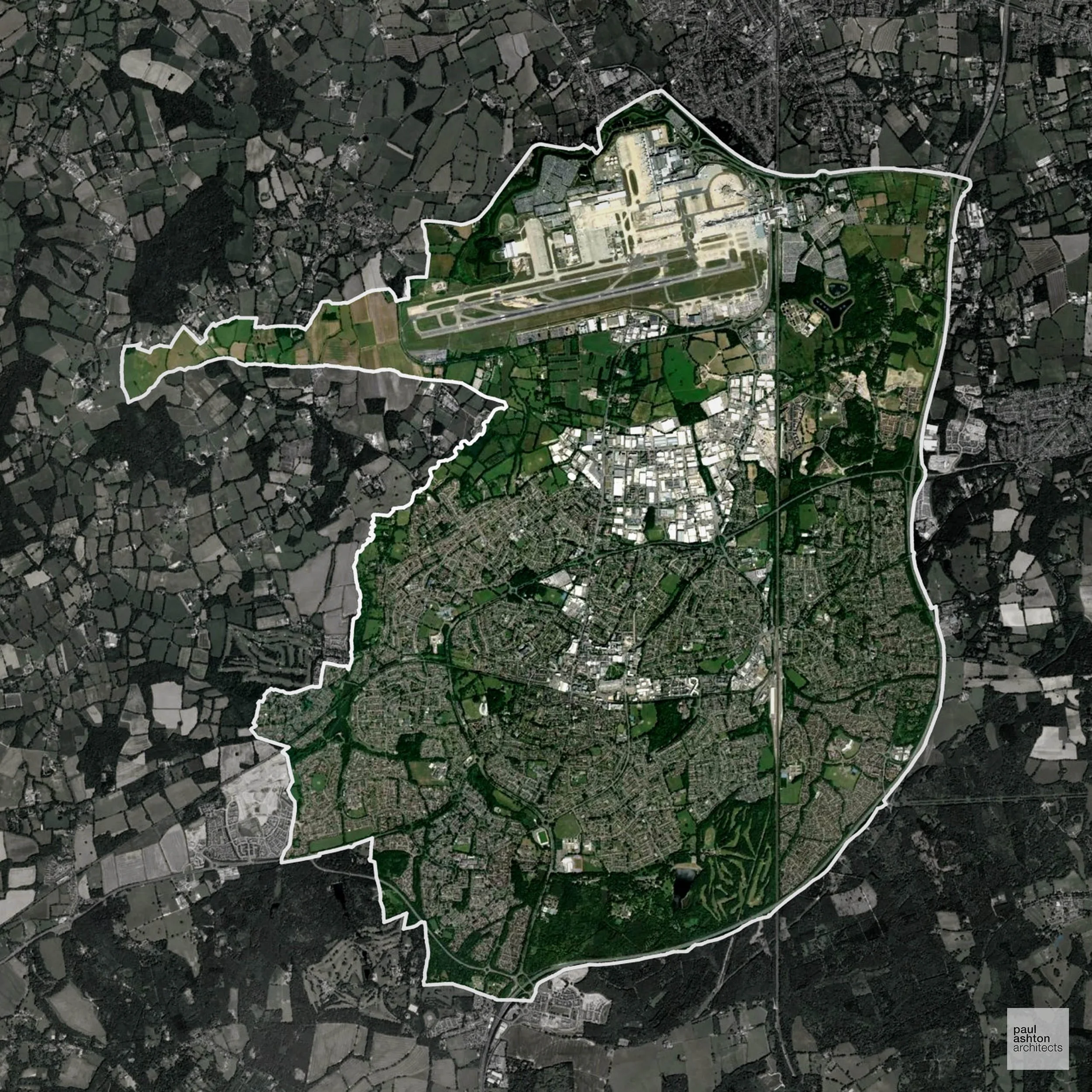
Crawley in West Sussex includes the town centre, Three Bridges, and Gatwick-adjacent neighbourhoods. Known for its post-war New Town design and proximity to Gatwick Airport. Planning is urban-focused, often addressing mixed-use schemes and residential extensions. We can support projects throughout Crawley.
In the last year Crawley decided 220 applications which is well below the national average of 988. The approval rate was 81% (slightly below the national average of 88%) and 31% of applications were decided on time, (significantly below the national average of 59%). Stats updated March 2026 from gov. sources. See how Crawley performs relative to other LPAs in our LPA hub.
"We love helping clients win Planning Permission in Crawley"
Areas of Outstanding Natural Beauty in Crawley
Areas of Outstanding Natural Beauty (AONBs), (now often referred to as National Landscapes), are protected areas recognised for their exceptional scenic and natural value. For developers, this means that planning proposals within these areas are carefully scrutinised, with a strong presumption against inappropriate development.
Crawley contains small sections of the High Weald AONB. Development is subject to careful landscape assessment.
In our experience, one of the top reasons proposals in Areas of Outstanding Natural Beauty are refused is causing landscape harm or visual intrusion, a risk that often arises when applications are not fully informed. We help minimise the likelihood of refusal with expert, guidance; contact us here.
Development in the Open Countryside
The Open Countryside is generally defined as land outside settlement and Green Belt boundaries, often comprising agricultural or natural land. Development, particularly standard residential development, is usually restricted in Open Countryside.
Crawley’s surrounding Green Belt and countryside are sensitive to development, maintaining clear separation from nearby settlements.
One of the top reasons poorly prepared proposals in the Open Countryside are refused is that they fail to demonstrate a policy-supported need. To minimise that risk with bespoke advice contact us here.
Planning Applications in Crawley
Alongside acting as Planning Consultants we are ARB registered architects with 25+ years of experience. We use the following proven work stages to guide clients in Crawley through the planning process in order to maximise the potential of their development :
- Stage 1: Site Appraisals & Planning Strategy Advice
- Stage 2: Feasibility Studies & Concept Designs
- Stage 3: Planning Application Packages
- Architectural Drawing Packages
- Planning Statements & Design and Access Statements
- Coordination of Consultant Reports
- Direct Liaison with Planning Officers
- Stage 4: Technical Design
- Discharge of Planning Conditions
- Building Regulations and Construction Packages
Planning Services We Offer in Crawley
- Full Planning Applications: Commercial, new buildings, changes of use.
- Householder Planning Applications: Domestic extensions / garden structures.
- Listed Building Consent: Alterations / repairs to listed buildings.
- Conservation Area Consent: Developments within Conservation Areas.
- Lawful Development Certificates: Confirming existing / completed works are lawful.
- Validation Requirements: Gathering documentation to ensure applications are validated by Crawley LPA.
Contextual Planning Support in Crawley
We work collaboratively with clients and shape a design that respects local character and meets Planning Policy requirements in order to maximise your chances of winning Planning Permission.
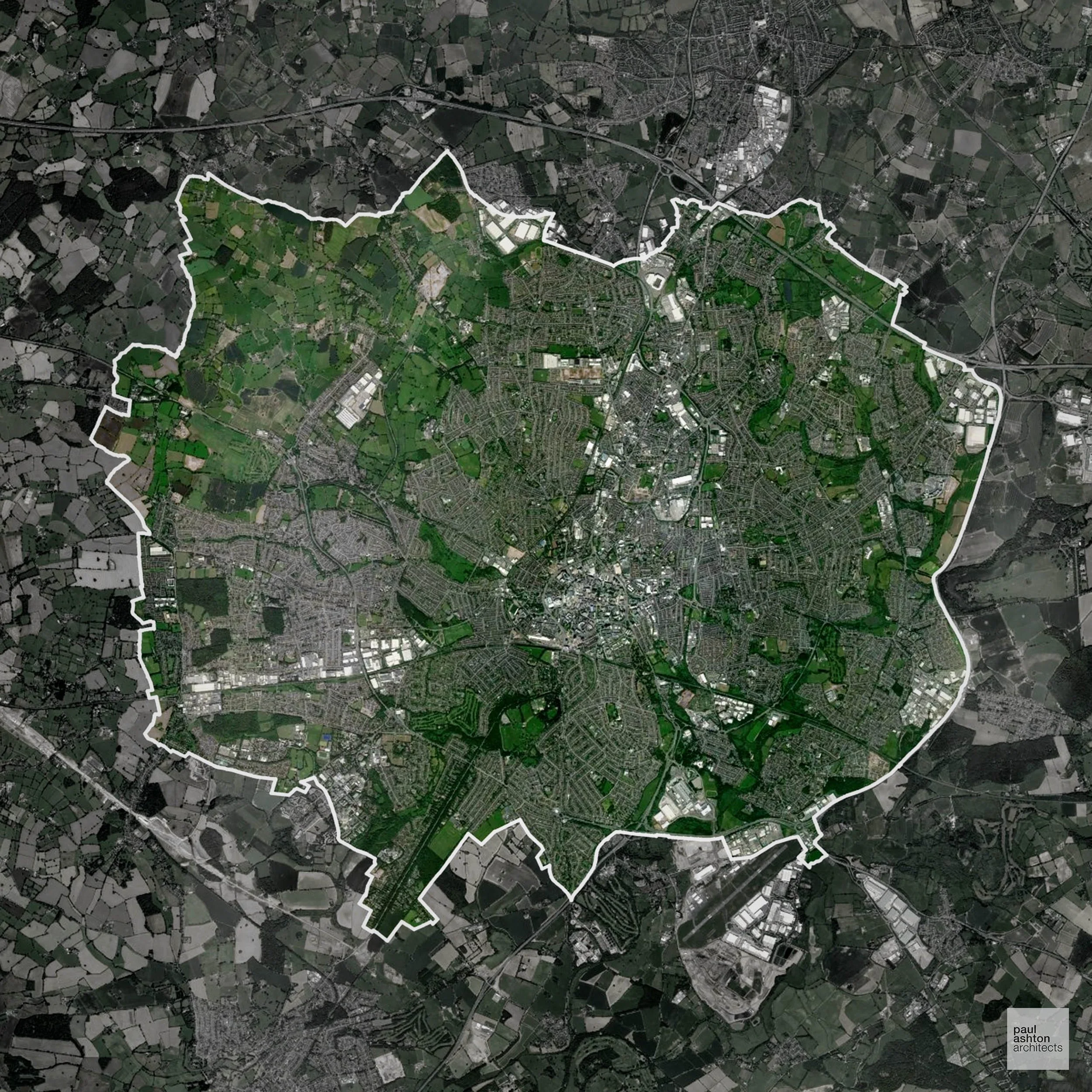
Coventry is a city of historic and modern contrasts, with areas like the city centre, Foleshill, and Earlsdon. Famous for the Cathedral, manufacturing history, and the Motor Industry, about 15% of the district is Green Belt, shaping development on the outskirts. Planning focuses on urban regeneration, extensions, and conversions. We can support residential and commercial projects across Coventry.
In the last year Coventry decided 1,226 applications which is well above the national average of 988. The approval rate was 86% (roughly equal to the national average of 88%) and 89% of applications were decided on time, (significantly above the national average of 59%). Stats updated March 2026 from gov. sources. See how Coventry performs relative to other LPAs in our LPA hub.
"We love helping clients win Planning Permission in Coventry"
Green Belt Approvals in Coventry
The Green Belt is nationally designated land around towns and cities, created to limit urban growth.
15.0% of Coventry is within the Green Belt and proposals in these areas can be subject to high levels of scrutiny.
The Coventry Green Belt preserves farmland, river corridors, and villages such as Baginton and Allesley, vulnerable to urban sprawl.
In our experience, one of the top reasons poorly conceived Green Belt proposals are refused is causing 'harm to openness'. We can lower the risk of refusal with site-specific guidance. Contact us here.
You can also check whether your land is within the Green Belt using our interactive Green Belt map.
Planning Applications in Coventry
Alongside acting as Planning Consultants we are ARB registered architects with 25+ years of experience. We use the following proven work stages to guide clients in Coventry through the planning process in order to maximise the potential of their development :
- Stage 1: Site Appraisals & Planning Strategy Advice
- Stage 2: Feasibility Studies & Concept Designs
- Stage 3: Planning Application Packages
- Architectural Drawing Packages
- Planning Statements & Design and Access Statements
- Coordination of Consultant Reports
- Direct Liaison with Planning Officers
- Stage 4: Technical Design
- Discharge of Planning Conditions
- Building Regulations and Construction Packages
Planning Services We Offer in Coventry
- Full Planning Applications: Commercial, new buildings, changes of use.
- Householder Planning Applications: Domestic extensions / garden structures.
- Listed Building Consent: Alterations / repairs to listed buildings.
- Conservation Area Consent: Developments within Conservation Areas.
- Lawful Development Certificates: Confirming existing / completed works are lawful.
- Validation Requirements: Gathering documentation to ensure applications are validated by Coventry LPA.
Design-Led Planning Advice in Coventry
We can review your site in Coventry and offer informed guidance on how proposals can be developed in order to maximise your chances of securing Planning Permission.
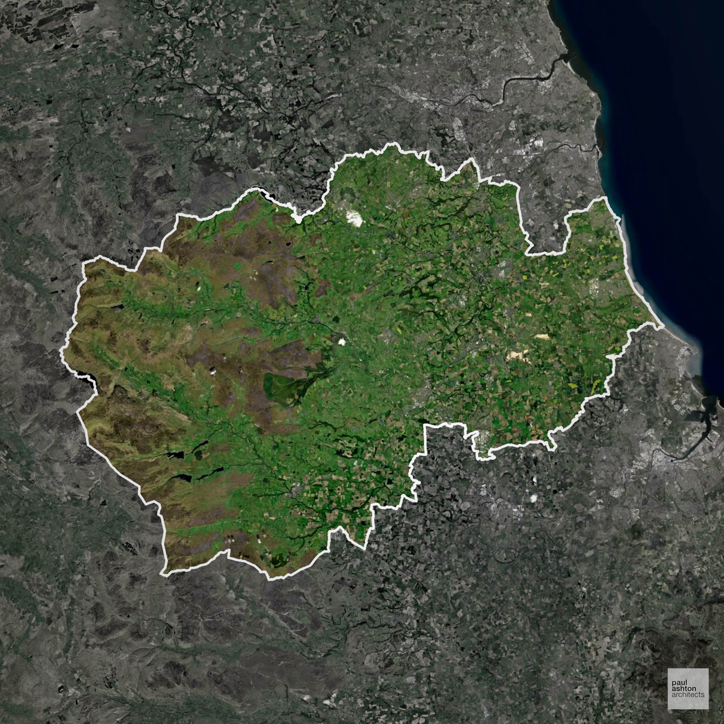
County Durham includes Durham city, Darlington, and Bishop Auckland. Known for Durham Cathedral, historic castles, and its industrial heritage, the district blends urban centres with rural landscapes. Green Belt is 3.8%, limiting urban expansion around Durham city. Planning often involves sensitive conservation and residential schemes. We can support residential, commercial, and conversion projects throughout the county.
In the last year County Durham decided 1,693 applications which is well above the national average of 988. The approval rate was 94% (marginally above the national average of 88%) and 51% of applications were decided on time, (significantly below the national average of 59%). Stats updated March 2026 from gov. sources. See how County Durham performs relative to other LPAs in our LPA hub.
"We love helping clients win Planning Permission in County Durham"
Conservation and Listed Buildings in County Durham
Durham’s historic core is defined by the dramatic peninsula formed by the River Wear, dominated by the cathedral and castle which together create an exceptionally sensitive and highly designated heritage setting. The presence of the Durham Cathedral and Durham Castle, forming part of a Durham World Heritage Site, imposes substantial constraints on development.
Proposals are subject to rigorous scrutiny in respect of protected views, topography, and the wider setting of these landmark assets, with particular emphasis on the city’s skyline and river valley context. Achieving Planning Permission typically depends on a robust, evidence-led heritage strategy and a design approach that demonstrably preserves or enhances the significance and character of the historic environment.
One of the top reasons heritage building applications are refused is causing harm to historic significance, a risk that can arise when proposals are not prepared by a consultant with heritage expertise. We help minimise this risk with expert, site-specific guidance; contact us here.
Green Belt Approvals in County Durham
The Green Belt is a nationally designated area of protected land surrounding many English towns and cities, where development is strictly controlled to prevent urban sprawl.
3.8% of County Durham is within the Green Belt and proposals in these areas can be subject to reasonable levels of scrutiny.
The County Durham Green Belt safeguards rural landscapes, small villages such as Esh and Edmondsley, and river valleys like the Wear, preventing urban sprawl and maintaining important ecological and historic sites.
In our experience, one of the top reasons poorly conceived Green Belt proposals are refused is causing 'harm to openness'. We can lower the risk of refusal with site-specific guidance. Contact us here.
You can also check whether your land is within the Green Belt using our interactive Green Belt map.
Development in the Open Countryside
The Open Countryside is generally defined as land outside settlement and Green Belt boundaries, often comprising agricultural or natural land. Development, particularly standard residential development, is usually restricted in Open Countryside.
County Durham’s upland moorlands, river valleys, and historic farmland landscapes are protected to maintain visual and ecological character.
One of the top reasons poorly prepared proposals in the Open Countryside are refused is that they fail to demonstrate a policy-supported need. To minimise that risk with bespoke advice contact us here.
Nutrient Neutrality in County Durham
Nutrient Neutrality ensures new developments do not increase harmful nitrogen or phosphorus levels in sensitive waterways. Significant parts of County Durham drain to the Teesmouth designated sensitive catchment, requiring nitrogen neutrality for new residential development across a wide rural and urban area. Unfortunately, Nutrient Neutrality can halt development completely. If you need early-stage, project-specific advice contact us here.
Planning Applications in County Durham
In addition to acting as Planing Conultants we are ARB registered architects with 25+ years of experience. Our planning proposals are creatively tailored to each site to maximise potential and improve planning outcomes. We use the following tried and tested process to guide clients in County Durham through planning to completion:
- Stage 1: Site Appraisals & Planning Strategy Advice
- Stage 2: Feasibility Studies & Concept Designs
- Stage 3: Planning Application Packages
- Architectural Drawing Packages
- Planning Statements & Design and Access Statements
- Coordination of Consultant Reports
- Direct Liaison with Planning Officers
- Stage 4: Technical Design
- Discharge of Planning Conditions
- Building Regulations and Construction Packages
Planning Services We Offer in County Durham
- Full Planning Applications: Commercial, new buildings, changes of use.
- Householder Planning Applications: Domestic extensions / garden structures.
- Listed Building Consent: Alterations / repairs to listed buildings.
- Conservation Area Consent: Developments within Conservation Areas.
- Lawful Development Certificates: Confirming existing / completed works are lawful.
- Validation Requirements: Gathering documentation to ensure applications are validated by County Durham LPA.
Design-Led Planning Advice in County Durham
We can review your site in County Durham and offer informed guidance on how proposals can be developed in order to maximise your chances of securing Planning Permission.
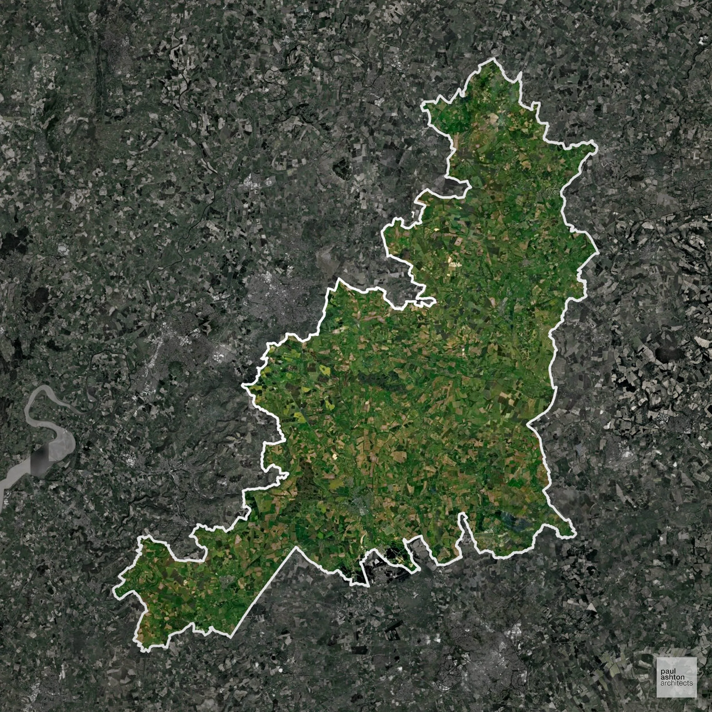
The Cotswold District includes Cirencester, Chipping Campden, and Tetbury. Renowned for its stone-built villages and historic market towns, Green Belt is 0.1%, playing a very minor role in planning. We can support projects ranging from residential extensions to bespoke new-build developments, sensitive to the district’s heritage.
In the last year Cotswold decided 1,287 applications which is well above the national average of 988. The approval rate was 89% (roughly equal to the national average of 88%) and 53% of applications were decided on time, (significantly below the national average of 59%). Stats updated March 2026 from gov. sources. See how Cotswold performs relative to other LPAs in our LPA hub.
"We love helping clients win Planning Permission in Cotswold"
Conservation and Listed Buildings in Cotswold
The Cotswolds has an extensive and highly valued historic landscape, with a large number of Conservation Areas and listed buildings constructed in Cotswold limestone. Planning proposals are subject to detailed scrutiny in relation to scale, materials, and impact on village character and wider landscape setting.
Cotswold LPA places very strong emphasis on heritage and design quality, with Planning Permission generally requiring proposals that reinforce local distinctiveness.
One of the top reasons heritage building applications are refused is causing harm to historic significance, a risk that can arise when proposals are not prepared by a consultant with heritage expertise. We help minimise this risk with expert, site-specific guidance; contact us here.
Green Belt Approvals in Cotswold
The Green Belt is a nationally designated area of protected land surrounding many English towns and cities, where development is strictly controlled to prevent urban sprawl.
0.1% of Cotswold is within the Green Belt and proposals in these areas can be subject to reasonable levels of scrutiny.
The Cotswold Green Belt protects rolling countryside, historic villages such as Bourton-on-the-Water and Stow-on-the-Wold, and distinctive limestone landscapes, restricting urban expansion and preserving sensitive ecological and heritage areas.
In our experience, one of the top reasons poorly conceived Green Belt proposals are refused is causing 'harm to openness'. We can lower the risk of refusal with site-specific guidance. Contact us here.
You can also check whether your land is within the Green Belt using our interactive Green Belt map.
Development in the Open Countryside
The Open Countryside is generally defined as land outside settlement and Green Belt boundaries, often comprising agricultural or natural land. Development, particularly standard residential development, is usually restricted in Open Countryside.
The Cotswolds AONB dominates the district, with its limestone villages and rolling hills highly sensitive to development.
One of the top reasons poorly prepared proposals in the Open Countryside are refused is that they fail to demonstrate a policy-supported need. To minimise that risk with bespoke advice contact us here.
Planning Applications in Cotswold
Alongside acting as Planning Consultants we are ARB registered architects with 25+ years of experience. We use the following proven work stages to guide clients in Cotswold through the planning process in order to maximise the potential of their development :
- Stage 1: Site Appraisals & Planning Strategy Advice
- Stage 2: Feasibility Studies & Concept Designs
- Stage 3: Planning Application Packages
- Architectural Drawing Packages
- Planning Statements & Design and Access Statements
- Coordination of Consultant Reports
- Direct Liaison with Planning Officers
- Stage 4: Technical Design
- Discharge of Planning Conditions
- Building Regulations and Construction Packages
Planning Services We Offer in Cotswold
- Full Planning Applications: Commercial, new buildings, changes of use.
- Householder Planning Applications: Domestic extensions / garden structures.
- Listed Building Consent: Alterations / repairs to listed buildings.
- Conservation Area Consent: Developments within Conservation Areas.
- Lawful Development Certificates: Confirming existing / completed works are lawful.
- Validation Requirements: Gathering documentation to ensure applications are validated by Cotswold LPA.
Contextual Planning Support in Cotswold
We work collaboratively with clients and shape a design that respects local character and meets Planning Policy requirements in order to maximise your chances of winning Planning Permission.
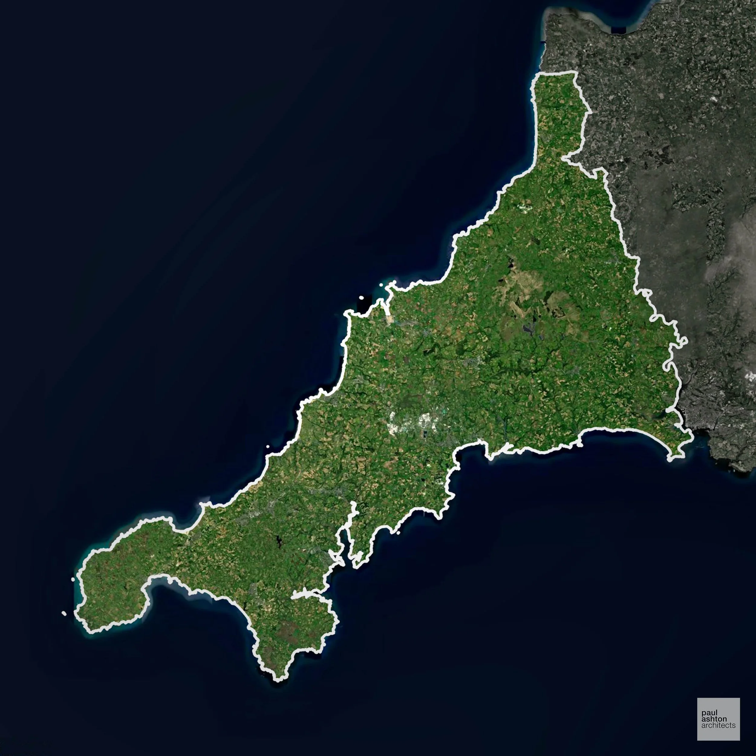
Cornwall encompasses towns such as Truro, St Austell, and Penzance. Known for its coastal villages, heritage architecture, and tourism. Planning often focuses on conservation, rural development, and sensitive coastal projects. We can advise on residential, commercial, and extension schemes across the county.
In the last year Cornwall decided 4,956 applications which is well above the national average of 988. The approval rate was 93% (marginally above the national average of 88%) and 63% of applications were decided on time, (slightly above the national average of 59%). Stats updated March 2026 from gov. sources. See how Cornwall performs relative to other LPAs in our LPA hub.
"We love helping clients win Planning Permission in Cornwall"
Areas of Outstanding Natural Beauty in Cornwall
Areas of Outstanding Natural Beauty (AONBs), (now often referred to as National Landscapes), are protected areas recognised for their exceptional scenic and natural value. For developers, this means that planning proposals within these areas are carefully scrutinised, with a strong presumption against inappropriate development.
Cornwall includes the Cornwall AONB regions. Development proposals must respect scenic and ecological qualities.
In our experience, one of the top reasons proposals in Areas of Outstanding Natural Beauty are refused is causing landscape harm or visual intrusion, a risk that often arises when applications are not fully informed. We help minimise the likelihood of refusal with expert, guidance; contact us here.
Development in the Open Countryside
Cornwall includes areas classed as Open Countryside, generally encompassing land beyond settlements and Green Belt zones, often used for agriculture or left as natural landscapes. Development in these areas is tightly controlled, with standard residential proposals rarely permitted.
Cornwall’s iconic coastal and inland countryside is nationally protected for its landscape, historic sites, and ecological value.
One of the top reasons poorly prepared proposals in the Open Countryside are refused is that they fail to demonstrate a policy-supported need. To minimise that risk with bespoke advice contact us here.
Flood Risk in Cornwall
In some areas of the LPA, flood risk plays a key role in determining planning proposals. Extensive estuaries, a long coastline exposed to Atlantic storm surge, and numerous steep river valleys combine to make flood risk a widespread planning constraint across the peninsula. Where constraints permit, we can develop proposals that manage flood risk thoughtfully to give applications the best chance of approval.
Nutrient Neutrality in Cornwall
Nutrient Neutrality ensures new developments do not increase harmful nitrogen or phosphorus levels in sensitive waterways. Parts of Cornwall draining to the River Camel SAC require phosphorus neutrality for new residential development. Unfortunately, Nutrient Neutrality can halt development completely. If you need early-stage, project-specific advice contact us here.
Planning Applications in Cornwall
In addition to acting as Planing Conultants we are ARB registered architects with 25+ years of experience. Our planning proposals are creatively tailored to each site to maximise potential and improve planning outcomes. We use the following tried and tested process to guide clients in Cornwall through planning to completion:
- Stage 1: Site Appraisals & Planning Strategy Advice
- Stage 2: Feasibility Studies & Concept Designs
- Stage 3: Planning Application Packages
- Architectural Drawing Packages
- Planning Statements & Design and Access Statements
- Coordination of Consultant Reports
- Direct Liaison with Planning Officers
- Stage 4: Technical Design
- Discharge of Planning Conditions
- Building Regulations and Construction Packages
Planning Services We Offer in Cornwall
- Full Planning Applications: Commercial, new buildings, changes of use.
- Householder Planning Applications: Domestic extensions / garden structures.
- Listed Building Consent: Alterations / repairs to listed buildings.
- Conservation Area Consent: Developments within Conservation Areas.
- Lawful Development Certificates: Confirming existing / completed works are lawful.
- Validation Requirements: Gathering documentation to ensure applications are validated by Cornwall LPA.
Contextual Planning Support in Cornwall
We work collaboratively with clients and shape a design that respects local character and meets Planning Policy requirements in order to maximise your chances of winning Planning Permission.
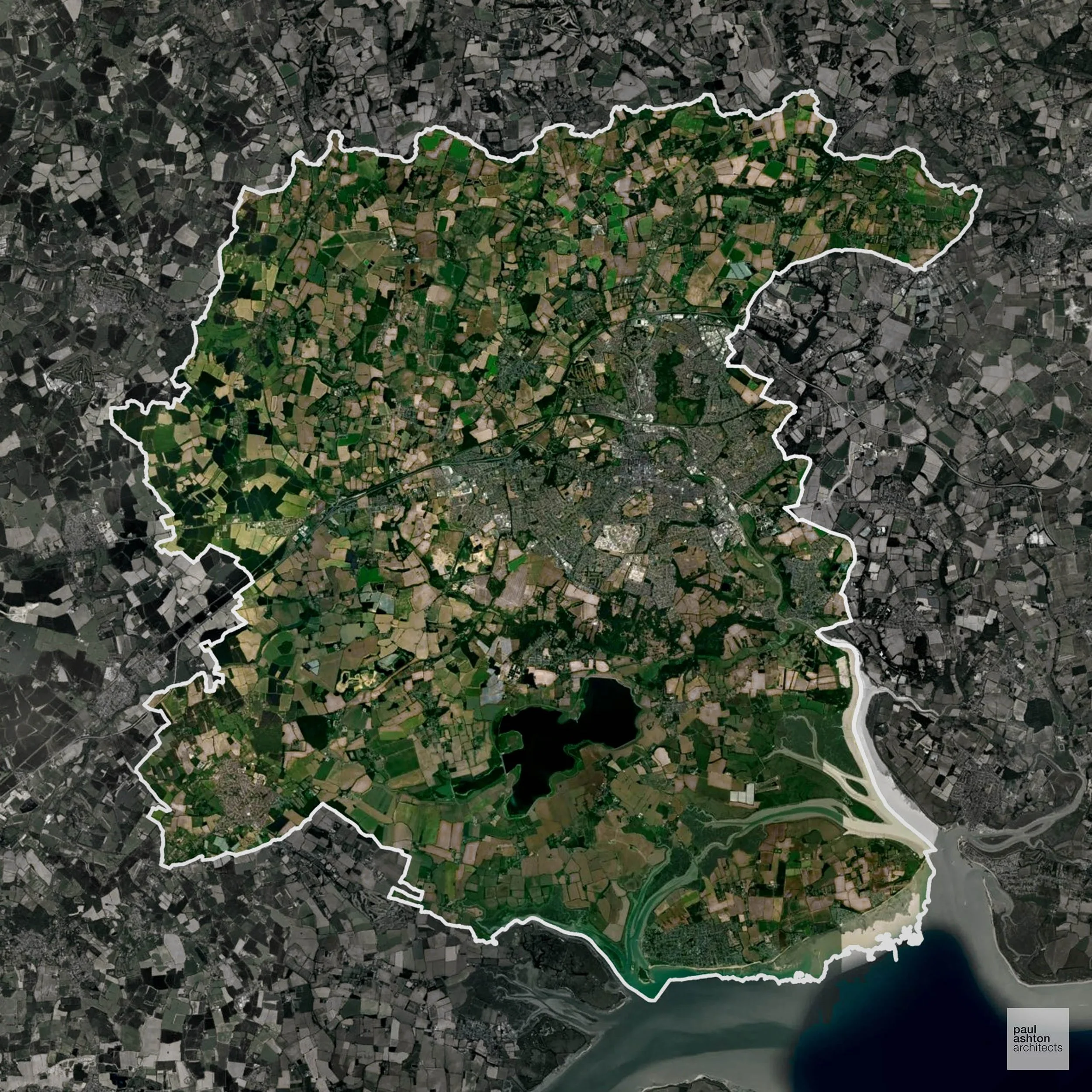
Colchester in Essex includes Colchester town, Wivenhoe, and surrounding villages. Famous for its Roman heritage and historic buildings, planning focuses on urban growth and sensitive redevelopment. We can assist with residential, commercial, and conversion projects throughout Colchester.
In the last year Colchester decided 1,059 applications which is just above the national average of 988. The approval rate was 80% (slightly below the national average of 88%) and 73% of applications were decided on time, (significantly above the national average of 59%). Stats updated March 2026 from gov. sources. See how Colchester performs relative to other LPAs in our LPA hub.
"We love helping clients win Planning Permission in Colchester"
Development in the Open Countryside
The Open Countryside is generally defined as land outside settlement and Green Belt boundaries, often comprising agricultural or natural land. Development, particularly standard residential development, is usually restricted in Open Countryside.
Colchester’s rolling farmland and AONB-adjacent areas are preserved for their heritage, biodiversity, and visual quality.
One of the top reasons poorly prepared proposals in the Open Countryside are refused is that they fail to demonstrate a policy-supported need. To minimise that risk with bespoke advice contact us here.
Flood Risk in Colchester
In some areas of the LPA, flood risk plays a key role in determining planning proposals. The tidal Colne Estuary and its tributaries place substantial areas of the district within Flood Zone 3, particularly affecting potential development sites to the east of the city. Where constraints permit, we can develop proposals that manage flood risk thoughtfully to give applications the best chance of approval.
Planning Applications in Colchester
As well as acting as Planning Consultants we are ARB registered architects with over 25 years’ experience. Our site-specific planning proposals balance creativity with strategic insight. We use the following field-tested work stages to help clients in Colchester achieve successful planning outcomes:
- Stage 1: Site Appraisals & Planning Strategy Advice
- Stage 2: Feasibility Studies & Concept Designs
- Stage 3: Planning Application Packages
- Architectural Drawing Packages
- Planning Statements & Design and Access Statements
- Coordination of Consultant Reports
- Direct Liaison with Planning Officers
- Stage 4: Technical Design
- Discharge of Planning Conditions
- Building Regulations and Construction Packages
Planning Services We Offer in Colchester
- Full Planning Applications: Commercial, new buildings, changes of use.
- Householder Planning Applications: Domestic extensions / garden structures.
- Listed Building Consent: Alterations / repairs to listed buildings.
- Conservation Area Consent: Developments within Conservation Areas.
- Lawful Development Certificates: Confirming existing / completed works are lawful.
- Validation Requirements: Gathering documentation to ensure applications are validated by Colchester LPA.
Design-Led Planning Advice in Colchester
We can review your site in Colchester and offer informed guidance on how proposals can be developed in order to maximise your chances of securing Planning Permission.
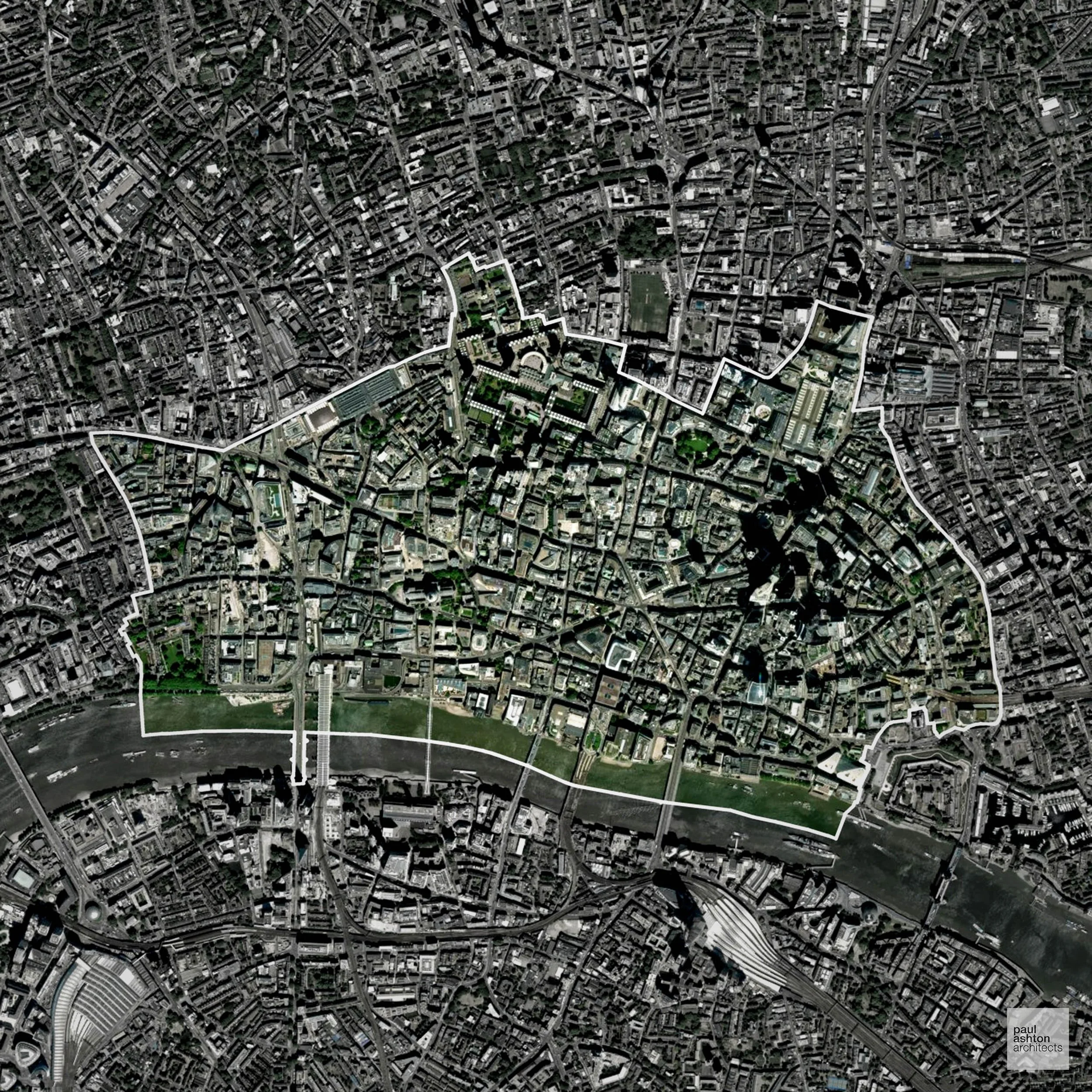
The City of London is the historic financial district, known for St Paul’s Cathedral, listed buildings, and commercial hubs. Planning focuses on dense urban development, heritage, and tall buildings. We can provide expertise for office conversions, mixed-use schemes, and design-led residential projects.
In the last year City of London decided 448 applications which is well below the national average of 988. The approval rate was 96% (marginally above the national average of 88%) and 16% of applications were decided on time, (significantly below the national average of 59%). Stats updated March 2026 from gov. sources. See how City of London performs relative to other LPAs in our LPA hub.
"We love helping clients win Planning Permission in City of London"
Conservation and Listed Buildings in City of London
The City of London contains a highly concentrated and complex historic environment, with numerous Conservation Areas and a significant number of listed buildings embedded within a dense commercial context. Development proposals are subject to rigorous assessment in relation to townscape, strategic views, and the setting of key heritage assets such as St Paul's Cathedral.
City of London LPA places substantial weight on heritage considerations alongside growth, with Planning Permission typically requiring a carefully balanced, design-led approach that responds to both historic significance and the city’s evolving skyline.
One of the top reasons heritage building applications are refused is causing harm to historic significance, a risk that can arise when proposals are not prepared by a consultant with heritage expertise. We help minimise this risk with expert, site-specific guidance; contact us here.
Planning Applications in City of London
In addition to acting as Planing Conultants we are ARB registered architects with 25+ years of experience. Our planning proposals are creatively tailored to each site to maximise potential and improve planning outcomes. We use the following tried and tested process to guide clients in City of London through planning to completion:
- Stage 1: Site Appraisals & Planning Strategy Advice
- Stage 2: Feasibility Studies & Concept Designs
- Stage 3: Planning Application Packages
- Architectural Drawing Packages
- Planning Statements & Design and Access Statements
- Coordination of Consultant Reports
- Direct Liaison with Planning Officers
- Stage 4: Technical Design
- Discharge of Planning Conditions
- Building Regulations and Construction Packages
Planning Services We Offer in City of London
- Full Planning Applications: Commercial, new buildings, changes of use.
- Householder Planning Applications: Domestic extensions / garden structures.
- Listed Building Consent: Alterations / repairs to listed buildings.
- Conservation Area Consent: Developments within Conservation Areas.
- Lawful Development Certificates: Confirming existing / completed works are lawful.
- Validation Requirements: Gathering documentation to ensure applications are validated by City of London LPA.
Creative Planning Advice in City of London
We collaborate closely with our clients to develop designs that respond to local character and align with Planning Policy, helping to maximise the likelihood of securing Planning Permission in City of London.
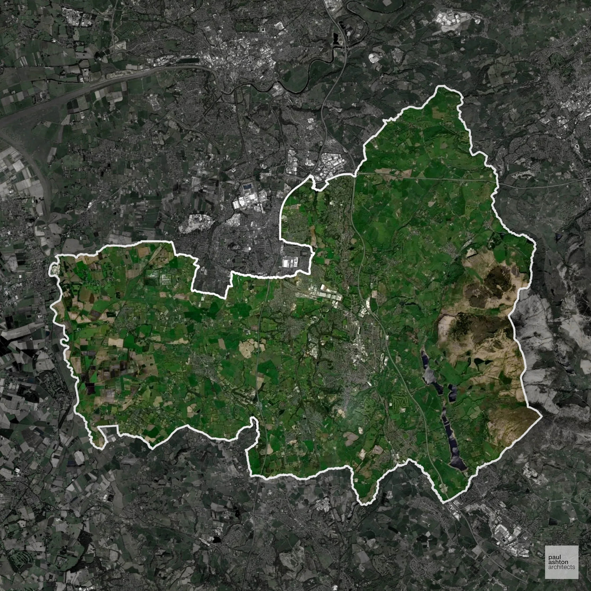
Chorley in Lancashire encompasses Chorley town, Adlington, and Buckshaw Village. The district combines industrial heritage with rural surroundings. Around 71.8% of the area is Green Belt, guiding development and preserving open countryside. We can advise on residential, commercial, and sensitive town centre projects.
In the last year Chorley decided 570 applications which is well below the national average of 988. The approval rate was 93% (marginally above the national average of 88%) and 65% of applications were decided on time, (significantly above the national average of 59%). Stats updated March 2026 from gov. sources. See how Chorley performs relative to other LPAs in our LPA hub.
"We love helping clients win Planning Permission in Chorley"
Green Belt Approvals in Chorley
The Green Belt is a nationally designated area of protected land surrounding many English towns and cities, where development is strictly controlled to prevent urban sprawl.
Significantly, 71.8% of Chorley is within the Green Belt and proposals in these areas can be subject to high levels of scrutiny.
The Green Belt around Chorley town and rural edges focuses policy on openness and separation between settlements.
In our experience, one of the top reasons poorly conceived Green Belt proposals are refused is causing 'harm to openness'. We can lower the risk of refusal with site-specific guidance. Contact us here.
You can also check whether your land is within the Green Belt using our interactive Green Belt map.
Development in the Open Countryside
Chorley includes areas classed as Open Countryside, generally encompassing land beyond settlements and Green Belt zones, often used for agriculture or left as natural landscapes. Development in these areas is tightly controlled, with standard residential proposals rarely permitted.
Chorley’s rural edge landscapes and historic farmsteads are sensitive to development to prevent encroachment on open countryside.
One of the top reasons poorly prepared proposals in the Open Countryside are refused is that they fail to demonstrate a policy-supported need. To minimise that risk with bespoke advice contact us here.
Planning Applications in Chorley
In addition to acting as Planing Conultants we are ARB registered architects with 25+ years of experience. Our planning proposals are creatively tailored to each site to maximise potential and improve planning outcomes. We use the following tried and tested process to guide clients in Chorley through planning to completion:
- Stage 1: Site Appraisals & Planning Strategy Advice
- Stage 2: Feasibility Studies & Concept Designs
- Stage 3: Planning Application Packages
- Architectural Drawing Packages
- Planning Statements & Design and Access Statements
- Coordination of Consultant Reports
- Direct Liaison with Planning Officers
- Stage 4: Technical Design
- Discharge of Planning Conditions
- Building Regulations and Construction Packages
Planning Services We Offer in Chorley
- Full Planning Applications: Commercial, new buildings, changes of use.
- Householder Planning Applications: Domestic extensions / garden structures.
- Listed Building Consent: Alterations / repairs to listed buildings.
- Conservation Area Consent: Developments within Conservation Areas.
- Lawful Development Certificates: Confirming existing / completed works are lawful.
- Validation Requirements: Gathering documentation to ensure applications are validated by Chorley LPA.
Contextual Planning Support in Chorley
We work collaboratively with clients and shape a design that respects local character and meets Planning Policy requirements in order to maximise your chances of winning Planning Permission.
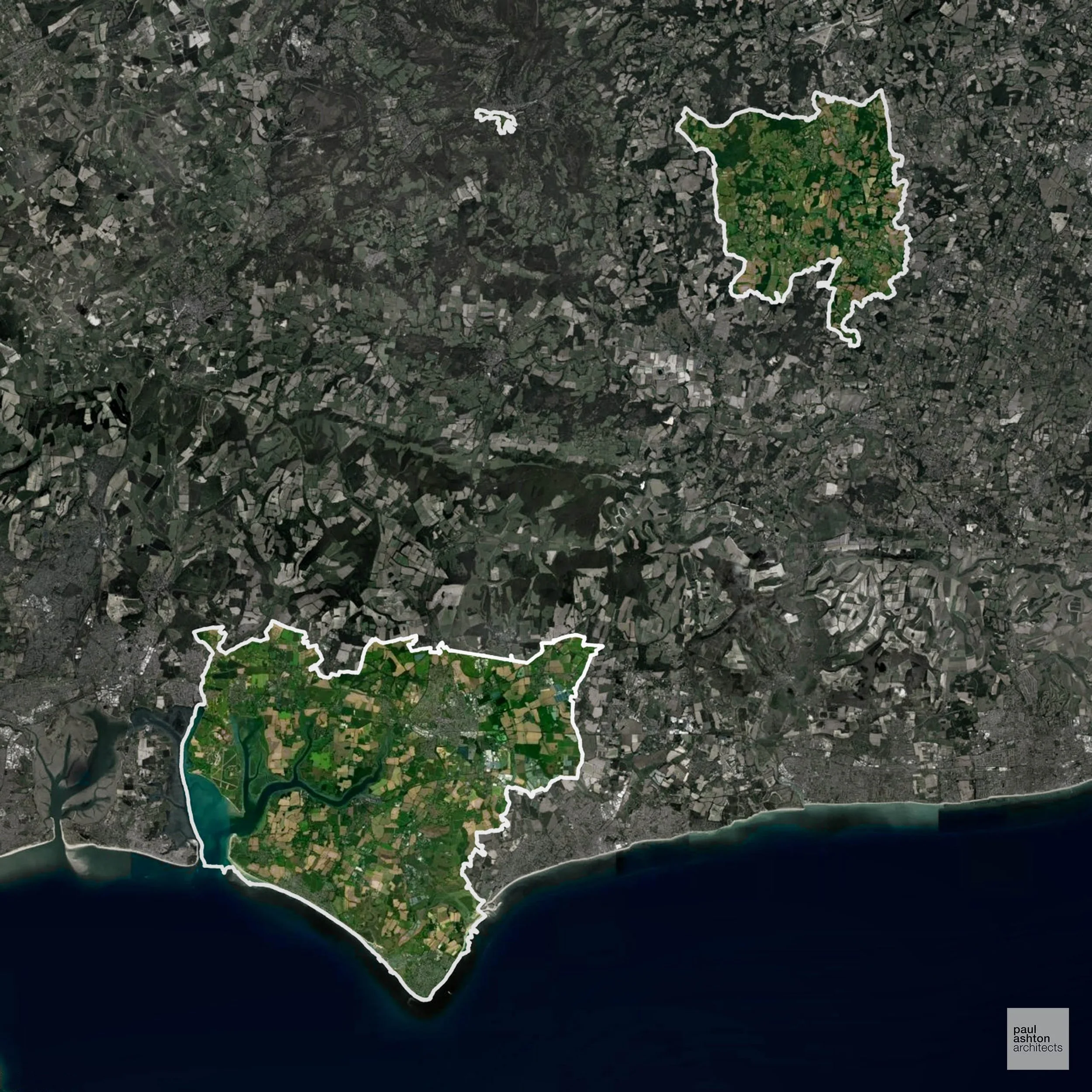
Chichester in West Sussex includes Chichester city, Bognor Regis, and Selsey. Known for the Cathedral, historic streets, and seaside towns. Planning focuses on urban renewal, conservation, and sensitive residential schemes. We can support conversions, extensions, and new builds across Chichester.
In the last year Chichester decided 929 applications which is slightly below the national average of 988. The approval rate was 89% (roughly equal to the national average of 88%) and 82% of applications were decided on time, (significantly above the national average of 59%). Stats updated March 2026 from gov. sources. See how Chichester performs relative to other LPAs in our LPA hub.
"We love helping clients win Planning Permission in Chichester"
Conservation and Listed Buildings in Chichester
Chichester has a rich historic environment, with several Conservation Areas and a very high concentration of listed buildings reflecting its Roman and medieval origins. Heritage constraints are particularly evident within the Chichester City Centre Conservation Area and Northgate Conservation Area, where city walls, cathedral views, and historic streets define character.
Development proposals are rigorously assessed in relation to key views, listed buildings, and the wider townscape, with Planning Permission typically requiring a context-led design approach that balances heritage protection with sustainable development.
One of the top reasons heritage building applications are refused is causing harm to historic significance, a risk that can arise when proposals are not prepared by a consultant with heritage expertise. We help minimise this risk with expert, site-specific guidance; contact us here.
Development in the Open Countryside
Chichester includes areas classed as Open Countryside, generally encompassing land beyond settlements and Green Belt zones, often used for agriculture or left as natural landscapes. Development in these areas is tightly controlled, with standard residential proposals rarely permitted.
Chichester’s South Downs and coastal hinterland comprise protected landscapes, with development tightly constrained to maintain scenic and ecological integrity.
One of the top reasons poorly prepared proposals in the Open Countryside are refused is that they fail to demonstrate a policy-supported need. To minimise that risk with bespoke advice contact us here.
Flood Risk in Chichester
In some areas of the LPA, flood risk plays a key role in determining planning proposals. A combination of tidal risk from Chichester Harbour, the flooding-prone River Lavant, and low-lying coastal plain creates significant Flood Zone 2 and 3 constraints on development. Where constraints permit, we can develop proposals that manage flood risk thoughtfully to give applications the best chance of approval.
Nutrient Neutrality in Chichester
Nutrient Neutrality ensures new developments do not increase harmful nitrogen or phosphorus levels in sensitive waterways. Within the Solent nitrogen catchment; all new residential development must demonstrate nitrogen neutrality, and the district has faced significant housing delivery constraints since the rules were first applied. Unfortunately, Nutrient Neutrality can halt development completely. If you need early-stage, project-specific advice contact us here.
Planning Applications in Chichester
In addition to acting as Planing Conultants we are ARB registered architects with 25+ years of experience. Our planning proposals are creatively tailored to each site to maximise potential and improve planning outcomes. We use the following tried and tested process to guide clients in Chichester through planning to completion:
- Stage 1: Site Appraisals & Planning Strategy Advice
- Stage 2: Feasibility Studies & Concept Designs
- Stage 3: Planning Application Packages
- Architectural Drawing Packages
- Planning Statements & Design and Access Statements
- Coordination of Consultant Reports
- Direct Liaison with Planning Officers
- Stage 4: Technical Design
- Discharge of Planning Conditions
- Building Regulations and Construction Packages
Planning Services We Offer in Chichester
- Full Planning Applications: Commercial, new buildings, changes of use.
- Householder Planning Applications: Domestic extensions / garden structures.
- Listed Building Consent: Alterations / repairs to listed buildings.
- Conservation Area Consent: Developments within Conservation Areas.
- Lawful Development Certificates: Confirming existing / completed works are lawful.
- Validation Requirements: Gathering documentation to ensure applications are validated by Chichester LPA.
Design-Led Planning Advice in Chichester
We can review your site in Chichester and offer informed guidance on how proposals can be developed in order to maximise your chances of securing Planning Permission.
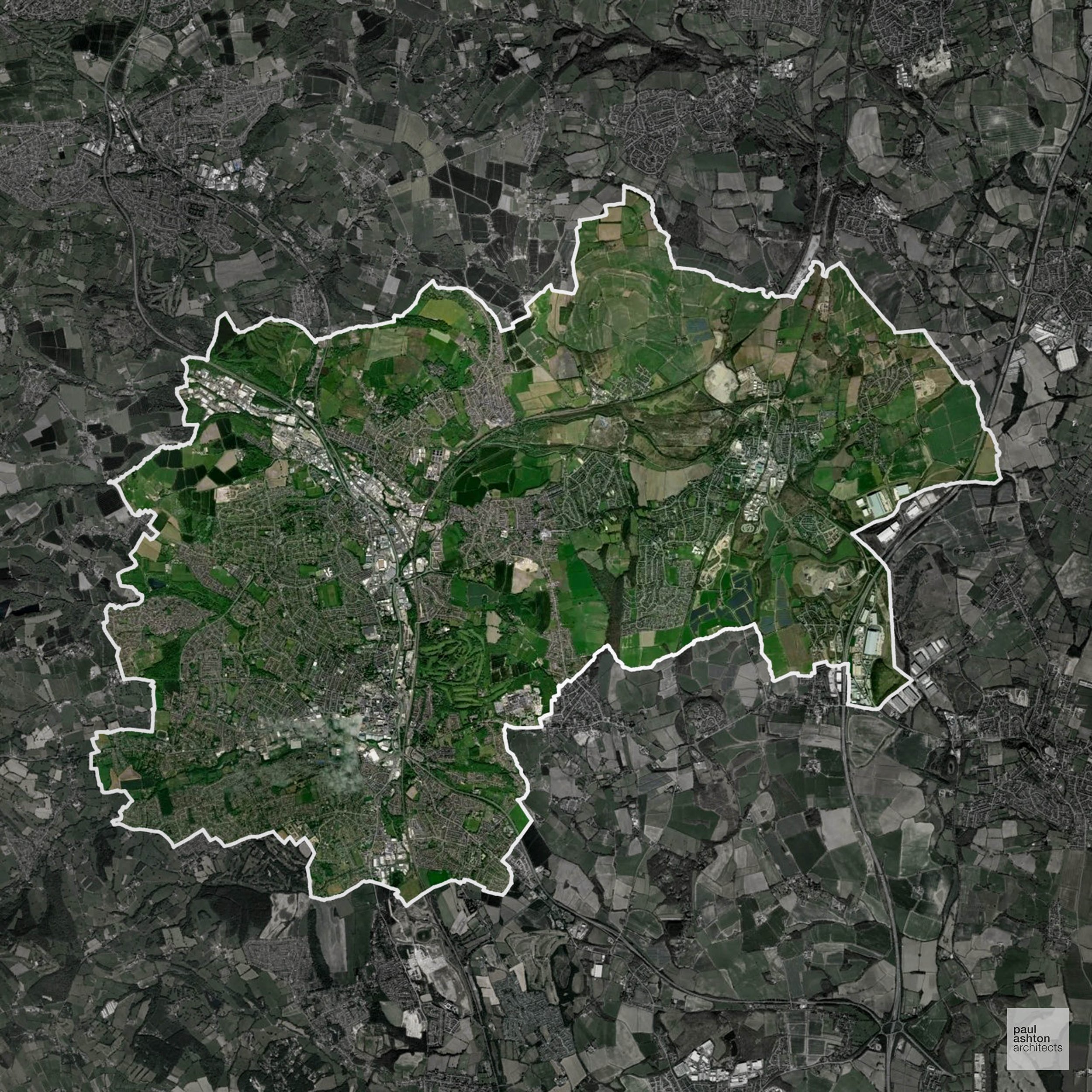
Chesterfield in Derbyshire encompasses Chesterfield town, Staveley, and Dronfield. Famous for the crooked spire, historic mills, and market heritage, around 21.8% of the district is Green Belt. Planning balances urban regeneration with protection of the surrounding countryside. We can assist with residential and commercial projects across Chesterfield.
In the last year Chesterfield decided 327 applications which is well below the national average of 988. The approval rate was 89% (roughly equal to the national average of 88%) and 44% of applications were decided on time, (significantly below the national average of 59%). Stats updated March 2026 from gov. sources. See how Chesterfield performs relative to other LPAs in our LPA hub.
"We love helping clients win Planning Permission in Chesterfield"
Green Belt Approvals in Chesterfield
The Green Belt is a nationally designated area of protected land surrounding many English towns and cities, where development is strictly controlled to prevent urban sprawl.
21.8% of Chesterfield is within the Green Belt and proposals in these areas can be subject to high levels of scrutiny.
The Chesterfield Green Belt protects open farmland and valley edges around Staveley and Brimington, which are particularly sensitive to urban encroachment.
In our experience, one of the top reasons poorly conceived Green Belt proposals are refused is causing 'harm to openness'. We can lower the risk of refusal with site-specific guidance. Contact us here.
You can also check whether your land is within the Green Belt using our interactive Green Belt map.
Development in the Open Countryside
The Open Countryside is generally defined as land outside settlement and Green Belt boundaries, often comprising agricultural or natural land. Development, particularly standard residential development, is usually restricted in Open Countryside.
Chesterfield’s upland fringes and agricultural valleys are visually prominent, with careful restrictions on new housing in the open countryside.
One of the top reasons poorly prepared proposals in the Open Countryside are refused is that they fail to demonstrate a policy-supported need. To minimise that risk with bespoke advice contact us here.
Planning Applications in Chesterfield
In addition to acting as Planing Conultants we are ARB registered architects with 25+ years of experience. Our planning proposals are creatively tailored to each site to maximise potential and improve planning outcomes. We use the following tried and tested process to guide clients in Chesterfield through planning to completion:
- Stage 1: Site Appraisals & Planning Strategy Advice
- Stage 2: Feasibility Studies & Concept Designs
- Stage 3: Planning Application Packages
- Architectural Drawing Packages
- Planning Statements & Design and Access Statements
- Coordination of Consultant Reports
- Direct Liaison with Planning Officers
- Stage 4: Technical Design
- Discharge of Planning Conditions
- Building Regulations and Construction Packages
Planning Services We Offer in Chesterfield
- Full Planning Applications: Commercial, new buildings, changes of use.
- Householder Planning Applications: Domestic extensions / garden structures.
- Listed Building Consent: Alterations / repairs to listed buildings.
- Conservation Area Consent: Developments within Conservation Areas.
- Lawful Development Certificates: Confirming existing / completed works are lawful.
- Validation Requirements: Gathering documentation to ensure applications are validated by Chesterfield LPA.
Creative Planning Advice in Chesterfield
We collaborate closely with our clients to develop designs that respond to local character and align with Planning Policy, helping to maximise the likelihood of securing Planning Permission in Chesterfield.
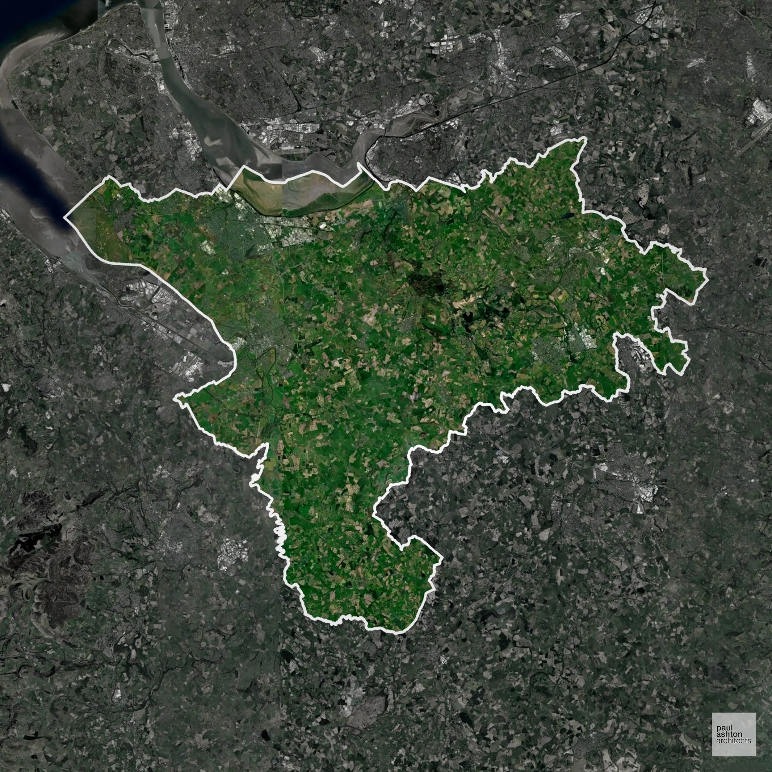
Cheshire West and Chester includes Chester, Ellesmere Port, and Northwich. Known for Chester’s Roman walls, historic buildings, and canals, about 42.2% of the district is Green Belt. Planning focuses on heritage conservation alongside sustainable urban growth. We can advise on residential, commercial, and conversion schemes throughout the district.
In the last year Cheshire West and Chester decided 1,688 applications which is well above the national average of 988. The approval rate was 93% (marginally above the national average of 88%) and 29% of applications were decided on time, (significantly below the national average of 59%). Stats updated March 2026 from gov. sources. See how Cheshire West and Chester performs relative to other LPAs in our LPA hub.
"We love helping clients win Planning Permission in Cheshire West and Chester"
Conservation and Listed Buildings in Cheshire West and Chester
Chester is distinguished by its Roman origins and well-preserved medieval and Georgian fabric, with a large Conservation Area and a high concentration of listed buildings. Planning proposals must respond sensitively to historic street patterns, the city walls, and characteristic features such as the Chester Rows.
Cheshire West and Chester LPA places strong emphasis on heritage considerations, with high expectations for design quality and contextual integration.
One of the top reasons heritage building applications are refused is causing harm to historic significance, a risk that can arise when proposals are not prepared by a consultant with heritage expertise. We help minimise this risk with expert, site-specific guidance; contact us here.
Green Belt Approvals in Cheshire West and Chester
The Green Belt is a nationally designated area of protected land surrounding many English towns and cities, where development is strictly controlled to prevent urban sprawl.
42.2% of Cheshire West and Chester is within the Green Belt and proposals in these areas can be subject to high levels of scrutiny.
The Green Belt surrounding Northwich, Winsford, and Malpas restricts growth to safeguard countryside and village separation.
In our experience, one of the top reasons poorly conceived Green Belt proposals are refused is causing 'harm to openness'. We can lower the risk of refusal with site-specific guidance. Contact us here.
You can also check whether your land is within the Green Belt using our interactive Green Belt map.
Development in the Open Countryside
The Open Countryside is generally defined as land outside settlement and Green Belt boundaries, often comprising agricultural or natural land. Development, particularly standard residential development, is usually restricted in Open Countryside.
The rural landscapes within Cheshire West and Chester, including riverside farmland and villages such as Aldford, Beeston, and Cholmondeley, are sensitive to development to protect the character and heritage of the area.
One of the top reasons poorly prepared proposals in the Open Countryside are refused is that they fail to demonstrate a policy-supported need. To minimise that risk with bespoke advice contact us here.
Nutrient Neutrality in Cheshire West and Chester
Nutrient Neutrality ensures new developments do not increase harmful nitrogen or phosphorus levels in sensitive waterways. Parts of Cheshire West and Chester are within several catchments including Oak Mere and Rostherne Mere; nitrogen and phosphorus neutrality apply in affected areas, though only parts of the LPA are constrained. Unfortunately, Nutrient Neutrality can halt development completely. If you need early-stage, project-specific advice contact us here.
Planning Applications in Cheshire West and Chester
In addition to acting as Planing Conultants we are ARB registered architects with 25+ years of experience. Our planning proposals are creatively tailored to each site to maximise potential and improve planning outcomes. We use the following tried and tested process to guide clients in Cheshire West and Chester through planning to completion:
- Stage 1: Site Appraisals & Planning Strategy Advice
- Stage 2: Feasibility Studies & Concept Designs
- Stage 3: Planning Application Packages
- Architectural Drawing Packages
- Planning Statements & Design and Access Statements
- Coordination of Consultant Reports
- Direct Liaison with Planning Officers
- Stage 4: Technical Design
- Discharge of Planning Conditions
- Building Regulations and Construction Packages
Planning Services We Offer in Cheshire West and Chester
- Full Planning Applications: Commercial, new buildings, changes of use.
- Householder Planning Applications: Domestic extensions / garden structures.
- Listed Building Consent: Alterations / repairs to listed buildings.
- Conservation Area Consent: Developments within Conservation Areas.
- Lawful Development Certificates: Confirming existing / completed works are lawful.
- Validation Requirements: Gathering documentation to ensure applications are validated by Cheshire West and Chester LPA.
Planning Permissions We’ve Won in Cheshire West and Chester
- Full Planning Application: Single-storey side extension with roof terrace approved on dwelling in Chester town centre. →
- Full Planning Application: New-build house in the Green Belt approved as a replacement dwelling. Location: Littleton, Chester. →
- Full Planning Application: Two-storey side extension and single-storey rear extension approved on dwelling in Chester town centre. →
Contextual Planning Support in Cheshire West and Chester
We work collaboratively with clients and shape a design that respects local character and meets Planning Policy requirements in order to maximise your chances of winning Planning Permission.
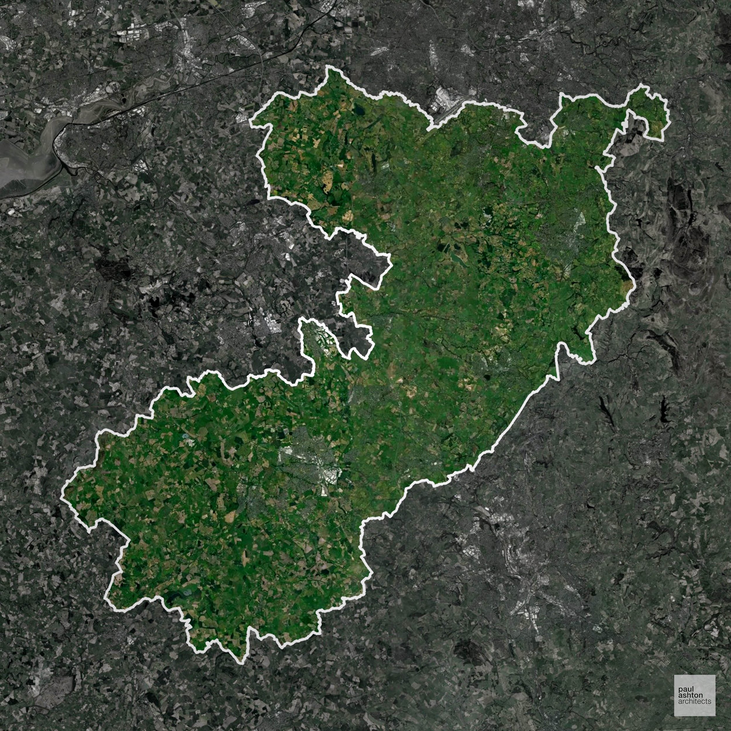
Cheshire East covers Crewe, Macclesfield, and Knutsford. The area is renowned for industrial heritage, market towns, and Cheshire countryside. Approximately 34.4% of the district is Green Belt, guiding new development in rural areas. We can help deliver Planning Permission for housing, commercial projects, and sensitive conversions.
In the last year Cheshire East decided 2,460 applications which is well above the national average of 988. The approval rate was 87% (roughly equal to the national average of 88%) and 32% of applications were decided on time, (significantly below the national average of 59%). Stats updated March 2026 from gov. sources. See how Cheshire East performs relative to other LPAs in our LPA hub.
"We love helping clients win Planning Permission in Cheshire East"
Conservation and Listed Buildings in Cheshire East
Cheshire East has a varied historic environment, with numerous Conservation Areas and a substantial number of listed buildings across its towns, villages, and rural areas. Heritage constraints are particularly evident in locations such as Nantwich and Congleton, where historic character, street pattern, and architectural detail are key considerations.
One of the top reasons heritage building applications are refused is causing harm to historic significance, a risk that can arise when proposals are not prepared by a consultant with heritage expertise. We help minimise this risk with expert, site-specific guidance; contact us here.
Green Belt Approvals in Cheshire East
The Green Belt is nationally designated land around towns and cities, created to limit urban growth.
34.4% of Cheshire East is within the Green Belt and proposals in these areas can be subject to high levels of scrutiny.
The Green Belt within Cheshire East protects upland farmland, wooded areas, and historic village settings near Macclesfield and Knutsford, under pressure from housing growth.
In our experience, one of the top reasons poorly conceived Green Belt proposals are refused is causing 'harm to openness'. We can lower the risk of refusal with site-specific guidance. Contact us here.
You can also check whether your land is within the Green Belt using our interactive Green Belt map.
Development in the Open Countryside
Open Countryside within Cheshire East refers to land situated outside built-up areas and Green Belt boundaries, typically comprising farmland or natural landscapes. Residential development is generally restricted unless special circumstances can be demonstrated.
Cheshire East’s open farmland, parkland edges and historic villages such as Alderley Edge, Prestbury and Bollington are highly valued for their rural character. Development on the fringes of these settlements and in the surrounding countryside is tightly controlled to protect landscape quality, settlement separation and local distinctiveness under planning policy.
One of the top reasons poorly prepared proposals in the Open Countryside are refused is that they fail to demonstrate a policy-supported need. To minimise that risk with bespoke advice contact us here.
Nutrient Neutrality in Cheshire East
Nutrient Neutrality ensures new developments do not increase harmful nitrogen or phosphorus levels in sensitive waterways. Parts of Cheshire East fall within multiple catchments including Rostherne Mere and West Midlands Mosses, requiring both nitrogen and phosphorus neutrality in affected areas. Unfortunately, Nutrient Neutrality can halt development completely. If you need early-stage, project-specific advice contact us here.
Planning Applications in Cheshire East
In addition to acting as Planing Conultants we are ARB registered architects with 25+ years of experience. Our planning proposals are creatively tailored to each site to maximise potential and improve planning outcomes. We use the following tried and tested process to guide clients in Cheshire East through planning to completion:
- Stage 1: Site Appraisals & Planning Strategy Advice
- Stage 2: Feasibility Studies & Concept Designs
- Stage 3: Planning Application Packages
- Architectural Drawing Packages
- Planning Statements & Design and Access Statements
- Coordination of Consultant Reports
- Direct Liaison with Planning Officers
- Stage 4: Technical Design
- Discharge of Planning Conditions
- Building Regulations and Construction Packages
Planning Services We Offer in Cheshire East
- Full Planning Applications: Commercial, new buildings, changes of use.
- Householder Planning Applications: Domestic extensions / garden structures.
- Listed Building Consent: Alterations / repairs to listed buildings.
- Conservation Area Consent: Developments within Conservation Areas.
- Lawful Development Certificates: Confirming existing / completed works are lawful.
- Validation Requirements: Gathering documentation to ensure applications are validated by Cheshire East LPA.
Planning Permissions We’ve Won in Cheshire East
- Householder Planning Application: First floor glass room extension to an existing farmhouse in the Open Countryside outside Macclesfield. →
Contextual Planning Support in Cheshire East
We work collaboratively with clients and shape a design that respects local character and meets Planning Policy requirements in order to maximise your chances of winning Planning Permission.
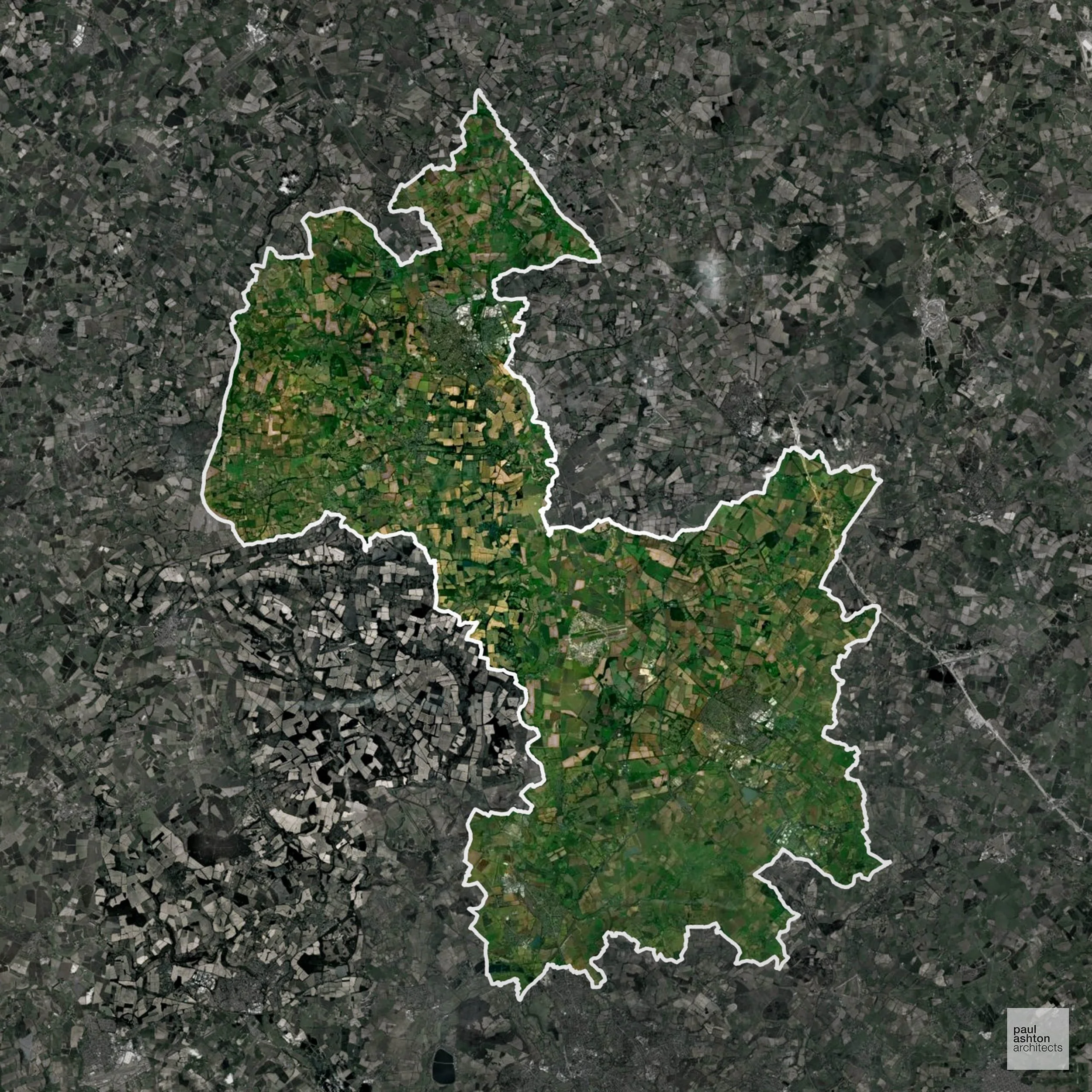
Cherwell in Oxfordshire includes Banbury, Bicester, and Kidlington. Known for historic market towns and Georgian buildings, about 13.8% of the district is Green Belt, influencing development on the outskirts of towns. Planning balances growth with conservation and design-led projects. We can assist with residential, commercial, and conversion schemes across Cherwell.
In the last year Cherwell decided 1,082 applications which is just above the national average of 988. The approval rate was 93% (marginally above the national average of 88%) and 52% of applications were decided on time, (significantly below the national average of 59%). Stats updated March 2026 from gov. sources. See how Cherwell performs relative to other LPAs in our LPA hub.
"We love helping clients win Planning Permission in Cherwell"
Areas of Outstanding Natural Beauty in Cherwell
Areas of Outstanding Natural Beauty (AONBs), sometimes called National Landscapes, are designated for their exceptional scenic and natural importance. Planning proposals in these areas face close scrutiny, with a strong presumption against inappropriate development.
Cherwell includes parts of the North Wessex Downs AONB. Development proposals must respect scenic quality and landscape character.
In our experience, one of the top reasons proposals in Areas of Outstanding Natural Beauty are refused is causing landscape harm or visual intrusion, a risk that often arises when applications are not fully informed. We help minimise the likelihood of refusal with expert, guidance; contact us here.
Green Belt Approvals in Cherwell
The Green Belt is a policy protecting land around many English towns and cities, where development is tightly controlled to safeguard the open countryside.
13.8% of Cherwell is within the Green Belt and proposals in these areas can be subject to reasonable levels of scrutiny.
The Cherwell Green Belt safeguards rural villages like Deddington and Adderbury, open farmland, and historic landscapes, preventing urban sprawl and maintaining ecological and cultural assets.
In our experience, one of the top reasons poorly conceived Green Belt proposals are refused is causing 'harm to openness'. We can lower the risk of refusal with site-specific guidance. Contact us here.
You can also check whether your land is within the Green Belt using our interactive Green Belt map.
Development in the Open Countryside
Open Countryside within Cherwell refers to land situated outside built-up areas and Green Belt boundaries, typically comprising farmland or natural landscapes. Residential development is generally restricted unless special circumstances can be demonstrated.
Cherwell’s rolling farmland and conservation villages are preserved under strict planning policies to maintain landscape character.
One of the top reasons poorly prepared proposals in the Open Countryside are refused is that they fail to demonstrate a policy-supported need. To minimise that risk with bespoke advice contact us here.
Planning Applications in Cherwell
Alongside acting as Planning Consultants we are ARB registered architects with 25+ years of experience. We use the following proven work stages to guide clients in Cherwell through the planning process in order to maximise the potential of their development :
- Stage 1: Site Appraisals & Planning Strategy Advice
- Stage 2: Feasibility Studies & Concept Designs
- Stage 3: Planning Application Packages
- Architectural Drawing Packages
- Planning Statements & Design and Access Statements
- Coordination of Consultant Reports
- Direct Liaison with Planning Officers
- Stage 4: Technical Design
- Discharge of Planning Conditions
- Building Regulations and Construction Packages
Planning Services We Offer in Cherwell
- Full Planning Applications: Commercial, new buildings, changes of use.
- Householder Planning Applications: Domestic extensions / garden structures.
- Listed Building Consent: Alterations / repairs to listed buildings.
- Conservation Area Consent: Developments within Conservation Areas.
- Lawful Development Certificates: Confirming existing / completed works are lawful.
- Validation Requirements: Gathering documentation to ensure applications are validated by Cherwell LPA.
Design-Led Planning Advice in Cherwell
We can review your site in Cherwell and offer informed guidance on how proposals can be developed in order to maximise your chances of securing Planning Permission.
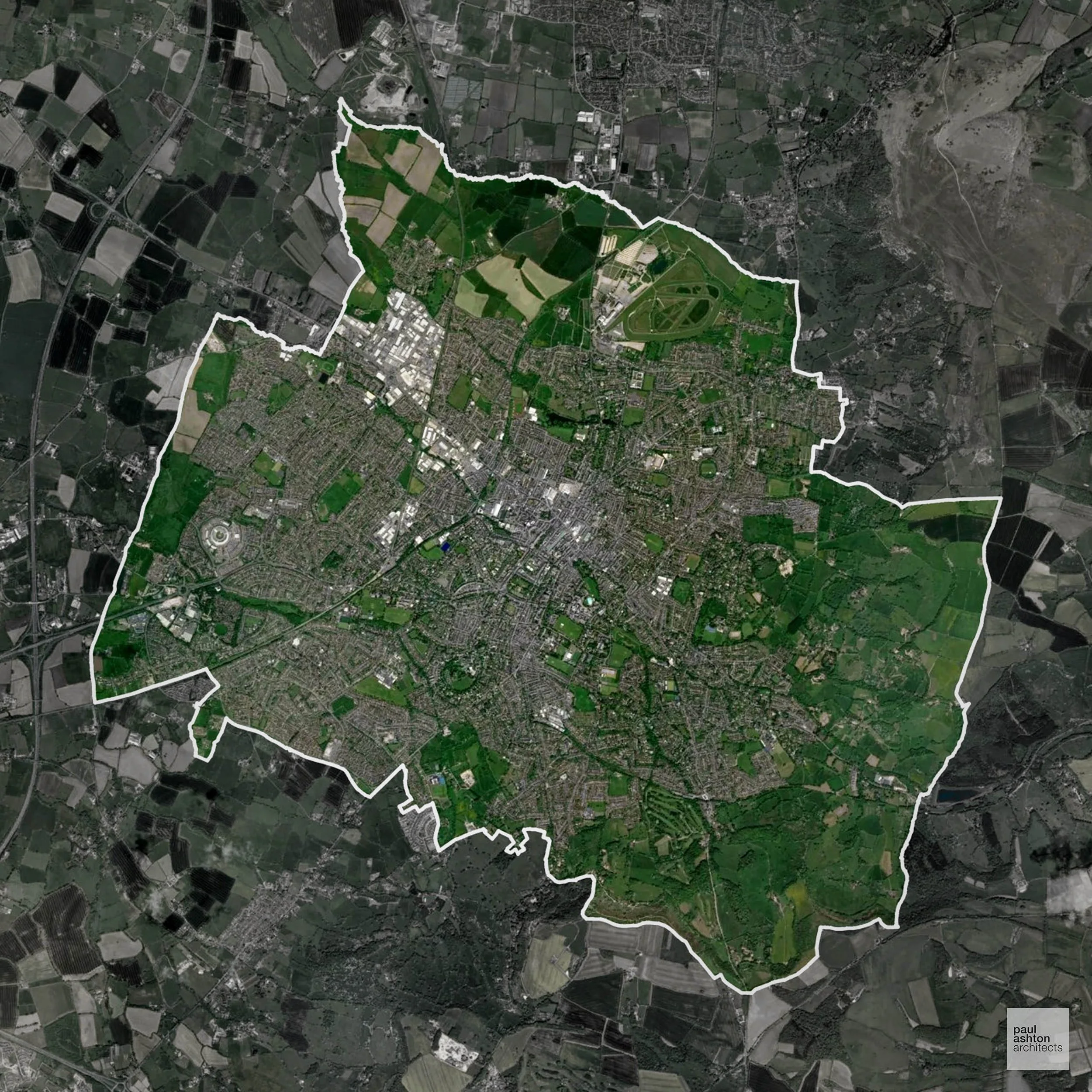
Cheltenham in Gloucestershire is known for Regency architecture, the Racecourse, and cultural festivals. The district includes surrounding villages like Leckhampton and Prestbury. Around 11.7% of the area is Green Belt, shaping the edges of Cheltenham’s urban areas. We can support projects from sensitive conversions to new-build developments.
In the last year Cheltenham decided 1,021 applications which is broadly in line with the national average of 988. The approval rate was 96% (marginally above the national average of 88%) and 72% of applications were decided on time, (significantly above the national average of 59%). Stats updated March 2026 from gov. sources. See how Cheltenham performs relative to other LPAs in our LPA hub.
"We love helping clients win Planning Permission in Cheltenham"
Areas of Outstanding Natural Beauty in Cheltenham
Areas of Outstanding Natural Beauty (AONBs), often referred to as National Landscapes, are protected for their remarkable natural and scenic value. Any development proposals here are closely evaluated, with a strong presumption against works that could harm the landscape.
Cheltenham overlaps with the Cotswolds AONB. Projects are subject to strict landscape and heritage protection rules.
In our experience, one of the top reasons proposals in Areas of Outstanding Natural Beauty are refused is causing landscape harm or visual intrusion, a risk that often arises when applications are not fully informed. We help minimise the likelihood of refusal with expert, guidance; contact us here.
Green Belt Approvals in Cheltenham
The Green Belt is a policy protecting land around many English towns and cities, where development is tightly controlled to safeguard the open countryside.
11.7% of Cheltenham is within the Green Belt and proposals in these areas can be subject to reasonable levels of scrutiny.
The Cheltenham Green Belt preserves surrounding farmland, villages such as Leckhampton and Prestbury, and the Cotswold escarpment, restricting urban expansion and protecting sensitive ecological and heritage landscapes.
In our experience, one of the top reasons poorly conceived Green Belt proposals are refused is causing 'harm to openness'. We can lower the risk of refusal with site-specific guidance. Contact us here.
You can also check whether your land is within the Green Belt using our interactive Green Belt map.
Planning Applications in Cheltenham
As well as acting as Planning Consultants we are ARB registered architects with over 25 years’ experience. Our site-specific planning proposals balance creativity with strategic insight. We use the following field-tested work stages to help clients in Cheltenham achieve successful planning outcomes:
- Stage 1: Site Appraisals & Planning Strategy Advice
- Stage 2: Feasibility Studies & Concept Designs
- Stage 3: Planning Application Packages
- Architectural Drawing Packages
- Planning Statements & Design and Access Statements
- Coordination of Consultant Reports
- Direct Liaison with Planning Officers
- Stage 4: Technical Design
- Discharge of Planning Conditions
- Building Regulations and Construction Packages
Planning Services We Offer in Cheltenham
- Full Planning Applications: Commercial, new buildings, changes of use.
- Householder Planning Applications: Domestic extensions / garden structures.
- Listed Building Consent: Alterations / repairs to listed buildings.
- Conservation Area Consent: Developments within Conservation Areas.
- Lawful Development Certificates: Confirming existing / completed works are lawful.
- Validation Requirements: Gathering documentation to ensure applications are validated by Cheltenham LPA.
Creative Planning Advice in Cheltenham
We collaborate closely with our clients to develop designs that respond to local character and align with Planning Policy, helping to maximise the likelihood of securing Planning Permission in Cheltenham.
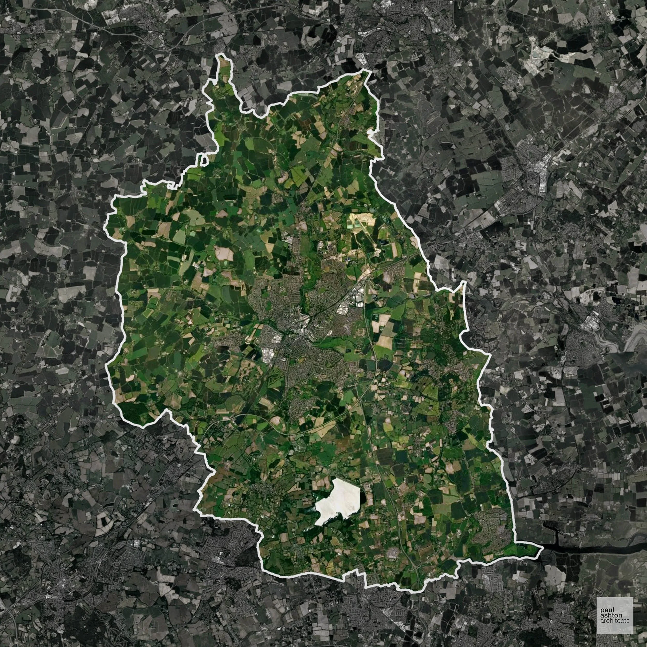
Chelmsford in Essex includes Chelmsford city, South Woodham Ferrers, and Danbury. The area is famous for its cathedral, historic streets, and thriving town centres. Approximately 37.5% of the district is Green Belt, influencing the location of new developments. We can advise on residential, commercial, and conversion schemes throughout Chelmsford.
In the last year Chelmsford decided 1,291 applications which is well above the national average of 988. The approval rate was 87% (roughly equal to the national average of 88%) and 82% of applications were decided on time, (significantly above the national average of 59%). Stats updated March 2026 from gov. sources. See how Chelmsford performs relative to other LPAs in our LPA hub.
"We love helping clients win Planning Permission in Chelmsford"
Areas of Outstanding Natural Beauty in Chelmsford
Areas of Outstanding Natural Beauty (AONBs), often referred to as National Landscapes, are protected for their remarkable natural and scenic value. Any development proposals here are closely evaluated, with a strong presumption against works that could harm the landscape.
Chelmsford is partially within the Essex Coast AONB. Development must take account of landscape sensitivity.
In our experience, one of the top reasons proposals in Areas of Outstanding Natural Beauty are refused is causing landscape harm or visual intrusion, a risk that often arises when applications are not fully informed. We help minimise the likelihood of refusal with expert, guidance; contact us here.
Green Belt Approvals in Chelmsford
The Green Belt is a policy protecting land around many English towns and cities, where development is tightly controlled to safeguard the open countryside.
37.5% of Chelmsford is within the Green Belt and proposals in these areas can be subject to high levels of scrutiny.
The Green Belt within Chelmsford preserves rural villages, agricultural land, and parklands around Chelmsford and surrounding villages, under pressure from expansion.
In our experience, one of the top reasons poorly conceived Green Belt proposals are refused is causing 'harm to openness'. We can lower the risk of refusal with site-specific guidance. Contact us here.
You can also check whether your land is within the Green Belt using our interactive Green Belt map.
Development in the Open Countryside
Chelmsford includes areas classed as Open Countryside, generally encompassing land beyond settlements and Green Belt zones, often used for agriculture or left as natural landscapes. Development in these areas is tightly controlled, with standard residential proposals rarely permitted.
Chelmsford’s open countryside, including farmland and river valleys, is sensitive to development due to visual prominence and heritage features.
One of the top reasons poorly prepared proposals in the Open Countryside are refused is that they fail to demonstrate a policy-supported need. To minimise that risk with bespoke advice contact us here.
Planning Applications in Chelmsford
As well as acting as Planning Consultants we are ARB registered architects with over 25 years’ experience. Our site-specific planning proposals balance creativity with strategic insight. We use the following field-tested work stages to help clients in Chelmsford achieve successful planning outcomes:
- Stage 1: Site Appraisals & Planning Strategy Advice
- Stage 2: Feasibility Studies & Concept Designs
- Stage 3: Planning Application Packages
- Architectural Drawing Packages
- Planning Statements & Design and Access Statements
- Coordination of Consultant Reports
- Direct Liaison with Planning Officers
- Stage 4: Technical Design
- Discharge of Planning Conditions
- Building Regulations and Construction Packages
Planning Services We Offer in Chelmsford
- Full Planning Applications: Commercial, new buildings, changes of use.
- Householder Planning Applications: Domestic extensions / garden structures.
- Listed Building Consent: Alterations / repairs to listed buildings.
- Conservation Area Consent: Developments within Conservation Areas.
- Lawful Development Certificates: Confirming existing / completed works are lawful.
- Validation Requirements: Gathering documentation to ensure applications are validated by Chelmsford LPA.
Design-Led Planning Advice in Chelmsford
We can review your site in Chelmsford and offer informed guidance on how proposals can be developed in order to maximise your chances of securing Planning Permission.
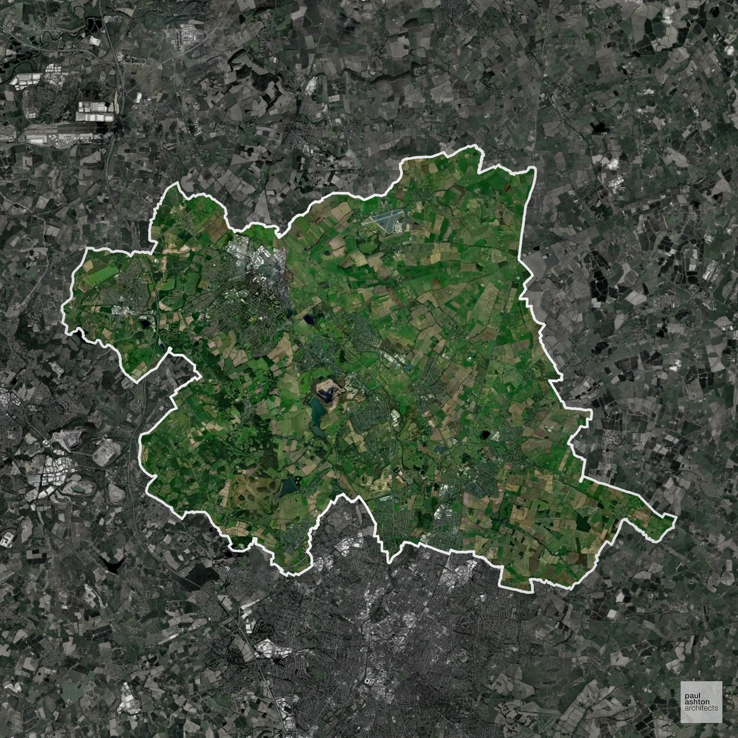
Charnwood in Leicestershire encompasses Loughborough, Shepshed, and Mountsorrel. Known for Loughborough University, historic buildings, and market towns. Planning focuses on sensitive urban development and heritage conservation. We can help deliver Planning Permission for residential, commercial, and town centre schemes.
In the last year Charnwood decided 837 applications which is slightly below the national average of 988. The approval rate was 87% (roughly equal to the national average of 88%) and 74% of applications were decided on time, (significantly above the national average of 59%). Stats updated March 2026 from gov. sources. See how Charnwood performs relative to other LPAs in our LPA hub.
"We love helping clients win Planning Permission in Charnwood"
Development in the Open Countryside
Charnwood includes areas classed as Open Countryside, generally encompassing land beyond settlements and Green Belt zones, often used for agriculture or left as natural landscapes. Development in these areas is tightly controlled, with standard residential proposals rarely permitted.
Charnwood’s rural woodlands, heathlands, and open fields require careful planning to preserve the area’s distinctive character.
One of the top reasons poorly prepared proposals in the Open Countryside are refused is that they fail to demonstrate a policy-supported need. To minimise that risk with bespoke advice contact us here.
Planning Applications in Charnwood
In addition to acting as Planing Conultants we are ARB registered architects with 25+ years of experience. Our planning proposals are creatively tailored to each site to maximise potential and improve planning outcomes. We use the following tried and tested process to guide clients in Charnwood through planning to completion:
- Stage 1: Site Appraisals & Planning Strategy Advice
- Stage 2: Feasibility Studies & Concept Designs
- Stage 3: Planning Application Packages
- Architectural Drawing Packages
- Planning Statements & Design and Access Statements
- Coordination of Consultant Reports
- Direct Liaison with Planning Officers
- Stage 4: Technical Design
- Discharge of Planning Conditions
- Building Regulations and Construction Packages
Planning Services We Offer in Charnwood
- Full Planning Applications: Commercial, new buildings, changes of use.
- Householder Planning Applications: Domestic extensions / garden structures.
- Listed Building Consent: Alterations / repairs to listed buildings.
- Conservation Area Consent: Developments within Conservation Areas.
- Lawful Development Certificates: Confirming existing / completed works are lawful.
- Validation Requirements: Gathering documentation to ensure applications are validated by Charnwood LPA.
Creative Planning Advice in Charnwood
We collaborate closely with our clients to develop designs that respond to local character and align with Planning Policy, helping to maximise the likelihood of securing Planning Permission in Charnwood.
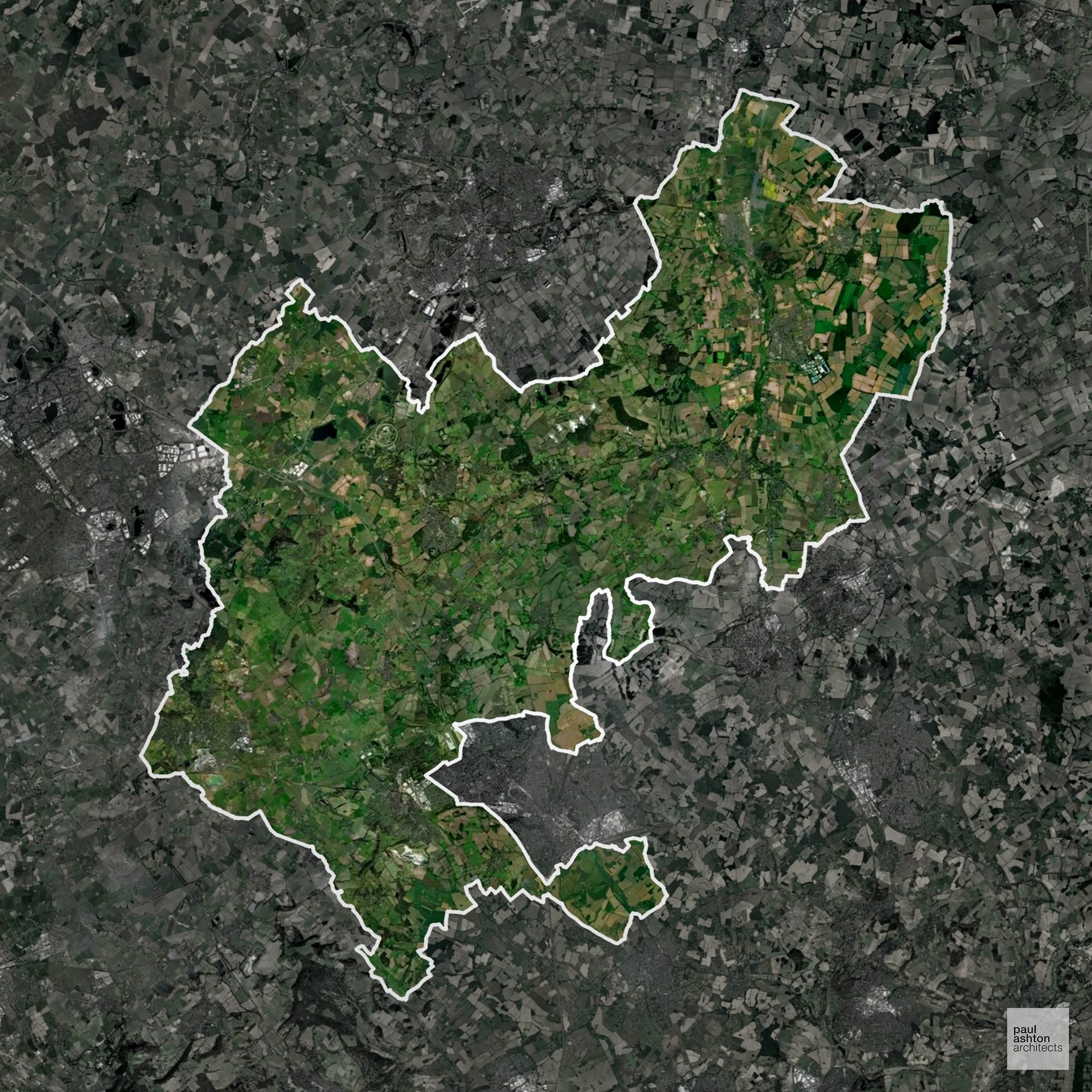
Central Bedfordshire includes Dunstable, Leighton Buzzard, and Biggleswade, blending historic market towns with commuter villages. About 37.6% of the district is Green Belt, influencing where housing and commercial schemes can be located. Planning balances growth with conservation of historic towns and rural character. We can support residential, commercial, and conversion projects across Central Bedfordshire.
In the last year Central Bedfordshire decided 1,482 applications which is well above the national average of 988. The approval rate was 84% (roughly equal to the national average of 88%) and 68% of applications were decided on time, (significantly above the national average of 59%). Stats updated March 2026 from gov. sources. See how Central Bedfordshire performs relative to other LPAs in our LPA hub.
"We love helping clients win Planning Permission in Central Bedfordshire"
Areas of Outstanding Natural Beauty in Central Bedfordshire
Areas of Outstanding Natural Beauty (AONBs), (now often referred to as National Landscapes), are protected areas recognised for their exceptional scenic and natural value. For developers, this means that planning proposals within these areas are carefully scrutinised, with a strong presumption against inappropriate development.
Central Bedfordshire includes sections of the Chilterns AONB. Development proposals must demonstrate minimal landscape impact.
In our experience, one of the top reasons proposals in Areas of Outstanding Natural Beauty are refused is causing landscape harm or visual intrusion, a risk that often arises when applications are not fully informed. We help minimise the likelihood of refusal with expert, guidance; contact us here.
Green Belt Approvals in Central Bedfordshire
The Green Belt is a nationally designated area of protected land surrounding many English towns and cities, where development is strictly controlled to prevent urban sprawl.
37.6% of Central Bedfordshire is within the Green Belt and proposals in these areas can be subject to high levels of scrutiny.
The Green Belt within Central Bedfordshire includes historic villages, open farmland, and small woodlands near Leighton Buzzard and Biggleswade, under pressure from housing demand.
In our experience, one of the top reasons poorly conceived Green Belt proposals are refused is causing 'harm to openness'. We can lower the risk of refusal with site-specific guidance. Contact us here.
You can also check whether your land is within the Green Belt using our interactive Green Belt map.
Development in the Open Countryside
Central Bedfordshire includes areas classed as Open Countryside, generally encompassing land beyond settlements and Green Belt zones, often used for agriculture or left as natural landscapes. Development in these areas is tightly controlled, with standard residential proposals rarely permitted.
Central Bedfordshire’s chalk landscapes and river valleys are protected for their natural beauty and historical significance.
One of the top reasons poorly prepared proposals in the Open Countryside are refused is that they fail to demonstrate a policy-supported need. To minimise that risk with bespoke advice contact us here.
Planning Applications in Central Bedfordshire
As well as acting as Planning Consultants we are ARB registered architects with over 25 years’ experience. Our site-specific planning proposals balance creativity with strategic insight. We use the following field-tested work stages to help clients in Central Bedfordshire achieve successful planning outcomes:
- Stage 1: Site Appraisals & Planning Strategy Advice
- Stage 2: Feasibility Studies & Concept Designs
- Stage 3: Planning Application Packages
- Architectural Drawing Packages
- Planning Statements & Design and Access Statements
- Coordination of Consultant Reports
- Direct Liaison with Planning Officers
- Stage 4: Technical Design
- Discharge of Planning Conditions
- Building Regulations and Construction Packages
Planning Services We Offer in Central Bedfordshire
- Full Planning Applications: Commercial, new buildings, changes of use.
- Householder Planning Applications: Domestic extensions / garden structures.
- Listed Building Consent: Alterations / repairs to listed buildings.
- Conservation Area Consent: Developments within Conservation Areas.
- Lawful Development Certificates: Confirming existing / completed works are lawful.
- Validation Requirements: Gathering documentation to ensure applications are validated by Central Bedfordshire LPA.
Creative Planning Advice in Central Bedfordshire
We collaborate closely with our clients to develop designs that respond to local character and align with Planning Policy, helping to maximise the likelihood of securing Planning Permission in Central Bedfordshire.
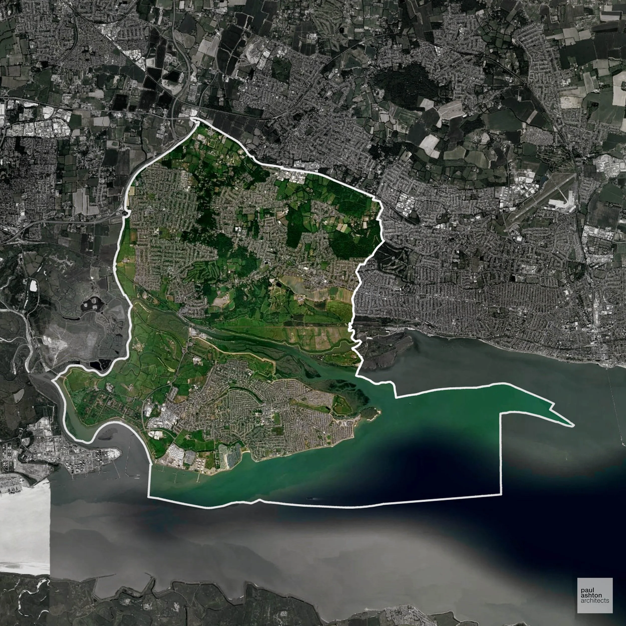
Castle Point in Essex encompasses Benfleet, Canvey Island, and Hadleigh. The area features coastal towns and post-war housing, with around 55.9% Green Belt shaping development at the edges. Planning balances urban growth with protection of surrounding open land. We can advise on residential, commercial, and mixed-use projects throughout the borough.
In the last year Castle Point decided 429 applications which is well below the national average of 988. The approval rate was 77% (slightly below the national average of 88%) and 92% of applications were decided on time, (significantly above the national average of 59%). Stats updated March 2026 from gov. sources. See how Castle Point performs relative to other LPAs in our LPA hub.
"We love helping clients win Planning Permission in Castle Point"
Green Belt Approvals in Castle Point
The Green Belt is nationally designated land around towns and cities, created to limit urban growth.
Significantly, 55.9% of Castle Point is within the Green Belt and proposals in these areas can be subject to high levels of scrutiny.
The Green Belt near Benfleet and Thundersley limits expansion to preserve open land and prevent coalescence of towns.
In our experience, one of the top reasons poorly conceived Green Belt proposals are refused is causing 'harm to openness'. We can lower the risk of refusal with site-specific guidance. Contact us here.
You can also check whether your land is within the Green Belt using our interactive Green Belt map.
Flood Risk in Castle Point
In some areas of the LPA, flood risk plays a key role in determining planning proposals. Canvey Island, which sits almost entirely within Flood Zone 3 due to its position in the Thames Estuary, means flood risk is the defining planning constraint across much of the borough. Where constraints permit, we can develop proposals that manage flood risk thoughtfully to give applications the best chance of approval.
Planning Applications in Castle Point
In addition to acting as Planing Conultants we are ARB registered architects with 25+ years of experience. Our planning proposals are creatively tailored to each site to maximise potential and improve planning outcomes. We use the following tried and tested process to guide clients in Castle Point through planning to completion:
- Stage 1: Site Appraisals & Planning Strategy Advice
- Stage 2: Feasibility Studies & Concept Designs
- Stage 3: Planning Application Packages
- Architectural Drawing Packages
- Planning Statements & Design and Access Statements
- Coordination of Consultant Reports
- Direct Liaison with Planning Officers
- Stage 4: Technical Design
- Discharge of Planning Conditions
- Building Regulations and Construction Packages
Planning Services We Offer in Castle Point
- Full Planning Applications: Commercial, new buildings, changes of use.
- Householder Planning Applications: Domestic extensions / garden structures.
- Listed Building Consent: Alterations / repairs to listed buildings.
- Conservation Area Consent: Developments within Conservation Areas.
- Lawful Development Certificates: Confirming existing / completed works are lawful.
- Validation Requirements: Gathering documentation to ensure applications are validated by Castle Point LPA.
Design-Led Planning Advice in Castle Point
We can review your site in Castle Point and offer informed guidance on how proposals can be developed in order to maximise your chances of securing Planning Permission.
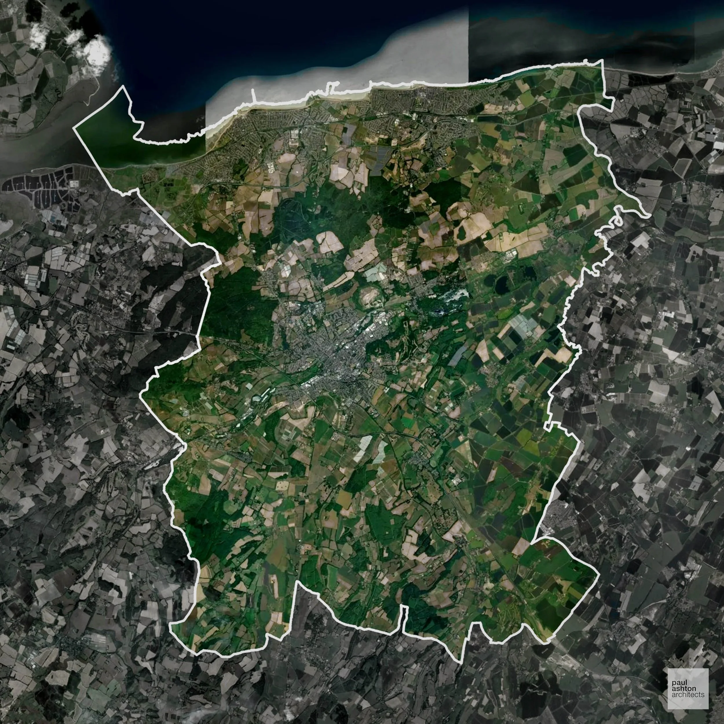
Canterbury in Kent includes Canterbury, Whitstable, and Herne Bay. The city is celebrated for its Cathedral, historic streets, and market heritage. Development is guided by urban policy and heritage considerations. We can support projects ranging from residential extensions to complex conversions and town centre schemes.
In the last year Canterbury decided 978 applications which is broadly in line with the national average of 988. The approval rate was 93% (marginally above the national average of 88%) and 53% of applications were decided on time, (significantly below the national average of 59%). Stats updated March 2026 from gov. sources. See how Canterbury performs relative to other LPAs in our LPA hub.
"We love helping clients win Planning Permission in Canterbury"
Areas of Outstanding Natural Beauty in Canterbury
Areas of Outstanding Natural Beauty (AONBs), often referred to as National Landscapes, are protected for their remarkable natural and scenic value. Any development proposals here are closely evaluated, with a strong presumption against works that could harm the landscape.
Canterbury contains part of the Kent Downs AONB. Projects are assessed for landscape, heritage, and environmental impact.
In our experience, one of the top reasons proposals in Areas of Outstanding Natural Beauty are refused is causing landscape harm or visual intrusion, a risk that often arises when applications are not fully informed. We help minimise the likelihood of refusal with expert, guidance; contact us here.
Conservation and Listed Buildings in Canterbury
Canterbury is defined by its compact historic core, extensive Conservation Area, and exceptionally high concentration of listed buildings. Development proposals are subject to stringent assessment, particularly where they affect historic streetscapes, archaeological remains, and the setting of landmark assets such as Canterbury Cathedral. Canterbury LPA places very strong weight on heritage protection, requiring well-justified and contextually sensitive proposals to achieve Planning Permission.
One of the top reasons heritage building applications are refused is causing harm to historic significance, a risk that can arise when proposals are not prepared by a consultant with heritage expertise. We help minimise this risk with expert, site-specific guidance; contact us here.
Development in the Open Countryside
Open Countryside within Canterbury refers to land situated outside built-up areas and Green Belt boundaries, typically comprising farmland or natural landscapes. Residential development is generally restricted unless special circumstances can be demonstrated.
Canterbury’s Kent Downs AONB and open countryside around historic villages are highly sensitive to development proposals.
One of the top reasons poorly prepared proposals in the Open Countryside are refused is that they fail to demonstrate a policy-supported need. To minimise that risk with bespoke advice contact us here.
Nutrient Neutrality in Canterbury
Nutrient Neutrality ensures new developments do not increase harmful nitrogen or phosphorus levels in sensitive waterways. Canterbury is substantially within the Stodmarsh designated sensitive catchment; both nitrogen and phosphorus neutrality are required, and the constraint applies to a wide range of development types generating additional wastewater. Unfortunately, Nutrient Neutrality can halt development completely. If you need early-stage, project-specific advice contact us here.
Planning Applications in Canterbury
In addition to acting as Planing Conultants we are ARB registered architects with 25+ years of experience. Our planning proposals are creatively tailored to each site to maximise potential and improve planning outcomes. We use the following tried and tested process to guide clients in Canterbury through planning to completion:
- Stage 1: Site Appraisals & Planning Strategy Advice
- Stage 2: Feasibility Studies & Concept Designs
- Stage 3: Planning Application Packages
- Architectural Drawing Packages
- Planning Statements & Design and Access Statements
- Coordination of Consultant Reports
- Direct Liaison with Planning Officers
- Stage 4: Technical Design
- Discharge of Planning Conditions
- Building Regulations and Construction Packages
Planning Services We Offer in Canterbury
- Full Planning Applications: Commercial, new buildings, changes of use.
- Householder Planning Applications: Domestic extensions / garden structures.
- Listed Building Consent: Alterations / repairs to listed buildings.
- Conservation Area Consent: Developments within Conservation Areas.
- Lawful Development Certificates: Confirming existing / completed works are lawful.
- Validation Requirements: Gathering documentation to ensure applications are validated by Canterbury LPA.
Design-Led Planning Advice in Canterbury
We can review your site in Canterbury and offer informed guidance on how proposals can be developed in order to maximise your chances of securing Planning Permission.
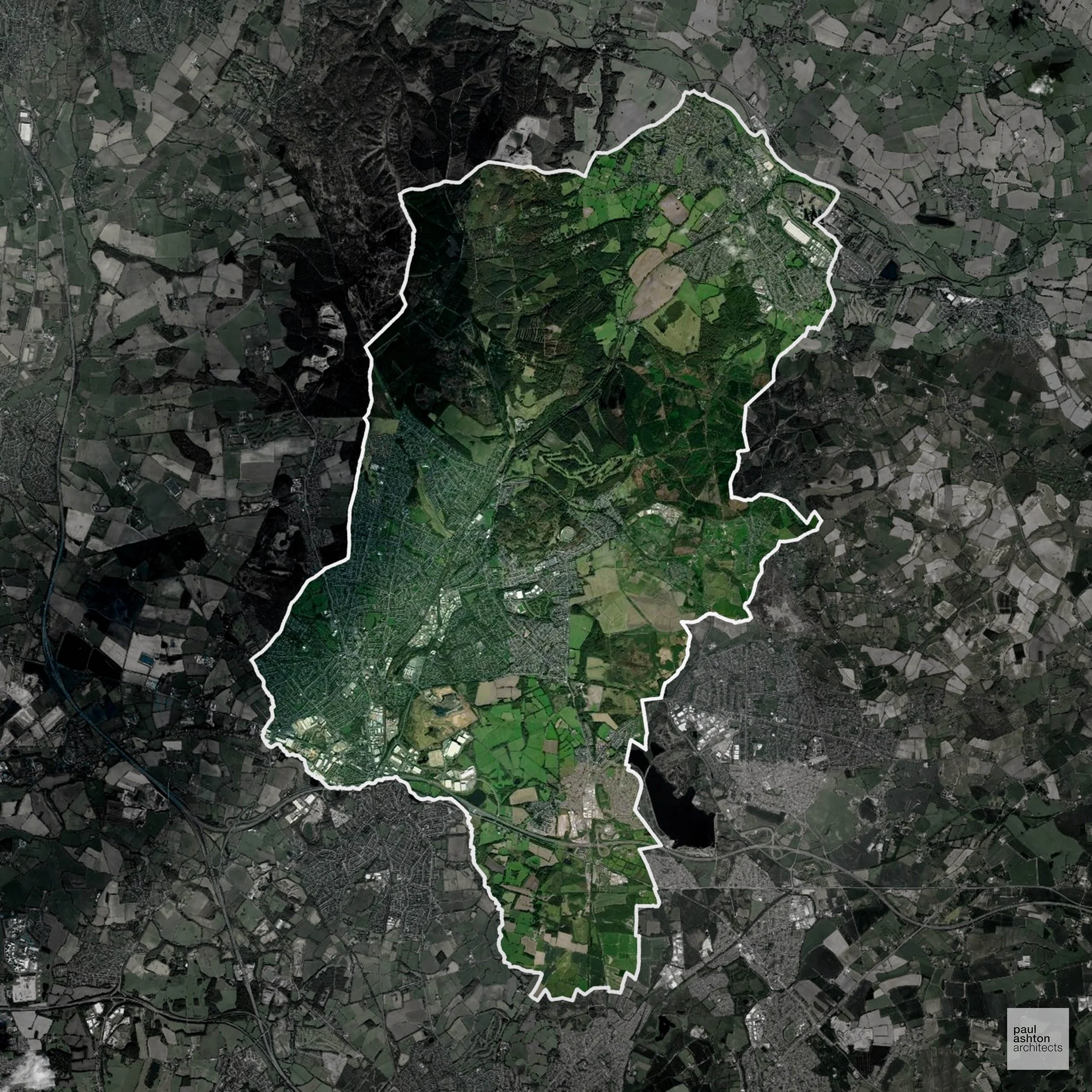
Cannock Chase in Staffordshire includes Cannock, Rugeley, and Hednesford. Famous for the Cannock Chase Area of Outstanding Natural Beauty and historic industrial towns, around 61.1% of the district is Green Belt. Planning balances urban growth with protection of the surrounding landscape. We can advise on residential and commercial developments, as well as conversions and extensions.
In the last year Cannock Chase decided 247 applications which is well below the national average of 988. The approval rate was 90% (roughly equal to the national average of 88%) and 64% of applications were decided on time, (slightly above the national average of 59%). Stats updated March 2026 from gov. sources. See how Cannock Chase performs relative to other LPAs in our LPA hub.
"We love helping clients win Planning Permission in Cannock Chase"
Areas of Outstanding Natural Beauty in Cannock Chase
Areas of Outstanding Natural Beauty (AONBs), sometimes called National Landscapes, are designated for their exceptional scenic and natural importance. Planning proposals in these areas face close scrutiny, with a strong presumption against inappropriate development.
Cannock Chase overlaps with the Cannock Chase AONB. Development is strictly regulated to preserve woodland and heathland character.
In our experience, one of the top reasons proposals in Areas of Outstanding Natural Beauty are refused is causing landscape harm or visual intrusion, a risk that often arises when applications are not fully informed. We help minimise the likelihood of refusal with expert, guidance; contact us here.
Green Belt Approvals in Cannock Chase
The Green Belt is nationally designated land around towns and cities, created to limit urban growth.
Significantly, 61.1% of Cannock Chase is within the Green Belt and proposals in these areas can be subject to high levels of scrutiny.
The Green Belt surrounding Cannock and Rugeley protects forested landscapes and settlement separation from urban areas.
In our experience, one of the top reasons poorly conceived Green Belt proposals are refused is causing 'harm to openness'. We can lower the risk of refusal with site-specific guidance. Contact us here.
You can also check whether your land is within the Green Belt using our interactive Green Belt map.
Planning Applications in Cannock Chase
In addition to acting as Planing Conultants we are ARB registered architects with 25+ years of experience. Our planning proposals are creatively tailored to each site to maximise potential and improve planning outcomes. We use the following tried and tested process to guide clients in Cannock Chase through planning to completion:
- Stage 1: Site Appraisals & Planning Strategy Advice
- Stage 2: Feasibility Studies & Concept Designs
- Stage 3: Planning Application Packages
- Architectural Drawing Packages
- Planning Statements & Design and Access Statements
- Coordination of Consultant Reports
- Direct Liaison with Planning Officers
- Stage 4: Technical Design
- Discharge of Planning Conditions
- Building Regulations and Construction Packages
Planning Services We Offer in Cannock Chase
- Full Planning Applications: Commercial, new buildings, changes of use.
- Householder Planning Applications: Domestic extensions / garden structures.
- Listed Building Consent: Alterations / repairs to listed buildings.
- Conservation Area Consent: Developments within Conservation Areas.
- Lawful Development Certificates: Confirming existing / completed works are lawful.
- Validation Requirements: Gathering documentation to ensure applications are validated by Cannock Chase LPA.
Design-Led Planning Advice in Cannock Chase
We can review your site in Cannock Chase and offer informed guidance on how proposals can be developed in order to maximise your chances of securing Planning Permission.
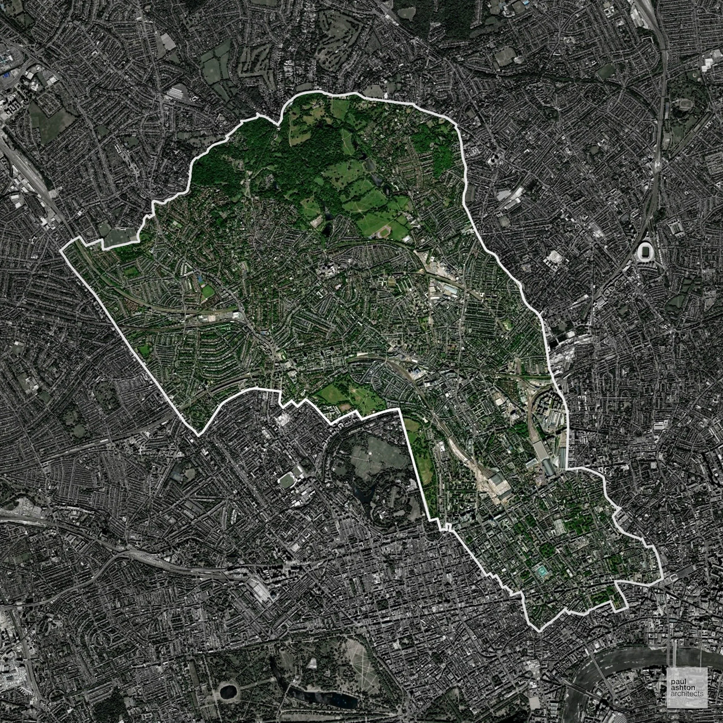
Camden in London encompasses Camden Town, Hampstead, and Kentish Town. Known for its cultural vibrancy, historic streets, and conservation areas, planning focuses on heritage and high-density urban sites. Development considerations centre on urban policy and design sensitivity. We can assist with residential, commercial, and mixed-use projects across the borough.
In the last year Camden decided 1,969 applications which is well above the national average of 988. The approval rate was 89% (roughly equal to the national average of 88%) and 61% of applications were decided on time, (on par with the national average of 59%). Stats updated March 2026 from gov. sources. See how Camden performs relative to other LPAs in our LPA hub.
"We love helping clients win Planning Permission in Camden"
Conservation and Listed Buildings in Camden
Camden contains a highly diverse and sensitive historic environment, with numerous Conservation Areas and a significant concentration of listed buildings ranging from Georgian terraces to notable twentieth-century architecture. Heritage constraints are particularly evident within areas such as Bloomsbury Conservation Area and Hampstead Conservation Area, where formal townscape, historic squares, and varied architectural styles define local character.
One of the top reasons heritage building applications are refused is causing harm to historic significance, a risk that can arise when proposals are not prepared by a consultant with heritage expertise. We help minimise this risk with expert, site-specific guidance; contact us here.
Planning Applications in Camden
Alongside acting as Planning Consultants we are ARB registered architects with 25+ years of experience. We use the following proven work stages to guide clients in Camden through the planning process in order to maximise the potential of their development :
- Stage 1: Site Appraisals & Planning Strategy Advice
- Stage 2: Feasibility Studies & Concept Designs
- Stage 3: Planning Application Packages
- Architectural Drawing Packages
- Planning Statements & Design and Access Statements
- Coordination of Consultant Reports
- Direct Liaison with Planning Officers
- Stage 4: Technical Design
- Discharge of Planning Conditions
- Building Regulations and Construction Packages
Planning Services We Offer in Camden
- Full Planning Applications: Commercial, new buildings, changes of use.
- Householder Planning Applications: Domestic extensions / garden structures.
- Listed Building Consent: Alterations / repairs to listed buildings.
- Conservation Area Consent: Developments within Conservation Areas.
- Lawful Development Certificates: Confirming existing / completed works are lawful.
- Validation Requirements: Gathering documentation to ensure applications are validated by Camden LPA.
Creative Planning Advice in Camden
We collaborate closely with our clients to develop designs that respond to local character and align with Planning Policy, helping to maximise the likelihood of securing Planning Permission in Camden.
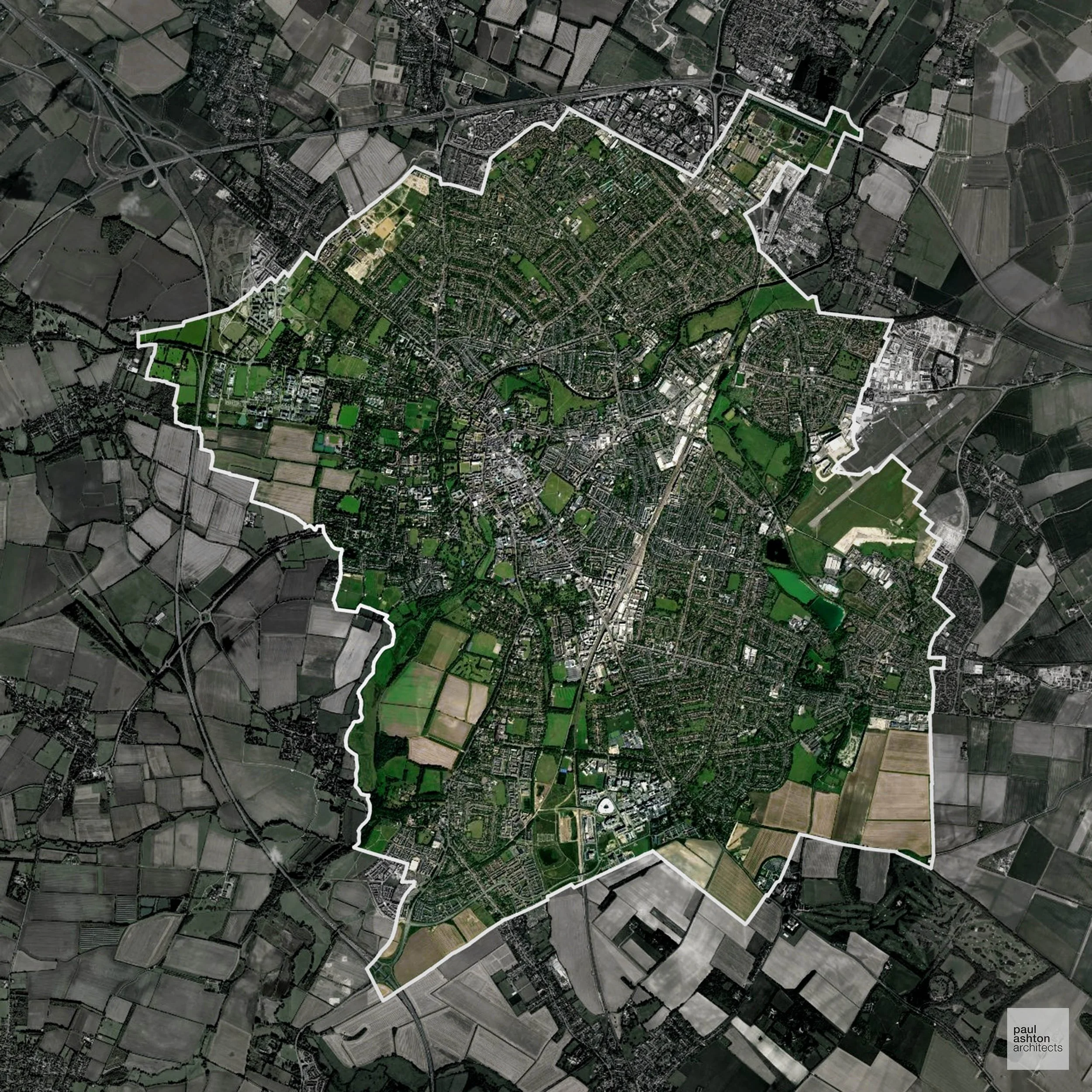
Cambridge in Cambridgeshire combines a historic city centre with surrounding villages such as Trumpington and Histon. Famous for the University of Cambridge and iconic architecture, planning often involves conservation and townscape considerations. Approximately 23.9% of the area is Green Belt, influencing growth around the city’s periphery. We can support projects from sensitive conversions to new-build residential developments.
In the last year Cambridge decided 1,034 applications which is broadly in line with the national average of 988. The approval rate was 91% (roughly equal to the national average of 88%) and 74% of applications were decided on time, (significantly above the national average of 59%). Stats updated March 2026 from gov. sources. See how Cambridge performs relative to other LPAs in our LPA hub.
"We love helping clients win Planning Permission in Cambridge"
Conservation and Listed Buildings in Cambridge
Cambridge has a highly sensitive historic environment, characterised by its collegiate architecture, extensive Conservation Areas, and a significant number of listed buildings. Development proposals are carefully assessed for their impact on key views, townscape character, and the setting of heritage assets, particularly in relation to the colleges and river corridors.
One of the top reasons heritage building applications are refused is causing harm to historic significance, a risk that can arise when proposals are not prepared by a consultant with heritage expertise. We help minimise this risk with expert, site-specific guidance; contact us here.
Green Belt Approvals in Cambridge
The Green Belt is nationally designated land around towns and cities, created to limit urban growth.
23.9% of Cambridge is within the Green Belt and proposals in these areas can be subject to high levels of scrutiny.
The Green Belt around Cambridge preserves farmland and historic villages near Girton and Histon, which are under high development pressure
In our experience, one of the top reasons poorly conceived Green Belt proposals are refused is causing 'harm to openness'. We can lower the risk of refusal with site-specific guidance. Contact us here.
You can also check whether your land is within the Green Belt using our interactive Green Belt map.
Planning Applications in Cambridge
As well as acting as Planning Consultants we are ARB registered architects with over 25 years’ experience. Our site-specific planning proposals balance creativity with strategic insight. We use the following field-tested work stages to help clients in Cambridge achieve successful planning outcomes:
- Stage 1: Site Appraisals & Planning Strategy Advice
- Stage 2: Feasibility Studies & Concept Designs
- Stage 3: Planning Application Packages
- Architectural Drawing Packages
- Planning Statements & Design and Access Statements
- Coordination of Consultant Reports
- Direct Liaison with Planning Officers
- Stage 4: Technical Design
- Discharge of Planning Conditions
- Building Regulations and Construction Packages
Planning Services We Offer in Cambridge
- Full Planning Applications: Commercial, new buildings, changes of use.
- Householder Planning Applications: Domestic extensions / garden structures.
- Listed Building Consent: Alterations / repairs to listed buildings.
- Conservation Area Consent: Developments within Conservation Areas.
- Lawful Development Certificates: Confirming existing / completed works are lawful.
- Validation Requirements: Gathering documentation to ensure applications are validated by Cambridge LPA.
Design-Led Planning Advice in Cambridge
We can review your site in Cambridge and offer informed guidance on how proposals can be developed in order to maximise your chances of securing Planning Permission.
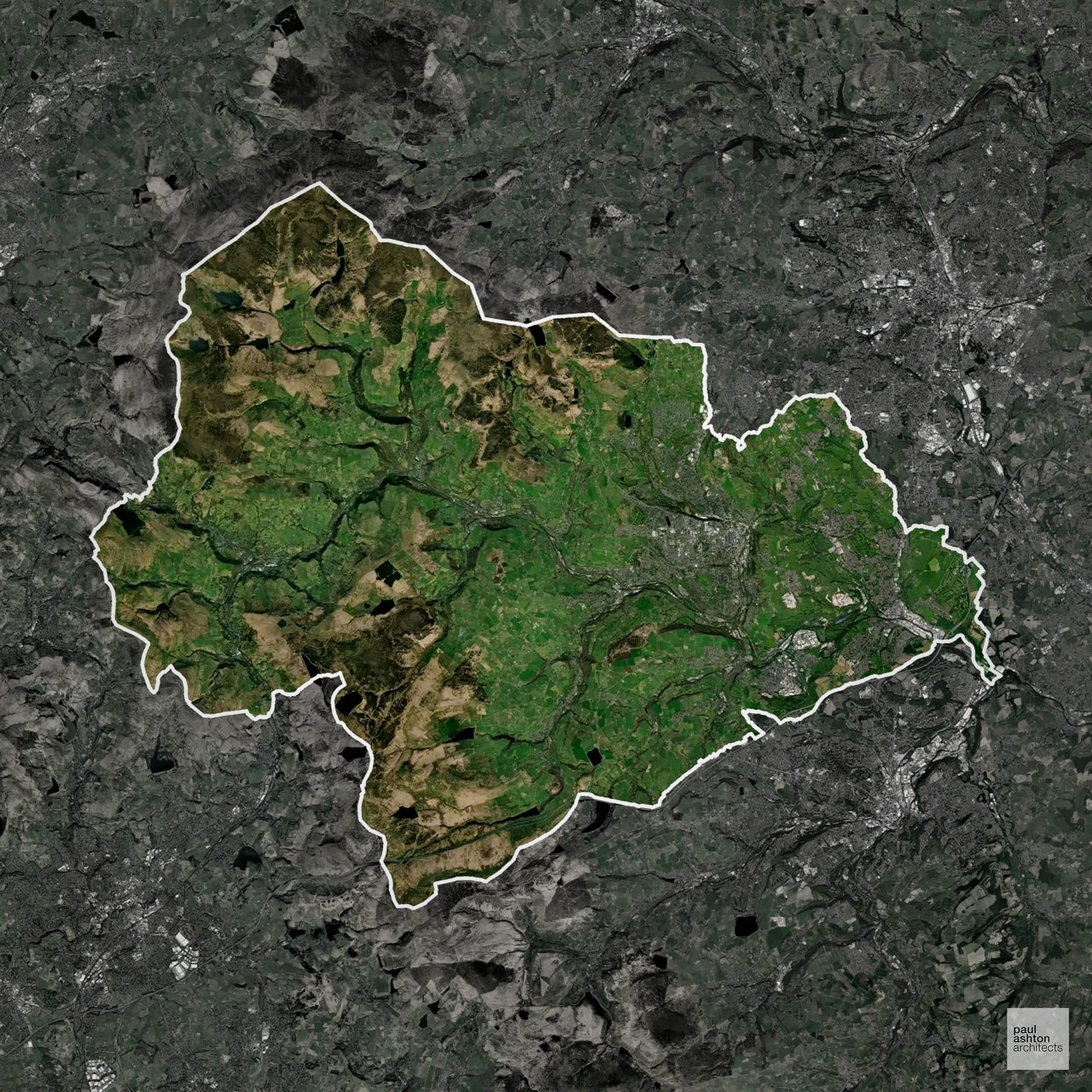
Calderdale in West Yorkshire includes Halifax, Todmorden, Hebden Bridge, and Brighouse. The district is renowned for its industrial heritage, Pennine landscapes, and historic mills. Around 61.4% of the district is Green Belt, shaping development on the edges of towns. Planning balances sensitive urban regeneration with protection of open countryside. We can advise on residential, commercial, and conversion schemes throughout Calderdale.
In the last year Calderdale decided 877 applications which is slightly below the national average of 988. The approval rate was 85% (roughly equal to the national average of 88%) and 51% of applications were decided on time, (significantly below the national average of 59%). Stats updated March 2026 from gov. sources. See how Calderdale performs relative to other LPAs in our LPA hub.
"We love helping clients win Planning Permission in Calderdale"
Areas of Outstanding Natural Beauty in Calderdale
Areas of Outstanding Natural Beauty (AONBs), (now often referred to as National Landscapes), are protected areas recognised for their exceptional scenic and natural value. For developers, this means that planning proposals within these areas are carefully scrutinised, with a strong presumption against inappropriate development.
Calderdale includes part of the South Pennines AONB. Development must respect the scenic and ecological qualities of the area.
In our experience, one of the top reasons proposals in Areas of Outstanding Natural Beauty are refused is causing landscape harm or visual intrusion, a risk that often arises when applications are not fully informed. We help minimise the likelihood of refusal with expert, guidance; contact us here.
Green Belt Approvals in Calderdale
The Green Belt is a policy protecting land around many English towns and cities, where development is tightly controlled to safeguard the open countryside.
Significantly, 61.4% of Calderdale is within the Green Belt and proposals in these areas can be subject to high levels of scrutiny.
The Green Belt near Halifax and Hebden Bridge focuses on protecting upland landscapes, villages, and ecological assets.
In our experience, one of the top reasons poorly conceived Green Belt proposals are refused is causing 'harm to openness'. We can lower the risk of refusal with site-specific guidance. Contact us here.
You can also check whether your land is within the Green Belt using our interactive Green Belt map.
Flood Risk in Calderdale
In some areas of the LPA, flood risk plays a key role in determining planning proposals. The Calder Valley suffered catastrophic flooding in both 2015 and 2020, and the steep-sided valley topography means Flood Zone 3 runs through the centre of virtually every main town in the district. Where constraints permit, we can develop proposals that manage flood risk thoughtfully to give applications the best chance of approval.
Planning Applications in Calderdale
As well as acting as Planning Consultants we are ARB registered architects with over 25 years’ experience. Our site-specific planning proposals balance creativity with strategic insight. We use the following field-tested work stages to help clients in Calderdale achieve successful planning outcomes:
- Stage 1: Site Appraisals & Planning Strategy Advice
- Stage 2: Feasibility Studies & Concept Designs
- Stage 3: Planning Application Packages
- Architectural Drawing Packages
- Planning Statements & Design and Access Statements
- Coordination of Consultant Reports
- Direct Liaison with Planning Officers
- Stage 4: Technical Design
- Discharge of Planning Conditions
- Building Regulations and Construction Packages
Planning Services We Offer in Calderdale
- Full Planning Applications: Commercial, new buildings, changes of use.
- Householder Planning Applications: Domestic extensions / garden structures.
- Listed Building Consent: Alterations / repairs to listed buildings.
- Conservation Area Consent: Developments within Conservation Areas.
- Lawful Development Certificates: Confirming existing / completed works are lawful.
- Validation Requirements: Gathering documentation to ensure applications are validated by Calderdale LPA.
Design-Led Planning Advice in Calderdale
We can review your site in Calderdale and offer informed guidance on how proposals can be developed in order to maximise your chances of securing Planning Permission.
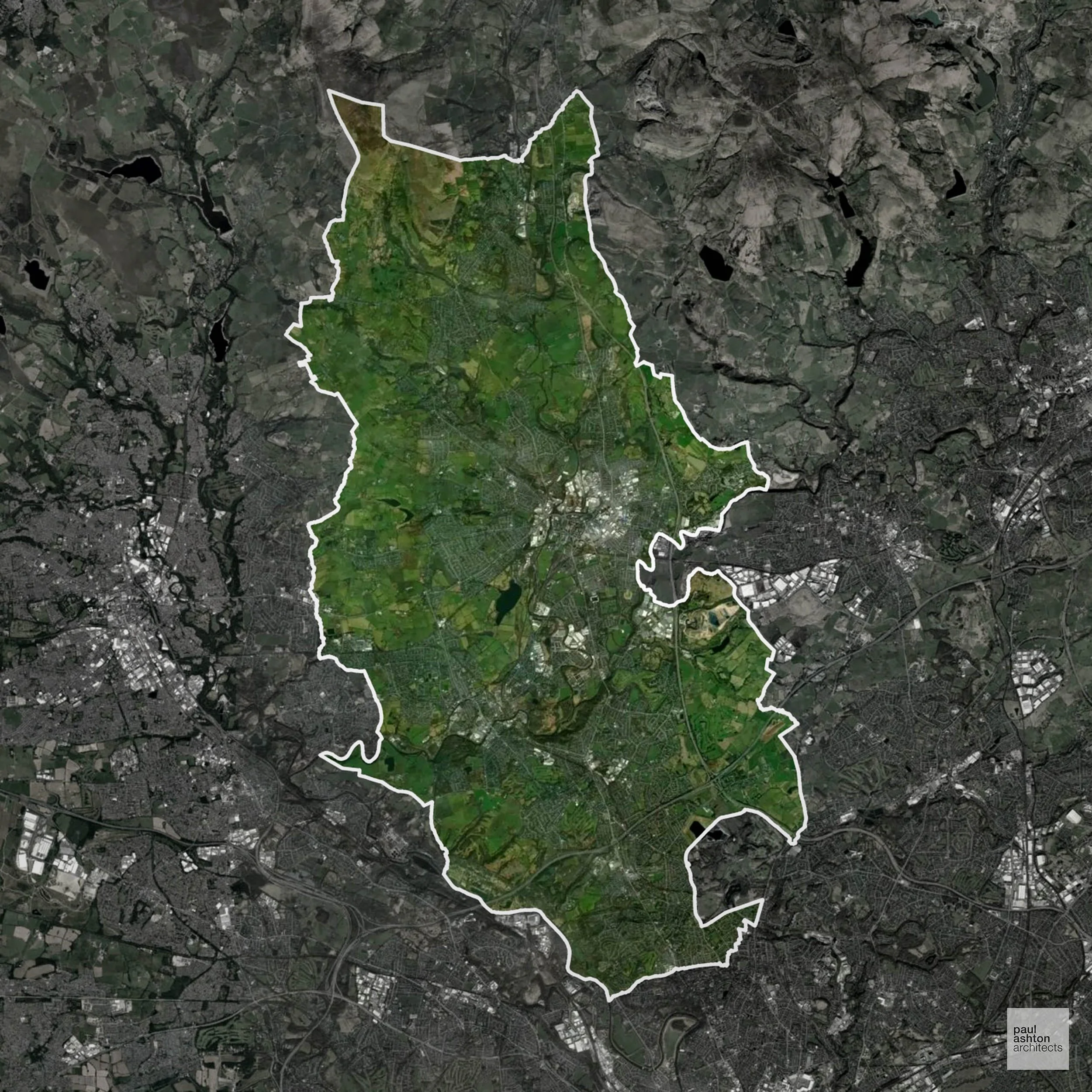
Bury in Greater Manchester includes Bury town, Radcliffe, and Prestwich. Known for its market, mill heritage, and listed buildings such as the East Lancashire Railway station, Bury blends urban areas with surrounding Green Belt, which accounts for 53.8% of the borough. Planning requires careful policy navigation for town centre and suburban developments. We can assist with approvals for all types of development.
In the last year Bury decided 777 applications which is well below the national average of 988. The approval rate was 88% (roughly equal to the national average of 88%) and 66% of applications were decided on time, (significantly above the national average of 59%). Stats updated March 2026 from gov. sources. See how Bury performs relative to other LPAs in our LPA hub.
"We love helping clients win Planning Permission in Bury"
Green Belt Approvals in Bury
The Green Belt is a nationally designated area of protected land surrounding many English towns and cities, where development is strictly controlled to prevent urban sprawl.
Significantly, 53.8% of Bury is within the Green Belt and proposals in these areas can be subject to high levels of scrutiny.
The Green Belt near Ramsbottom and Tottington protects rural areas and prevents coalescence between settlements.
In our experience, one of the top reasons poorly conceived Green Belt proposals are refused is causing 'harm to openness'. We can lower the risk of refusal with site-specific guidance. Contact us here.
You can also check whether your land is within the Green Belt using our interactive Green Belt map.
Planning Applications in Bury
In addition to acting as Planing Conultants we are ARB registered architects with 25+ years of experience. Our planning proposals are creatively tailored to each site to maximise potential and improve planning outcomes. We use the following tried and tested process to guide clients in Bury through planning to completion:
- Stage 1: Site Appraisals & Planning Strategy Advice
- Stage 2: Feasibility Studies & Concept Designs
- Stage 3: Planning Application Packages
- Architectural Drawing Packages
- Planning Statements & Design and Access Statements
- Coordination of Consultant Reports
- Direct Liaison with Planning Officers
- Stage 4: Technical Design
- Discharge of Planning Conditions
- Building Regulations and Construction Packages
Planning Services We Offer in Bury
- Full Planning Applications: Commercial, new buildings, changes of use.
- Householder Planning Applications: Domestic extensions / garden structures.
- Listed Building Consent: Alterations / repairs to listed buildings.
- Conservation Area Consent: Developments within Conservation Areas.
- Lawful Development Certificates: Confirming existing / completed works are lawful.
- Validation Requirements: Gathering documentation to ensure applications are validated by Bury LPA.
Creative Planning Advice in Bury
We collaborate closely with our clients to develop designs that respond to local character and align with Planning Policy, helping to maximise the likelihood of securing Planning Permission in Bury.
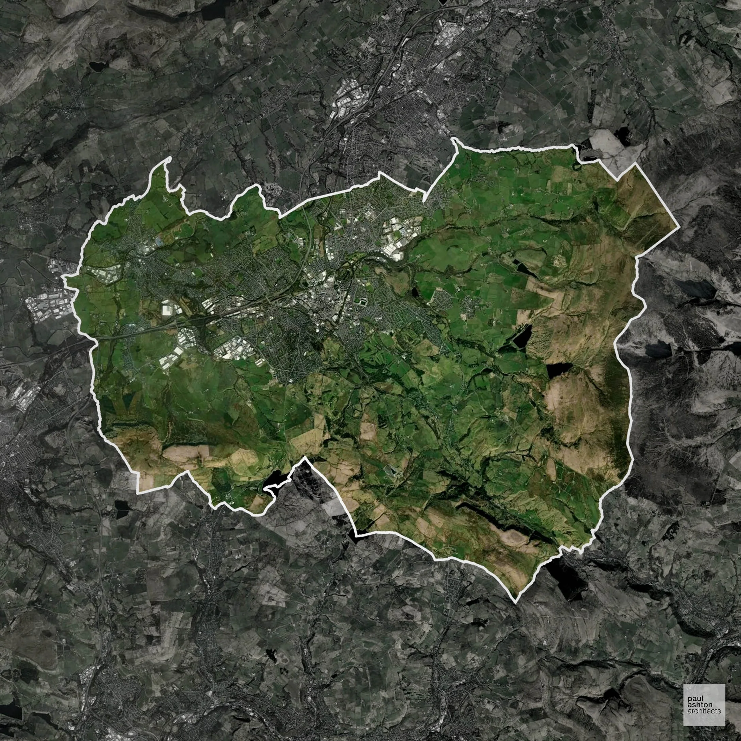
Burnley in Lancashire combines a strong industrial past with surrounding Pennine countryside. Towns include Burnley, Padiham, and Nelson, featuring historic mills and Victorian housing. Green Belt makes up 9.5% of the borough, primarily around its outskirts. We can support residential, commercial, and conversion projects across Burnley.
In the last year Burnley decided 300 applications which is well below the national average of 988. The approval rate was 88% (roughly equal to the national average of 88%) and 59% of applications were decided on time, (on par with the national average of 59%). Stats updated March 2026 from gov. sources. See how Burnley performs relative to other LPAs in our LPA hub.
"We love helping clients win Planning Permission in Burnley"
Green Belt Approvals in Burnley
The Green Belt is a policy protecting land around many English towns and cities, where development is tightly controlled to safeguard the open countryside.
9.5% of Burnley is within the Green Belt and proposals in these areas can be subject to reasonable levels of scrutiny.
The Burnley Green Belt protects surrounding villages such as Hapton and Worsthorne, agricultural land, and the Pennine foothills, preventing urban sprawl and preserving sensitive landscapes and ecological habitats.
In our experience, one of the top reasons poorly conceived Green Belt proposals are refused is causing 'harm to openness'. We can lower the risk of refusal with site-specific guidance. Contact us here.
You can also check whether your land is within the Green Belt using our interactive Green Belt map.
Development in the Open Countryside
The Open Countryside is generally defined as land outside settlement and Green Belt boundaries, often comprising agricultural or natural land. Development, particularly standard residential development, is usually restricted in Open Countryside.
Burnley’s Pennine fringe and rural valley landscapes are valued for scenic and ecological reasons, with strong Green Belt protections.
One of the top reasons poorly prepared proposals in the Open Countryside are refused is that they fail to demonstrate a policy-supported need. To minimise that risk with bespoke advice contact us here.
Planning Applications in Burnley
Alongside acting as Planning Consultants we are ARB registered architects with 25+ years of experience. We use the following proven work stages to guide clients in Burnley through the planning process in order to maximise the potential of their development :
- Stage 1: Site Appraisals & Planning Strategy Advice
- Stage 2: Feasibility Studies & Concept Designs
- Stage 3: Planning Application Packages
- Architectural Drawing Packages
- Planning Statements & Design and Access Statements
- Coordination of Consultant Reports
- Direct Liaison with Planning Officers
- Stage 4: Technical Design
- Discharge of Planning Conditions
- Building Regulations and Construction Packages
Planning Services We Offer in Burnley
- Full Planning Applications: Commercial, new buildings, changes of use.
- Householder Planning Applications: Domestic extensions / garden structures.
- Listed Building Consent: Alterations / repairs to listed buildings.
- Conservation Area Consent: Developments within Conservation Areas.
- Lawful Development Certificates: Confirming existing / completed works are lawful.
- Validation Requirements: Gathering documentation to ensure applications are validated by Burnley LPA.
Contextual Planning Support in Burnley
We work collaboratively with clients and shape a design that respects local character and meets Planning Policy requirements in order to maximise your chances of winning Planning Permission.
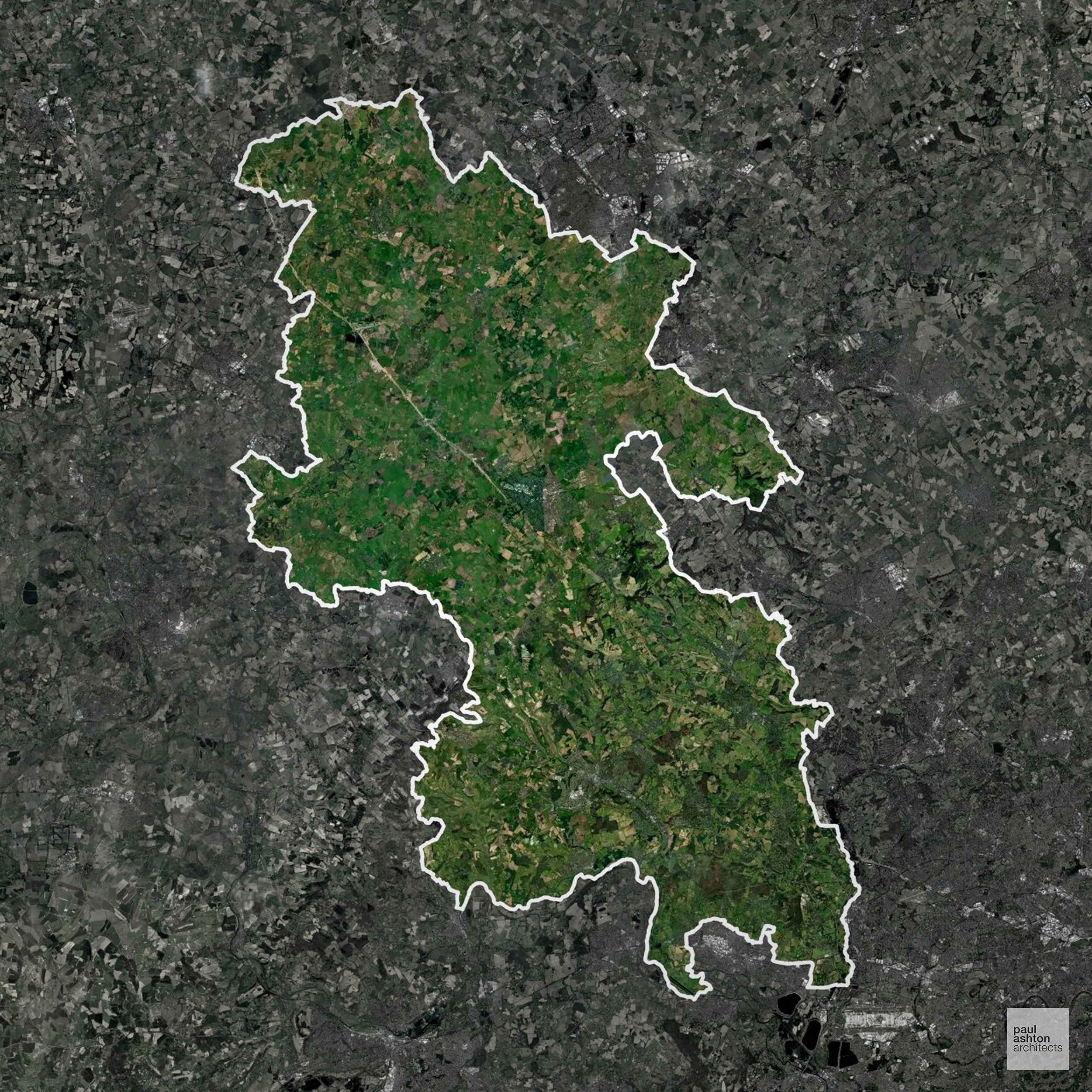
Buckinghamshire encompasses towns such as Aylesbury, High Wycombe, and Amersham, with a mix of historic market towns and modern commuter centres. About 32.1% of the county is Green Belt, guiding where housing and commercial schemes can be located. Planning balances development with conservation of historic sites. We can deliver Planning Permission for a variety of schemes across the county.
In the last year Buckinghamshire decided 4,436 applications which is well above the national average of 988. The approval rate was 83% (roughly equal to the national average of 88%) and 50% of applications were decided on time, (significantly below the national average of 59%). Stats updated March 2026 from gov. sources. See how Buckinghamshire performs relative to other LPAs in our LPA hub.
"We love helping clients win Planning Permission in Buckinghamshire"
Areas of Outstanding Natural Beauty in Buckinghamshire
Areas of Outstanding Natural Beauty (AONBs), often referred to as National Landscapes, are protected for their remarkable natural and scenic value. Any development proposals here are closely evaluated, with a strong presumption against works that could harm the landscape.
Buckinghamshire contains sections of the Chilterns AONB. Planning must consider landscape character, heritage, and visual impact.
In our experience, one of the top reasons proposals in Areas of Outstanding Natural Beauty are refused is causing landscape harm or visual intrusion, a risk that often arises when applications are not fully informed. We help minimise the likelihood of refusal with expert, guidance; contact us here.
Conservation and Listed Buildings in Buckinghamshire
Buckinghamshire has an extensive and varied historic environment, with numerous Conservation Areas and a high concentration of listed buildings across its towns and villages. Heritage constraints are particularly evident in locations such as Beaconsfield and Marlow, where historic character, townscape quality, and landscape setting are key considerations.
One of the top reasons heritage building applications are refused is causing harm to historic significance, a risk that can arise when proposals are not prepared by a consultant with heritage expertise. We help minimise this risk with expert, site-specific guidance; contact us here.
Green Belt Approvals in Buckinghamshire
The Green Belt is nationally designated land around towns and cities, created to limit urban growth.
32.1% of Buckinghamshire is within the Green Belt and proposals in these areas can be subject to high levels of scrutiny.
The very high Green Belt coverage around Amersham and Chesham makes development highly sensitive to landscape and settlement gap protection.
In our experience, one of the top reasons poorly conceived Green Belt proposals are refused is causing 'harm to openness'. We can lower the risk of refusal with site-specific guidance. Contact us here.
You can also check whether your land is within the Green Belt using our interactive Green Belt map.
Development in the Open Countryside
Buckinghamshire includes areas classed as Open Countryside, generally encompassing land beyond settlements and Green Belt zones, often used for agriculture or left as natural landscapes. Development in these areas is tightly controlled, with standard residential proposals rarely permitted.
Buckinghamshire’s open chalk hills, wooded valleys, and historic parklands are highly scenic and carefully controlled for development.
One of the top reasons poorly prepared proposals in the Open Countryside are refused is that they fail to demonstrate a policy-supported need. To minimise that risk with bespoke advice contact us here.
Planning Applications in Buckinghamshire
Alongside acting as Planning Consultants we are ARB registered architects with 25+ years of experience. We use the following proven work stages to guide clients in Buckinghamshire through the planning process in order to maximise the potential of their development :
- Stage 1: Site Appraisals & Planning Strategy Advice
- Stage 2: Feasibility Studies & Concept Designs
- Stage 3: Planning Application Packages
- Architectural Drawing Packages
- Planning Statements & Design and Access Statements
- Coordination of Consultant Reports
- Direct Liaison with Planning Officers
- Stage 4: Technical Design
- Discharge of Planning Conditions
- Building Regulations and Construction Packages
Planning Services We Offer in Buckinghamshire
- Full Planning Applications: Commercial, new buildings, changes of use.
- Householder Planning Applications: Domestic extensions / garden structures.
- Listed Building Consent: Alterations / repairs to listed buildings.
- Conservation Area Consent: Developments within Conservation Areas.
- Lawful Development Certificates: Confirming existing / completed works are lawful.
- Validation Requirements: Gathering documentation to ensure applications are validated by Buckinghamshire LPA.
Planning Permissions We’ve Won in Buckinghamshire
- Full Planning Application: Proposed domestic alterations extensions and new pool outbuilding in the Green Belt. →
- Prior Approval Application: Rear extension in the Green Belt →
- Lawful Development Certificate: Certificate of Lawfulness for pool outbuilding in the Green Belt. →
Contextual Planning Support in Buckinghamshire
We work collaboratively with clients and shape a design that respects local character and meets Planning Policy requirements in order to maximise your chances of winning Planning Permission.
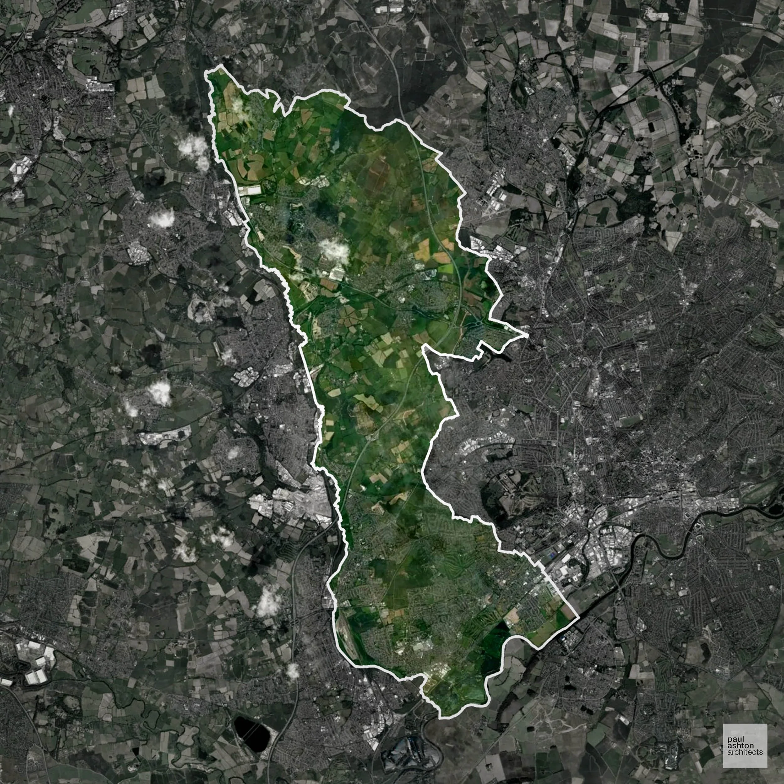
Broxtowe in Nottinghamshire includes Beeston, Stapleford, and Eastwood. Approximately 61.2% of the borough is Green Belt, shaping development around suburban edges. Planning balances town centre intensification with protection of surrounding countryside. We can provide support for residential, commercial, and sensitive town centre schemes.
In the last year Broxtowe decided 501 applications which is well below the national average of 988. The approval rate was 93% (marginally above the national average of 88%) and 66% of applications were decided on time, (significantly above the national average of 59%). Stats updated March 2026 from gov. sources. See how Broxtowe performs relative to other LPAs in our LPA hub.
"We love helping clients win Planning Permission in Broxtowe"
Green Belt Approvals in Broxtowe
The Green Belt is a policy protecting land around many English towns and cities, where development is tightly controlled to safeguard the open countryside.
Significantly, 61.2% of Broxtowe is within the Green Belt and proposals in these areas can be subject to high levels of scrutiny.
The Green Belt around Beeston and Stapleford restricts expansion to maintain open land and separation between Nottingham and surrounding villages.
In our experience, one of the top reasons poorly conceived Green Belt proposals are refused is causing 'harm to openness'. We can lower the risk of refusal with site-specific guidance. Contact us here.
You can also check whether your land is within the Green Belt using our interactive Green Belt map.
Planning Applications in Broxtowe
In addition to acting as Planing Conultants we are ARB registered architects with 25+ years of experience. Our planning proposals are creatively tailored to each site to maximise potential and improve planning outcomes. We use the following tried and tested process to guide clients in Broxtowe through planning to completion:
- Stage 1: Site Appraisals & Planning Strategy Advice
- Stage 2: Feasibility Studies & Concept Designs
- Stage 3: Planning Application Packages
- Architectural Drawing Packages
- Planning Statements & Design and Access Statements
- Coordination of Consultant Reports
- Direct Liaison with Planning Officers
- Stage 4: Technical Design
- Discharge of Planning Conditions
- Building Regulations and Construction Packages
Planning Services We Offer in Broxtowe
- Full Planning Applications: Commercial, new buildings, changes of use.
- Householder Planning Applications: Domestic extensions / garden structures.
- Listed Building Consent: Alterations / repairs to listed buildings.
- Conservation Area Consent: Developments within Conservation Areas.
- Lawful Development Certificates: Confirming existing / completed works are lawful.
- Validation Requirements: Gathering documentation to ensure applications are validated by Broxtowe LPA.
Design-Led Planning Advice in Broxtowe
We can review your site in Broxtowe and offer informed guidance on how proposals can be developed in order to maximise your chances of securing Planning Permission.
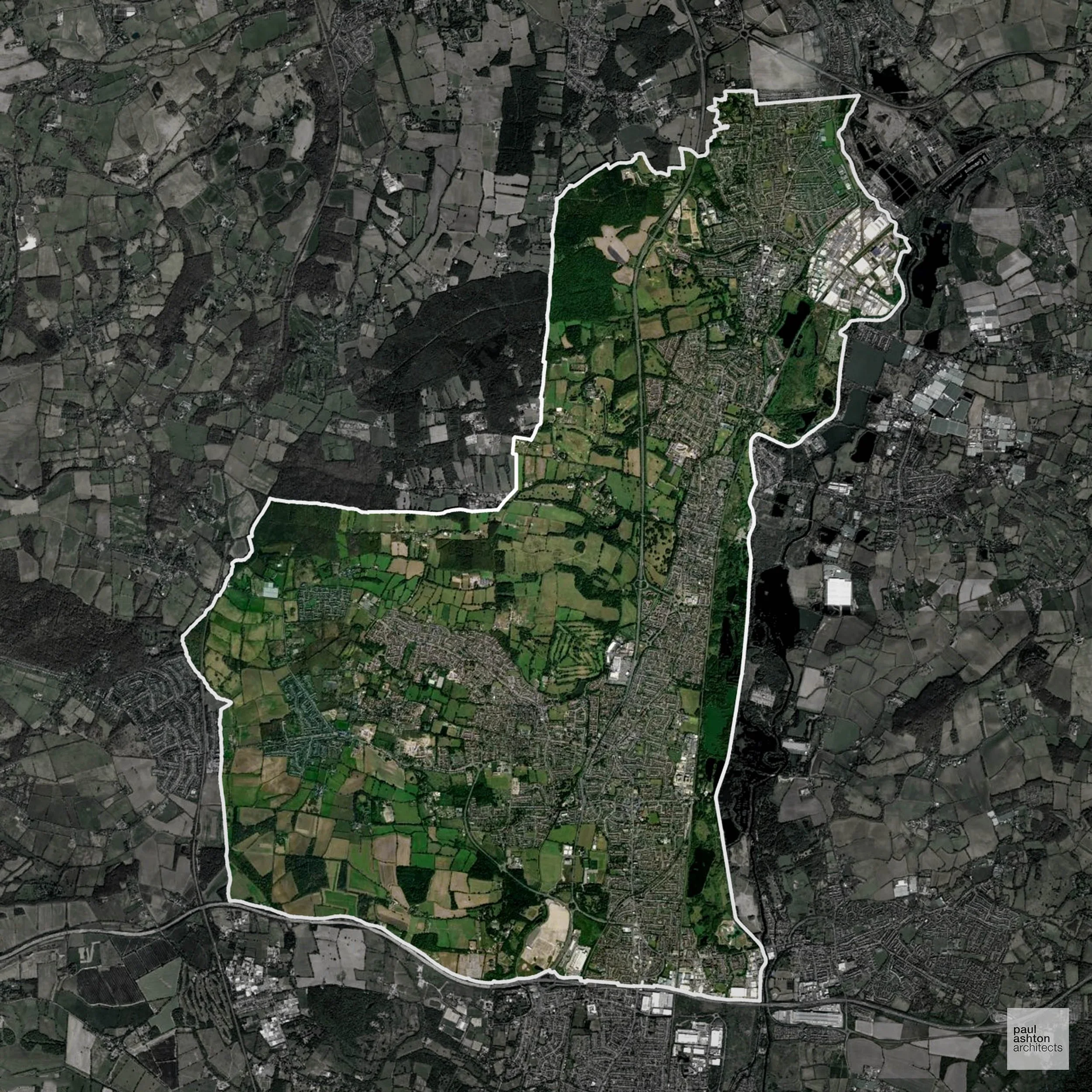
Broxbourne in Hertfordshire encompasses towns such as Cheshunt and Waltham Cross. Around 55% of the district is Green Belt, influencing where new developments can be accommodated. Planning requires careful navigation of policies protecting open land and heritage. We can assist with residential and commercial projects throughout Broxbourne.
In the last year Broxbourne decided 477 applications which is well below the national average of 988. The approval rate was 85% (roughly equal to the national average of 88%) and 52% of applications were decided on time, (significantly below the national average of 59%). Stats updated March 2026 from gov. sources. See how Broxbourne performs relative to other LPAs in our LPA hub.
"We love helping clients win Planning Permission in Broxbourne"
Green Belt Approvals in Broxbourne
The Green Belt is nationally designated land around towns and cities, created to limit urban growth.
Significantly, 55.0% of Broxbourne is within the Green Belt and proposals in these areas can be subject to high levels of scrutiny.
The Green Belt around Broxbourne and Wormley restricts development to preserve rural landscapes and maintain separation from London suburbs.
In our experience, one of the top reasons poorly conceived Green Belt proposals are refused is causing 'harm to openness'. We can lower the risk of refusal with site-specific guidance. Contact us here.
You can also check whether your land is within the Green Belt using our interactive Green Belt map.
Planning Applications in Broxbourne
Alongside acting as Planning Consultants we are ARB registered architects with 25+ years of experience. We use the following proven work stages to guide clients in Broxbourne through the planning process in order to maximise the potential of their development :
- Stage 1: Site Appraisals & Planning Strategy Advice
- Stage 2: Feasibility Studies & Concept Designs
- Stage 3: Planning Application Packages
- Architectural Drawing Packages
- Planning Statements & Design and Access Statements
- Coordination of Consultant Reports
- Direct Liaison with Planning Officers
- Stage 4: Technical Design
- Discharge of Planning Conditions
- Building Regulations and Construction Packages
Planning Services We Offer in Broxbourne
- Full Planning Applications: Commercial, new buildings, changes of use.
- Householder Planning Applications: Domestic extensions / garden structures.
- Listed Building Consent: Alterations / repairs to listed buildings.
- Conservation Area Consent: Developments within Conservation Areas.
- Lawful Development Certificates: Confirming existing / completed works are lawful.
- Validation Requirements: Gathering documentation to ensure applications are validated by Broxbourne LPA.
Design-Led Planning Advice in Broxbourne
We can review your site in Broxbourne and offer informed guidance on how proposals can be developed in order to maximise your chances of securing Planning Permission.
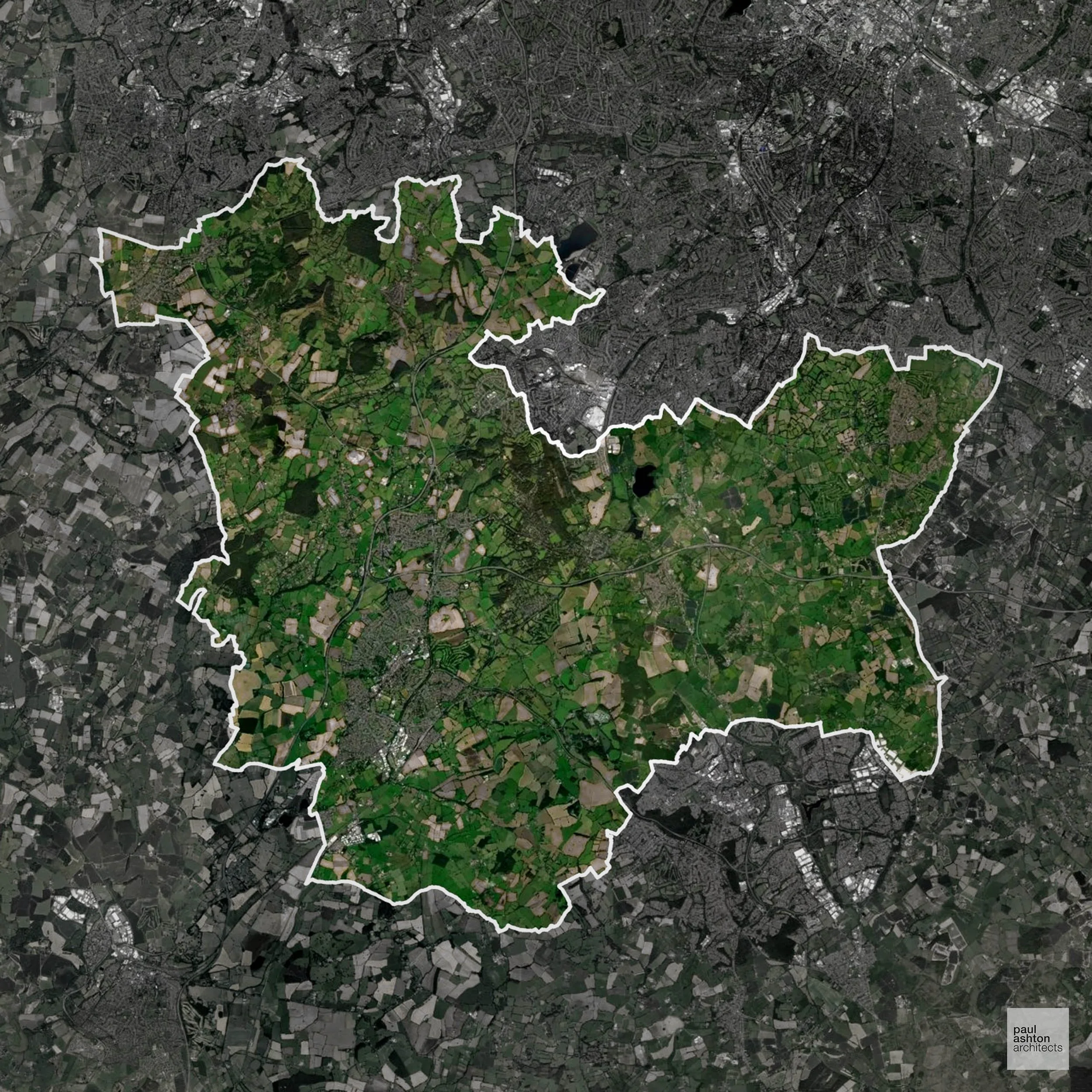
Bromsgrove in Worcestershire features the town of Bromsgrove and surrounding villages. Approximately 88.9% of the district is Green Belt, which heavily shapes residential and commercial development opportunities. Planning here focuses on preserving the rural and historic character. We can advise clients on residential, commercial, and conversion projects across the district.
In the last year Bromsgrove decided 477 applications which is well below the national average of 988. The approval rate was 95% (marginally above the national average of 88%) and 62% of applications were decided on time, (slightly above the national average of 59%). Stats updated March 2026 from gov. sources. See how Bromsgrove performs relative to other LPAs in our LPA hub.
"We love helping clients win Planning Permission in Bromsgrove"
Areas of Outstanding Natural Beauty in Bromsgrove
Areas of Outstanding Natural Beauty (AONBs), often referred to as National Landscapes, are protected for their remarkable natural and scenic value. Any development proposals here are closely evaluated, with a strong presumption against works that could harm the landscape.
Bromsgrove overlaps with the Clent Hills and Lickey Hills AONB edges. Development proposals are constrained by scenic and ecological considerations.
In our experience, one of the top reasons proposals in Areas of Outstanding Natural Beauty are refused is causing landscape harm or visual intrusion, a risk that often arises when applications are not fully informed. We help minimise the likelihood of refusal with expert, guidance; contact us here.
Green Belt Approvals in Bromsgrove
The Green Belt is a policy protecting land around many English towns and cities, where development is tightly controlled to safeguard the open countryside.
Significantly, 88.9% of Bromsgrove is within the Green Belt and proposals in these areas can be subject to high levels of scrutiny.
The Bromsgrove Green Belt around Barnt Green, Alvechurch, and Bromsgrove town protects the Clent Hills Area of Outstanding Natural Beauty and prevents urban sprawl.
In our experience, one of the top reasons poorly conceived Green Belt proposals are refused is causing 'harm to openness'. We can lower the risk of refusal with site-specific guidance. Contact us here.
You can also check whether your land is within the Green Belt using our interactive Green Belt map.
Planning Applications in Bromsgrove
In addition to acting as Planing Conultants we are ARB registered architects with 25+ years of experience. Our planning proposals are creatively tailored to each site to maximise potential and improve planning outcomes. We use the following tried and tested process to guide clients in Bromsgrove through planning to completion:
- Stage 1: Site Appraisals & Planning Strategy Advice
- Stage 2: Feasibility Studies & Concept Designs
- Stage 3: Planning Application Packages
- Architectural Drawing Packages
- Planning Statements & Design and Access Statements
- Coordination of Consultant Reports
- Direct Liaison with Planning Officers
- Stage 4: Technical Design
- Discharge of Planning Conditions
- Building Regulations and Construction Packages
Planning Services We Offer in Bromsgrove
- Full Planning Applications: Commercial, new buildings, changes of use.
- Householder Planning Applications: Domestic extensions / garden structures.
- Listed Building Consent: Alterations / repairs to listed buildings.
- Conservation Area Consent: Developments within Conservation Areas.
- Lawful Development Certificates: Confirming existing / completed works are lawful.
- Validation Requirements: Gathering documentation to ensure applications are validated by Bromsgrove LPA.
Design-Led Planning Advice in Bromsgrove
We can review your site in Bromsgrove and offer informed guidance on how proposals can be developed in order to maximise your chances of securing Planning Permission.
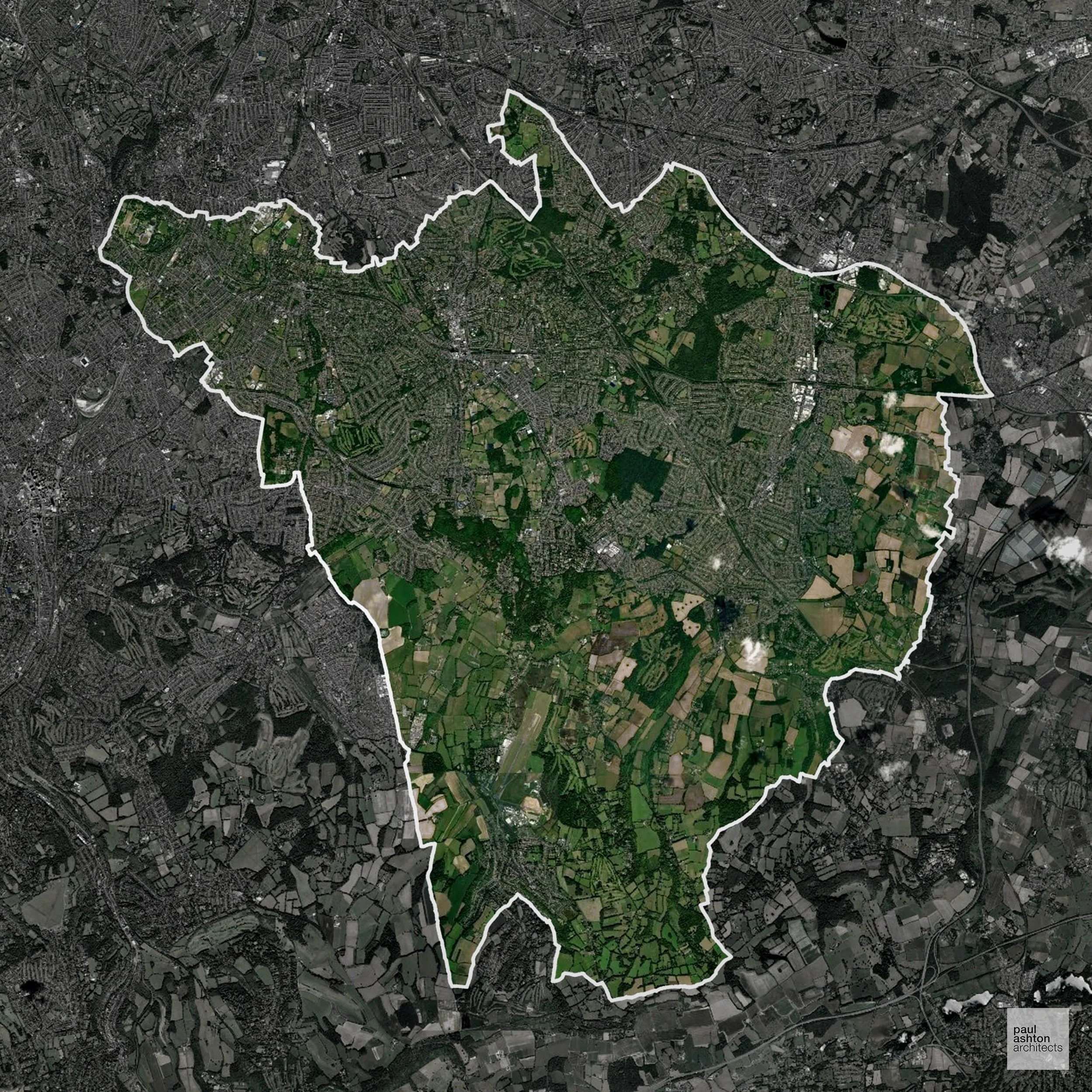
Bromley in South East London includes Bromley, Beckenham, and Orpington. About 51% of the borough is Green Belt, creating a balance between suburban growth and open countryside protection. Planning projects often require careful design to respect local heritage. We can support a wide range of schemes, from conversions to new-build residential developments.
In the last year Bromley decided 2,171 applications which is well above the national average of 988. The approval rate was 75% (slightly below the national average of 88%) and 66% of applications were decided on time, (significantly above the national average of 59%). Stats updated March 2026 from gov. sources. See how Bromley performs relative to other LPAs in our LPA hub.
"We love helping clients win Planning Permission in Bromley"
Green Belt Approvals in Bromley
The Green Belt is nationally designated land around towns and cities, created to limit urban growth.
Significantly, 51.0% of Bromley is within the Green Belt and proposals in these areas can be subject to very high levels of scrutiny.
Development within the Green Belt surrounding London is highly sensitive and politically contentious. The Green Belt around Orpington and Chislehurst restricts growth to preserve countryside and buffer settlements from London.
In our experience, one of the top reasons poorly conceived Green Belt proposals are refused is causing 'harm to openness'. We can lower the risk of refusal with site-specific guidance. Contact us here.
You can also check whether your land is within the Green Belt using our interactive Green Belt map.
Planning Applications in Bromley
As well as acting as Planning Consultants we are ARB registered architects with over 25 years’ experience. Our site-specific planning proposals balance creativity with strategic insight. We use the following field-tested work stages to help clients in Bromley achieve successful planning outcomes:
- Stage 1: Site Appraisals & Planning Strategy Advice
- Stage 2: Feasibility Studies & Concept Designs
- Stage 3: Planning Application Packages
- Architectural Drawing Packages
- Planning Statements & Design and Access Statements
- Coordination of Consultant Reports
- Direct Liaison with Planning Officers
- Stage 4: Technical Design
- Discharge of Planning Conditions
- Building Regulations and Construction Packages
Planning Services We Offer in Bromley
- Full Planning Applications: Commercial, new buildings, changes of use.
- Householder Planning Applications: Domestic extensions / garden structures.
- Listed Building Consent: Alterations / repairs to listed buildings.
- Conservation Area Consent: Developments within Conservation Areas.
- Lawful Development Certificates: Confirming existing / completed works are lawful.
- Validation Requirements: Gathering documentation to ensure applications are validated by Bromley LPA.
Design-Led Planning Advice in Bromley
We can review your site in Bromley and offer informed guidance on how proposals can be developed in order to maximise your chances of securing Planning Permission.
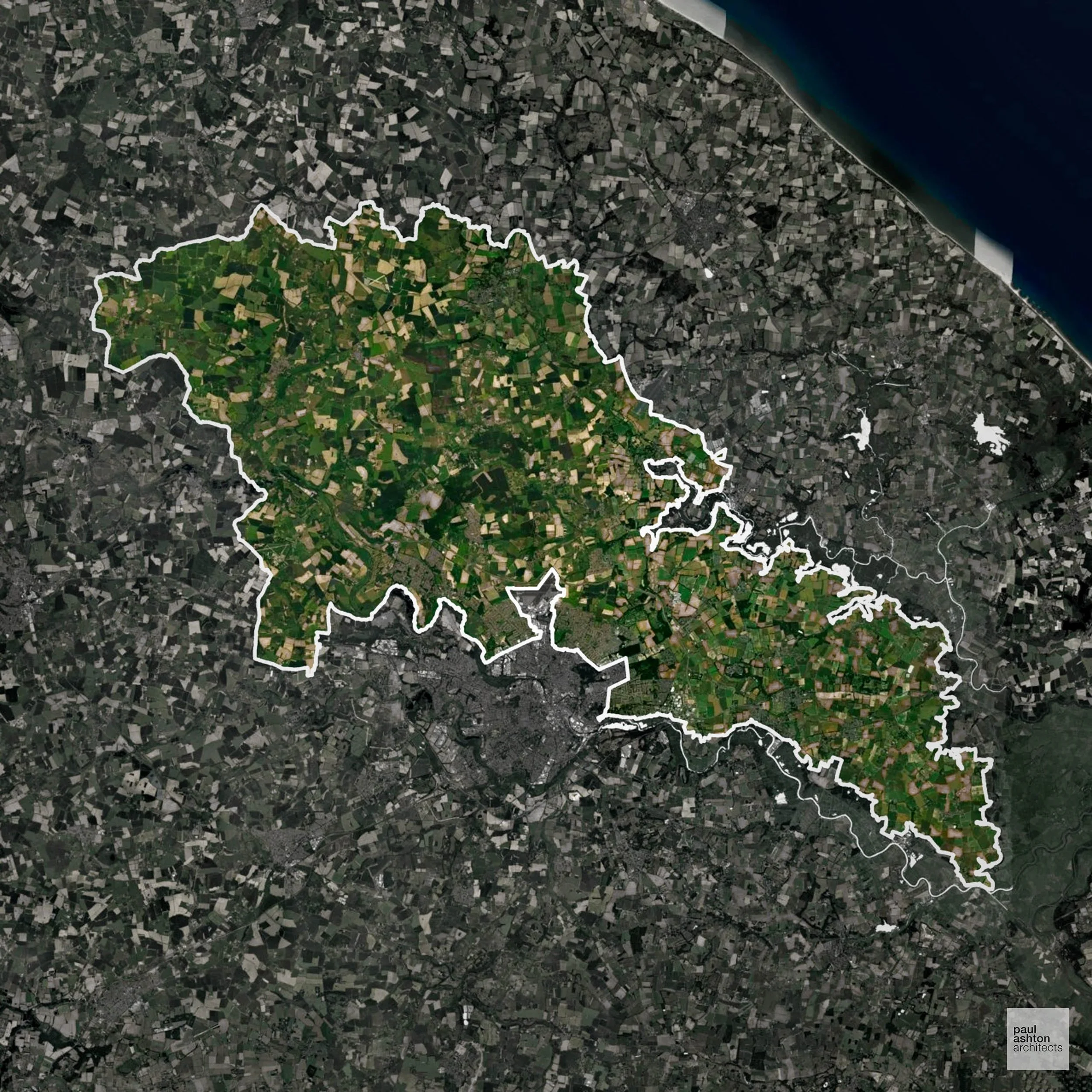
Broadland in Norfolk encompasses Norwich’s suburbs and rural villages like Aylsham and Wroxham. Planning foduses on maintaining village character and sensitive development. We can advise on residential and mixed-use developments across Broadland.
In the last year Broadland decided 772 applications which is well below the national average of 988. The approval rate was 93% (marginally above the national average of 88%) and 61% of applications were decided on time, (on par with the national average of 59%). Stats updated March 2026 from gov. sources. See how Broadland performs relative to other LPAs in our LPA hub.
"We love helping clients win Planning Permission in Broadland"
Areas of Outstanding Natural Beauty in Broadland
Areas of Outstanding Natural Beauty (AONBs), (now often referred to as National Landscapes), are protected areas recognised for their exceptional scenic and natural value. For developers, this means that planning proposals within these areas are carefully scrutinised, with a strong presumption against inappropriate development.
Broadland contains parts of the Norfolk Coast and Broads AONBs. Projects are assessed for ecological and scenic impact.
In our experience, one of the top reasons proposals in Areas of Outstanding Natural Beauty are refused is causing landscape harm or visual intrusion, a risk that often arises when applications are not fully informed. We help minimise the likelihood of refusal with expert, guidance; contact us here.
Development in the Open Countryside
Broadland includes areas classed as Open Countryside, generally encompassing land beyond settlements and Green Belt zones, often used for agriculture or left as natural landscapes. Development in these areas is tightly controlled, with standard residential proposals rarely permitted.
Broadland’s river valleys, wetlands, and protected floodplain countryside are subject to strict planning to maintain ecological balance.
One of the top reasons poorly prepared proposals in the Open Countryside are refused is that they fail to demonstrate a policy-supported need. To minimise that risk with bespoke advice contact us here.
Flood Risk in Broadland
In some areas of the LPA, flood risk plays a key role in determining planning proposals. The Norfolk Broads and the floodplains of the Yare, Bure and Wensum rivers place large parts of the district in Flood Zone 3, significantly constraining development in many settlements. Where constraints permit, we can develop proposals that manage flood risk thoughtfully to give applications the best chance of approval.
Nutrient Neutrality in Broadland
Nutrient Neutrality ensures new developments do not increase harmful nitrogen or phosphorus levels in sensitive waterways. Broadland sits within both the Broads SAC and River Wensum catchments; nitrogen and phosphorus neutrality apply to new residential development and overnight accommodation. Unfortunately, Nutrient Neutrality can halt development completely. If you need early-stage, project-specific advice contact us here.
Planning Applications in Broadland
As well as acting as Planning Consultants we are ARB registered architects with over 25 years’ experience. Our site-specific planning proposals balance creativity with strategic insight. We use the following field-tested work stages to help clients in Broadland achieve successful planning outcomes:
- Stage 1: Site Appraisals & Planning Strategy Advice
- Stage 2: Feasibility Studies & Concept Designs
- Stage 3: Planning Application Packages
- Architectural Drawing Packages
- Planning Statements & Design and Access Statements
- Coordination of Consultant Reports
- Direct Liaison with Planning Officers
- Stage 4: Technical Design
- Discharge of Planning Conditions
- Building Regulations and Construction Packages
Planning Services We Offer in Broadland
- Full Planning Applications: Commercial, new buildings, changes of use.
- Householder Planning Applications: Domestic extensions / garden structures.
- Listed Building Consent: Alterations / repairs to listed buildings.
- Conservation Area Consent: Developments within Conservation Areas.
- Lawful Development Certificates: Confirming existing / completed works are lawful.
- Validation Requirements: Gathering documentation to ensure applications are validated by Broadland LPA.
Design-Led Planning Advice in Broadland
We can review your site in Broadland and offer informed guidance on how proposals can be developed in order to maximise your chances of securing Planning Permission.
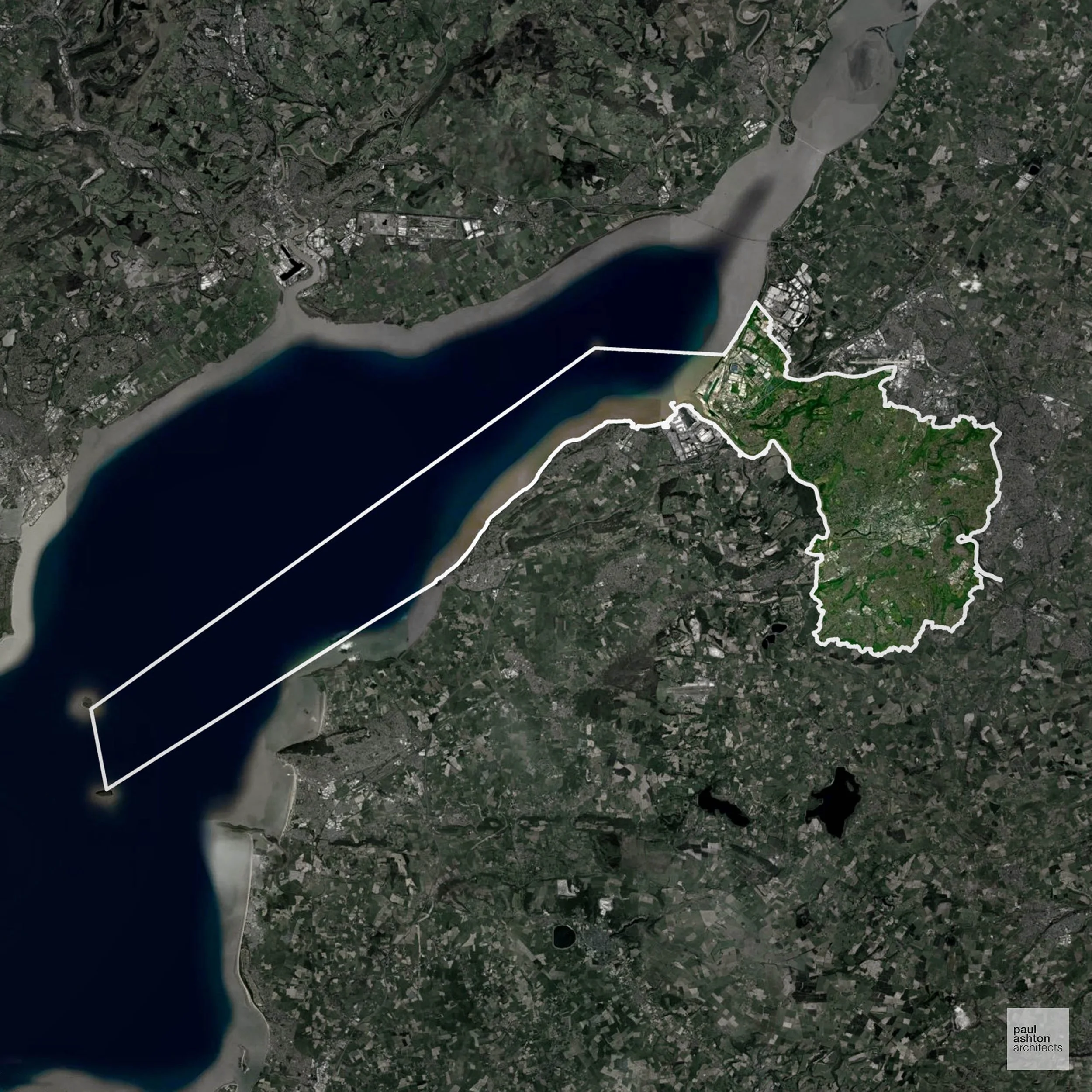
Bristol combines a maritime history with a thriving contemporary urban environment. Areas such as Clifton, Redland, and the city centre feature listed Georgian and Victorian buildings. Green Belt accounts for 5.5% of the district, mainly surrounding outer suburbs. We can provide guidance on schemes from sensitive conversions to new builds throughout Bristol.
In the last year Bristol decided 2,112 applications which is well above the national average of 988. The approval rate was 86% (roughly equal to the national average of 88%) and 62% of applications were decided on time, (on par with the national average of 59%). Stats updated March 2026 from gov. sources. See how Bristol performs relative to other LPAs in our LPA hub.
"We love helping clients win Planning Permission in Bristol"
Conservation and Listed Buildings in Bristol
Bristol has a diverse and layered historic environment, with a wide range of Conservation Areas and heritage assets spanning medieval, industrial, and maritime periods. Planning proposals must carefully consider impacts on historic character, key views, and the setting of listed buildings, particularly in sensitive locations such as the harbour and city centre.
One of the top reasons heritage building applications are refused is causing harm to historic significance, a risk that can arise when proposals are not prepared by a consultant with heritage expertise. We help minimise this risk with expert, site-specific guidance; contact us here.
Green Belt Approvals in Bristol
The Green Belt is a nationally designated area of protected land surrounding many English towns and cities, where development is strictly controlled to prevent urban sprawl.
5.5% of Bristol is within the Green Belt and proposals in these areas can be subject to reasonable levels of scrutiny.
The Green Belt around Bristol safeguards villages such as Bradley Stoke and Almondsbury, rolling farmland, and the northern edges of the Cotswolds, preventing urban sprawl and protecting historic landscapes and ecologically sensitive areas.
In our experience, one of the top reasons poorly conceived Green Belt proposals are refused is causing 'harm to openness'. We can lower the risk of refusal with site-specific guidance. Contact us here.
You can also check whether your land is within the Green Belt using our interactive Green Belt map.
Planning Applications in Bristol
Alongside acting as Planning Consultants we are ARB registered architects with 25+ years of experience. We use the following proven work stages to guide clients in Bristol through the planning process in order to maximise the potential of their development :
- Stage 1: Site Appraisals & Planning Strategy Advice
- Stage 2: Feasibility Studies & Concept Designs
- Stage 3: Planning Application Packages
- Architectural Drawing Packages
- Planning Statements & Design and Access Statements
- Coordination of Consultant Reports
- Direct Liaison with Planning Officers
- Stage 4: Technical Design
- Discharge of Planning Conditions
- Building Regulations and Construction Packages
Planning Services We Offer in Bristol
- Full Planning Applications: Commercial, new buildings, changes of use.
- Householder Planning Applications: Domestic extensions / garden structures.
- Listed Building Consent: Alterations / repairs to listed buildings.
- Conservation Area Consent: Developments within Conservation Areas.
- Lawful Development Certificates: Confirming existing / completed works are lawful.
- Validation Requirements: Gathering documentation to ensure applications are validated by Bristol LPA.
Contextual Planning Support in Bristol
We work collaboratively with clients and shape a design that respects local character and meets Planning Policy requirements in order to maximise your chances of winning Planning Permission.
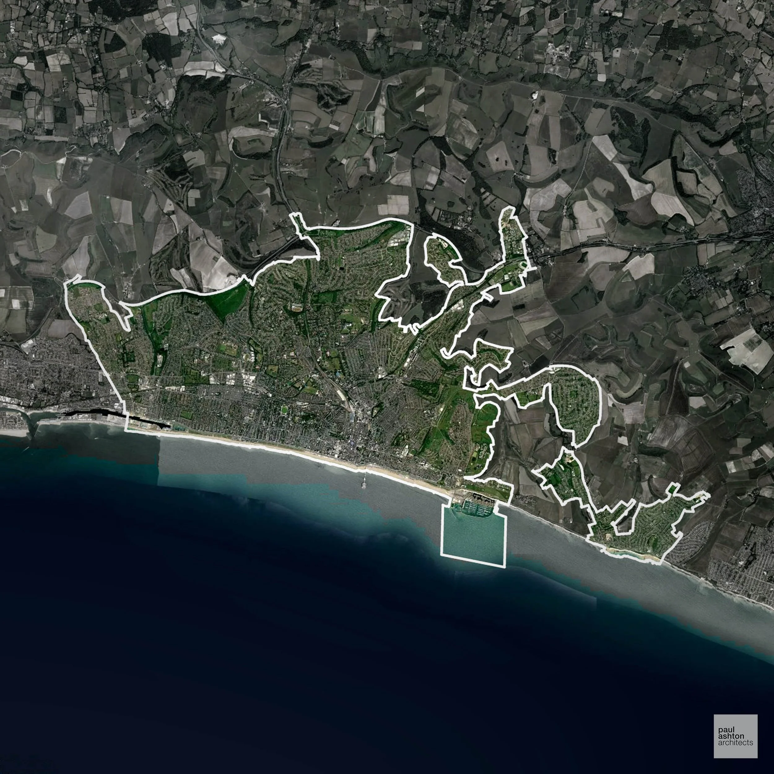
Brighton and Hove is a vibrant coastal city with a rich heritage of Regency architecture and cultural landmarks. Key areas include Kemptown, Hove, and the seafront, with notable conservation areas. The planning context is primarily urban and sensitive to historic preservation. We can help secure Planning Permission for conversions, extensions, and bespoke projects.
In the last year Brighton and Hove decided 1,710 applications which is well above the national average of 988. The approval rate was 89% (roughly equal to the national average of 88%) and 55% of applications were decided on time, (slightly below the national average of 59%). Stats updated March 2026 from gov. sources. See how Brighton and Hove performs relative to other LPAs in our LPA hub.
"We love helping clients win Planning Permission in Brighton and Hove"
Areas of Outstanding Natural Beauty in Brighton and Hove
Areas of Outstanding Natural Beauty (AONBs), often referred to as National Landscapes, are protected for their remarkable natural and scenic value. Any development proposals here are closely evaluated, with a strong presumption against works that could harm the landscape.
Brighton and Hove is partially within the South Downs AONB. Development is restricted to protect scenic and environmental qualities.
In our experience, one of the top reasons proposals in Areas of Outstanding Natural Beauty are refused is causing landscape harm or visual intrusion, a risk that often arises when applications are not fully informed. We help minimise the likelihood of refusal with expert, guidance; contact us here.
Planning Applications in Brighton and Hove
In addition to acting as Planing Conultants we are ARB registered architects with 25+ years of experience. Our planning proposals are creatively tailored to each site to maximise potential and improve planning outcomes. We use the following tried and tested process to guide clients in Brighton and Hove through planning to completion:
- Stage 1: Site Appraisals & Planning Strategy Advice
- Stage 2: Feasibility Studies & Concept Designs
- Stage 3: Planning Application Packages
- Architectural Drawing Packages
- Planning Statements & Design and Access Statements
- Coordination of Consultant Reports
- Direct Liaison with Planning Officers
- Stage 4: Technical Design
- Discharge of Planning Conditions
- Building Regulations and Construction Packages
Planning Services We Offer in Brighton and Hove
- Full Planning Applications: Commercial, new buildings, changes of use.
- Householder Planning Applications: Domestic extensions / garden structures.
- Listed Building Consent: Alterations / repairs to listed buildings.
- Conservation Area Consent: Developments within Conservation Areas.
- Lawful Development Certificates: Confirming existing / completed works are lawful.
- Validation Requirements: Gathering documentation to ensure applications are validated by Brighton and Hove LPA.
Design-Led Planning Advice in Brighton and Hove
We can review your site in Brighton and Hove and offer informed guidance on how proposals can be developed in order to maximise your chances of securing Planning Permission.
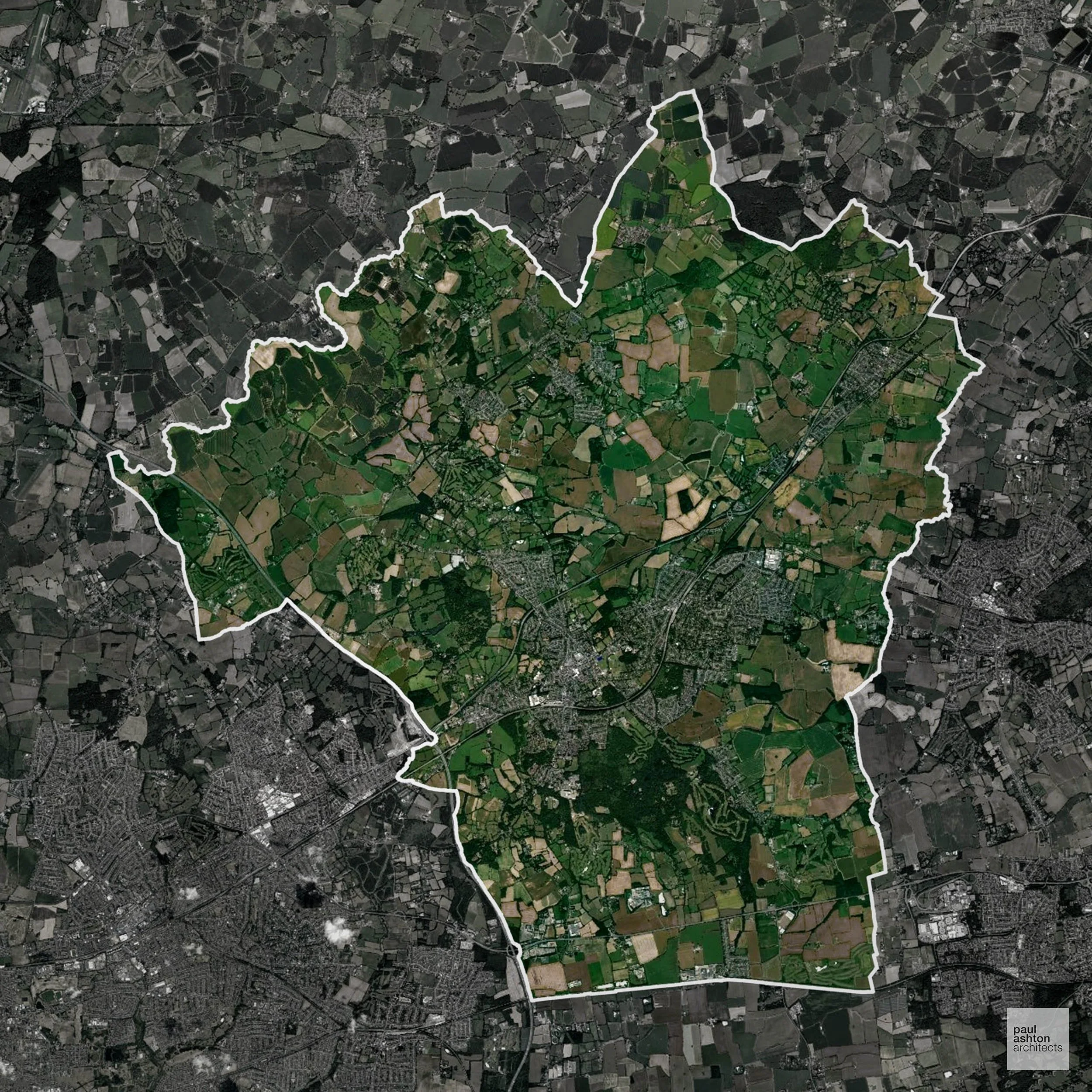
Brentwood in Essex combines the town of Brentwood with surrounding villages like Shenfield and Ingatestone. About 86.8% of the district is Green Belt, shaping where housing and commercial schemes can be located. Planning here balances residential growth with protecting historic landscapes. We can support projects ranging from small extensions to full-scale new-build schemes.
In the last year Brentwood decided 742 applications which is well below the national average of 988. The approval rate was 83% (roughly equal to the national average of 88%) and 33% of applications were decided on time, (significantly below the national average of 59%). Stats updated March 2026 from gov. sources. See how Brentwood performs relative to other LPAs in our LPA hub.
"We love helping clients win Planning Permission in Brentwood"
Green Belt Approvals in Brentwood
The Green Belt is nationally designated land around towns and cities, created to limit urban growth.
Significantly, 86.8% of Brentwood is within the Green Belt and proposals in these areas can be subject to very high levels of scrutiny.
The Brentwood Green Belt near Brentwood town and Dunton Hills limits development to protect historic parkland and woodland, while preventing urban merge with London suburbs.
In our experience, one of the top reasons poorly conceived Green Belt proposals are refused is causing 'harm to openness'. We can lower the risk of refusal with site-specific guidance. Contact us here.
You can also check whether your land is within the Green Belt using our interactive Green Belt map.
Planning Applications in Brentwood
As well as acting as Planning Consultants we are ARB registered architects with over 25 years’ experience. Our site-specific planning proposals balance creativity with strategic insight. We use the following field-tested work stages to help clients in Brentwood achieve successful planning outcomes:
- Stage 1: Site Appraisals & Planning Strategy Advice
- Stage 2: Feasibility Studies & Concept Designs
- Stage 3: Planning Application Packages
- Architectural Drawing Packages
- Planning Statements & Design and Access Statements
- Coordination of Consultant Reports
- Direct Liaison with Planning Officers
- Stage 4: Technical Design
- Discharge of Planning Conditions
- Building Regulations and Construction Packages
Planning Services We Offer in Brentwood
- Full Planning Applications: Commercial, new buildings, changes of use.
- Householder Planning Applications: Domestic extensions / garden structures.
- Listed Building Consent: Alterations / repairs to listed buildings.
- Conservation Area Consent: Developments within Conservation Areas.
- Lawful Development Certificates: Confirming existing / completed works are lawful.
- Validation Requirements: Gathering documentation to ensure applications are validated by Brentwood LPA.
Design-Led Planning Advice in Brentwood
We can review your site in Brentwood and offer informed guidance on how proposals can be developed in order to maximise your chances of securing Planning Permission.
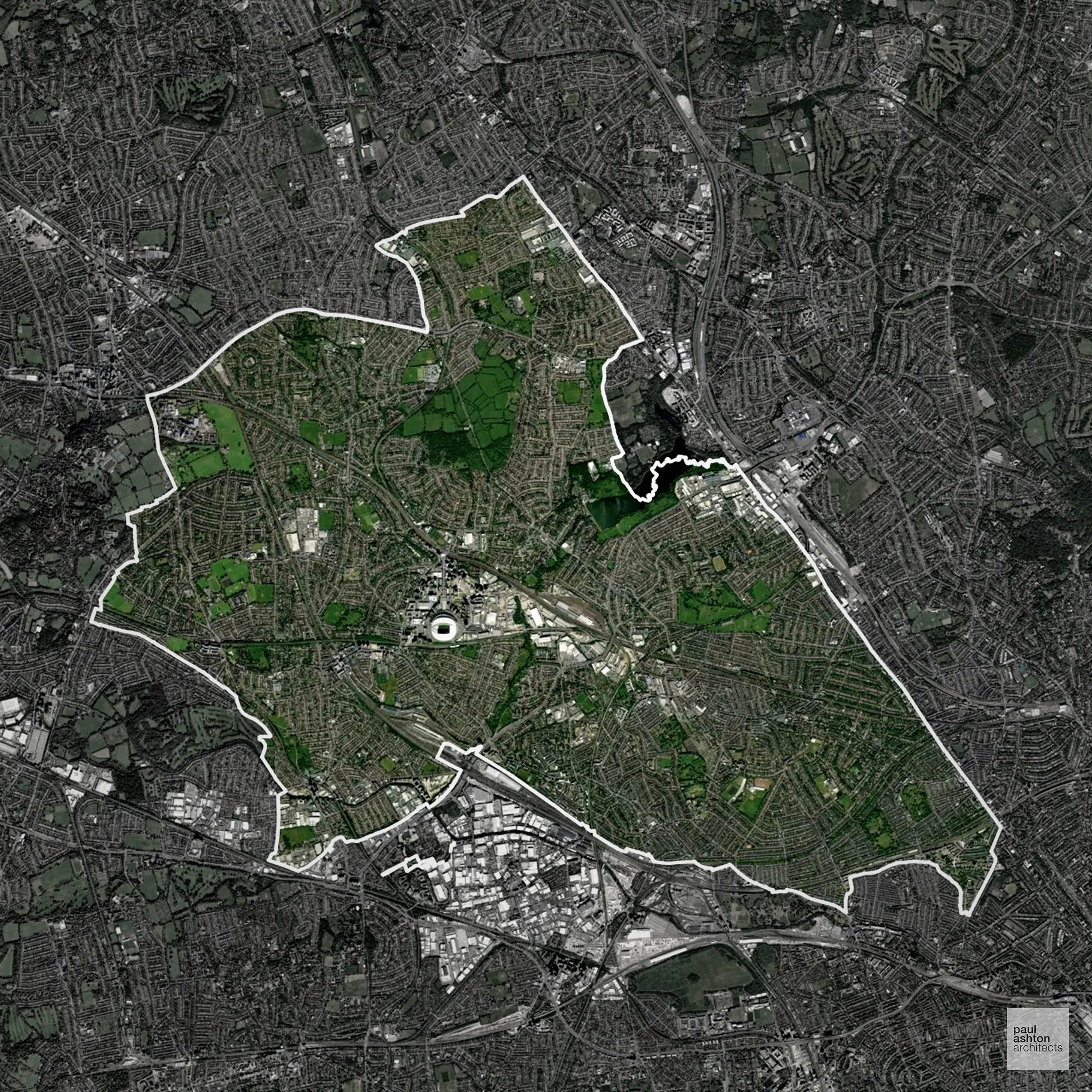
Brent in North West London includes Wembley, Kilburn, and Harlesden. The borough is known for Wembley Stadium, diverse communities, and conservation areas. We can advise on residential, commercial, and mixed-use proposals throughout Brent.
In the last year Brent decided 2,022 applications which is well above the national average of 988. The approval rate was 79% (slightly below the national average of 88%) and 70% of applications were decided on time, (significantly above the national average of 59%). Stats updated March 2026 from gov. sources. See how Brent performs relative to other LPAs in our LPA hub.
"We love helping clients win Planning Permission in Brent"
Planning Applications in Brent
As well as acting as Planning Consultants we are ARB registered architects with over 25 years’ experience. Our site-specific planning proposals balance creativity with strategic insight. We use the following field-tested work stages to help clients in Brent achieve successful planning outcomes:
- Stage 1: Site Appraisals & Planning Strategy Advice
- Stage 2: Feasibility Studies & Concept Designs
- Stage 3: Planning Application Packages
- Architectural Drawing Packages
- Planning Statements & Design and Access Statements
- Coordination of Consultant Reports
- Direct Liaison with Planning Officers
- Stage 4: Technical Design
- Discharge of Planning Conditions
- Building Regulations and Construction Packages
Planning Services We Offer in Brent
- Full Planning Applications: Commercial, new buildings, changes of use.
- Householder Planning Applications: Domestic extensions / garden structures.
- Listed Building Consent: Alterations / repairs to listed buildings.
- Conservation Area Consent: Developments within Conservation Areas.
- Lawful Development Certificates: Confirming existing / completed works are lawful.
- Validation Requirements: Gathering documentation to ensure applications are validated by Brent LPA.
Design-Led Planning Advice in Brent
We can review your site in Brent and offer informed guidance on how proposals can be developed in order to maximise your chances of securing Planning Permission.
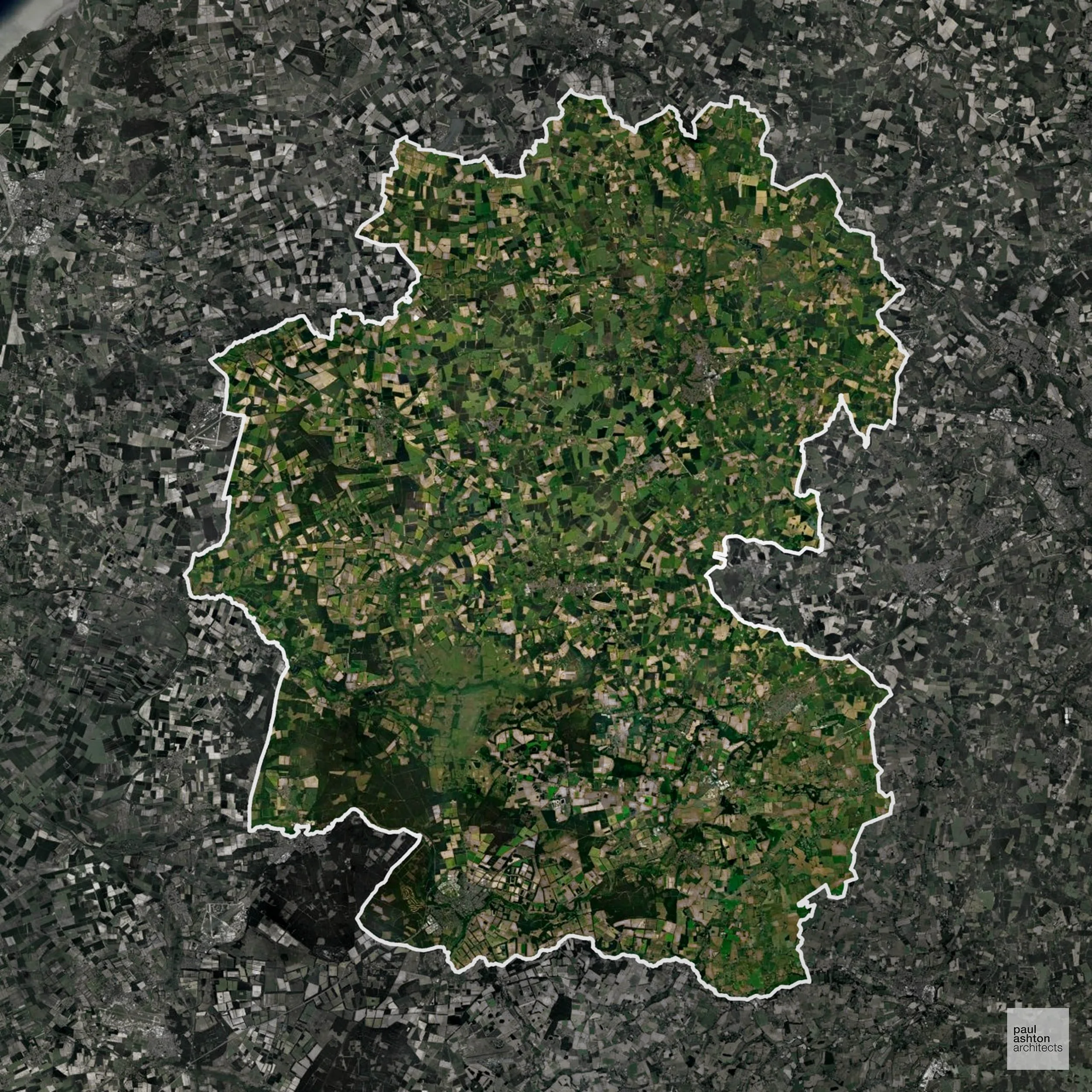
Breckland in Norfolk covers towns such as Thetford, Dereham, and Attleborough. The area is characterised by historic market towns, agricultural landscapes, and conservation villages. We can provide expertise for residential, commercial, and conversion schemes across the district.
In the last year Breckland decided 799 applications which is slightly below the national average of 988. The approval rate was 84% (roughly equal to the national average of 88%) and 63% of applications were decided on time, (slightly above the national average of 59%). Stats updated March 2026 from gov. sources. See how Breckland performs relative to other LPAs in our LPA hub.
"We love helping clients win Planning Permission in Breckland"
Areas of Outstanding Natural Beauty in Breckland
Areas of Outstanding Natural Beauty (AONBs), (now often referred to as National Landscapes), are protected areas recognised for their exceptional scenic and natural value. For developers, this means that planning proposals within these areas are carefully scrutinised, with a strong presumption against inappropriate development.
Breckland overlaps with the Brecks AONB. Development proposals are assessed for ecological and landscape sensitivity.
In our experience, one of the top reasons proposals in Areas of Outstanding Natural Beauty are refused is causing landscape harm or visual intrusion, a risk that often arises when applications are not fully informed. We help minimise the likelihood of refusal with expert, guidance; contact us here.
Development in the Open Countryside
Open Countryside within Breckland refers to land situated outside built-up areas and Green Belt boundaries, typically comprising farmland or natural landscapes. Residential development is generally restricted unless special circumstances can be demonstrated.
Breckland’s heathlands and sparsely wooded farmland are internationally recognised for biodiversity, restricting urban expansion.
One of the top reasons poorly prepared proposals in the Open Countryside are refused is that they fail to demonstrate a policy-supported need. To minimise that risk with bespoke advice contact us here.
Nutrient Neutrality in Breckland
Nutrient Neutrality ensures new developments do not increase harmful nitrogen or phosphorus levels in sensitive waterways. Within the River Wensum and Broads SAC catchments; both nitrogen and phosphorus neutrality are required for development generating additional overnight stays, causing significant delays to housing delivery across Norfolk. Unfortunately, Nutrient Neutrality can halt development completely. If you need early-stage, project-specific advice contact us here.
Planning Applications in Breckland
In addition to acting as Planing Conultants we are ARB registered architects with 25+ years of experience. Our planning proposals are creatively tailored to each site to maximise potential and improve planning outcomes. We use the following tried and tested process to guide clients in Breckland through planning to completion:
- Stage 1: Site Appraisals & Planning Strategy Advice
- Stage 2: Feasibility Studies & Concept Designs
- Stage 3: Planning Application Packages
- Architectural Drawing Packages
- Planning Statements & Design and Access Statements
- Coordination of Consultant Reports
- Direct Liaison with Planning Officers
- Stage 4: Technical Design
- Discharge of Planning Conditions
- Building Regulations and Construction Packages
Planning Services We Offer in Breckland
- Full Planning Applications: Commercial, new buildings, changes of use.
- Householder Planning Applications: Domestic extensions / garden structures.
- Listed Building Consent: Alterations / repairs to listed buildings.
- Conservation Area Consent: Developments within Conservation Areas.
- Lawful Development Certificates: Confirming existing / completed works are lawful.
- Validation Requirements: Gathering documentation to ensure applications are validated by Breckland LPA.
Contextual Planning Support in Breckland
We work collaboratively with clients and shape a design that respects local character and meets Planning Policy requirements in order to maximise your chances of winning Planning Permission.
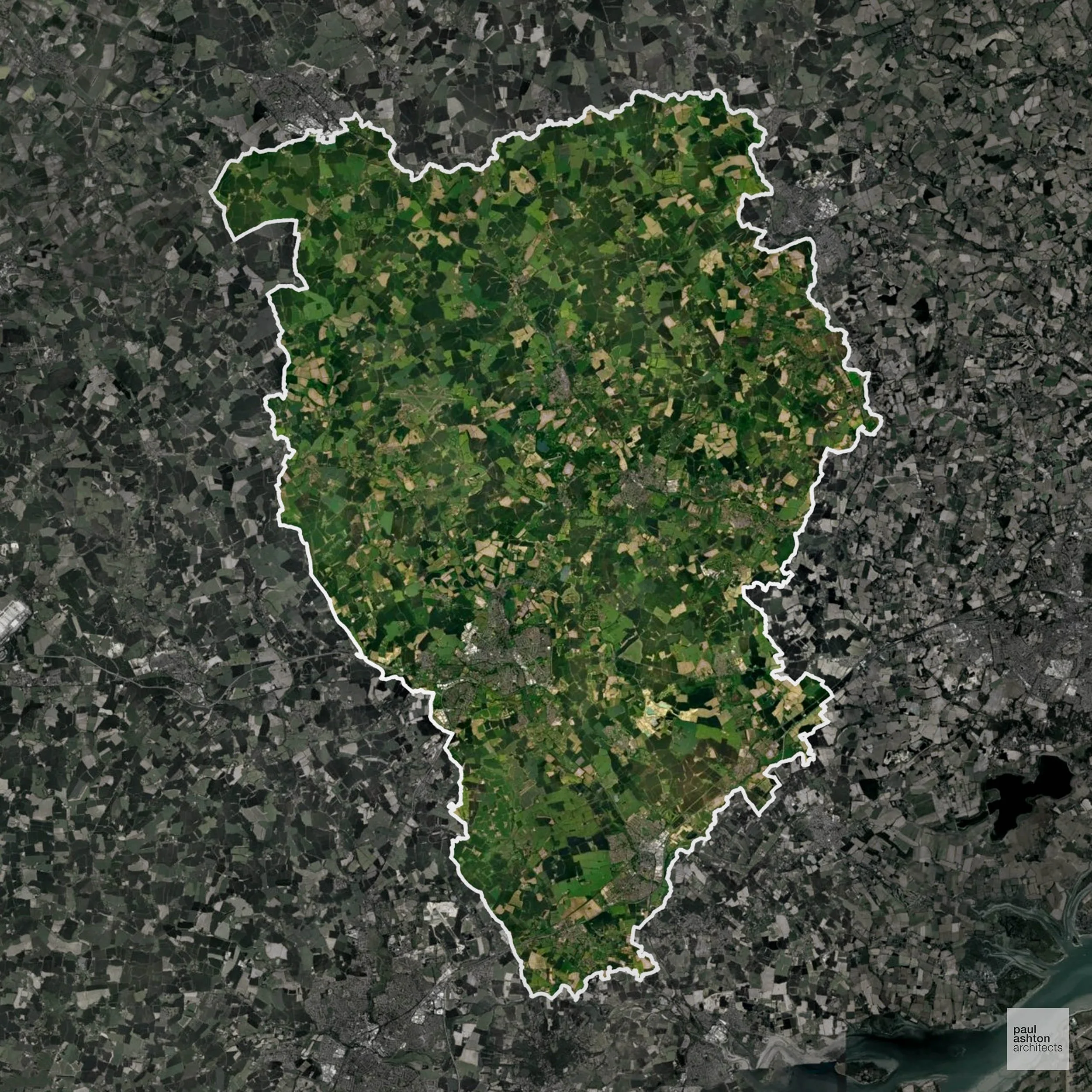
Braintree in Essex includes Braintree, Witham, and Halstead, towns known for their market heritage and historic industrial buildings. We can assist with projects ranging from residential extensions to larger mixed-use developments.
In the last year Braintree decided 917 applications which is slightly below the national average of 988. The approval rate was 86% (roughly equal to the national average of 88%) and 68% of applications were decided on time, (significantly above the national average of 59%). Stats updated March 2026 from gov. sources. See how Braintree performs relative to other LPAs in our LPA hub.
"We love helping clients win Planning Permission in Braintree"
Development in the Open Countryside
Open Countryside within Braintree refers to land situated outside built-up areas and Green Belt boundaries, typically comprising farmland or natural landscapes. Residential development is generally restricted unless special circumstances can be demonstrated.
Braintree’s rolling arable fields and hedgerow landscapes form a visually sensitive setting that development must respect.
One of the top reasons poorly prepared proposals in the Open Countryside are refused is that they fail to demonstrate a policy-supported need. To minimise that risk with bespoke advice contact us here.
Planning Applications in Braintree
In addition to acting as Planing Conultants we are ARB registered architects with 25+ years of experience. Our planning proposals are creatively tailored to each site to maximise potential and improve planning outcomes. We use the following tried and tested process to guide clients in Braintree through planning to completion:
- Stage 1: Site Appraisals & Planning Strategy Advice
- Stage 2: Feasibility Studies & Concept Designs
- Stage 3: Planning Application Packages
- Architectural Drawing Packages
- Planning Statements & Design and Access Statements
- Coordination of Consultant Reports
- Direct Liaison with Planning Officers
- Stage 4: Technical Design
- Discharge of Planning Conditions
- Building Regulations and Construction Packages
Planning Services We Offer in Braintree
- Full Planning Applications: Commercial, new buildings, changes of use.
- Householder Planning Applications: Domestic extensions / garden structures.
- Listed Building Consent: Alterations / repairs to listed buildings.
- Conservation Area Consent: Developments within Conservation Areas.
- Lawful Development Certificates: Confirming existing / completed works are lawful.
- Validation Requirements: Gathering documentation to ensure applications are validated by Braintree LPA.
Design-Led Planning Advice in Braintree
We can review your site in Braintree and offer informed guidance on how proposals can be developed in order to maximise your chances of securing Planning Permission.
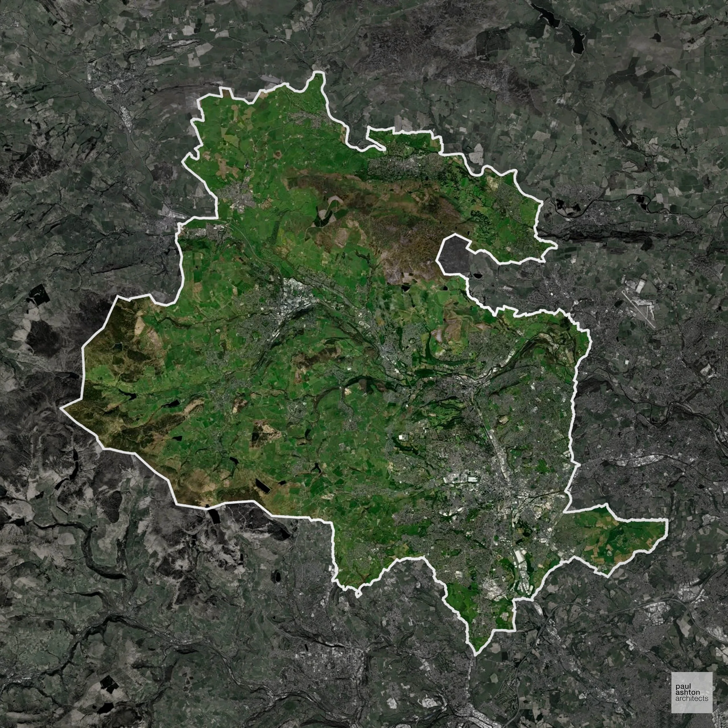
Bradford in West Yorkshire is a diverse city with a rich industrial heritage and significant textile history. Districts include Shipley, Keighley, and the city centre, which houses iconic listed buildings and conservation areas. Approximately 65.2% of the district is Green Belt, framing urban expansion and town planning. We can advise clients on projects across the city, from conversions to new builds.
In the last year Bradford decided 2,330 applications which is well above the national average of 988. The approval rate was 85% (roughly equal to the national average of 88%) and 62% of applications were decided on time, (slightly above the national average of 59%). Stats updated March 2026 from gov. sources. See how Bradford performs relative to other LPAs in our LPA hub.
"We love helping clients win Planning Permission in Bradford"
Areas of Outstanding Natural Beauty in Bradford
Areas of Outstanding Natural Beauty (AONBs), sometimes called National Landscapes, are designated for their exceptional scenic and natural importance. Planning proposals in these areas face close scrutiny, with a strong presumption against inappropriate development.
Bradford includes parts of the South Pennines AONB. Proposals must respect landscape character and visual amenity.
In our experience, one of the top reasons proposals in Areas of Outstanding Natural Beauty are refused is causing landscape harm or visual intrusion, a risk that often arises when applications are not fully informed. We help minimise the likelihood of refusal with expert, guidance; contact us here.
Green Belt Approvals in Bradford
The Green Belt is a nationally designated area of protected land surrounding many English towns and cities, where development is strictly controlled to prevent urban sprawl.
Significantly, 65.2% of Bradford is within the Green Belt and proposals in these areas can be subject to high levels of scrutiny.
The Green Belt near Ilkley, Addingham, and Keighley limits growth to preserve landscape character, ecological assets, and separation between settlements.
In our experience, one of the top reasons poorly conceived Green Belt proposals are refused is causing 'harm to openness'. We can lower the risk of refusal with site-specific guidance. Contact us here.
You can also check whether your land is within the Green Belt using our interactive Green Belt map.
Planning Applications in Bradford
Alongside acting as Planning Consultants we are ARB registered architects with 25+ years of experience. We use the following proven work stages to guide clients in Bradford through the planning process in order to maximise the potential of their development :
- Stage 1: Site Appraisals & Planning Strategy Advice
- Stage 2: Feasibility Studies & Concept Designs
- Stage 3: Planning Application Packages
- Architectural Drawing Packages
- Planning Statements & Design and Access Statements
- Coordination of Consultant Reports
- Direct Liaison with Planning Officers
- Stage 4: Technical Design
- Discharge of Planning Conditions
- Building Regulations and Construction Packages
Planning Services We Offer in Bradford
- Full Planning Applications: Commercial, new buildings, changes of use.
- Householder Planning Applications: Domestic extensions / garden structures.
- Listed Building Consent: Alterations / repairs to listed buildings.
- Conservation Area Consent: Developments within Conservation Areas.
- Lawful Development Certificates: Confirming existing / completed works are lawful.
- Validation Requirements: Gathering documentation to ensure applications are validated by Bradford LPA.
Design-Led Planning Advice in Bradford
We can review your site in Bradford and offer informed guidance on how proposals can be developed in order to maximise your chances of securing Planning Permission.
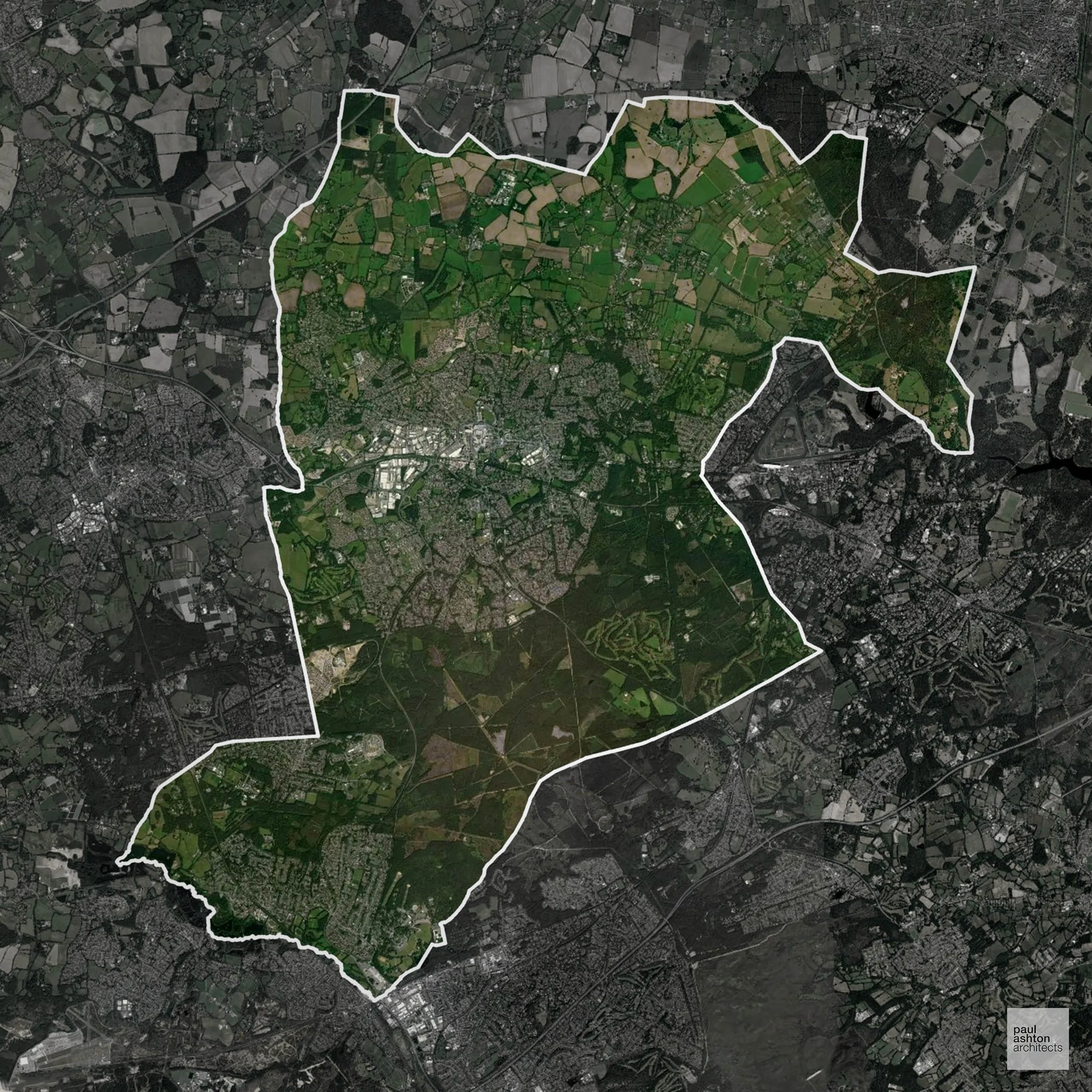
Bracknell Forest in Berkshire combines Bracknell, Sandhurst, and Crowthorne, with a mix of urban and green areas. About 35.1% of the district is Green Belt, influencing where growth can be accommodated. Planning often involves balancing residential growth with conservation areas. We can deliver Planning Permission for housing schemes, commercial developments, and town centre projects.
In the last year Bracknell Forest decided 524 applications which is well below the national average of 988. The approval rate was 86% (roughly equal to the national average of 88%) and 41% of applications were decided on time, (significantly below the national average of 59%). Stats updated March 2026 from gov. sources. See how Bracknell Forest performs relative to other LPAs in our LPA hub.
"We love helping clients win Planning Permission in Bracknell Forest"
Green Belt Approvals in Bracknell Forest
The Green Belt is a policy protecting land around many English towns and cities, where development is tightly controlled to safeguard the open countryside.
35.1% of Bracknell Forest is within the Green Belt and proposals in these areas can be subject to high levels of scrutiny.
The Green Belt within Bracknell Forest contains heathland, woodland, and farmland around Bracknell, protecting village edges and recreational areas from encroachment.
In our experience, one of the top reasons poorly conceived Green Belt proposals are refused is causing 'harm to openness'. We can lower the risk of refusal with site-specific guidance. Contact us here.
You can also check whether your land is within the Green Belt using our interactive Green Belt map.
Development in the Open Countryside
The Open Countryside is generally defined as land outside settlement and Green Belt boundaries, often comprising agricultural or natural land. Development, particularly standard residential development, is usually restricted in Open Countryside.
Bracknell Forest's remaining countryside includes Windsor Forest fringes, Thames Basin Heaths, and the wooded corridors of Swinley Forest, where ecological designations restrict most new development.
One of the top reasons poorly prepared proposals in the Open Countryside are refused is that they fail to demonstrate a policy-supported need. To minimise that risk with bespoke advice contact us here.
Planning Applications in Bracknell Forest
As well as acting as Planning Consultants we are ARB registered architects with over 25 years’ experience. Our site-specific planning proposals balance creativity with strategic insight. We use the following field-tested work stages to help clients in Bracknell Forest achieve successful planning outcomes:
- Stage 1: Site Appraisals & Planning Strategy Advice
- Stage 2: Feasibility Studies & Concept Designs
- Stage 3: Planning Application Packages
- Architectural Drawing Packages
- Planning Statements & Design and Access Statements
- Coordination of Consultant Reports
- Direct Liaison with Planning Officers
- Stage 4: Technical Design
- Discharge of Planning Conditions
- Building Regulations and Construction Packages
Planning Services We Offer in Bracknell Forest
- Full Planning Applications: Commercial, new buildings, changes of use.
- Householder Planning Applications: Domestic extensions / garden structures.
- Listed Building Consent: Alterations / repairs to listed buildings.
- Conservation Area Consent: Developments within Conservation Areas.
- Lawful Development Certificates: Confirming existing / completed works are lawful.
- Validation Requirements: Gathering documentation to ensure applications are validated by Bracknell Forest LPA.
Contextual Planning Support in Bracknell Forest
We work collaboratively with clients and shape a design that respects local character and meets Planning Policy requirements in order to maximise your chances of winning Planning Permission.
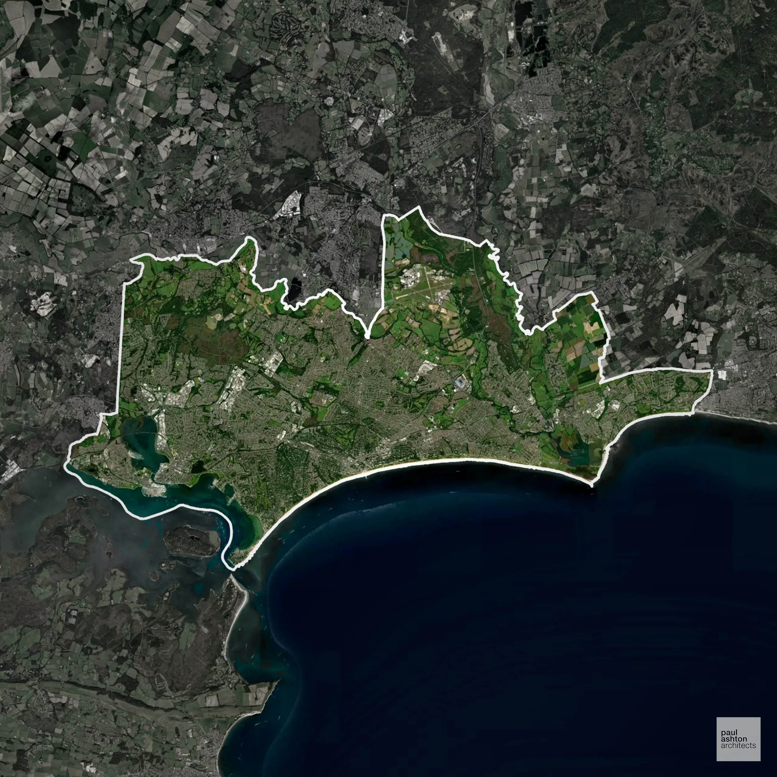
This coastal conurbation in Dorset features Bournemouth, Poole, and Christchurch. It is known for sandy beaches, Victorian and Georgian architecture, and Poole Harbour. Around 35% of the area is Green Belt, affecting development on the outskirts of the urban centres. We support a variety of projects, including conversions, extensions, and bespoke new-build schemes across the area.
In the last year Bournemouth, Christchurch and Poole decided 2,150 applications which is well above the national average of 988. The approval rate was 83% (slightly below the national average of 88%) and 37% of applications were decided on time, (significantly below the national average of 59%). Stats updated March 2026 from gov. sources. See how Bournemouth, Christchurch and Poole performs relative to other LPAs in our LPA hub.
"We love helping clients win Planning Permission in Bournemouth, Christchurch and Poole"
Areas of Outstanding Natural Beauty in Bournemouth, Christchurch and Poole
Areas of Outstanding Natural Beauty (AONBs), sometimes called National Landscapes, are designated for their exceptional scenic and natural importance. Planning proposals in these areas face close scrutiny, with a strong presumption against inappropriate development.
Bournemouth, Christchurch and Poole is partly within the Dorset AONB. Development must consider scenic, ecological, and recreational impacts.
In our experience, one of the top reasons proposals in Areas of Outstanding Natural Beauty are refused is causing landscape harm or visual intrusion, a risk that often arises when applications are not fully informed. We help minimise the likelihood of refusal with expert, guidance; contact us here.
Green Belt Approvals in Bournemouth, Christchurch and Poole
The Green Belt is a nationally designated area of protected land surrounding many English towns and cities, where development is strictly controlled to prevent urban sprawl.
35.0% of Bournemouth, Christchurch and Poole is within the Green Belt and proposals in these areas can be subject to high levels of scrutiny.
The Green Belt within Bournemouth, Christchurch and Poole covers rural hinterlands, coastal edges, and farmland surrounding Poole and Bournemouth, protecting villages and open countryside from urban expansion.
In our experience, one of the top reasons poorly conceived Green Belt proposals are refused is causing 'harm to openness'. We can lower the risk of refusal with site-specific guidance. Contact us here.
You can also check whether your land is within the Green Belt using our interactive Green Belt map.
Flood Risk in Bournemouth, Christchurch and Poole
In some areas of the LPA, flood risk plays a key role in determining planning proposals. The confluence of the rivers Stour and Avon, combined with tidal harbour areas and a low-lying coast, creates extensive Flood Zone 3 constraints across the conurbation. Where constraints permit, we can develop proposals that manage flood risk thoughtfully to give applications the best chance of approval.
Nutrient Neutrality in Bournemouth, Christchurch and Poole
Nutrient Neutrality ensures new developments do not increase harmful nitrogen or phosphorus levels in sensitive waterways. Bournemouth, Christchurch and Poole is entirely within the Poole Harbour designated sensitive catchment; nitrogen neutrality is required for all new residential development. Unfortunately, Nutrient Neutrality can halt development completely. If you need early-stage, project-specific advice contact us here.
Planning Applications in Bournemouth, Christchurch and Poole
As well as acting as Planning Consultants we are ARB registered architects with over 25 years’ experience. Our site-specific planning proposals balance creativity with strategic insight. We use the following field-tested work stages to help clients in Bournemouth, Christchurch and Poole achieve successful planning outcomes:
- Stage 1: Site Appraisals & Planning Strategy Advice
- Stage 2: Feasibility Studies & Concept Designs
- Stage 3: Planning Application Packages
- Architectural Drawing Packages
- Planning Statements & Design and Access Statements
- Coordination of Consultant Reports
- Direct Liaison with Planning Officers
- Stage 4: Technical Design
- Discharge of Planning Conditions
- Building Regulations and Construction Packages
Planning Services We Offer in Bournemouth, Christchurch and Poole
- Full Planning Applications: Commercial, new buildings, changes of use.
- Householder Planning Applications: Domestic extensions / garden structures.
- Listed Building Consent: Alterations / repairs to listed buildings.
- Conservation Area Consent: Developments within Conservation Areas.
- Lawful Development Certificates: Confirming existing / completed works are lawful.
- Validation Requirements: Gathering documentation to ensure applications are validated by Bournemouth, Christchurch and Poole LPA.
Design-Led Planning Advice in Bournemouth, Christchurch and Poole
We can review your site in Bournemouth, Christchurch and Poole and offer informed guidance on how proposals can be developed in order to maximise your chances of securing Planning Permission.
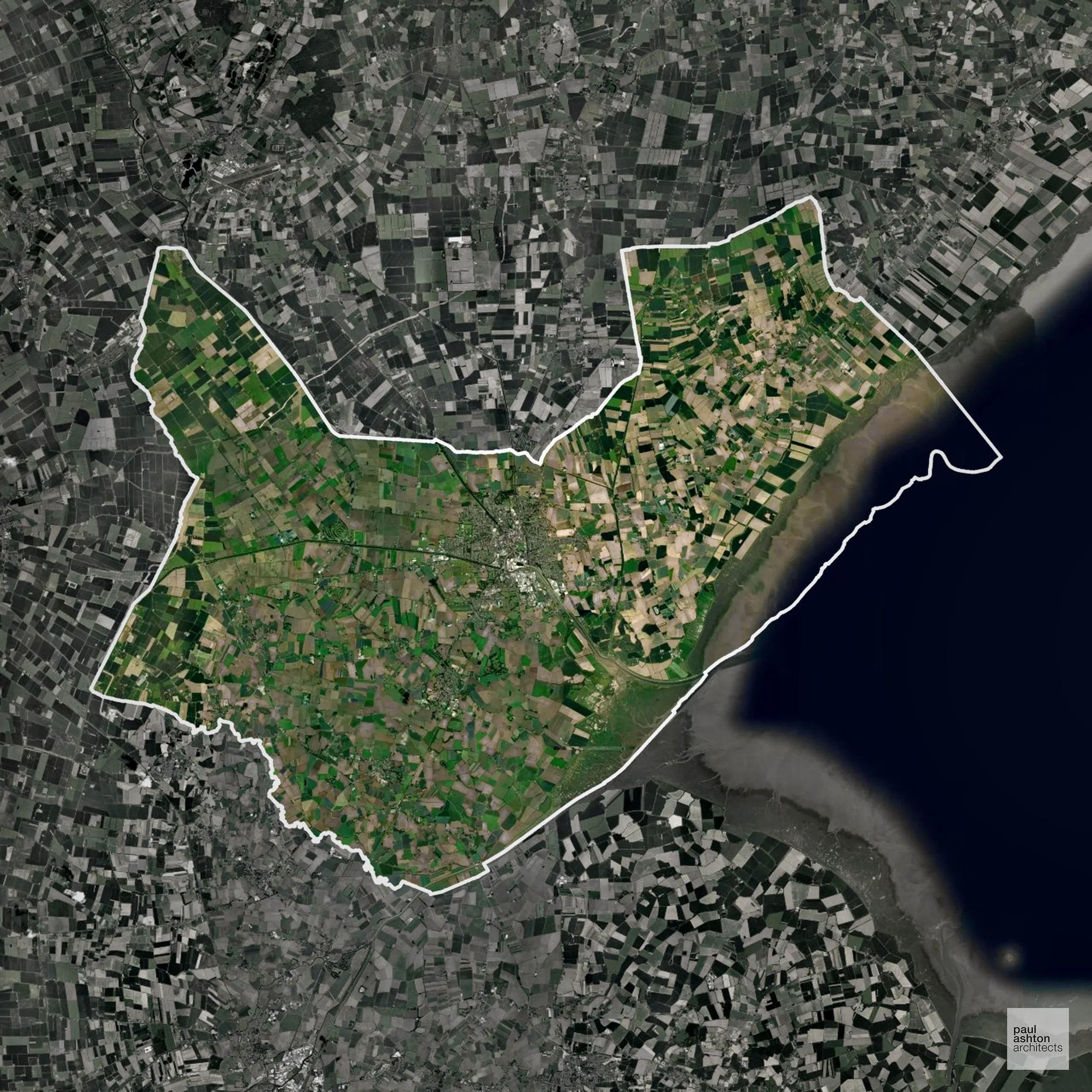
Boston in Lincolnshire is a market town famous for St Botolph’s Church, known locally as the “Stump,” and its historic port. The borough includes surrounding villages like Kirton and Fishtoft, with a mix of agriculture and heritage buildings. Planning here requires understanding both conservation and flood risk considerations. We assist with residential and commercial schemes, from minor works to full-scale developments.
In the last year Boston decided 308 applications which is well below the national average of 988. The approval rate was 91% (roughly equal to the national average of 88%) and 57% of applications were decided on time, (on par with the national average of 59%). Stats updated March 2026 from gov. sources. See how Boston performs relative to other LPAs in our LPA hub.
"We love helping clients win Planning Permission in Boston"
Development in the Open Countryside
Boston includes areas classed as Open Countryside, generally encompassing land beyond settlements and Green Belt zones, often used for agriculture or left as natural landscapes. Development in these areas is tightly controlled, with standard residential proposals rarely permitted.
Boston’s flat fenland countryside is distinctive for its agricultural productivity and historic drainage patterns, warranting careful planning consideration.
One of the top reasons poorly prepared proposals in the Open Countryside are refused is that they fail to demonstrate a policy-supported need. To minimise that risk with bespoke advice contact us here.
Flood Risk in Boston
In some areas of the LPA, flood risk plays a key role in determining planning proposals. Boston contains of the highest flood risk districts in England, with around 40% of land in Flood Zone 3 due to the tidal River Witham and its position within the low-lying Fens. Where constraints permit, we can develop proposals that manage flood risk thoughtfully to give applications the best chance of approval.
Planning Applications in Boston
As well as acting as Planning Consultants we are ARB registered architects with over 25 years’ experience. Our site-specific planning proposals balance creativity with strategic insight. We use the following field-tested work stages to help clients in Boston achieve successful planning outcomes:
- Stage 1: Site Appraisals & Planning Strategy Advice
- Stage 2: Feasibility Studies & Concept Designs
- Stage 3: Planning Application Packages
- Architectural Drawing Packages
- Planning Statements & Design and Access Statements
- Coordination of Consultant Reports
- Direct Liaison with Planning Officers
- Stage 4: Technical Design
- Discharge of Planning Conditions
- Building Regulations and Construction Packages
Planning Services We Offer in Boston
- Full Planning Applications: Commercial, new buildings, changes of use.
- Householder Planning Applications: Domestic extensions / garden structures.
- Listed Building Consent: Alterations / repairs to listed buildings.
- Conservation Area Consent: Developments within Conservation Areas.
- Lawful Development Certificates: Confirming existing / completed works are lawful.
- Validation Requirements: Gathering documentation to ensure applications are validated by Boston LPA.
Creative Planning Advice in Boston
We collaborate closely with our clients to develop designs that respond to local character and align with Planning Policy, helping to maximise the likelihood of securing Planning Permission in Boston.
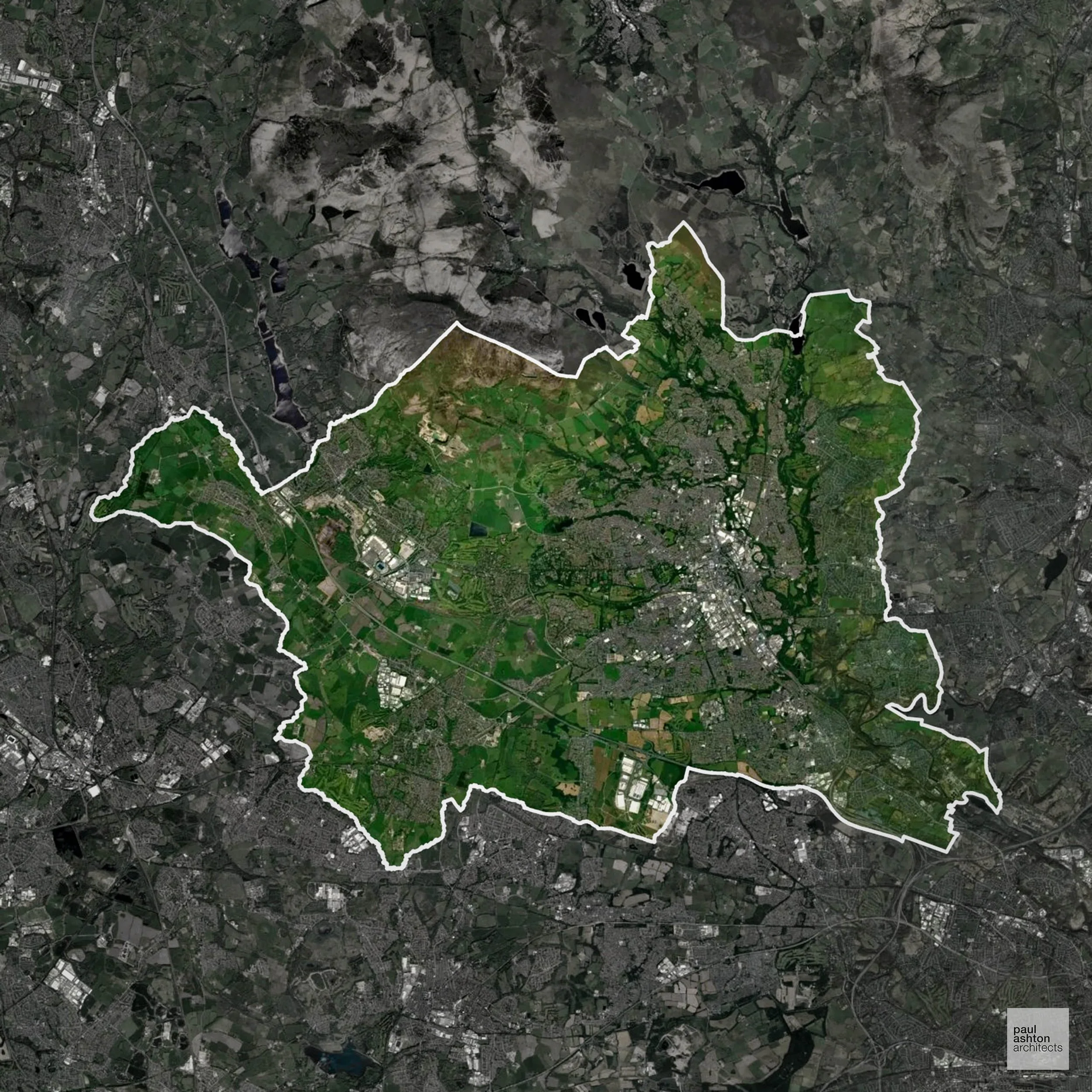
Bolton in Greater Manchester is a historic mill town with a strong industrial past and lively cultural scene. Key areas include Farnworth, Horwich, and the town centre, with notable buildings like Smithills Hall. About 50.3% of the borough is Green Belt, shaping development around its suburbs and open countryside. We advise on sensitive conversions and new builds throughout Bolton.
In the last year Bolton decided 981 applications which is broadly in line with the national average of 988. The approval rate was 81% (slightly below the national average of 88%) and 56% of applications were decided on time, (on par with the national average of 59%). Stats updated March 2026 from gov. sources. See how Bolton performs relative to other LPAs in our LPA hub.
"We love helping clients win Planning Permission in Bolton"
Green Belt Approvals in Bolton
The Green Belt is nationally designated land around towns and cities, created to limit urban growth.
Significantly, 50.3% of Bolton is within the Green Belt and proposals in these areas can be subject to high levels of scrutiny.
The Green Belt near Westhoughton and Horwich limits development to protect open landscapes and maintain village separation.
In our experience, one of the top reasons poorly conceived Green Belt proposals are refused is causing 'harm to openness'. We can lower the risk of refusal with site-specific guidance. Contact us here.
You can also check whether your land is within the Green Belt using our interactive Green Belt map.
Planning Applications in Bolton
In addition to acting as Planing Conultants we are ARB registered architects with 25+ years of experience. Our planning proposals are creatively tailored to each site to maximise potential and improve planning outcomes. We use the following tried and tested process to guide clients in Bolton through planning to completion:
- Stage 1: Site Appraisals & Planning Strategy Advice
- Stage 2: Feasibility Studies & Concept Designs
- Stage 3: Planning Application Packages
- Architectural Drawing Packages
- Planning Statements & Design and Access Statements
- Coordination of Consultant Reports
- Direct Liaison with Planning Officers
- Stage 4: Technical Design
- Discharge of Planning Conditions
- Building Regulations and Construction Packages
Planning Services We Offer in Bolton
- Full Planning Applications: Commercial, new buildings, changes of use.
- Householder Planning Applications: Domestic extensions / garden structures.
- Listed Building Consent: Alterations / repairs to listed buildings.
- Conservation Area Consent: Developments within Conservation Areas.
- Lawful Development Certificates: Confirming existing / completed works are lawful.
- Validation Requirements: Gathering documentation to ensure applications are validated by Bolton LPA.
Contextual Planning Support in Bolton
We work collaboratively with clients and shape a design that respects local character and meets Planning Policy requirements in order to maximise your chances of winning Planning Permission.
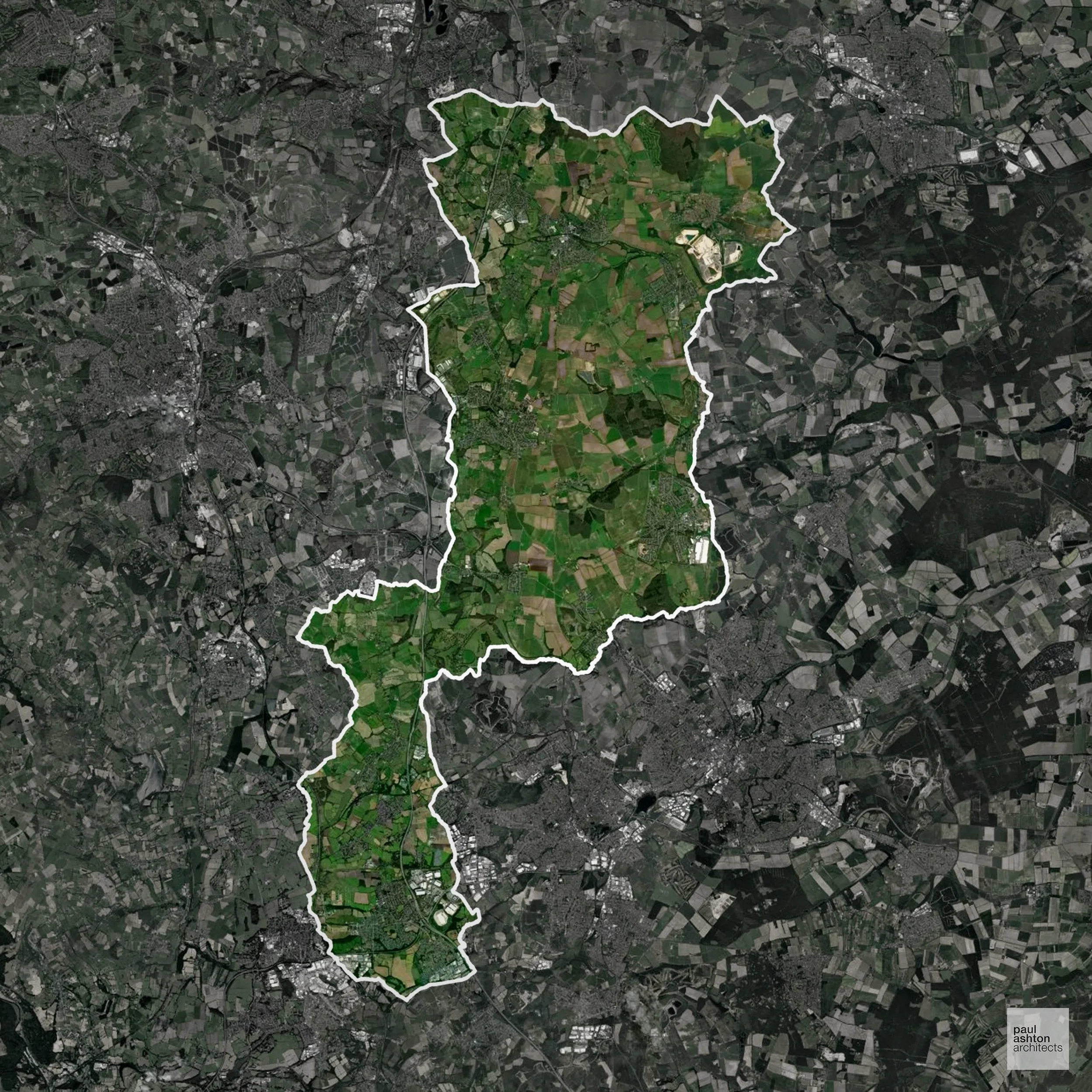
Bolsover District in Derbyshire includes Bolsover, Clowne, Shirebrook, and South Normanton. The area is known for Bolsover Castle, the mining heritage, and traditional market towns. Historic buildings like the Cundy House highlight the district's industrial past. Approximately 6.7% of the district lies within Green Belt, influencing the planning context around the edges of towns. We secure Planning Permission for residential, commercial, and conversion schemes, navigating the council's policies efficiently.
In the last year Bolsover decided 294 applications which is well below the national average of 988. The approval rate was 96% (marginally above the national average of 88%) and 66% of applications were decided on time, (significantly above the national average of 59%). Stats updated March 2026 from gov. sources. See how Bolsover performs relative to other LPAs in our LPA hub.
"We love helping clients win Planning Permission in Bolsover"
Green Belt Approvals in Bolsover
The Green Belt is a nationally designated area of protected land surrounding many English towns and cities, where development is strictly controlled to prevent urban sprawl.
6.7% of Bolsover is within the Green Belt and proposals in these areas can be subject to reasonable levels of scrutiny.
The Bolsover Green Belt preserves the surrounding countryside, small villages such as Clowne and Tibshelf, and farmland, helping to prevent coalescence with nearby towns and protecting sensitive historic and ecological landscapes.
In our experience, one of the top reasons poorly conceived Green Belt proposals are refused is causing 'harm to openness'. We can lower the risk of refusal with site-specific guidance. Contact us here.
You can also check whether your land is within the Green Belt using our interactive Green Belt map.
Development in the Open Countryside
Open Countryside within Bolsover refers to land situated outside built-up areas and Green Belt boundaries, typically comprising farmland or natural landscapes. Residential development is generally restricted unless special circumstances can be demonstrated.
Bolsover’s open upland fields and heritage landscapes, including former mining villages, are closely managed to prevent inappropriate development.
One of the top reasons poorly prepared proposals in the Open Countryside are refused is that they fail to demonstrate a policy-supported need. To minimise that risk with bespoke advice contact us here.
Planning Applications in Bolsover
In addition to acting as Planing Conultants we are ARB registered architects with 25+ years of experience. Our planning proposals are creatively tailored to each site to maximise potential and improve planning outcomes. We use the following tried and tested process to guide clients in Bolsover through planning to completion:
- Stage 1: Site Appraisals & Planning Strategy Advice
- Stage 2: Feasibility Studies & Concept Designs
- Stage 3: Planning Application Packages
- Architectural Drawing Packages
- Planning Statements & Design and Access Statements
- Coordination of Consultant Reports
- Direct Liaison with Planning Officers
- Stage 4: Technical Design
- Discharge of Planning Conditions
- Building Regulations and Construction Packages
Planning Services We Offer in Bolsover
- Full Planning Applications: Commercial, new buildings, changes of use.
- Householder Planning Applications: Domestic extensions / garden structures.
- Listed Building Consent: Alterations / repairs to listed buildings.
- Conservation Area Consent: Developments within Conservation Areas.
- Lawful Development Certificates: Confirming existing / completed works are lawful.
- Validation Requirements: Gathering documentation to ensure applications are validated by Bolsover LPA.
Contextual Planning Support in Bolsover
We work collaboratively with clients and shape a design that respects local character and meets Planning Policy requirements in order to maximise your chances of winning Planning Permission.
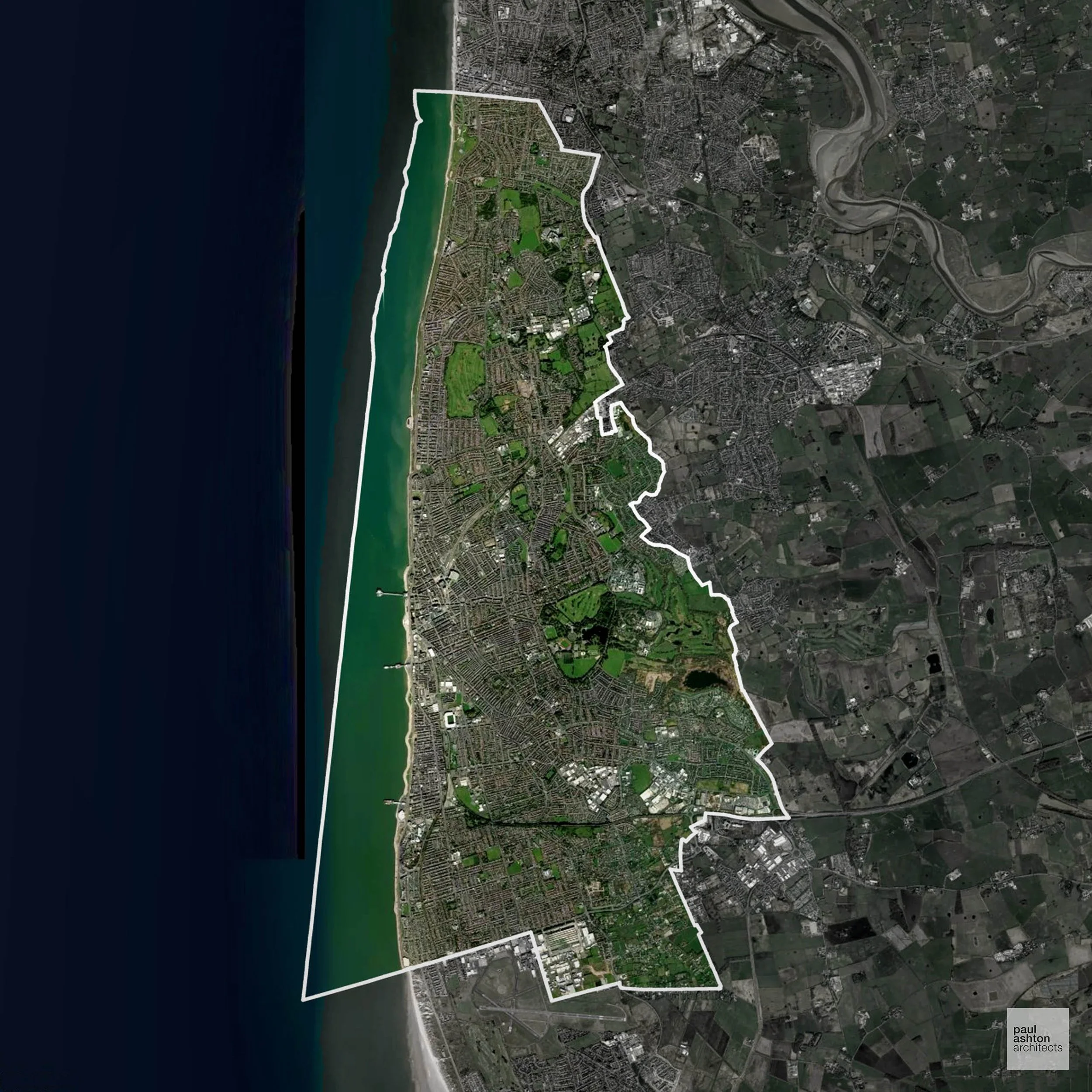
Blackpool, located on the Lancashire coast, is a renowned seaside resort known for its world famous Blackpool Tower and Pleasure Beach amusement park. The town features a mix of Victorian and Art Deco architecture. Blackpool has 1.8% Green Belt coverage, which may impact certain development projects.
In the last year Blackpool decided 349 applications which is well below the national average of 988. The approval rate was 82% (slightly below the national average of 88%) and 54% of applications were decided on time, (slightly below the national average of 59%). Stats updated March 2026 from gov. sources. See how Blackpool performs relative to other LPAs in our LPA hub.
"We love helping clients win Planning Permission in Blackpool"
Conservation and Listed Buildings in Blackpool
Blackpool has a distinctive historic environment shaped by its seaside resort heritage, with several Conservation Areas and a number of listed buildings. Heritage constraints are particularly evident within the Foxhall Conservation Area and Stanley Park Conservation Area, where Victorian and interwar architecture, planned landscapes, and tourist infrastructure define character.
One of the top reasons heritage building applications are refused is causing harm to historic significance, a risk that can arise when proposals are not prepared by a consultant with heritage expertise. We help minimise this risk with expert, site-specific guidance; contact us here.
Green Belt Approvals in Blackpool
The Green Belt is a policy protecting land around many English towns and cities, where development is tightly controlled to safeguard the open countryside.
1.8% of Blackpool is within the Green Belt and proposals in these areas can be subject to high levels of scrutiny.
The Green Belt around Blackpool is minimal but it protects pockets of farmland, small settlements such as Staining and Bispham, and open countryside, limiting urban sprawl and safeguarding sensitive landscapes along the Fylde coast.
In our experience, one of the top reasons poorly conceived Green Belt proposals are refused is causing 'harm to openness'. We can lower the risk of refusal with site-specific guidance. Contact us here.
You can also check whether your land is within the Green Belt using our interactive Green Belt map.
Planning Applications in Blackpool
Alongside acting as Planning Consultants we are ARB registered architects with 25+ years of experience. We use the following proven work stages to guide clients in Blackpool through the planning process in order to maximise the potential of their development :
- Stage 1: Site Appraisals & Planning Strategy Advice
- Stage 2: Feasibility Studies & Concept Designs
- Stage 3: Planning Application Packages
- Architectural Drawing Packages
- Planning Statements & Design and Access Statements
- Coordination of Consultant Reports
- Direct Liaison with Planning Officers
- Stage 4: Technical Design
- Discharge of Planning Conditions
- Building Regulations and Construction Packages
Planning Services We Offer in Blackpool
- Full Planning Applications: Commercial, new buildings, changes of use.
- Householder Planning Applications: Domestic extensions / garden structures.
- Listed Building Consent: Alterations / repairs to listed buildings.
- Conservation Area Consent: Developments within Conservation Areas.
- Lawful Development Certificates: Confirming existing / completed works are lawful.
- Validation Requirements: Gathering documentation to ensure applications are validated by Blackpool LPA.
Contextual Planning Support in Blackpool
We work collaboratively with clients and shape a design that respects local character and meets Planning Policy requirements in order to maximise your chances of winning Planning Permission.
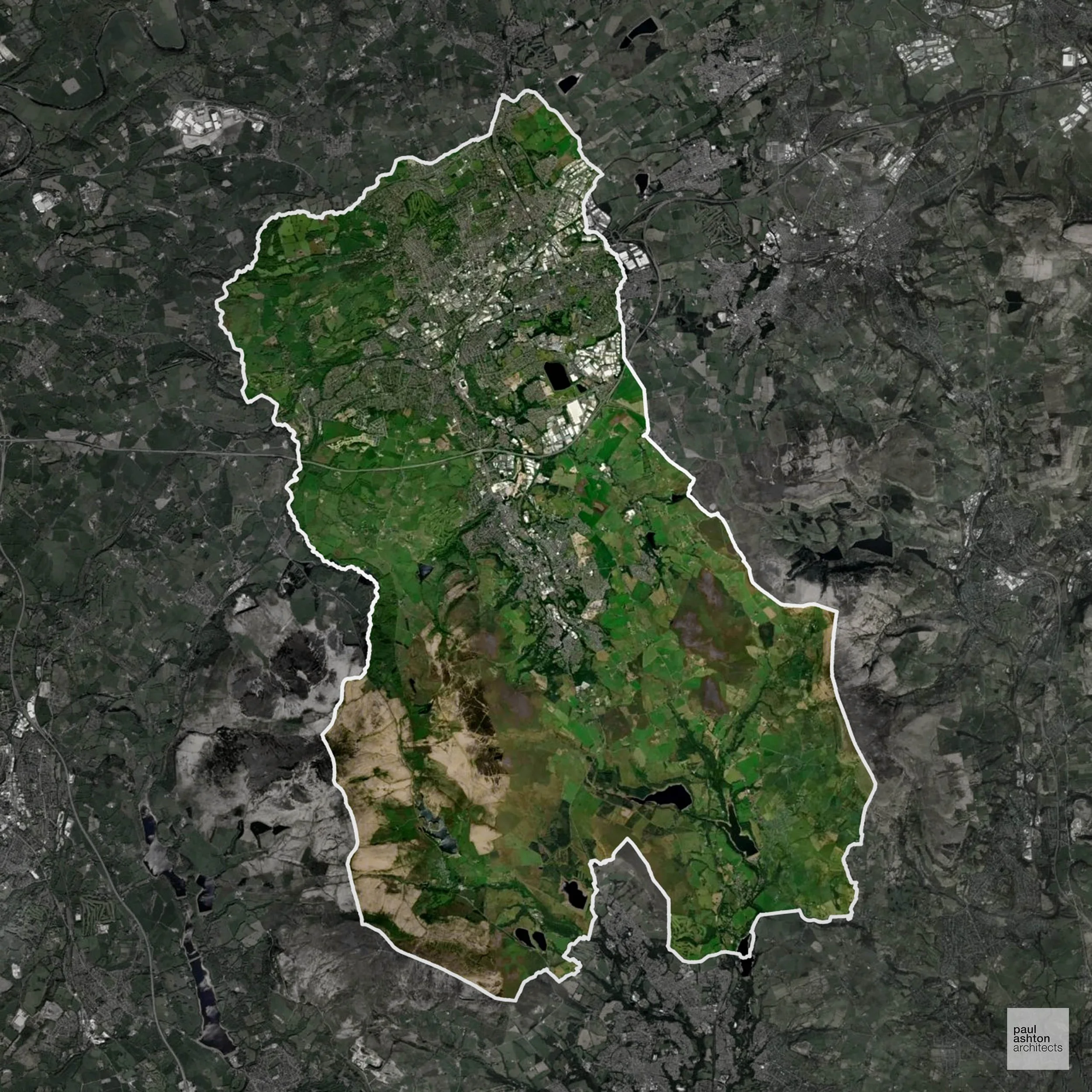
Blackburn with Darwen, situated in Lancashire, has a rich industrial history, particularly in textiles and engineering. The area features a mix of Victorian and modern architecture. Notable sites include the Grade II* listed Blackburn Cathedral. Approximately 38.2% of the district is within the Green Belt, influencing planning considerations.
In the last year Blackburn with Darwen decided 500 applications which is well below the national average of 988. The approval rate was 94% (marginally above the national average of 88%) and 63% of applications were decided on time, (slightly above the national average of 59%). Stats updated March 2026 from gov. sources. See how Blackburn with Darwen performs relative to other LPAs in our LPA hub.
"We love helping clients win Planning Permission in Blackburn with Darwen"
Conservation and Listed Buildings in Blackburn with Darwen
Blackburn with Darwen has a historic environment shaped largely by its industrial heritage. Heritage considerations are particularly relevant in areas such as Blackburn town centre and Darwen, where historic townscape, mills, and civic buildings contribute to local character.
One of the top reasons heritage building applications are refused is causing harm to historic significance, a risk that can arise when proposals are not prepared by a consultant with heritage expertise. We help minimise this risk with expert, site-specific guidance; contact us here.
Green Belt Approvals in Blackburn with Darwen
The Green Belt is a policy protecting land around many English towns and cities, where development is tightly controlled to safeguard the open countryside.
38.2% of Blackburn with Darwen is within the Green Belt and proposals in these areas can be subject to high levels of scrutiny.
The Blackburn with Darwen Green Belt protects upland and rural landscapes near Darwen, along with farmland separating towns.
In our experience, one of the top reasons poorly conceived Green Belt proposals are refused is causing 'harm to openness'. We can lower the risk of refusal with site-specific guidance. Contact us here.
You can also check whether your land is within the Green Belt using our interactive Green Belt map.
Development in the Open Countryside
Blackburn with Darwen includes areas classed as Open Countryside, generally encompassing land beyond settlements and Green Belt zones, often used for agriculture or left as natural landscapes. Development in these areas is tightly controlled, with standard residential proposals rarely permitted.
The Pennine fringe and rural valleys in Blackburn with Darwen are environmentally sensitive and subject to planning restrictions to protect landscape character.
One of the top reasons poorly prepared proposals in the Open Countryside are refused is that they fail to demonstrate a policy-supported need. To minimise that risk with bespoke advice contact us here.
Planning Applications in Blackburn with Darwen
As well as acting as Planning Consultants we are ARB registered architects with over 25 years’ experience. Our site-specific planning proposals balance creativity with strategic insight. We use the following field-tested work stages to help clients in Blackburn with Darwen achieve successful planning outcomes:
- Stage 1: Site Appraisals & Planning Strategy Advice
- Stage 2: Feasibility Studies & Concept Designs
- Stage 3: Planning Application Packages
- Architectural Drawing Packages
- Planning Statements & Design and Access Statements
- Coordination of Consultant Reports
- Direct Liaison with Planning Officers
- Stage 4: Technical Design
- Discharge of Planning Conditions
- Building Regulations and Construction Packages
Planning Services We Offer in Blackburn with Darwen
- Full Planning Applications: Commercial, new buildings, changes of use.
- Householder Planning Applications: Domestic extensions / garden structures.
- Listed Building Consent: Alterations / repairs to listed buildings.
- Conservation Area Consent: Developments within Conservation Areas.
- Lawful Development Certificates: Confirming existing / completed works are lawful.
- Validation Requirements: Gathering documentation to ensure applications are validated by Blackburn with Darwen LPA.
Creative Planning Advice in Blackburn with Darwen
We collaborate closely with our clients to develop designs that respond to local character and align with Planning Policy, helping to maximise the likelihood of securing Planning Permission in Blackburn with Darwen.
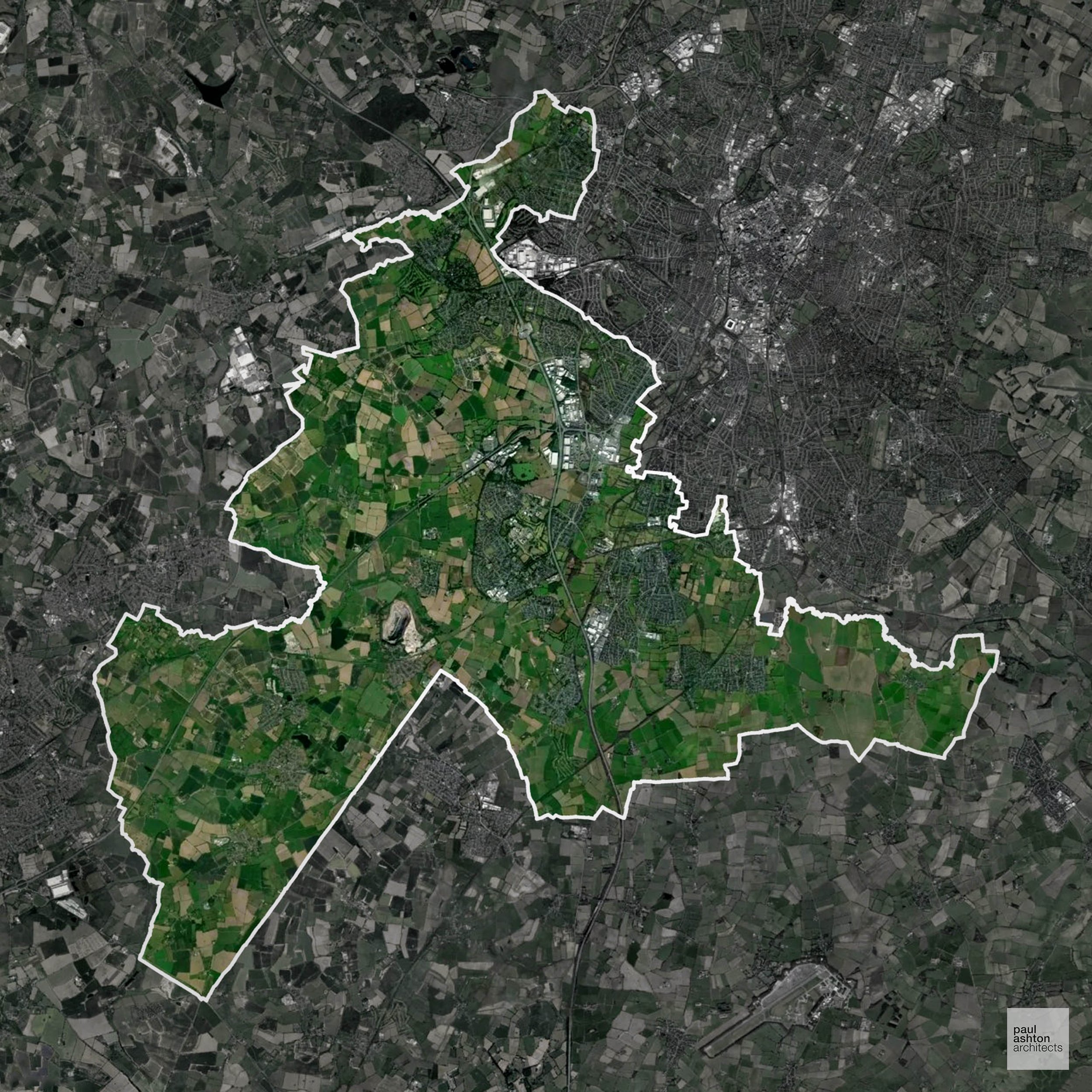
Blaby, located in Leicestershire, is a district known for its mix of urban and rural landscapes. The area features a variety of architectural styles, with notable buildings such as the Grade II listed Blaby Hall.
In the last year Blaby decided 491 applications which is well below the national average of 988. The approval rate was 91% (roughly equal to the national average of 88%) and 51% of applications were decided on time, (significantly below the national average of 59%). Stats updated March 2026 from gov. sources. See how Blaby performs relative to other LPAs in our LPA hub.
"We love helping clients win Planning Permission in Blaby"
Development in the Open Countryside
The Open Countryside is generally defined as land outside settlement and Green Belt boundaries, often comprising agricultural or natural land. Development, particularly standard residential development, is usually restricted in Open Countryside.
Blaby’s patchwork of farmland and woodlands is highly visible from nearby settlements and requires sensitive planning for any new development.
One of the top reasons poorly prepared proposals in the Open Countryside are refused is that they fail to demonstrate a policy-supported need. To minimise that risk with bespoke advice contact us here.
Planning Applications in Blaby
Alongside acting as Planning Consultants we are ARB registered architects with 25+ years of experience. We use the following proven work stages to guide clients in Blaby through the planning process in order to maximise the potential of their development :
- Stage 1: Site Appraisals & Planning Strategy Advice
- Stage 2: Feasibility Studies & Concept Designs
- Stage 3: Planning Application Packages
- Architectural Drawing Packages
- Planning Statements & Design and Access Statements
- Coordination of Consultant Reports
- Direct Liaison with Planning Officers
- Stage 4: Technical Design
- Discharge of Planning Conditions
- Building Regulations and Construction Packages
Planning Services We Offer in Blaby
- Full Planning Applications: Commercial, new buildings, changes of use.
- Householder Planning Applications: Domestic extensions / garden structures.
- Listed Building Consent: Alterations / repairs to listed buildings.
- Conservation Area Consent: Developments within Conservation Areas.
- Lawful Development Certificates: Confirming existing / completed works are lawful.
- Validation Requirements: Gathering documentation to ensure applications are validated by Blaby LPA.
Creative Planning Advice in Blaby
We collaborate closely with our clients to develop designs that respond to local character and align with Planning Policy, helping to maximise the likelihood of securing Planning Permission in Blaby.
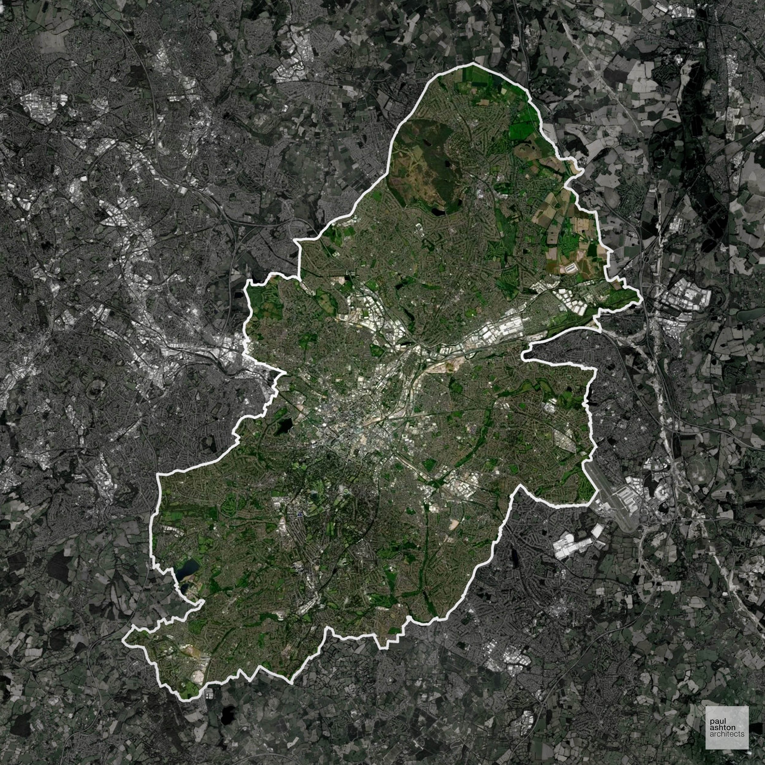
Birmingham, the UK's second-largest city, is known for its diverse architecture, ranging from Victorian to contemporary styles. Notable landmarks include the Grade I listed Birmingham Town Hall and the modernist Library of Birmingham. The city has a rich industrial heritage and is a major cultural and economic hub. Approximately 13.9% of Birmingham is designated as Green Belt, affecting planning policies.
In the last year Birmingham decided 3,533 applications which is well above the national average of 988. The approval rate was 83% (slightly below the national average of 88%) and 47% of applications were decided on time, (significantly below the national average of 59%). Stats updated March 2026 from gov. sources. See how Birmingham performs relative to other LPAs in our LPA hub.
"We love helping clients win Planning Permission in Birmingham"
Conservation and Listed Buildings in Birmingham
Birmingham has a varied historic environment shaped by its industrial and civic heritage. Heritage constraints are particularly evident within the Jewellery Quarter Conservation Area and Deritend Conservation Area, where historic industrial buildings, streetscapes, and civic architecture define local character.
One of the top reasons heritage building applications are refused is causing harm to historic significance, a risk that can arise when proposals are not prepared by a consultant with heritage expertise. We help minimise this risk with expert, site-specific guidance; contact us here.
Green Belt Approvals in Birmingham
The Green Belt is a policy protecting land around many English towns and cities, where development is tightly controlled to safeguard the open countryside.
13.9% of Birmingham is within the Green Belt and proposals in these areas can be subject to high levels of scrutiny.
The Green Belt encircling Birmingham preserves rural villages such as Harborne, Moseley, and Kings Norton, historic parklands, and significant open countryside, helping to contain urban expansion and protect sensitive landscapes in the West Midlands.
In our experience, one of the top reasons poorly conceived Green Belt proposals are refused is causing 'harm to openness'. We can lower the risk of refusal with site-specific guidance. Contact us here.
You can also check whether your land is within the Green Belt using our interactive Green Belt map.
Planning Applications in Birmingham
In addition to acting as Planing Conultants we are ARB registered architects with 25+ years of experience. Our planning proposals are creatively tailored to each site to maximise potential and improve planning outcomes. We use the following tried and tested process to guide clients in Birmingham through planning to completion:
- Stage 1: Site Appraisals & Planning Strategy Advice
- Stage 2: Feasibility Studies & Concept Designs
- Stage 3: Planning Application Packages
- Architectural Drawing Packages
- Planning Statements & Design and Access Statements
- Coordination of Consultant Reports
- Direct Liaison with Planning Officers
- Stage 4: Technical Design
- Discharge of Planning Conditions
- Building Regulations and Construction Packages
Planning Services We Offer in Birmingham
- Full Planning Applications: Commercial, new buildings, changes of use.
- Householder Planning Applications: Domestic extensions / garden structures.
- Listed Building Consent: Alterations / repairs to listed buildings.
- Conservation Area Consent: Developments within Conservation Areas.
- Lawful Development Certificates: Confirming existing / completed works are lawful.
- Validation Requirements: Gathering documentation to ensure applications are validated by Birmingham LPA.
Creative Planning Advice in Birmingham
We collaborate closely with our clients to develop designs that respond to local character and align with Planning Policy, helping to maximise the likelihood of securing Planning Permission in Birmingham.
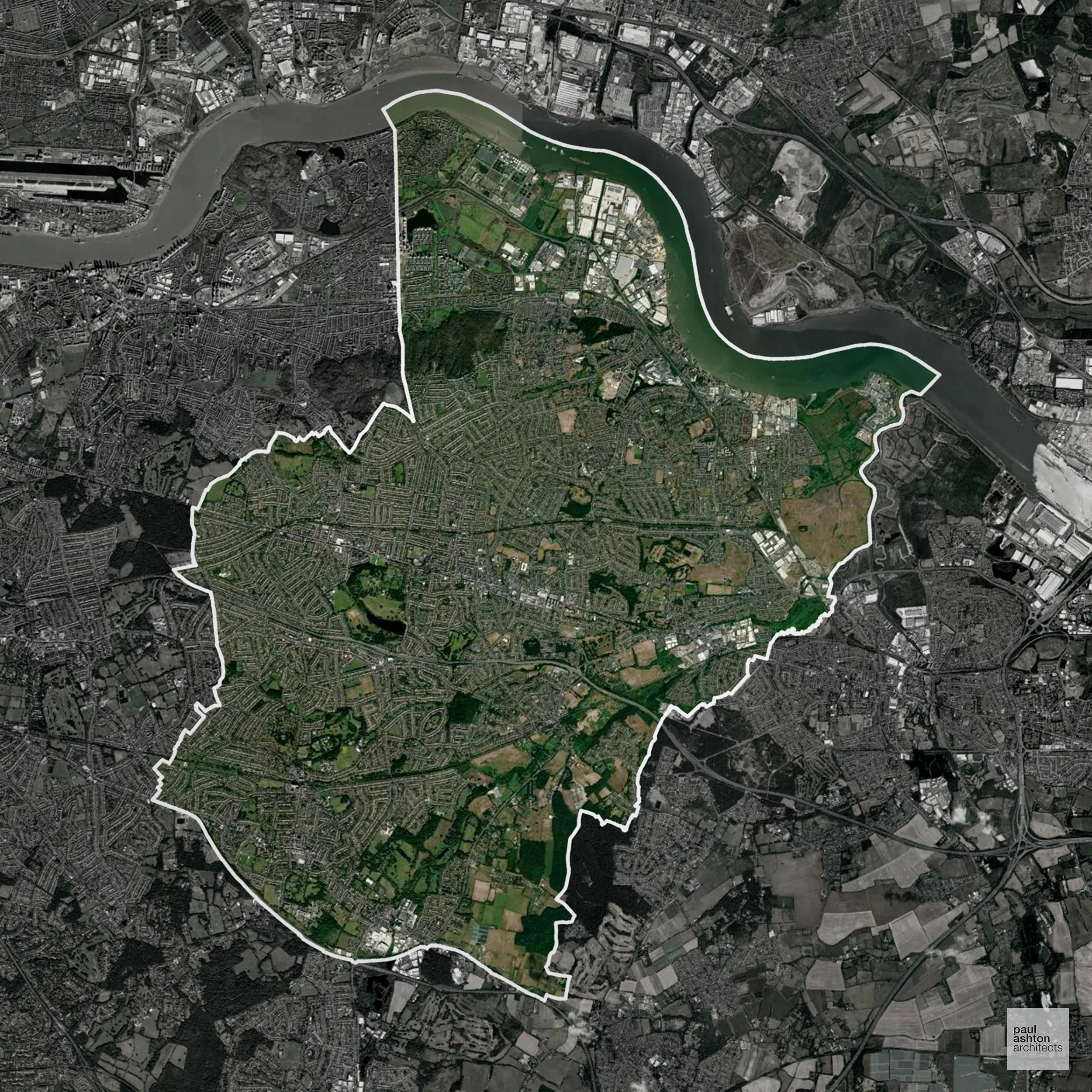
Bexley, situated in Southeast London, is a suburban borough known for its green spaces and residential areas. Key areas include Bexleyheath and Sidcup. The borough features a mix of architectural styles, with notable buildings such as the Grade II listed Danson House. Approximately 18.5% of Bexley is within the Green Belt, influencing planning decisions.
In the last year Bexley decided 1,314 applications which is well above the national average of 988. The approval rate was 89% (roughly equal to the national average of 88%) and 79% of applications were decided on time, (significantly above the national average of 59%). Stats updated March 2026 from gov. sources. See how Bexley performs relative to other LPAs in our LPA hub.
"We love helping clients win Planning Permission in Bexley"
Green Belt Approvals in Bexley
The Green Belt is a nationally designated area of protected land surrounding many English towns and cities, where development is strictly controlled to prevent urban sprawl.
18.5% of Bexley is within the Green Belt and proposals in these areas can be subject to very high levels of scrutiny.
Development within the Green Belt surrounding London is highly sensitive and politically contentious. The Bexley Green Belt preserves open countryside and parkland near Crayford and Welling, areas under pressure from London’s expansion.
In our experience, one of the top reasons poorly conceived Green Belt proposals are refused is causing 'harm to openness'. We can lower the risk of refusal with site-specific guidance. Contact us here.
You can also check whether your land is within the Green Belt using our interactive Green Belt map.
Planning Applications in Bexley
In addition to acting as Planing Conultants we are ARB registered architects with 25+ years of experience. Our planning proposals are creatively tailored to each site to maximise potential and improve planning outcomes. We use the following tried and tested process to guide clients in Bexley through planning to completion:
- Stage 1: Site Appraisals & Planning Strategy Advice
- Stage 2: Feasibility Studies & Concept Designs
- Stage 3: Planning Application Packages
- Architectural Drawing Packages
- Planning Statements & Design and Access Statements
- Coordination of Consultant Reports
- Direct Liaison with Planning Officers
- Stage 4: Technical Design
- Discharge of Planning Conditions
- Building Regulations and Construction Packages
Planning Services We Offer in Bexley
- Full Planning Applications: Commercial, new buildings, changes of use.
- Householder Planning Applications: Domestic extensions / garden structures.
- Listed Building Consent: Alterations / repairs to listed buildings.
- Conservation Area Consent: Developments within Conservation Areas.
- Lawful Development Certificates: Confirming existing / completed works are lawful.
- Validation Requirements: Gathering documentation to ensure applications are validated by Bexley LPA.
Creative Planning Advice in Bexley
We collaborate closely with our clients to develop designs that respond to local character and align with Planning Policy, helping to maximise the likelihood of securing Planning Permission in Bexley.
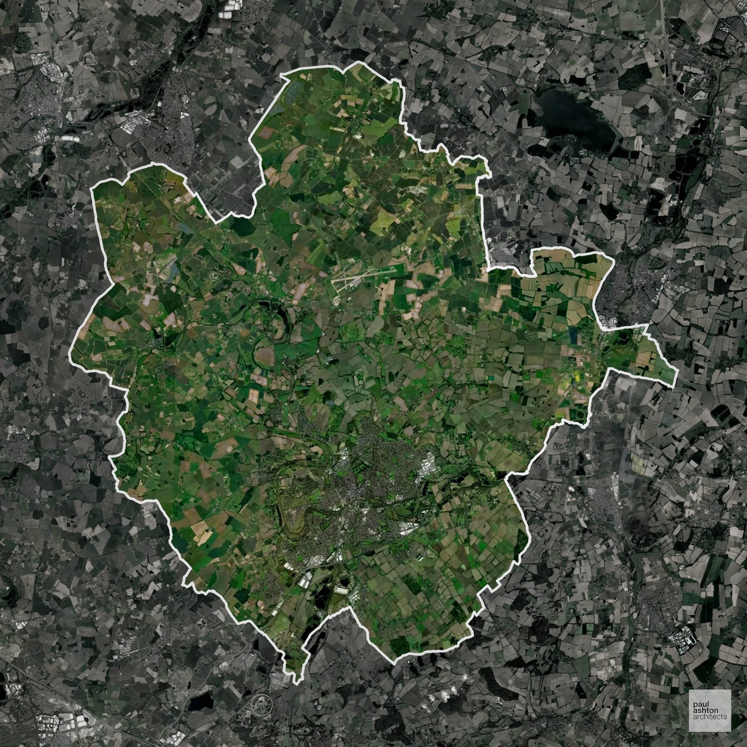
Bedford, located in Bedfordshire, is known for its riverside setting along the River Great Ouse. The town features a mix of architectural styles, including Georgian and Victorian buildings. Notable structures include the Grade II listed Bedford Castle Mound.
In the last year Bedford decided 1,031 applications which is broadly in line with the national average of 988. The approval rate was 81% (slightly below the national average of 88%) and 47% of applications were decided on time, (significantly below the national average of 59%). Stats updated March 2026 from gov. sources. See how Bedford performs relative to other LPAs in our LPA hub.
"We love helping clients win Planning Permission in Bedford"
Development in the Open Countryside
Open Countryside within Bedford refers to land situated outside built-up areas and Green Belt boundaries, typically comprising farmland or natural landscapes. Residential development is generally restricted unless special circumstances can be demonstrated.
Bedford’s river valleys and surrounding rural landscapes are protected to conserve scenic character and prevent encroachment from urban development.
One of the top reasons poorly prepared proposals in the Open Countryside are refused is that they fail to demonstrate a policy-supported need. To minimise that risk with bespoke advice contact us here.
Flood Risk in Bedford
In some areas of the LPA, flood risk plays a key role in determining planning proposals. The Great Ouse floodplain runs through the heart of Bedford, with significant Flood Zone 3 areas constraining residential and commercial development along the river corridor. Where constraints permit, we can develop proposals that manage flood risk thoughtfully to give applications the best chance of approval.
Planning Applications in Bedford
Alongside acting as Planning Consultants we are ARB registered architects with 25+ years of experience. We use the following proven work stages to guide clients in Bedford through the planning process in order to maximise the potential of their development :
- Stage 1: Site Appraisals & Planning Strategy Advice
- Stage 2: Feasibility Studies & Concept Designs
- Stage 3: Planning Application Packages
- Architectural Drawing Packages
- Planning Statements & Design and Access Statements
- Coordination of Consultant Reports
- Direct Liaison with Planning Officers
- Stage 4: Technical Design
- Discharge of Planning Conditions
- Building Regulations and Construction Packages
Planning Services We Offer in Bedford
- Full Planning Applications: Commercial, new buildings, changes of use.
- Householder Planning Applications: Domestic extensions / garden structures.
- Listed Building Consent: Alterations / repairs to listed buildings.
- Conservation Area Consent: Developments within Conservation Areas.
- Lawful Development Certificates: Confirming existing / completed works are lawful.
- Validation Requirements: Gathering documentation to ensure applications are validated by Bedford LPA.
Design-Led Planning Advice in Bedford
We can review your site in Bedford and offer informed guidance on how proposals can be developed in order to maximise your chances of securing Planning Permission.
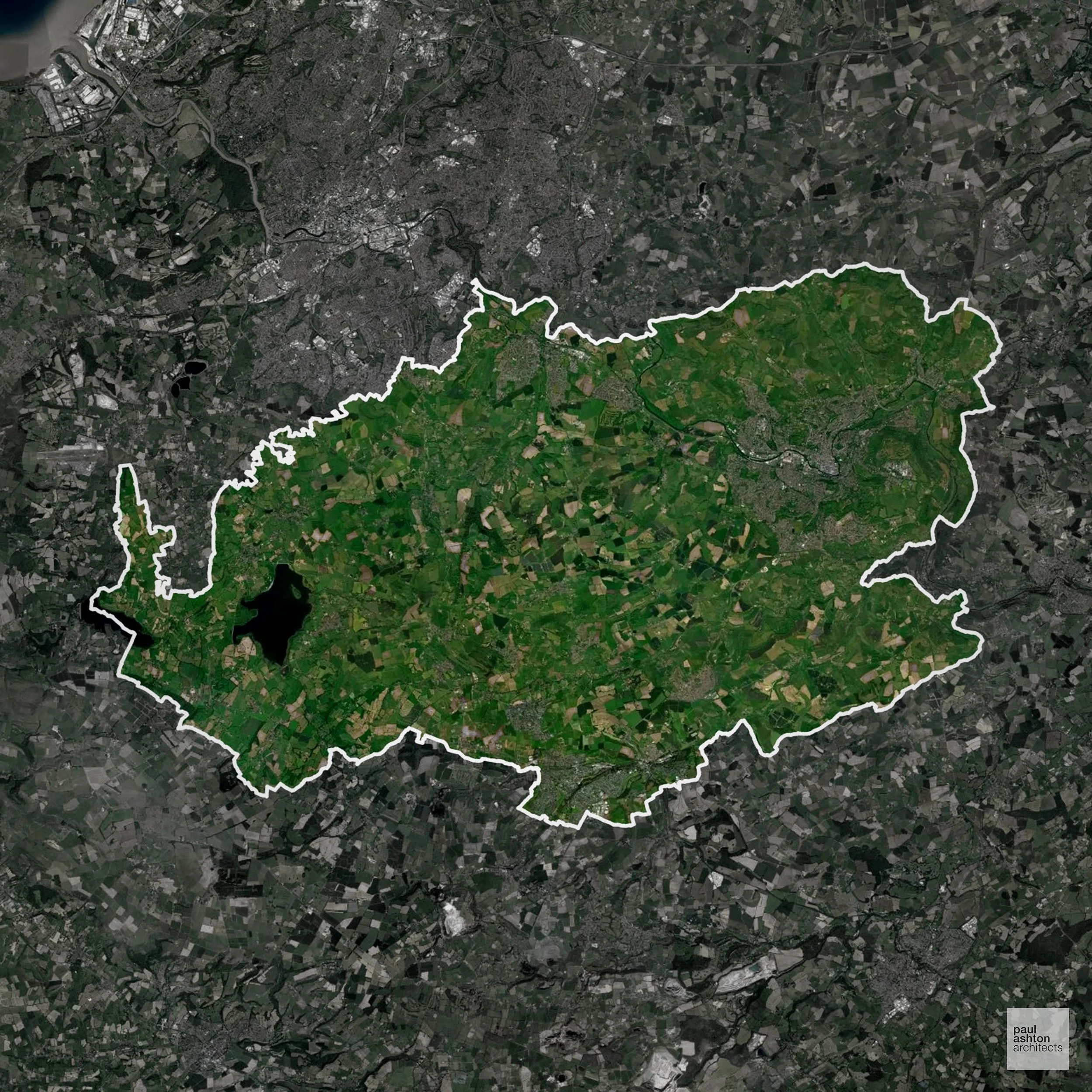
Bath and North East Somerset is renowned for its Roman and Georgian heritage, with the city of Bath being a UNESCO World Heritage Site. Key attractions include the Roman Baths, Bath Abbey, and the Royal Crescent. The district has a rich cultural scene, with numerous theatres, museums, and galleries. Approximately 70.4% of the area is designated as Green Belt, influencing planning policies.
In the last year Bath and North East Somerset decided 1,835 applications which is well above the national average of 988. The approval rate was 95% (marginally above the national average of 88%) and 56% of applications were decided on time, (slightly below the national average of 59%). Stats updated March 2026 from gov. sources. See how Bath and North East Somerset performs relative to other LPAs in our LPA hub.
"We love helping clients win Planning Permission in Bath and North East Somerset"
Areas of Outstanding Natural Beauty in Bath and North East Somerset
Areas of Outstanding Natural Beauty (AONBs), sometimes called National Landscapes, are designated for their exceptional scenic and natural importance. Planning proposals in these areas face close scrutiny, with a strong presumption against inappropriate development.
Bath and North East Somerset is partially within the Cotswolds AONB. Any development requires careful assessment for landscape impact and heritage conservation.
In our experience, one of the top reasons proposals in Areas of Outstanding Natural Beauty are refused is causing landscape harm or visual intrusion, a risk that often arises when applications are not fully informed. We help minimise the likelihood of refusal with expert, guidance; contact us here.
Conservation and Listed Buildings in Bath and North East Somerset
Bath has an exceptionally sensitive historic environment, with extensive Conservation Areas and a very high concentration of listed buildings reflecting its Roman and Georgian heritage. Heritage constraints are particularly pronounced within the Bath City Centre Conservation Area and Lansdown Conservation Area, where classical terraces, crescents, and historic streets define character.
Development proposals are rigorously assessed in relation to key views, heritage setting, and the World Heritage Site status, with Planning Permission typically requiring an exceptional, context-led design response.
One of the top reasons heritage building applications are refused is causing harm to historic significance, a risk that can arise when proposals are not prepared by a consultant with heritage expertise. We help minimise this risk with expert, site-specific guidance; contact us here.
Green Belt Approvals in Bath and North East Somerset
The Green Belt is a nationally designated area of protected land surrounding many English towns and cities, where development is strictly controlled to prevent urban sprawl.
Significantly, 70.4% of Bath and North East Somerset is within the Green Belt and proposals in these areas can be subject to high levels of scrutiny.
The Green Belt near Bath and Keynsham protects the surrounding hills and prevents coalescence of settlements.
In our experience, one of the top reasons poorly conceived Green Belt proposals are refused is causing 'harm to openness'. We can lower the risk of refusal with site-specific guidance. Contact us here.
You can also check whether your land is within the Green Belt using our interactive Green Belt map.
Nutrient Neutrality in Bath and North East Somerset
Nutrient Neutrality ensures new developments do not increase harmful nitrogen or phosphorus levels in sensitive waterways. Parts of Bath and North East Somerset fall within the Somerset Levels and Moors designated sensitive catchment, requiring phosphorus neutrality for residential development in those areas. Unfortunately, Nutrient Neutrality can halt development completely. If you need early-stage, project-specific advice contact us here.
Planning Applications in Bath and North East Somerset
Alongside acting as Planning Consultants we are ARB registered architects with 25+ years of experience. We use the following proven work stages to guide clients in Bath and North East Somerset through the planning process in order to maximise the potential of their development :
- Stage 1: Site Appraisals & Planning Strategy Advice
- Stage 2: Feasibility Studies & Concept Designs
- Stage 3: Planning Application Packages
- Architectural Drawing Packages
- Planning Statements & Design and Access Statements
- Coordination of Consultant Reports
- Direct Liaison with Planning Officers
- Stage 4: Technical Design
- Discharge of Planning Conditions
- Building Regulations and Construction Packages
Planning Services We Offer in Bath and North East Somerset
- Full Planning Applications: Commercial, new buildings, changes of use.
- Householder Planning Applications: Domestic extensions / garden structures.
- Listed Building Consent: Alterations / repairs to listed buildings.
- Conservation Area Consent: Developments within Conservation Areas.
- Lawful Development Certificates: Confirming existing / completed works are lawful.
- Validation Requirements: Gathering documentation to ensure applications are validated by Bath and North East Somerset LPA.
Contextual Planning Support in Bath and North East Somerset
We work collaboratively with clients and shape a design that respects local character and meets Planning Policy requirements in order to maximise your chances of winning Planning Permission.
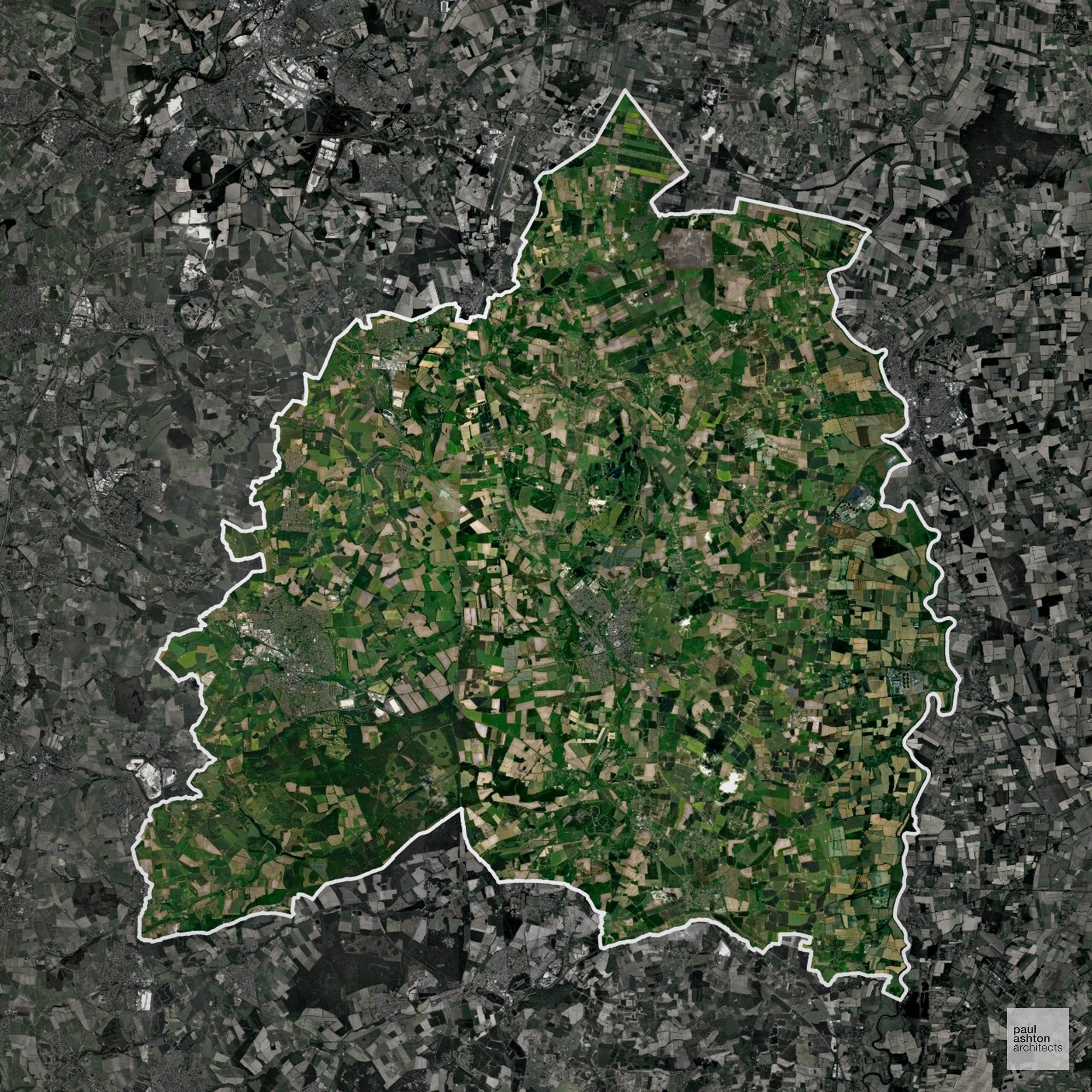
Bassetlaw, located in Nottinghamshire, encompasses towns like Worksop and Retford. The area is known for its agricultural landscape and historic market towns. Notable sites include the Grade II* listed Worksop Priory.
In the last year Bassetlaw decided 556 applications which is well below the national average of 988. The approval rate was 86% (roughly equal to the national average of 88%) and 33% of applications were decided on time, (significantly below the national average of 59%). Stats updated March 2026 from gov. sources. See how Bassetlaw performs relative to other LPAs in our LPA hub.
"We love helping clients win Planning Permission in Bassetlaw"
Areas of Outstanding Natural Beauty in Bassetlaw
Areas of Outstanding Natural Beauty (AONBs), sometimes called National Landscapes, are designated for their exceptional scenic and natural importance. Planning proposals in these areas face close scrutiny, with a strong presumption against inappropriate development.
Bassetlaw overlaps with the Nottinghamshire Wolds AONB. Projects must consider the preservation of scenic and rural qualities.
In our experience, one of the top reasons proposals in Areas of Outstanding Natural Beauty are refused is causing landscape harm or visual intrusion, a risk that often arises when applications are not fully informed. We help minimise the likelihood of refusal with expert, guidance; contact us here.
Development in the Open Countryside
The Open Countryside is generally defined as land outside settlement and Green Belt boundaries, often comprising agricultural or natural land. Development, particularly standard residential development, is usually restricted in Open Countryside.
Bassetlaw’s open countryside features historic farmland and woodland belts, where planning seeks to prevent coalescence of settlements.
One of the top reasons poorly prepared proposals in the Open Countryside are refused is that they fail to demonstrate a policy-supported need. To minimise that risk with bespoke advice contact us here.
Planning Applications in Bassetlaw
As well as acting as Planning Consultants we are ARB registered architects with over 25 years’ experience. Our site-specific planning proposals balance creativity with strategic insight. We use the following field-tested work stages to help clients in Bassetlaw achieve successful planning outcomes:
- Stage 1: Site Appraisals & Planning Strategy Advice
- Stage 2: Feasibility Studies & Concept Designs
- Stage 3: Planning Application Packages
- Architectural Drawing Packages
- Planning Statements & Design and Access Statements
- Coordination of Consultant Reports
- Direct Liaison with Planning Officers
- Stage 4: Technical Design
- Discharge of Planning Conditions
- Building Regulations and Construction Packages
Planning Services We Offer in Bassetlaw
- Full Planning Applications: Commercial, new buildings, changes of use.
- Householder Planning Applications: Domestic extensions / garden structures.
- Listed Building Consent: Alterations / repairs to listed buildings.
- Conservation Area Consent: Developments within Conservation Areas.
- Lawful Development Certificates: Confirming existing / completed works are lawful.
- Validation Requirements: Gathering documentation to ensure applications are validated by Bassetlaw LPA.
Contextual Planning Support in Bassetlaw
We work collaboratively with clients and shape a design that respects local character and meets Planning Policy requirements in order to maximise your chances of winning Planning Permission.
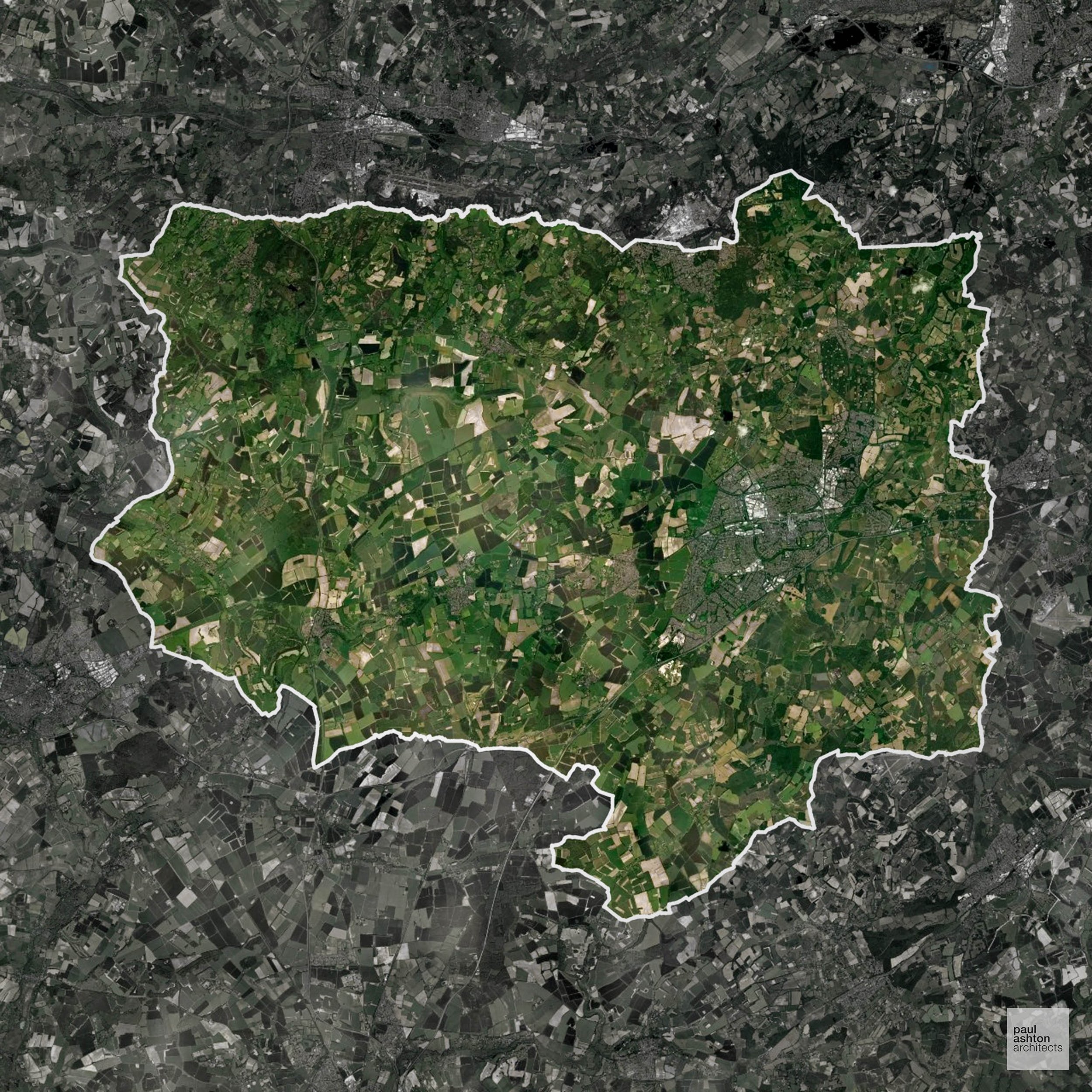
Basingstoke and Deane, situated in Hampshire, is known for its mix of urban and rural landscapes. The town of Basingstoke features a blend of modern and historic architecture, with notable buildings such as the Grade II listed Basingstoke Railway Station.
In the last year Basingstoke and Deane decided 1,066 applications which is just above the national average of 988. The approval rate was 91% (roughly equal to the national average of 88%) and 53% of applications were decided on time, (significantly below the national average of 59%). Stats updated March 2026 from gov. sources. See how Basingstoke and Deane performs relative to other LPAs in our LPA hub.
"We love helping clients win Planning Permission in Basingstoke and Deane"
Areas of Outstanding Natural Beauty in Basingstoke and Deane
Areas of Outstanding Natural Beauty (AONBs), (now often referred to as National Landscapes), are protected areas recognised for their exceptional scenic and natural value. For developers, this means that planning proposals within these areas are carefully scrutinised, with a strong presumption against inappropriate development.
Basingstoke and Deane contains parts of the North Wessex Downs AONB. Development is constrained to protect the open character and views.
In our experience, one of the top reasons proposals in Areas of Outstanding Natural Beauty are refused is causing landscape harm or visual intrusion, a risk that often arises when applications are not fully informed. We help minimise the likelihood of refusal with expert, guidance; contact us here.
Development in the Open Countryside
Basingstoke and Deane includes areas classed as Open Countryside, generally encompassing land beyond settlements and Green Belt zones, often used for agriculture or left as natural landscapes. Development in these areas is tightly controlled, with standard residential proposals rarely permitted.
The North Wessex Downs AONB and surrounding open farmland in Basingstoke and Deane are visually prominent and safeguarded against urban sprawl.
One of the top reasons poorly prepared proposals in the Open Countryside are refused is that they fail to demonstrate a policy-supported need. To minimise that risk with bespoke advice contact us here.
Nutrient Neutrality in Basingstoke and Deane
Nutrient Neutrality ensures new developments do not increase harmful nitrogen or phosphorus levels in sensitive waterways. Parts of Basingstoke and Deane drain to the Solent via the River Test catchment, requiring nitrogen neutrality for residential development in affected areas. Unfortunately, Nutrient Neutrality can halt development completely. If you need early-stage, project-specific advice contact us here.
Planning Applications in Basingstoke and Deane
Alongside acting as Planning Consultants we are ARB registered architects with 25+ years of experience. We use the following proven work stages to guide clients in Basingstoke and Deane through the planning process in order to maximise the potential of their development :
- Stage 1: Site Appraisals & Planning Strategy Advice
- Stage 2: Feasibility Studies & Concept Designs
- Stage 3: Planning Application Packages
- Architectural Drawing Packages
- Planning Statements & Design and Access Statements
- Coordination of Consultant Reports
- Direct Liaison with Planning Officers
- Stage 4: Technical Design
- Discharge of Planning Conditions
- Building Regulations and Construction Packages
Planning Services We Offer in Basingstoke and Deane
- Full Planning Applications: Commercial, new buildings, changes of use.
- Householder Planning Applications: Domestic extensions / garden structures.
- Listed Building Consent: Alterations / repairs to listed buildings.
- Conservation Area Consent: Developments within Conservation Areas.
- Lawful Development Certificates: Confirming existing / completed works are lawful.
- Validation Requirements: Gathering documentation to ensure applications are validated by Basingstoke and Deane LPA.
Design-Led Planning Advice in Basingstoke and Deane
We can review your site in Basingstoke and Deane and offer informed guidance on how proposals can be developed in order to maximise your chances of securing Planning Permission.
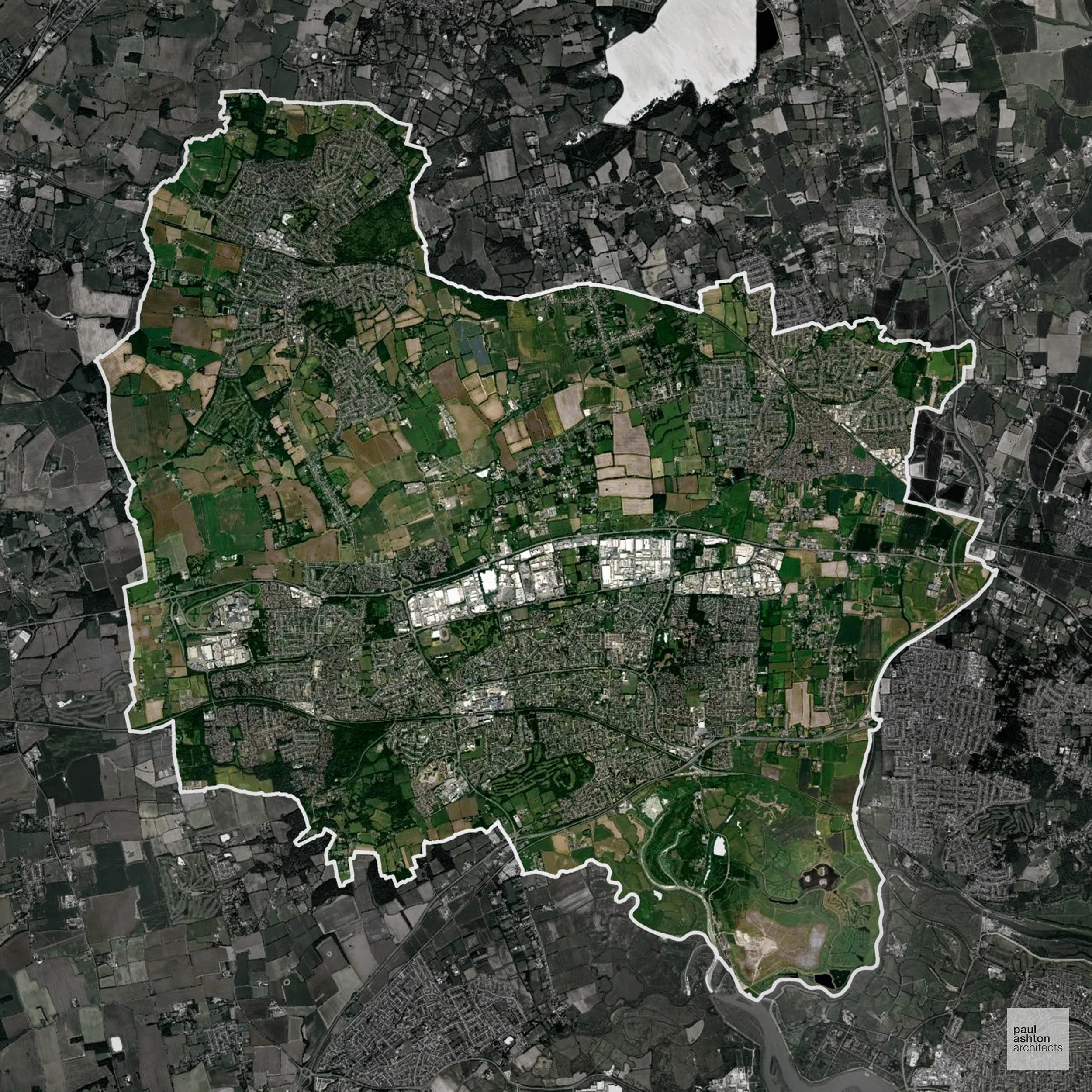
Basildon, located in Essex, is a post-war new town known for its modernist architecture and planned urban layout. The town centre features the Grade II listed Basildon Centre. Basildon's economy is diverse, with strengths in retail, manufacturing, and logistics. Approximately 62.7% of the area is within the Green Belt, influencing planning considerations.
In the last year Basildon decided 781 applications which is well below the national average of 988. The approval rate was 84% (roughly equal to the national average of 88%) and 69% of applications were decided on time, (significantly above the national average of 59%). Stats updated March 2026 from gov. sources. See how Basildon performs relative to other LPAs in our LPA hub.
"We love helping clients win Planning Permission in Basildon"
Green Belt Approvals in Basildon
The Green Belt is a nationally designated area of protected land surrounding many English towns and cities, where development is strictly controlled to prevent urban sprawl.
Significantly, 62.7% of Basildon is within the Green Belt and proposals in these areas can be subject to high levels of scrutiny.
The Green Belt surrounding Basildon and Billericay limits development to maintain settlement separation and safeguard rural character.
In our experience, one of the top reasons poorly conceived Green Belt proposals are refused is causing 'harm to openness'. We can lower the risk of refusal with site-specific guidance. Contact us here.
You can also check whether your land is within the Green Belt using our interactive Green Belt map.
Development in the Open Countryside
Open Countryside within Basildon refers to land situated outside built-up areas and Green Belt boundaries, typically comprising farmland or natural landscapes. Residential development is generally restricted unless special circumstances can be demonstrated.
Basildon’s remaining open farmland and marshland to the east and south are environmentally sensitive, with strict controls to maintain green corridors.
One of the top reasons poorly prepared proposals in the Open Countryside are refused is that they fail to demonstrate a policy-supported need. To minimise that risk with bespoke advice contact us here.
Planning Applications in Basildon
In addition to acting as Planing Conultants we are ARB registered architects with 25+ years of experience. Our planning proposals are creatively tailored to each site to maximise potential and improve planning outcomes. We use the following tried and tested process to guide clients in Basildon through planning to completion:
- Stage 1: Site Appraisals & Planning Strategy Advice
- Stage 2: Feasibility Studies & Concept Designs
- Stage 3: Planning Application Packages
- Architectural Drawing Packages
- Planning Statements & Design and Access Statements
- Coordination of Consultant Reports
- Direct Liaison with Planning Officers
- Stage 4: Technical Design
- Discharge of Planning Conditions
- Building Regulations and Construction Packages
Planning Services We Offer in Basildon
- Full Planning Applications: Commercial, new buildings, changes of use.
- Householder Planning Applications: Domestic extensions / garden structures.
- Listed Building Consent: Alterations / repairs to listed buildings.
- Conservation Area Consent: Developments within Conservation Areas.
- Lawful Development Certificates: Confirming existing / completed works are lawful.
- Validation Requirements: Gathering documentation to ensure applications are validated by Basildon LPA.
Creative Planning Advice in Basildon
We collaborate closely with our clients to develop designs that respond to local character and align with Planning Policy, helping to maximise the likelihood of securing Planning Permission in Basildon.
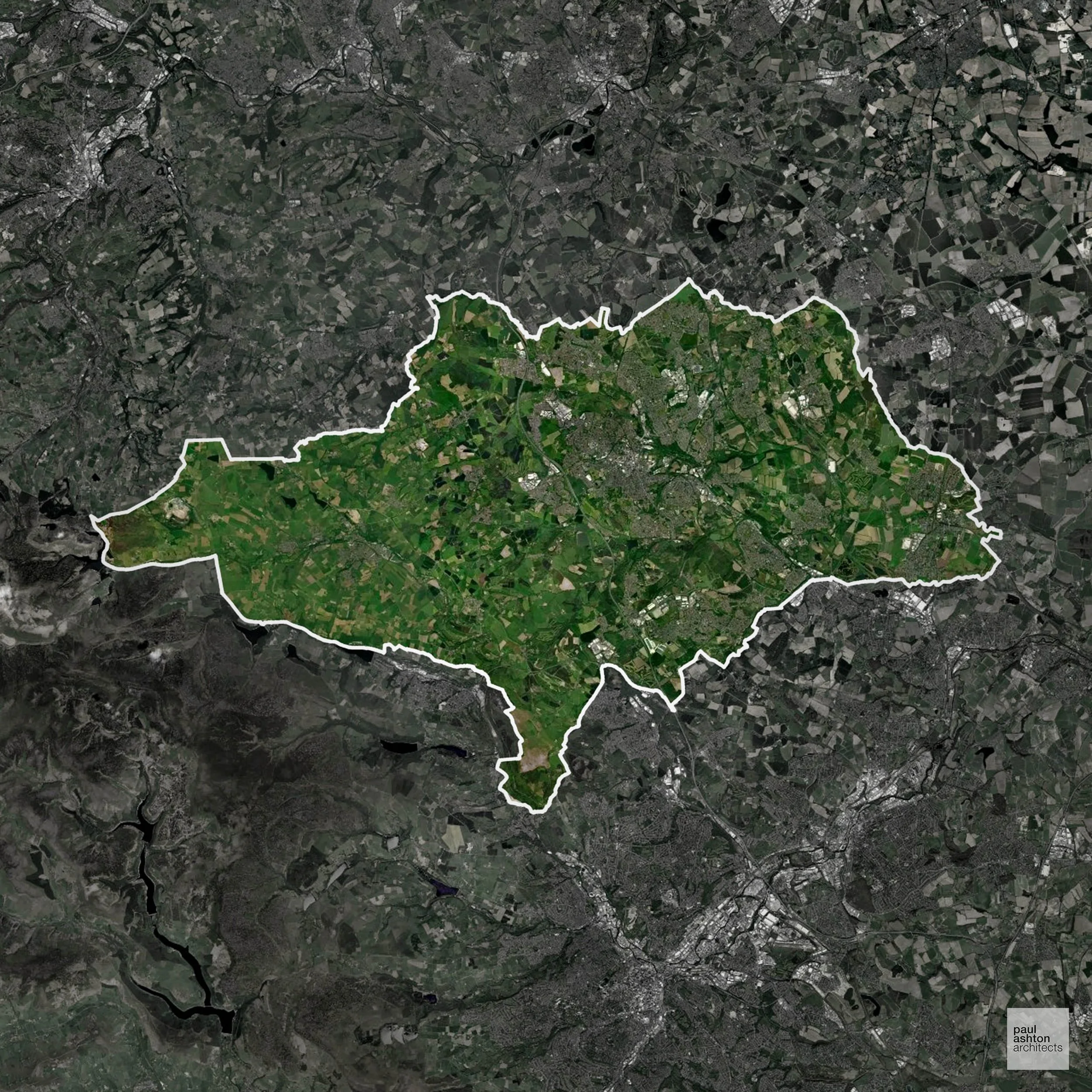
Barnsley, situated in South Yorkshire, is known for its coal mining history and industrial heritage. The town centre features a mix of Victorian and modern architecture. Notable buildings include the Grade II* listed Barnsley Town Hall. Approximately 68.0% of Barnsley is designated as Green Belt, which plays a significant role in shaping development policies.
In the last year Barnsley decided 647 applications which is well below the national average of 988. The approval rate was 93% (marginally above the national average of 88%) and 52% of applications were decided on time, (significantly below the national average of 59%). Stats updated March 2026 from gov. sources. See how Barnsley performs relative to other LPAs in our LPA hub.
"We love helping clients win Planning Permission in Barnsley"
Green Belt Approvals in Barnsley
The Green Belt is a policy protecting land around many English towns and cities, where development is tightly controlled to safeguard the open countryside.
Significantly, 68.0% of Barnsley is within the Green Belt and proposals in these areas can be subject to high levels of scrutiny.
The Green Belt near Barnsley and surrounding villages limits expansion to protect landscape and open space.
In our experience, one of the top reasons poorly conceived Green Belt proposals are refused is causing 'harm to openness'. We can lower the risk of refusal with site-specific guidance. Contact us here.
You can also check whether your land is within the Green Belt using our interactive Green Belt map.
Planning Applications in Barnsley
As well as acting as Planning Consultants we are ARB registered architects with over 25 years’ experience. Our site-specific planning proposals balance creativity with strategic insight. We use the following field-tested work stages to help clients in Barnsley achieve successful planning outcomes:
- Stage 1: Site Appraisals & Planning Strategy Advice
- Stage 2: Feasibility Studies & Concept Designs
- Stage 3: Planning Application Packages
- Architectural Drawing Packages
- Planning Statements & Design and Access Statements
- Coordination of Consultant Reports
- Direct Liaison with Planning Officers
- Stage 4: Technical Design
- Discharge of Planning Conditions
- Building Regulations and Construction Packages
Planning Services We Offer in Barnsley
- Full Planning Applications: Commercial, new buildings, changes of use.
- Householder Planning Applications: Domestic extensions / garden structures.
- Listed Building Consent: Alterations / repairs to listed buildings.
- Conservation Area Consent: Developments within Conservation Areas.
- Lawful Development Certificates: Confirming existing / completed works are lawful.
- Validation Requirements: Gathering documentation to ensure applications are validated by Barnsley LPA.
Design-Led Planning Advice in Barnsley
We can review your site in Barnsley and offer informed guidance on how proposals can be developed in order to maximise your chances of securing Planning Permission.
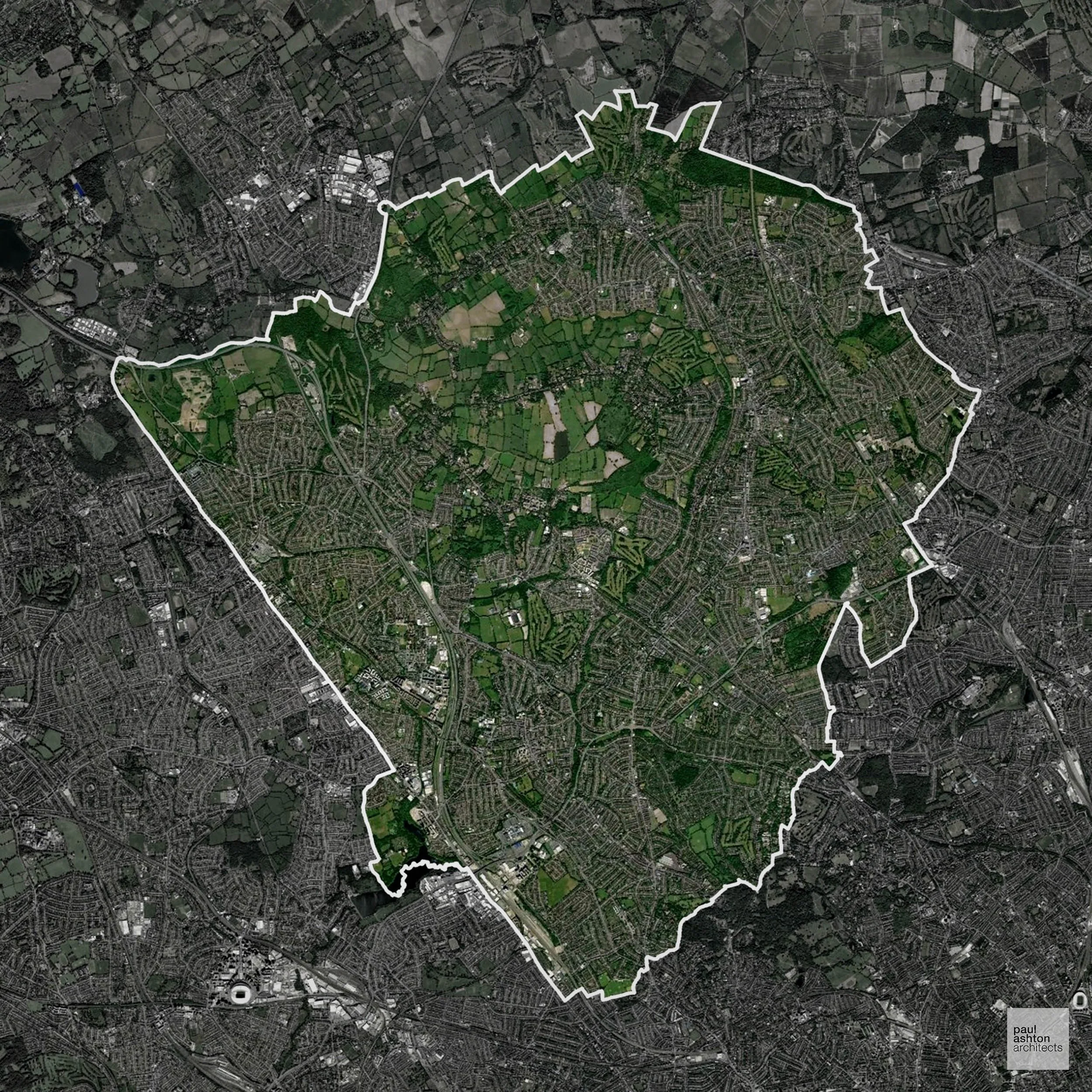
Barnet, located in North London, is one of the largest boroughs by population. Key areas include Hendon, Finchley, and Edgware. The borough is known for its suburban character, with a mix of residential, commercial, and green spaces. Barnet has a significant number of listed buildings, reflecting its rich history. Approximately 27.5% of the borough is within the Green Belt, affecting planning decisions.
In the last year Barnet decided 2,539 applications which is well above the national average of 988. The approval rate was 76% (slightly below the national average of 88%) and 77% of applications were decided on time, (significantly above the national average of 59%). Stats updated March 2026 from gov. sources. See how Barnet performs relative to other LPAs in our LPA hub.
"We love helping clients win Planning Permission in Barnet"
Green Belt Approvals in Barnet
The Green Belt is a nationally designated area of protected land surrounding many English towns and cities, where development is strictly controlled to prevent urban sprawl.
27.5% of Barnet is within the Green Belt and proposals in these areas can be subject to very high levels of scrutiny.
Development within the Green Belt surrounding London is highly sensitive and politically contentious. The Green Belt within Barnet protects woodland, farmland, and parkland between London suburbs, particularly around Arkley and Totteridge, important for settlement separation.
In our experience, one of the top reasons poorly conceived Green Belt proposals are refused is causing 'harm to openness'. We can lower the risk of refusal with site-specific guidance. Contact us here.
You can also check whether your land is within the Green Belt using our interactive Green Belt map.
Planning Applications in Barnet
In addition to acting as Planing Conultants we are ARB registered architects with 25+ years of experience. Our planning proposals are creatively tailored to each site to maximise potential and improve planning outcomes. We use the following tried and tested process to guide clients in Barnet through planning to completion:
- Stage 1: Site Appraisals & Planning Strategy Advice
- Stage 2: Feasibility Studies & Concept Designs
- Stage 3: Planning Application Packages
- Architectural Drawing Packages
- Planning Statements & Design and Access Statements
- Coordination of Consultant Reports
- Direct Liaison with Planning Officers
- Stage 4: Technical Design
- Discharge of Planning Conditions
- Building Regulations and Construction Packages
Planning Services We Offer in Barnet
- Full Planning Applications: Commercial, new buildings, changes of use.
- Householder Planning Applications: Domestic extensions / garden structures.
- Listed Building Consent: Alterations / repairs to listed buildings.
- Conservation Area Consent: Developments within Conservation Areas.
- Lawful Development Certificates: Confirming existing / completed works are lawful.
- Validation Requirements: Gathering documentation to ensure applications are validated by Barnet LPA.
Design-Led Planning Advice in Barnet
We can review your site in Barnet and offer informed guidance on how proposals can be developed in order to maximise your chances of securing Planning Permission.
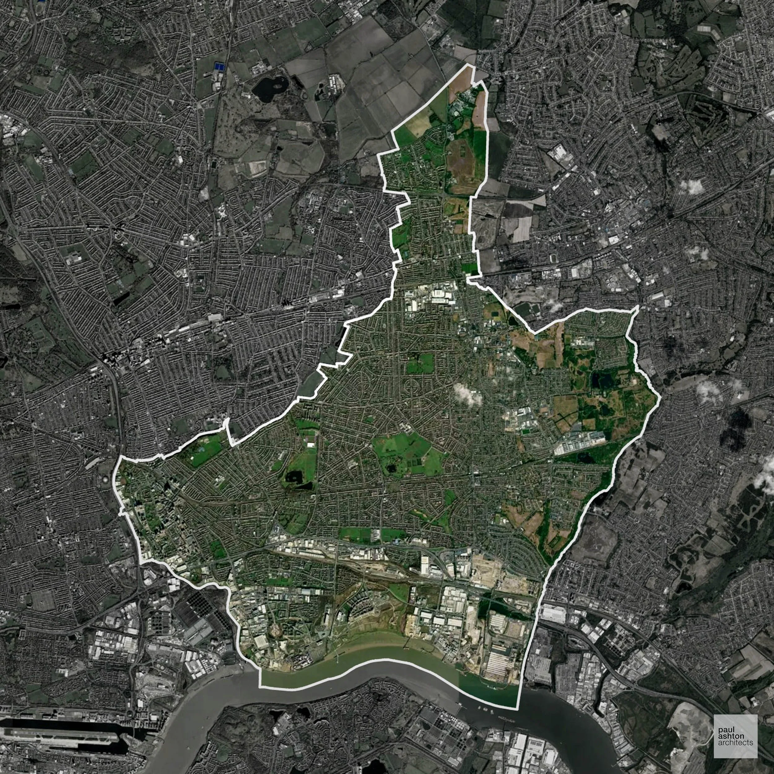
Barking and Dagenham, situated in East London, is a borough undergoing significant regeneration. The area is known for its industrial heritage, particularly in manufacturing and engineering. Notable landmarks include the Grade I listed Eastbury Manor House and the Dagenham & Redbridge Football Club Arena. The borough has 14.6% Green Belt coverage, influencing development policies.
In the last year Barking and Dagenham decided 713 applications which is well below the national average of 988. The approval rate was 66% (well below the national average of 88%) and 86% of applications were decided on time, (significantly above the national average of 59%). Stats updated March 2026 from gov. sources. See how Barking and Dagenham performs relative to other LPAs in our LPA hub.
"We love helping clients win Planning Permission in Barking and Dagenham"
Green Belt Approvals in Barking and Dagenham
The Green Belt is a policy protecting land around many English towns and cities, where development is tightly controlled to safeguard the open countryside.
14.6% of Barking and Dagenham is within the Green Belt and proposals in these areas can be subject to very high levels of scrutiny.
Development within the Green Belt surrounding London is highly sensitive and politically contentious. The Green Belt around Barking and Dagenham contains open parkland and farmland buffers near Chadwell Heath and Marks Gate which are sensitive to expansion pressures from London.
In our experience, one of the top reasons poorly conceived Green Belt proposals are refused is causing 'harm to openness'. We can lower the risk of refusal with site-specific guidance. Contact us here.
You can also check whether your land is within the Green Belt using our interactive Green Belt map.
Flood Risk in Barking and Dagenham
In some areas of the LPA, flood risk plays a key role in determining planning proposals. Large areas of the borough lie within Flood Zone 3 due to its position on the tidal Thames, making sequential testing a routine requirement for development proposals. Where constraints permit, we can develop proposals that manage flood risk thoughtfully to give applications the best chance of approval.
Planning Applications in Barking and Dagenham
Alongside acting as Planning Consultants we are ARB registered architects with 25+ years of experience. We use the following proven work stages to guide clients in Barking and Dagenham through the planning process in order to maximise the potential of their development :
- Stage 1: Site Appraisals & Planning Strategy Advice
- Stage 2: Feasibility Studies & Concept Designs
- Stage 3: Planning Application Packages
- Architectural Drawing Packages
- Planning Statements & Design and Access Statements
- Coordination of Consultant Reports
- Direct Liaison with Planning Officers
- Stage 4: Technical Design
- Discharge of Planning Conditions
- Building Regulations and Construction Packages
Planning Services We Offer in Barking and Dagenham
- Full Planning Applications: Commercial, new buildings, changes of use.
- Householder Planning Applications: Domestic extensions / garden structures.
- Listed Building Consent: Alterations / repairs to listed buildings.
- Conservation Area Consent: Developments within Conservation Areas.
- Lawful Development Certificates: Confirming existing / completed works are lawful.
- Validation Requirements: Gathering documentation to ensure applications are validated by Barking and Dagenham LPA.
Creative Planning Advice in Barking and Dagenham
We collaborate closely with our clients to develop designs that respond to local character and align with Planning Policy, helping to maximise the likelihood of securing Planning Permission in Barking and Dagenham.
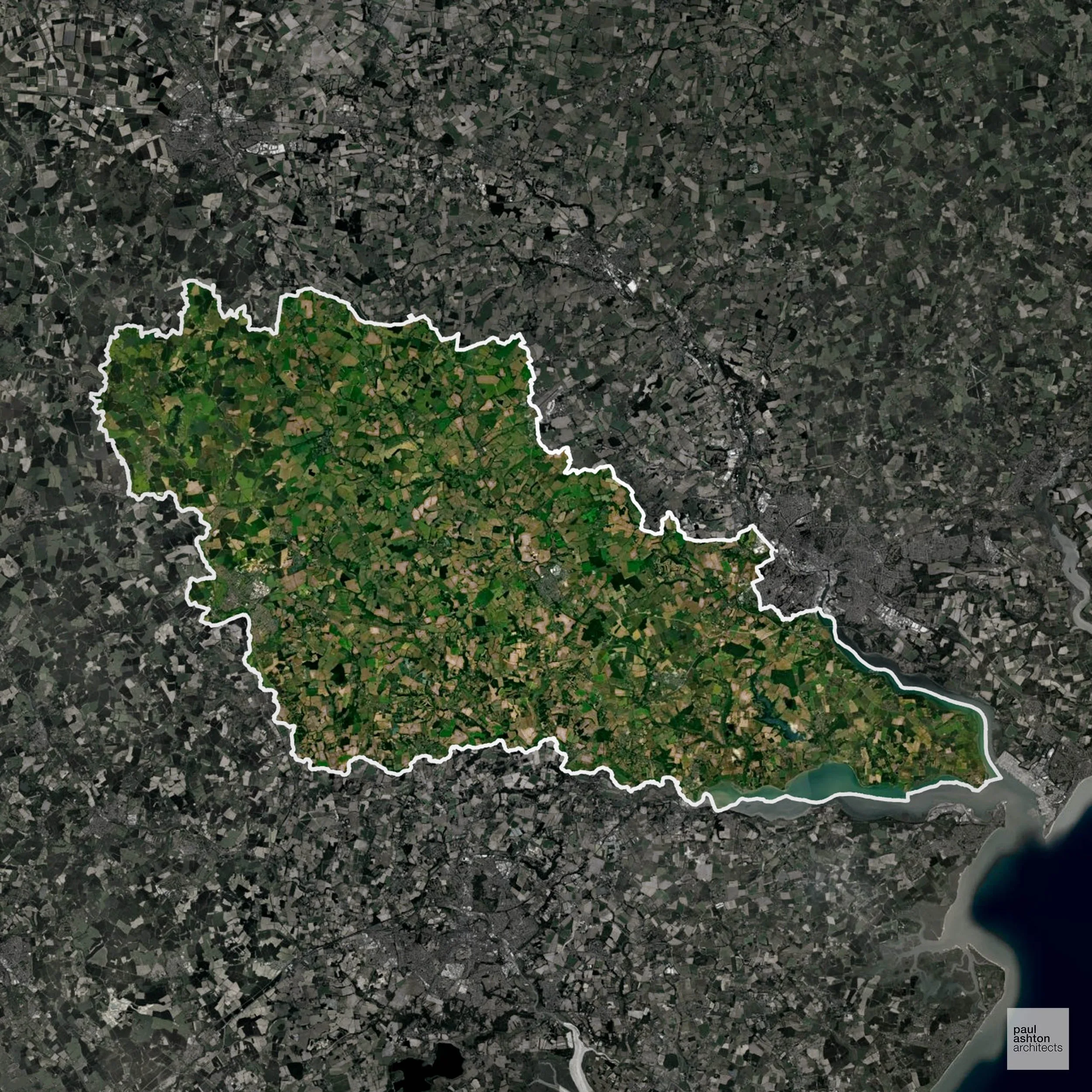
Babergh, located in Suffolk, is renowned for its historic market towns such as Sudbury and Hadleigh. The district boasts over 4,000 listed buildings, including the iconic Lavenham Guildhall and Flatford Mill. Babergh's economy is rooted in agriculture, with a focus on arable farming and horticulture.
In the last year Babergh decided 835 applications which is slightly below the national average of 988. The approval rate was 86% (roughly equal to the national average of 88%) and 69% of applications were decided on time, (significantly above the national average of 59%). Stats updated March 2026 from gov. sources. See how Babergh performs relative to other LPAs in our LPA hub.
"We love helping clients win Planning Permission in Babergh"
Areas of Outstanding Natural Beauty in Babergh
Areas of Outstanding Natural Beauty (AONBs), (now often referred to as National Landscapes), are protected areas recognised for their exceptional scenic and natural value. For developers, this means that planning proposals within these areas are carefully scrutinised, with a strong presumption against inappropriate development.
Babergh overlaps with Dedham Vale and Suffolk Coast & Heaths AONBs. Projects are assessed for compatibility with landscape and ecological objectives.
In our experience, one of the top reasons proposals in Areas of Outstanding Natural Beauty are refused is causing landscape harm or visual intrusion, a risk that often arises when applications are not fully informed. We help minimise the likelihood of refusal with expert, guidance; contact us here.
Development in the Open Countryside
Open Countryside within Babergh refers to land situated outside built-up areas and Green Belt boundaries, typically comprising farmland or natural landscapes. Residential development is generally restricted unless special circumstances can be demonstrated.
Babergh contains areas of Dedham Vale and Suffolk Coast & Heaths AONBs, where agricultural landscapes and historic villages are protected from unsympathetic development.
One of the top reasons poorly prepared proposals in the Open Countryside are refused is that they fail to demonstrate a policy-supported need. To minimise that risk with bespoke advice contact us here.
Planning Applications in Babergh
As well as acting as Planning Consultants we are ARB registered architects with over 25 years’ experience. Our site-specific planning proposals balance creativity with strategic insight. We use the following field-tested work stages to help clients in Babergh achieve successful planning outcomes:
- Stage 1: Site Appraisals & Planning Strategy Advice
- Stage 2: Feasibility Studies & Concept Designs
- Stage 3: Planning Application Packages
- Architectural Drawing Packages
- Planning Statements & Design and Access Statements
- Coordination of Consultant Reports
- Direct Liaison with Planning Officers
- Stage 4: Technical Design
- Discharge of Planning Conditions
- Building Regulations and Construction Packages
Planning Services We Offer in Babergh
- Full Planning Applications: Commercial, new buildings, changes of use.
- Householder Planning Applications: Domestic extensions / garden structures.
- Listed Building Consent: Alterations / repairs to listed buildings.
- Conservation Area Consent: Developments within Conservation Areas.
- Lawful Development Certificates: Confirming existing / completed works are lawful.
- Validation Requirements: Gathering documentation to ensure applications are validated by Babergh LPA.
Creative Planning Advice in Babergh
We collaborate closely with our clients to develop designs that respond to local character and align with Planning Policy, helping to maximise the likelihood of securing Planning Permission in Babergh.
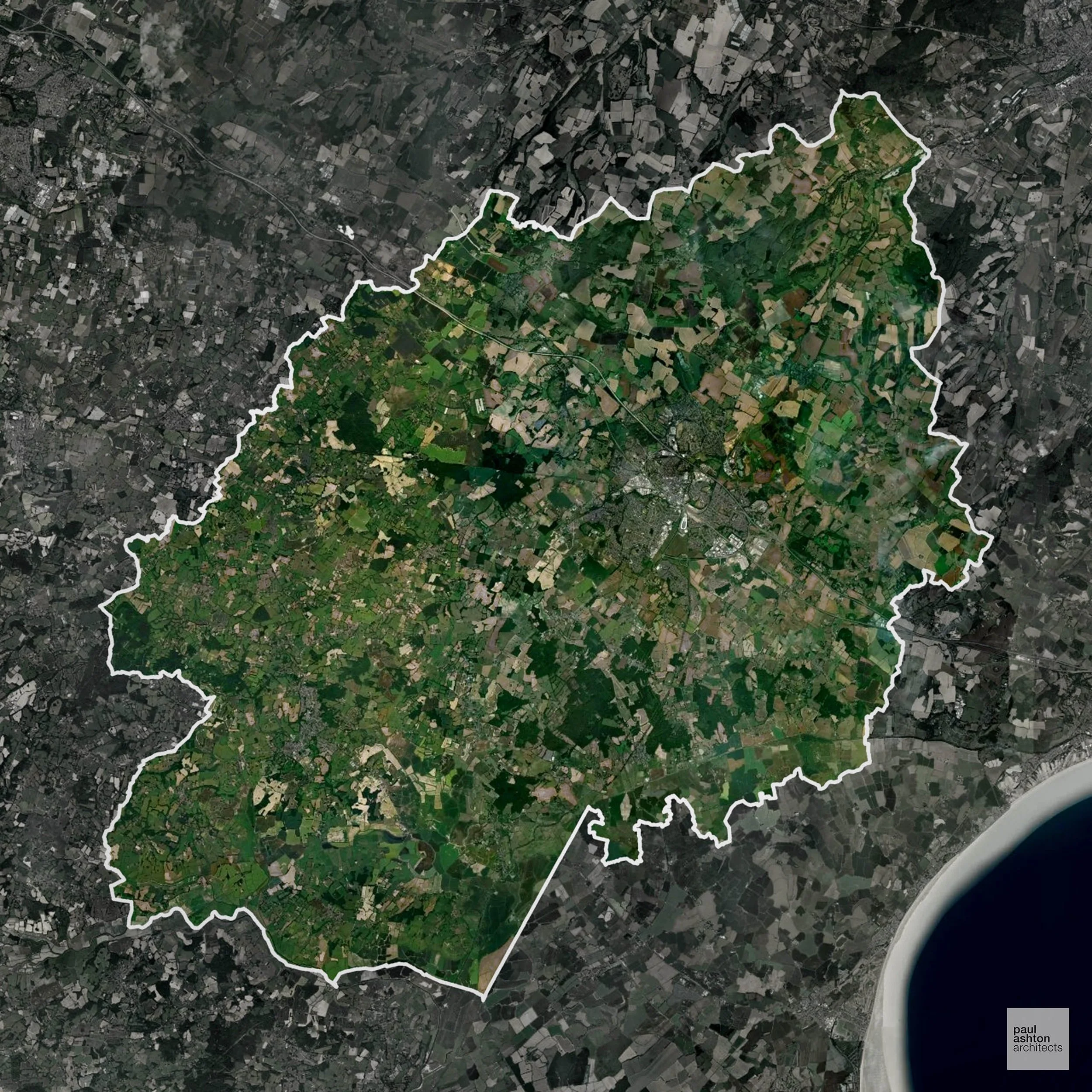
Ashford in Kent is a gateway to the continent, known for its high-speed rail connections via the Eurostar. The town is home to over 3,000 listed buildings, including Godinton House and the Ashford Tank WWI memorial. Ashford's economy is bolstered by logistics, retail, and agriculture, with a growing reputation in the wine industry, notably the Gusbourne vineyard.
In the last year Ashford decided 1,007 applications which is broadly in line with the national average of 988. The approval rate was 87% (roughly equal to the national average of 88%) and 61% of applications were decided on time, (on par with the national average of 59%). Stats updated March 2026 from gov. sources. See how Ashford performs relative to other LPAs in our LPA hub.
"We love helping clients win Planning Permission in Ashford"
Areas of Outstanding Natural Beauty in Ashford
Areas of Outstanding Natural Beauty (AONBs), (now often referred to as National Landscapes), are protected areas recognised for their exceptional scenic and natural value. For developers, this means that planning proposals within these areas are carefully scrutinised, with a strong presumption against inappropriate development.
Ashford contains sections of the Kent Downs AONB. Development must demonstrate sensitivity to landscape character.
In our experience, one of the top reasons proposals in Areas of Outstanding Natural Beauty are refused is causing landscape harm or visual intrusion, a risk that often arises when applications are not fully informed. We help minimise the likelihood of refusal with expert, guidance; contact us here.
Development in the Open Countryside
The Open Countryside is generally defined as land outside settlement and Green Belt boundaries, often comprising agricultural or natural land. Development, particularly standard residential development, is usually restricted in Open Countryside.
Ashford’s surrounding countryside, including sections of the Kent Downs AONB, is highly valued for its rolling chalk hills and biodiversity, limiting new residential expansion.
One of the top reasons poorly prepared proposals in the Open Countryside are refused is that they fail to demonstrate a policy-supported need. To minimise that risk with bespoke advice contact us here.
Nutrient Neutrality in Ashford
Nutrient Neutrality ensures new developments do not increase harmful nitrogen or phosphorus levels in sensitive waterways. Within the Stodmarsh designated sensitive catchment; both nitrogen and phosphorus neutrality are required for residential development, making it one of the most constrained planning environments in the South East. Unfortunately, Nutrient Neutrality can halt development completely. If you need early-stage, project-specific advice contact us here.
Planning Applications in Ashford
Alongside acting as Planning Consultants we are ARB registered architects with 25+ years of experience. We use the following proven work stages to guide clients in Ashford through the planning process in order to maximise the potential of their development :
- Stage 1: Site Appraisals & Planning Strategy Advice
- Stage 2: Feasibility Studies & Concept Designs
- Stage 3: Planning Application Packages
- Architectural Drawing Packages
- Planning Statements & Design and Access Statements
- Coordination of Consultant Reports
- Direct Liaison with Planning Officers
- Stage 4: Technical Design
- Discharge of Planning Conditions
- Building Regulations and Construction Packages
Planning Services We Offer in Ashford
- Full Planning Applications: Commercial, new buildings, changes of use.
- Householder Planning Applications: Domestic extensions / garden structures.
- Listed Building Consent: Alterations / repairs to listed buildings.
- Conservation Area Consent: Developments within Conservation Areas.
- Lawful Development Certificates: Confirming existing / completed works are lawful.
- Validation Requirements: Gathering documentation to ensure applications are validated by Ashford LPA.
Contextual Planning Support in Ashford
We work collaboratively with clients and shape a design that respects local character and meets Planning Policy requirements in order to maximise your chances of winning Planning Permission.
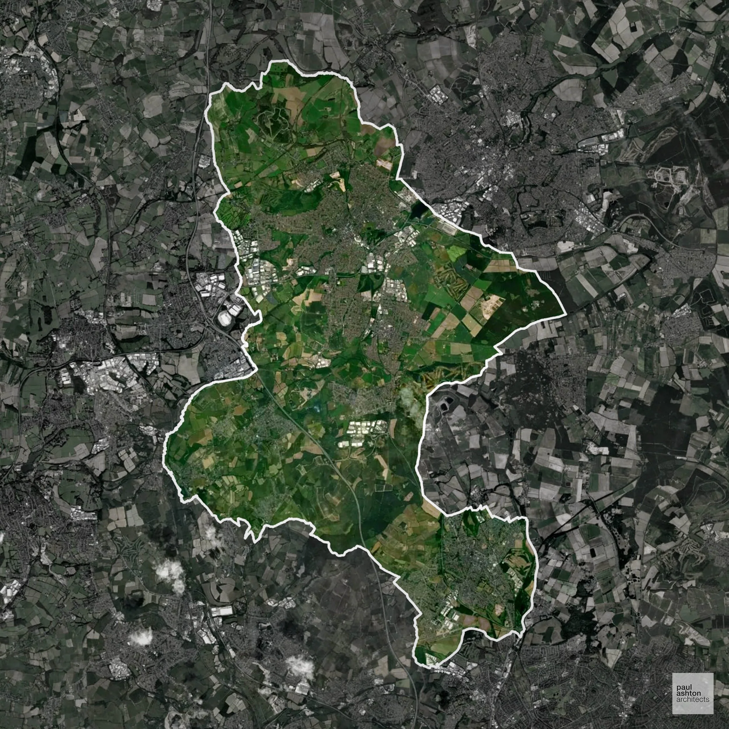
Ashfield, situated in Nottinghamshire, includes towns such as Sutton-in-Ashfield, Kirkby-in-Ashfield, and Hucknall. The district has a strong industrial legacy, particularly in coal mining and textiles. Notable sites include the Grade II* listed Sutton-in-Ashfield Town Hall. Recent regeneration projects, like the £65 million North Kirkby Gateway development, aim to revitalise town centres. Approximately 41.3% of Ashfield is within the Green Belt, impacting planning policies.
In the last year Ashfield decided 414 applications which is well below the national average of 988. The approval rate was 86% (roughly equal to the national average of 88%) and 64% of applications were decided on time, (slightly above the national average of 59%). Stats updated March 2026 from gov. sources. See how Ashfield performs relative to other LPAs in our LPA hub.
"We love helping clients win Planning Permission in Ashfield"
Green Belt Approvals in Ashfield
The Green Belt is a policy protecting land around many English towns and cities, where development is tightly controlled to safeguard the open countryside.
41.3% of Ashfield is within the Green Belt and proposals in these areas can be subject to high levels of scrutiny.
The Green Belt surrounding Sutton-in-Ashfield and Kirkby-in-Ashfield restricts expansion to preserve rural landscapes and prevent coalescence.
In our experience, one of the top reasons poorly conceived Green Belt proposals are refused is causing 'harm to openness'. We can lower the risk of refusal with site-specific guidance. Contact us here.
You can also check whether your land is within the Green Belt using our interactive Green Belt map.
Development in the Open Countryside
The Open Countryside is generally defined as land outside settlement and Green Belt boundaries, often comprising agricultural or natural land. Development, particularly standard residential development, is usually restricted in Open Countryside.
The rural fringes of Ashfield, particularly around Sutton-in-Ashfield and Kirkby-in-Ashfield, are sensitive to development to preserve historic field patterns and wooded landscapes.
One of the top reasons poorly prepared proposals in the Open Countryside are refused is that they fail to demonstrate a policy-supported need. To minimise that risk with bespoke advice contact us here.
Planning Applications in Ashfield
Alongside acting as Planning Consultants we are ARB registered architects with 25+ years of experience. We use the following proven work stages to guide clients in Ashfield through the planning process in order to maximise the potential of their development :
- Stage 1: Site Appraisals & Planning Strategy Advice
- Stage 2: Feasibility Studies & Concept Designs
- Stage 3: Planning Application Packages
- Architectural Drawing Packages
- Planning Statements & Design and Access Statements
- Coordination of Consultant Reports
- Direct Liaison with Planning Officers
- Stage 4: Technical Design
- Discharge of Planning Conditions
- Building Regulations and Construction Packages
Planning Services We Offer in Ashfield
- Full Planning Applications: Commercial, new buildings, changes of use.
- Householder Planning Applications: Domestic extensions / garden structures.
- Listed Building Consent: Alterations / repairs to listed buildings.
- Conservation Area Consent: Developments within Conservation Areas.
- Lawful Development Certificates: Confirming existing / completed works are lawful.
- Validation Requirements: Gathering documentation to ensure applications are validated by Ashfield LPA.
Design-Led Planning Advice in Ashfield
We can review your site in Ashfield and offer informed guidance on how proposals can be developed in order to maximise your chances of securing Planning Permission.
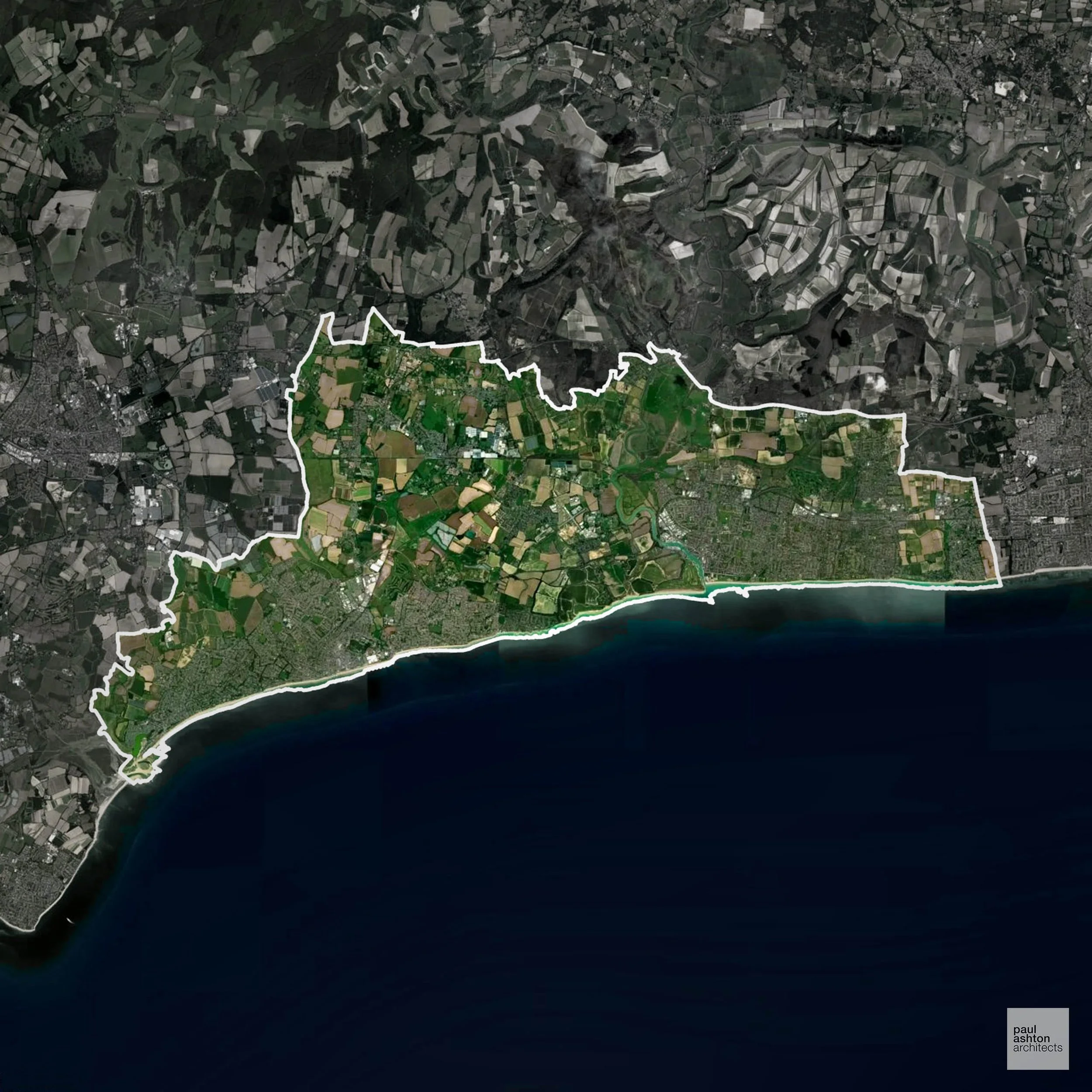
Arun, located in West Sussex, encompasses coastal towns like Littlehampton, Bognor Regis, and Arundel. Arundel is famed for its medieval architecture, including Arundel Castle and the Gothic-style Arundel Cathedral. The district has a rich cultural scene, with numerous theatres and galleries. Arun contains 971 listed buildings, reflecting its architectural heritage.
In the last year Arun decided 784 applications which is well below the national average of 988. The approval rate was 86% (roughly equal to the national average of 88%) and 90% of applications were decided on time, (significantly above the national average of 59%). Stats updated March 2026 from gov. sources. See how Arun performs relative to other LPAs in our LPA hub.
"We love helping clients win Planning Permission in Arun"
Areas of Outstanding Natural Beauty in Arun
Areas of Outstanding Natural Beauty (AONBs), (now often referred to as National Landscapes), are protected areas recognised for their exceptional scenic and natural value. For developers, this means that planning proposals within these areas are carefully scrutinised, with a strong presumption against inappropriate development.
Arun includes parts of the South Downs AONB. Development proposals must consider scenic and environmental protections.
In our experience, one of the top reasons proposals in Areas of Outstanding Natural Beauty are refused is causing landscape harm or visual intrusion, a risk that often arises when applications are not fully informed. We help minimise the likelihood of refusal with expert, guidance; contact us here.
Development in the Open Countryside
The Open Countryside is generally defined as land outside settlement and Green Belt boundaries, often comprising agricultural or natural land. Development, particularly standard residential development, is usually restricted in Open Countryside.
Arun’s open countryside, including parts of the South Downs National Landscape, is renowned for scenic beauty and is carefully protected against inappropriate development.
One of the top reasons poorly prepared proposals in the Open Countryside are refused is that they fail to demonstrate a policy-supported need. To minimise that risk with bespoke advice contact us here.
Nutrient Neutrality in Arun
Nutrient Neutrality ensures new developments do not increase harmful nitrogen or phosphorus levels in sensitive waterways. Some areas of Arun are part of the Solent nitrogen neutrality catchment; all residential development generating additional overnight stays must demonstrate nitrogen neutrality. Unfortunately, Nutrient Neutrality can halt development completely. If you need early-stage, project-specific advice contact us here.
Planning Applications in Arun
In addition to acting as Planing Conultants we are ARB registered architects with 25+ years of experience. Our planning proposals are creatively tailored to each site to maximise potential and improve planning outcomes. We use the following tried and tested process to guide clients in Arun through planning to completion:
- Stage 1: Site Appraisals & Planning Strategy Advice
- Stage 2: Feasibility Studies & Concept Designs
- Stage 3: Planning Application Packages
- Architectural Drawing Packages
- Planning Statements & Design and Access Statements
- Coordination of Consultant Reports
- Direct Liaison with Planning Officers
- Stage 4: Technical Design
- Discharge of Planning Conditions
- Building Regulations and Construction Packages
Planning Services We Offer in Arun
- Full Planning Applications: Commercial, new buildings, changes of use.
- Householder Planning Applications: Domestic extensions / garden structures.
- Listed Building Consent: Alterations / repairs to listed buildings.
- Conservation Area Consent: Developments within Conservation Areas.
- Lawful Development Certificates: Confirming existing / completed works are lawful.
- Validation Requirements: Gathering documentation to ensure applications are validated by Arun LPA.
Design-Led Planning Advice in Arun
We can review your site in Arun and offer informed guidance on how proposals can be developed in order to maximise your chances of securing Planning Permission.
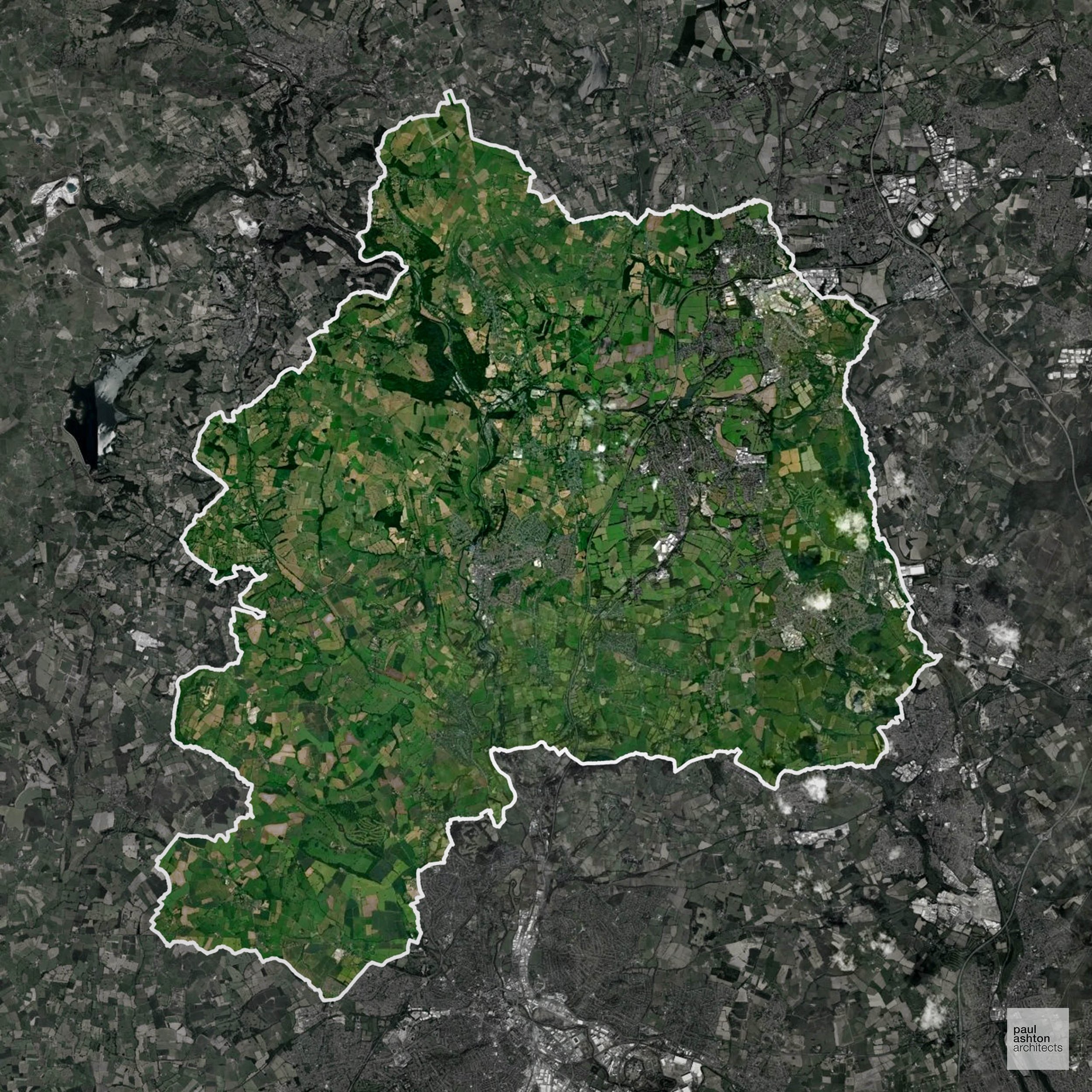
Amber Valley in Derbyshire is characterised by its rich industrial history and picturesque countryside. Key towns include Alfreton, Belper, Heanor, and Ripley. The area is known for its historic mills and the Derwent Valley Mills World Heritage Site. Grade II* listed buildings such as the Belper North Mill highlight the district's industrial heritage. Approximately 32.6% of Amber Valley is designated as Green Belt, influencing planning considerations.
In the last year Amber Valley decided 690 applications which is well below the national average of 988. The approval rate was 96% (marginally above the national average of 88%) and 58% of applications were decided on time, (on par with the national average of 59%). Stats updated March 2026 from gov. sources. See how Amber Valley performs relative to other LPAs in our LPA hub.
"We love helping clients win Planning Permission in Amber Valley"
Green Belt Approvals in Amber Valley
The Green Belt is nationally designated land around towns and cities, created to limit urban growth.
32.6% of Amber Valley is within the Green Belt and proposals in these areas can be subject to high levels of scrutiny.
The Green Belt within Amber Valley covers valley farmland, upland slopes, and historic villages near Ripley and Heage which are under pressure from urban expansion.
In our experience, one of the top reasons poorly conceived Green Belt proposals are refused is causing 'harm to openness'. We can lower the risk of refusal with site-specific guidance. Contact us here.
You can also check whether your land is within the Green Belt using our interactive Green Belt map.
Development in the Open Countryside
Amber Valley includes areas classed as Open Countryside, generally encompassing land beyond settlements and Green Belt zones, often used for agriculture or left as natural landscapes. Development in these areas is tightly controlled, with standard residential proposals rarely permitted.
Amber Valley’s upland valleys and historic villages are subject to strict planning oversight due to their heritage landscapes.
One of the top reasons poorly prepared proposals in the Open Countryside are refused is that they fail to demonstrate a policy-supported need. To minimise that risk with bespoke advice contact us here.
Planning Applications in Amber Valley
In addition to acting as Planing Conultants we are ARB registered architects with 25+ years of experience. Our planning proposals are creatively tailored to each site to maximise potential and improve planning outcomes. We use the following tried and tested process to guide clients in Amber Valley through planning to completion:
- Stage 1: Site Appraisals & Planning Strategy Advice
- Stage 2: Feasibility Studies & Concept Designs
- Stage 3: Planning Application Packages
- Architectural Drawing Packages
- Planning Statements & Design and Access Statements
- Coordination of Consultant Reports
- Direct Liaison with Planning Officers
- Stage 4: Technical Design
- Discharge of Planning Conditions
- Building Regulations and Construction Packages
Planning Services We Offer in Amber Valley
- Full Planning Applications: Commercial, new buildings, changes of use.
- Householder Planning Applications: Domestic extensions / garden structures.
- Listed Building Consent: Alterations / repairs to listed buildings.
- Conservation Area Consent: Developments within Conservation Areas.
- Lawful Development Certificates: Confirming existing / completed works are lawful.
- Validation Requirements: Gathering documentation to ensure applications are validated by Amber Valley LPA.
Contextual Planning Support in Amber Valley
We work collaboratively with clients and shape a design that respects local character and meets Planning Policy requirements in order to maximise your chances of winning Planning Permission.
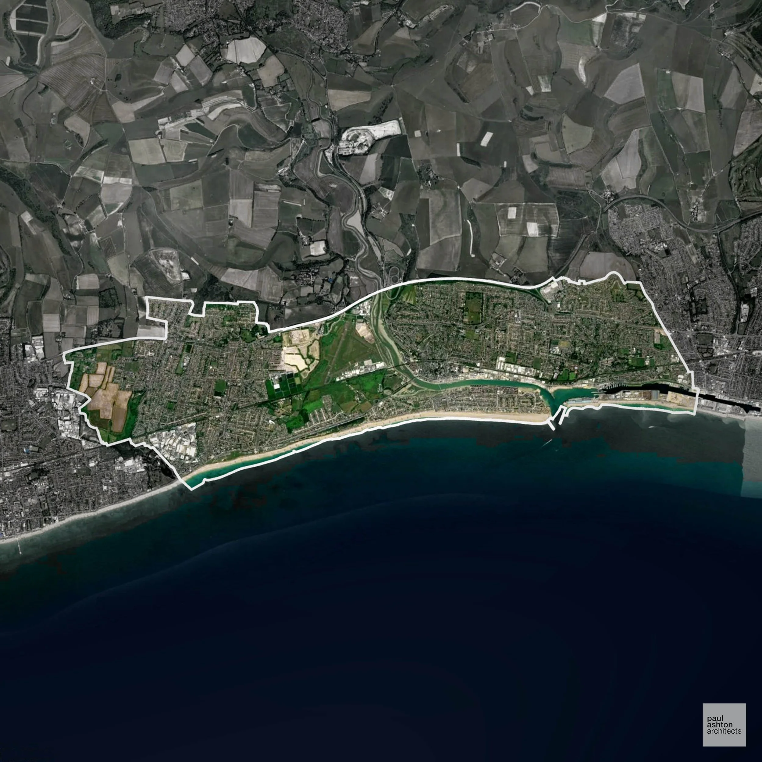
Adur is a coastal district in West Sussex, encompassing the towns of Shoreham-by-Sea, Lancing, and Southwick. The area is renowned for its maritime heritage, with Shoreham Harbour serving as a significant port. Architecturally, the district boasts a range of listed buildings, particularly in the historic town centres. Notable structures include Lancing College Chapel and the Grade II* listed Shoreham Tollbridge.
In the last year Adur decided 310 applications which is well below the national average of 988. The approval rate was 92% (marginally above the national average of 88%) and 59% of applications were decided on time, (on par with the national average of 59%). Stats updated March 2026 from gov. sources. See how Adur performs relative to other LPAs in our LPA hub.
"We love helping clients win Planning Permission in Adur"
Areas of Outstanding Natural Beauty in Adur
Areas of Outstanding Natural Beauty (AONBs), often referred to as National Landscapes, are protected for their remarkable natural and scenic value. Any development proposals here are closely evaluated, with a strong presumption against works that could harm the landscape.
Adur contains parts of the South Downs AONB. Development must preserve visual and ecological character.
In our experience, one of the top reasons proposals in Areas of Outstanding Natural Beauty are refused is causing landscape harm or visual intrusion, a risk that often arises when applications are not fully informed. We help minimise the likelihood of refusal with expert, guidance; contact us here.
Conservation and Listed Buildings in Adur
Adur has a varied historic environment shaped by its coastal and river valley setting, with several Conservation Areas and a number of listed buildings. Heritage constraints are particularly evident within the Shoreham-by-Sea Conservation Area and Southwick Conservation Area, where historic street patterns, maritime character, and traditional building forms define local identity.
One of the top reasons heritage building applications are refused is causing harm to historic significance, a risk that can arise when proposals are not prepared by a consultant with heritage expertise. We help minimise this risk with expert, site-specific guidance; contact us here.
Development in the Open Countryside
Open Countryside within Adur refers to land situated outside built-up areas and Green Belt boundaries, typically comprising farmland or natural landscapes. Residential development is generally restricted unless special circumstances can be demonstrated.
The rolling farmland and coastal hinterlands of Adur are visually sensitive, with development tightly controlled to protect the South Downs foothills and scenic coastline.
One of the top reasons poorly prepared proposals in the Open Countryside are refused is that they fail to demonstrate a policy-supported need. To minimise that risk with bespoke advice contact us here.
Planning Applications in Adur
In addition to acting as Planing Conultants we are ARB registered architects with 25+ years of experience. Our planning proposals are creatively tailored to each site to maximise potential and improve planning outcomes. We use the following tried and tested process to guide clients in Adur through planning to completion:
- Stage 1: Site Appraisals & Planning Strategy Advice
- Stage 2: Feasibility Studies & Concept Designs
- Stage 3: Planning Application Packages
- Architectural Drawing Packages
- Planning Statements & Design and Access Statements
- Coordination of Consultant Reports
- Direct Liaison with Planning Officers
- Stage 4: Technical Design
- Discharge of Planning Conditions
- Building Regulations and Construction Packages
Planning Services We Offer in Adur
- Full Planning Applications: Commercial, new buildings, changes of use.
- Householder Planning Applications: Domestic extensions / garden structures.
- Listed Building Consent: Alterations / repairs to listed buildings.
- Conservation Area Consent: Developments within Conservation Areas.
- Lawful Development Certificates: Confirming existing / completed works are lawful.
- Validation Requirements: Gathering documentation to ensure applications are validated by Adur LPA.
Contextual Planning Support in Adur
We work collaboratively with clients and shape a design that respects local character and meets Planning Policy requirements in order to maximise your chances of winning Planning Permission.
No results found
No results match your search. Try removing a few filters.

Learn about our latest pieces.
-
It all begins with an idea. Maybe you want to launch a business. Maybe you want to turn a hobby into something more.
-
It all begins with an idea. Maybe you want to launch a business. Maybe you want to turn a hobby into something more.
-
It all begins with an idea. Maybe you want to launch a business. Maybe you want to turn a hobby into something more.
Have Questions?
email@example.com
(555) 555-5555
123 Demo Street
New York, NY 12345